Katie drove up north to visit over the weekend. Instead of spending the time cooped up in the house we swung down to Skanee to camp at Big Erick's Bridge instead. When Saturday morning showed up I decided to take Logan for some quick waterfall adventuring, Katie opting to stay back at the site and take some mid-morning snoozes. I headed up Black Creek Road, hoping to finish up Huron River once and for all.
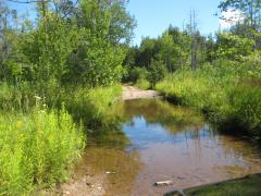
I had already done plenty of scouting of the area. In order to visit Big Falls I would have to cut down an unmarked two-track, ford West Branch Huron River (a shallow crossing at best), and then plow through a massive mud puddle near a swamp. It was the last obstacle that I was concerned about. With Katie's SUV I sat idling on the one side of the puddle, debating if it was worth the risk or not. The falls were several miles beyond the puddle - a walkable distance, yes, but one that could be skipped. With a deep breath I gunned the motor, water splashing yards around me and up over the hood. A few short seconds and it was over. Steam rolled up around the car as I rambled down the roads beyond the puddle. The SUV had made it.

Mud puddle in the swamp
Before continuing onto Big Falls I made a quick detour east in hopes of returning to East Branch Falls. I had already been there this summer, just last month, though I hoped that this route would be a shorter walk. An earthen berm and large 'No Trespassing' sign blocked my path. I turned around and focused on Big Falls.
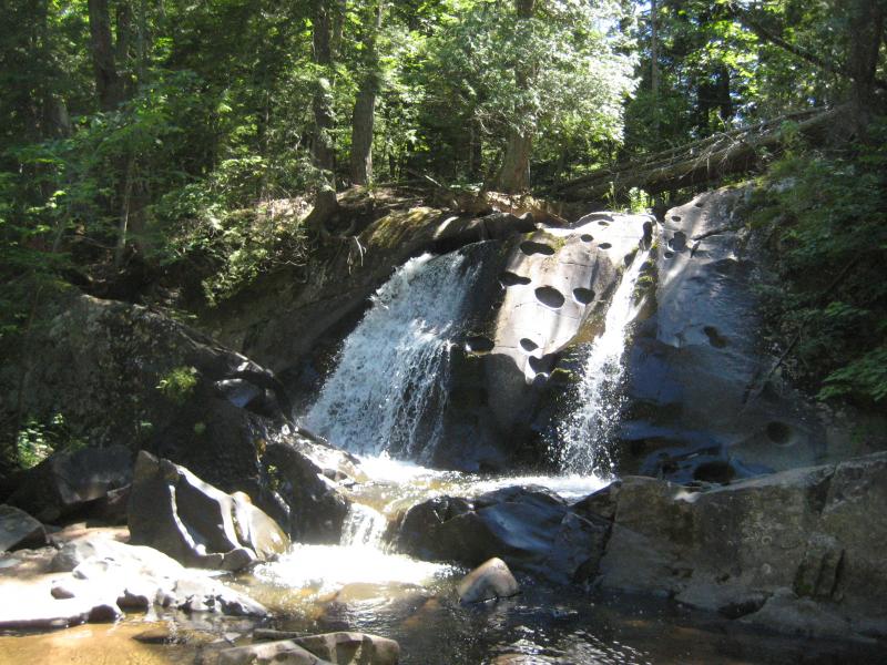
The roads meandered around the swamp I had driven past in a general southeast direction. I wasn't sure if it would lead me directly to the falls or not but Logan and I still enjoyed the drive, lowering the windows and breathing in the warm summer air. Our surroundings changed from swamp to hardwoods to pines when the sound of rushing water drifted up from below the road's bank. An area for parking among the tall trees had opened up on the left side of the road and I stopped here, leaving Logan in the car, while I ventured down a steep hill alone. Less than halfway down and I could recognize the tall drop and log perched on the rocks. We had found Big Falls.

Parking area near the falls
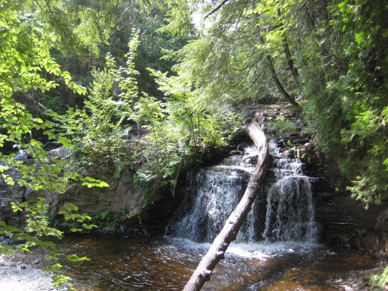
First view down on Big Falls
I didn't spend much time here, taking only a few photos of the main drops, before heading back to the car and backtracking up the roads. Elated at the discovery of the remote waterfall I drove quickly through the deep puddle of water near the swamp, causing the water to whoosh up over the hood again, leaving odd trails across the windshield that I knew Katie would ask about. After we crossed back to the other side of West Branch Huron River I parked the car in the small clearing just west of the river and let Logan out. Our next visit was going to involve a lot more walking and he was ready to stretch his legs.

Shallow ford over West Branch Huron River
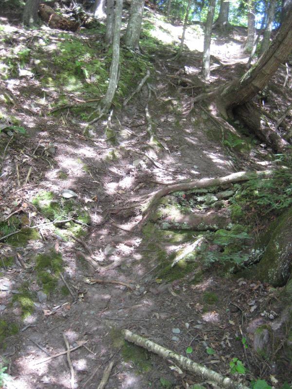
A faint path led up the side of the river a few hundred feet before the vegetation gave out. Scooping Logan up I forded the river here and picked up the trail on the eastern bank. It would have been easier to ford downstream, where the river is shallow enough to drive through, if it wasn't for a towering bank of baked dirt. Our path wove through a tall pine forest, making it's way upstream, until the rock walls closed around the river and forced us down on the rocky bed. There were a few cabins along the route, mostly on the western bank, yet (thankfully) no private property signs to deter us on our journey.
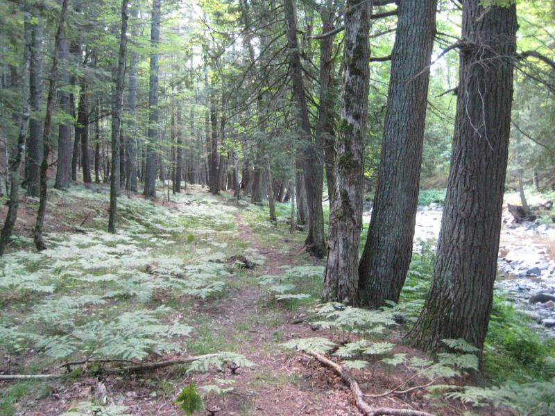
Riverside footpath

Cabin on the western bank
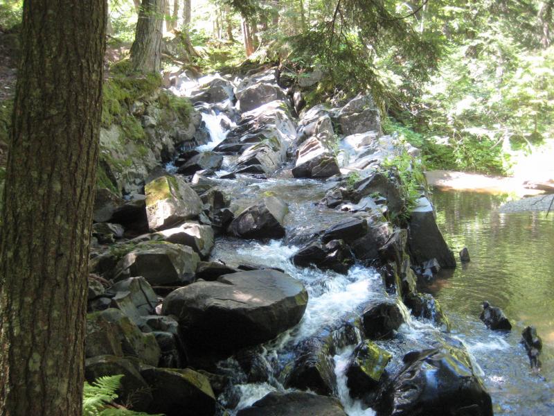
The river's gentle path over small rapids and a rocky bed started to roughen, creating a few small drops over bedrock, hemmed in tight by the steep gorge walls. I wasn't sure what to expect of this waterfall, having seen no images of it beforehand, when a tall, narrow chute appeared from behind a bend. The rock created a V that was clogged by a few large boulders and logs, with the water flowing out in a steady flow with a decent amount of spray near the bottom. Satisfied I turned around, unaware that there are many more drops to West Branch Falls upstream of this chute.
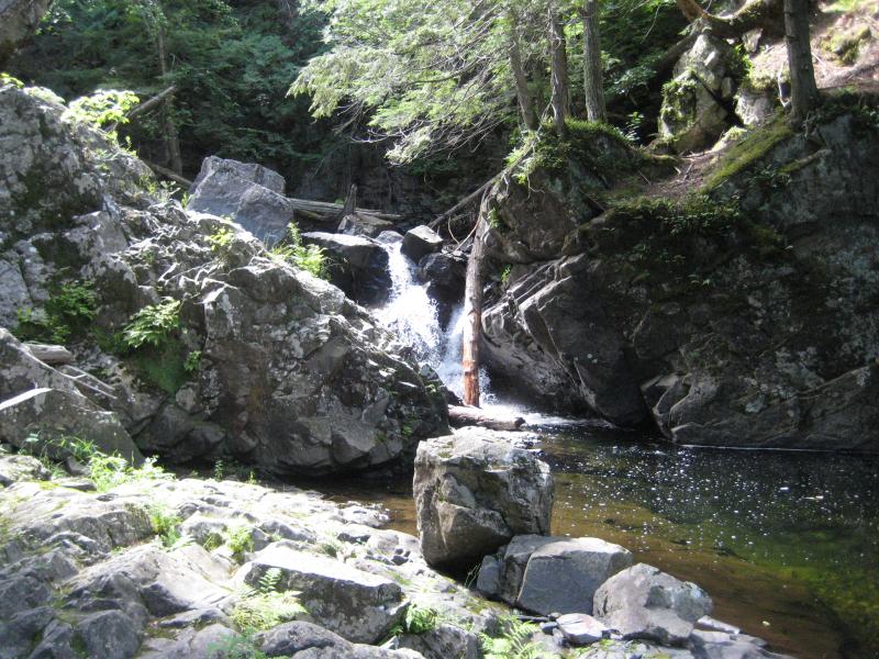
First view of the lower plunges
There was one final destination for today, far upstream. We hopped into the car and drove back to Black Creek Road, taking it south just past Erick's Bridge. A narrow two-track, Letherby Road, follows West Branch Huron River south before fading away into smaller logging tracks. Less than a mile in I bumped into a man on a four-wheeler. I usually try to avoid asking for directions, mostly out of manly pride, but had spent too many hours searching for Leatherby Falls already. He rattled off a set of complicated directions. I got the gist of them, that the drop was miles further than I had estimated, and thanked him.
We passed numerous forks, sticking to the main road each time, until we bumped into a promising side track. Turning west back to the river, which had slowly drifted away from the road, we found ourselves at tiny parking area right before the road became impassable. Hopeful I got out, bringing a leashed Logan along, and followed the road on foot.
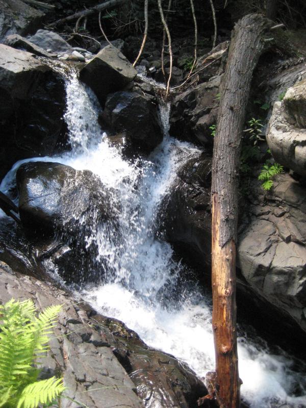
It didn't take long to confirm we had found Leatherby Falls. A network of footpaths and four-wheeler tracks branched out and led down the riverbank, passing camping spots and huge trees, before ending at the river. The main drop was a bit upstream, a sharp wall of pitted rock, but the lower blocky drops lay right before us. It was fun play around for awhile here, walking across the river's rocks and climbing up to the upper drop, even if Logan and his leash did get tangled a few times in the low undergrowth.

Paths leading down to the river
Up along the bumbling rocks
Noon had long passed by the time we made it back to an irritated Katie. Apparently the check-out time was at three and we were left with only minutes to pack up. Stopping by Slate River or hunting down Ravine River Falls was out of the question now. I was still happy to have found so many new waterfalls today. I had now visited every named drop on the Huron River (or so I thought) and my circle of completed adventures was slowly yet surely reaching back east to the wilds of Yellow Dog and the Huron Mountains.


Comments (1)