Huron River was one of my favorite finds from the waterfall project. I first bumped into it in the summer of 2008, where it marked my initial ventures east of Big Erick's Bridge. Between the two main branches it held five named drops and made for a fun goal to reach all five and 'complete' the river. Then, early in 2009, Faith and I had a grand time hiking the length of the East Branch gorge through snow and ice to find multiple unnamed drops between tall stone walls. It was no surprise that I was heading back down to Huron River in the pre-dawn morning for an ambitious spring hike.
Today I was mostly focused on the West Branch. During my multiple attempts to find Leatherby Falls last year I had hiked sections of the river about two miles upstream of Erick's Falls. The waterfall had been hard to track down, with topo maps and local directions disagreeing on what was and wasn't the waterfall, and during my search I had found a few suspicious small drops along the way. Today I would not only get the exact coordinates of Leatherby Falls, I would hike the whole length of the river down to Black Creek Road to make sure there wasn't more drops that I had missed out on. Oh, and I wanted to revisit West Branch Falls to make sure there wasn't more going on there, too.
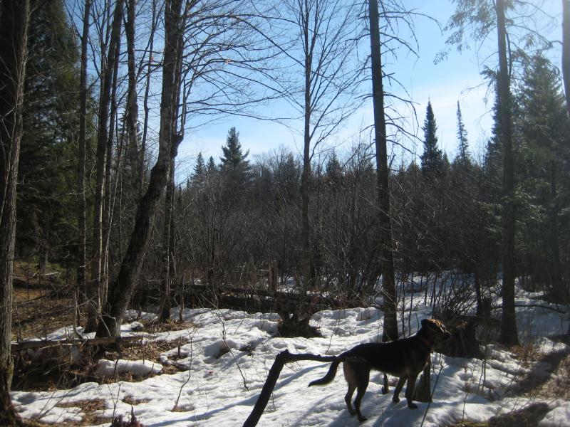
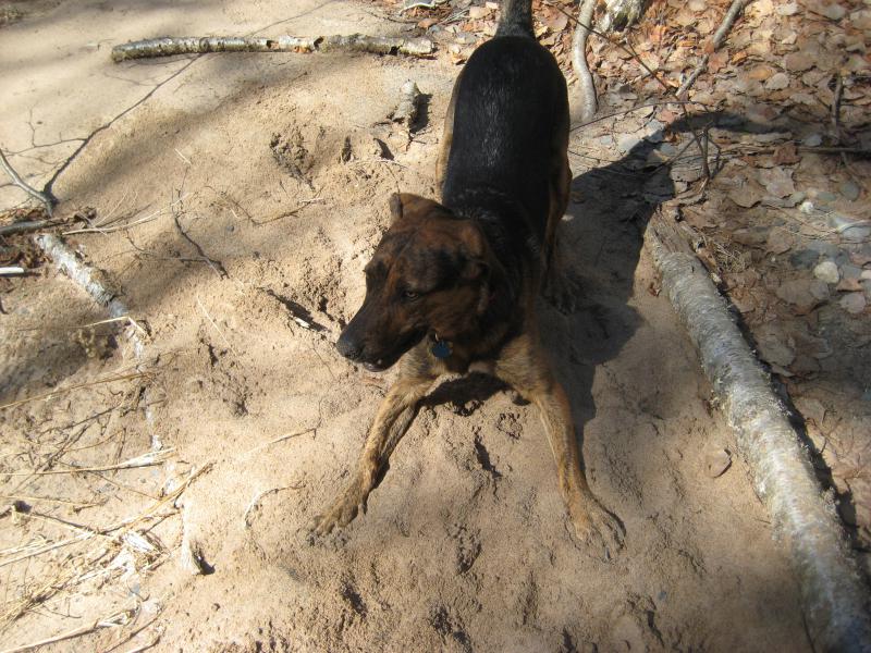
Our adventure started several miles down Black Creek Road. Logan, who is usually pretty good during drives, began to emit a low growl as his hair began to rise. He then exploded into a fury of barks, scratches, and howls as a porcupine waddled across the road ahead. Excited to find a new animal I hopped out of the car (being very careful that Logan couldn't follow) and took a few pictures of the awkward little guy as he climbed a nearby tree. Logan couldn't have been more upset at my lack of concern when we drove away from the porcupine perched high up in a tree.
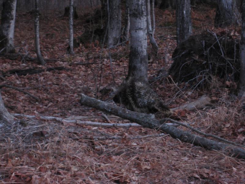
A lumbering porcupine
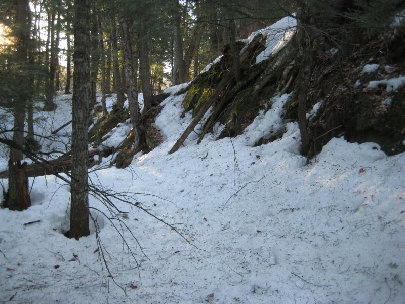
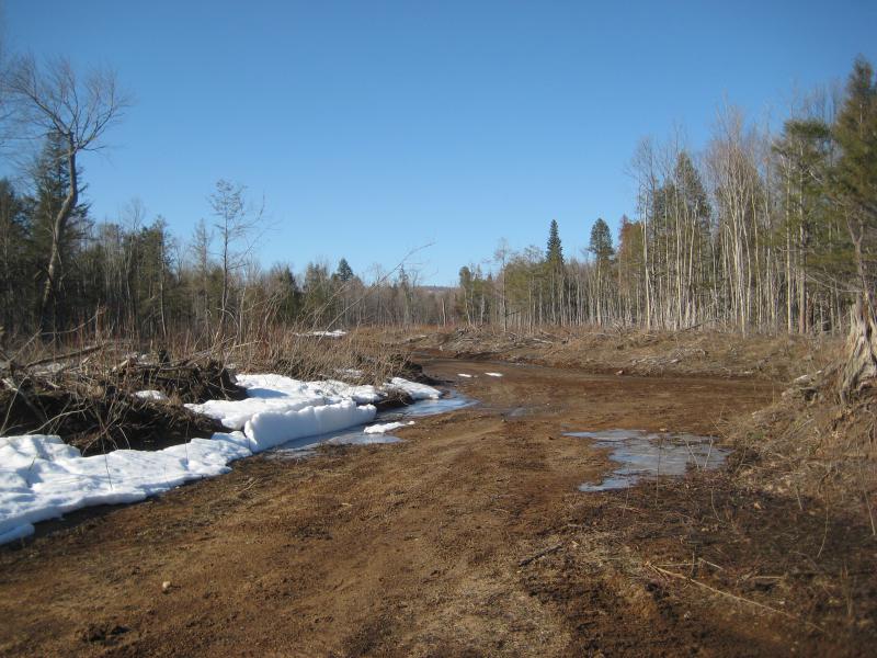
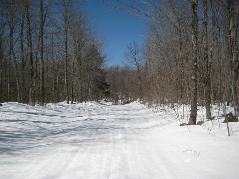
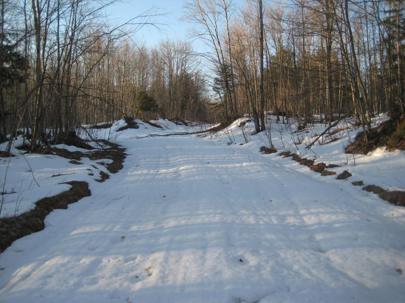
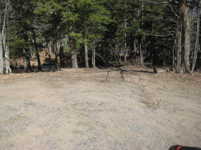
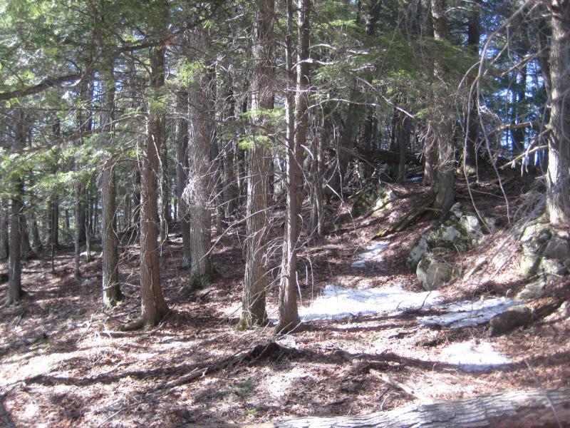
Another mile or two and we were at Erick's bridge, the large cement crossing over the upper reaches of the Huron River. Ever the optimist, I pulled up and took a look at Leatherby Road, which starts only a few dozen yards east of the bridge. Thick drifts of snow still lay over the road. It would be a boring three mile walk along the road before we reached the main falls. Well, if I wanted to follow the river all the way back downstream, might as well make it a loop. I parked at the bridge and we headed up the road.
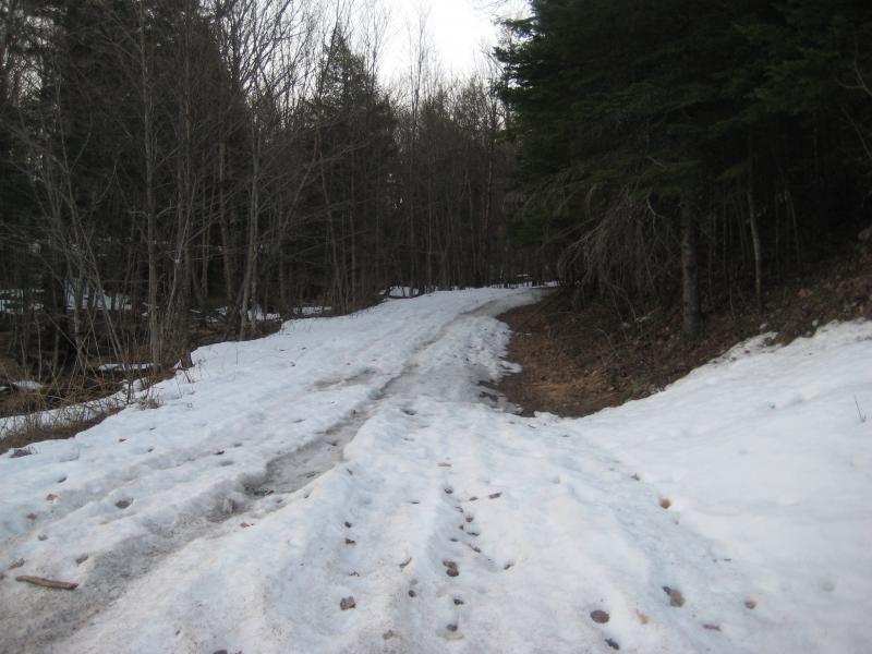
Leatherby Road in the spring
The sun slowly rose to wake up the woods around Logan and I as we walked south. There was a slight uphill clip, more pronounced and some sections than others, but otherwise the way wasn't bad. Enough snowmobiles had packed down the snow to make it easy to walk on and the open sky above had melted long sections. Every once in a while we bumped into a wet section, or some loose snow, and we'd take a short detour into the woods.
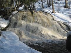
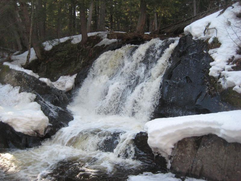
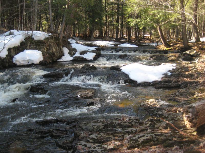
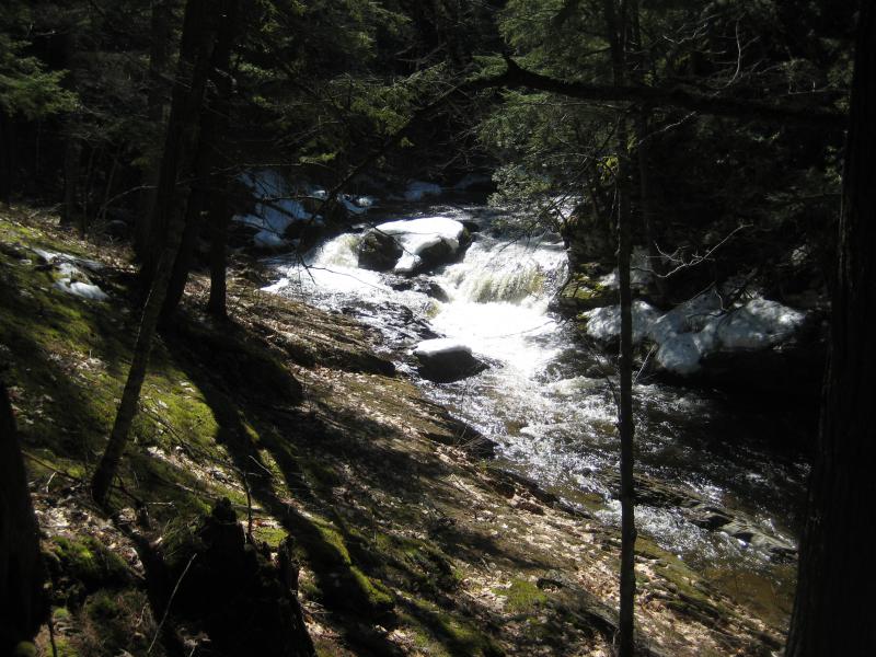
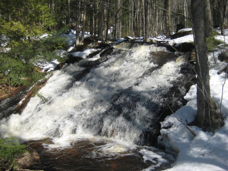
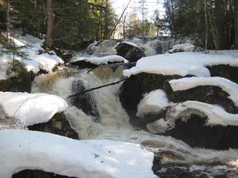
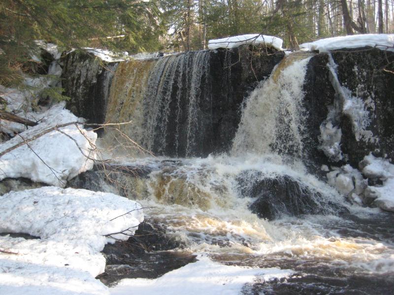
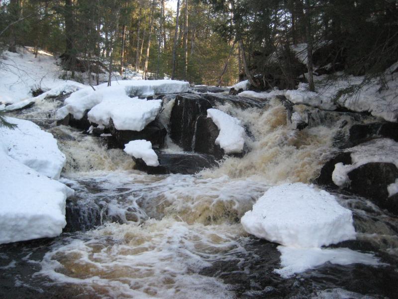
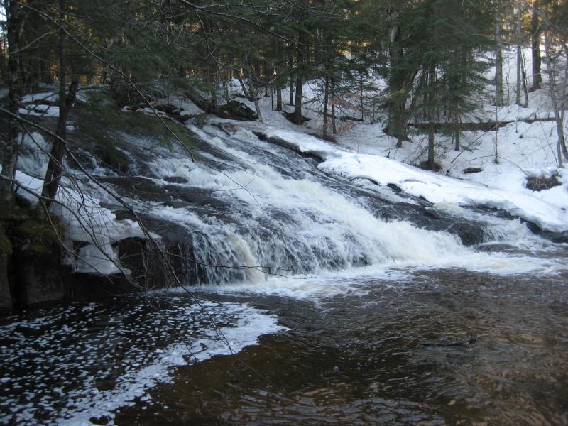
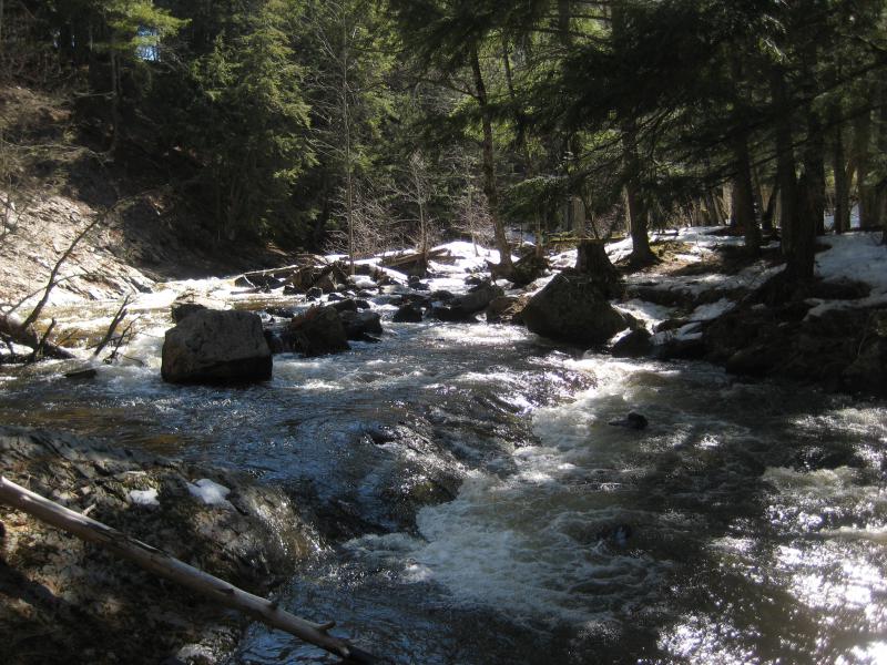
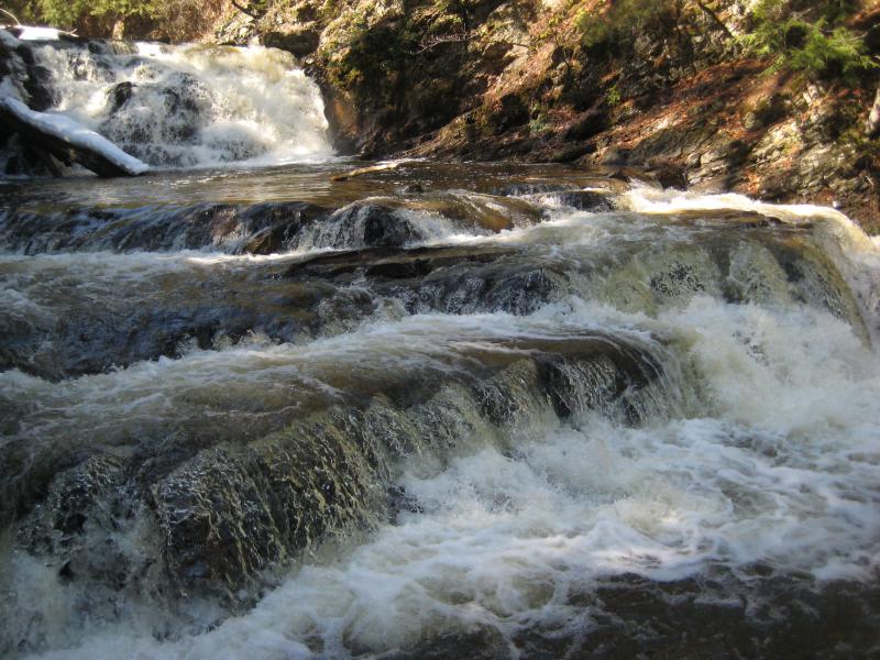
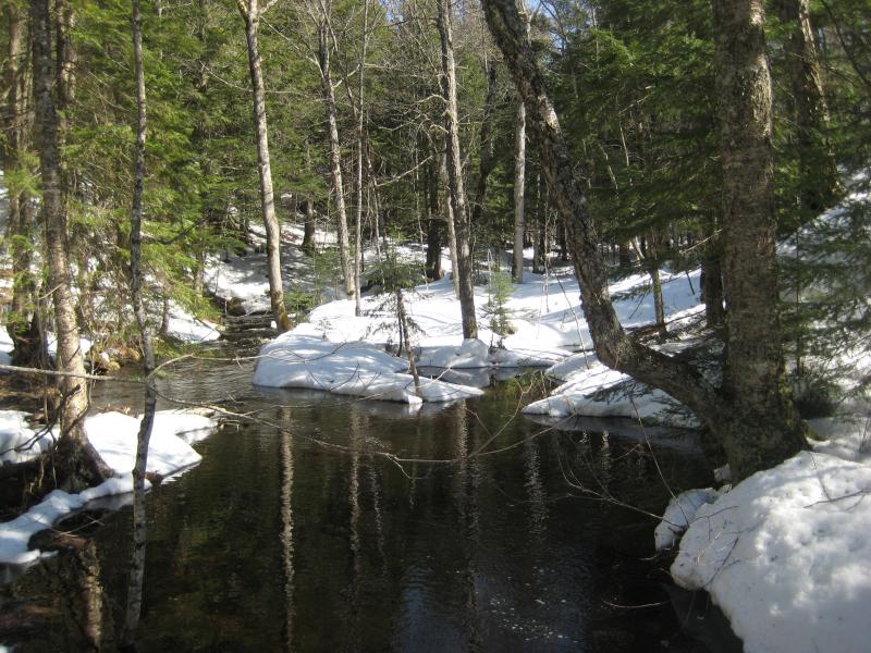
An hour into the walk and we reached the fork to the right that cut down to the river. For the most part the road runs high and east to the river, far enough to be out of earshot, and it was time to drop back down to it. Half-trotting down the slope we came upon the little parking area and followed the tracks down the bank. Leatherby Falls was running full this morning under the pines and cedars with low banks of snow sitting on either side.
Flowing drops around the snow
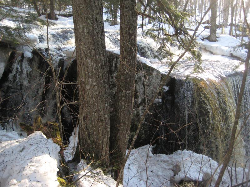
We didn't linger long at the falls. I wanted to head upstream first and search for an upper drop. If there was an upper falls, than I knew this drop was 'the' Leatherby Falls. Otherwise, the true waterfall may be downstream, as the older topo maps claimed. Logan and I headed upstream next to the falls, struggling a bit with the tall stone lip that forms the main drop, and entered a tangle of small pines.
Long steep ridge
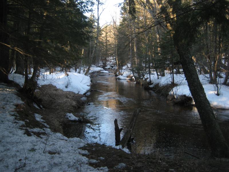
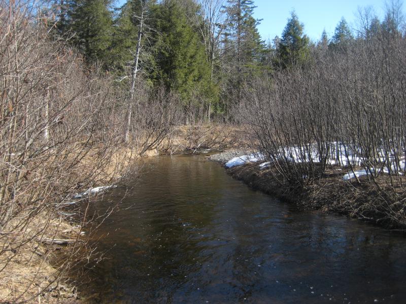
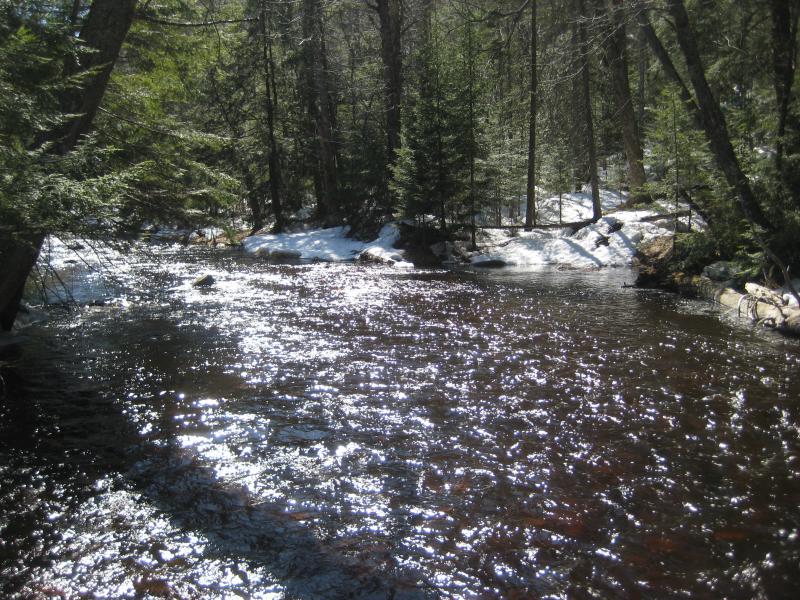
Calm river
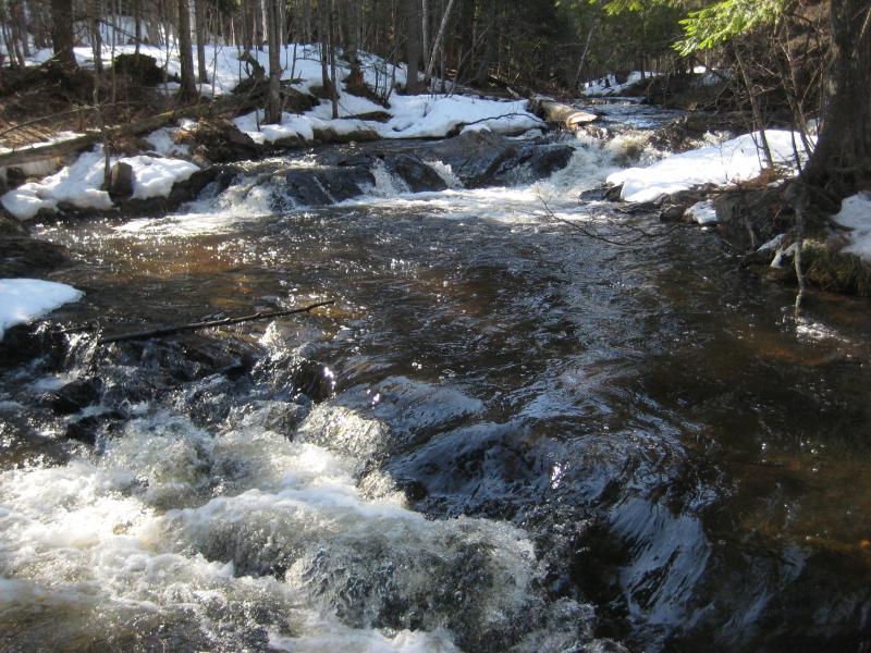
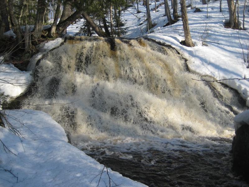
There was no path that I could find up here. Still hoping that there was an upper drop we struggled through the clinging red pines and thick brush along the calm river. A few hundred yards and we could hear another roar, and then it showed up. A wide fanning drop into a deep pool lay ahead of us, at least ten feet in height, marked Upper Leatherby Falls. New drop found and mystery solved. The topo maps were wrong.
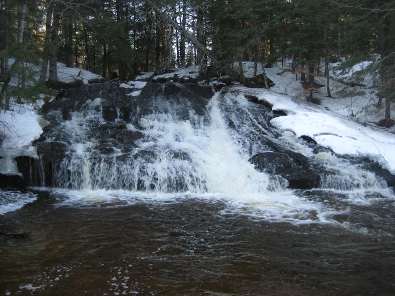
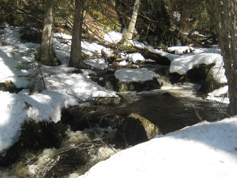
Dark, snowy waterfall
Excited to find this drop we continued on for a short distance, climbing up the side of the waterfall and heading even further upstream. There were no paths to be found, nothing connecting this drop with the nearby Leatherby Falls or to one of the nearby logging roads, but I may have missed it with the snow still laying around.
However, we did find was a swamp that stretched far to the south and east above the upper falls. The river split here, too. I had found a waterfall and the swamp was thick and the river's strength was halved. There was nothing to find up here. We turned and headed back downstream past Upper Leatherby and back down to Leatherby, crossing the river right before the second crest.
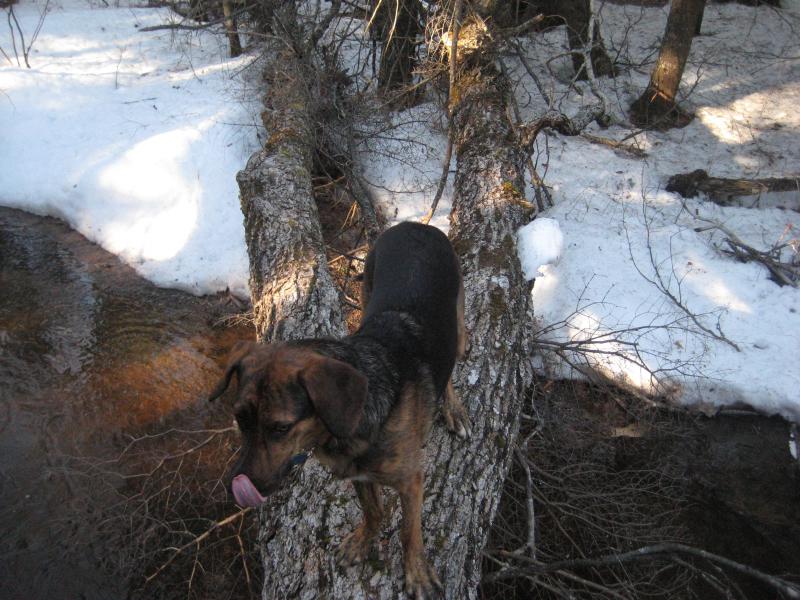
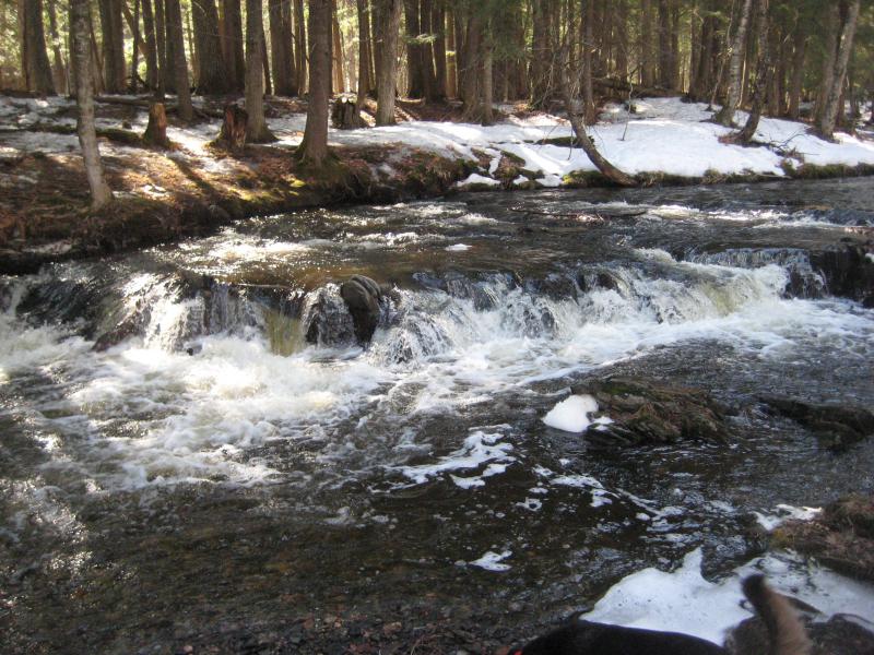
Brave Logan crossing above the falls
Flowing curtain of water over the rocks
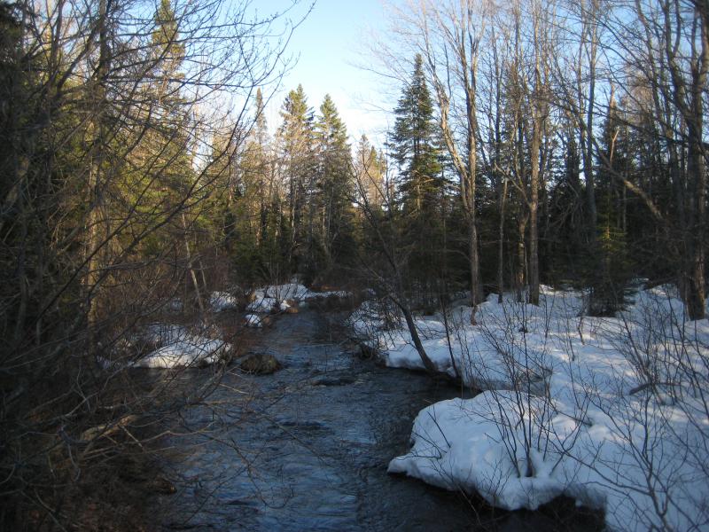
Our hike had just begun. We still had to follow the river all the way downstream to Black Creek Road and our parked car some three miles to the north. It wouldn't be easier going, either. The river was cold and swollen enough to keep us on the banks, and the banks were thickly grown and had deep snow piled up. I hoped there would be some drops worth the long hike.
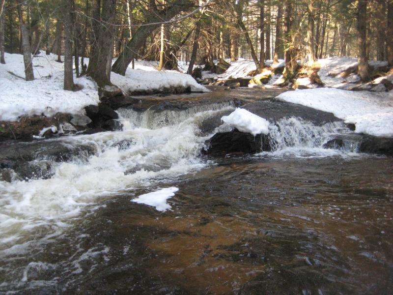
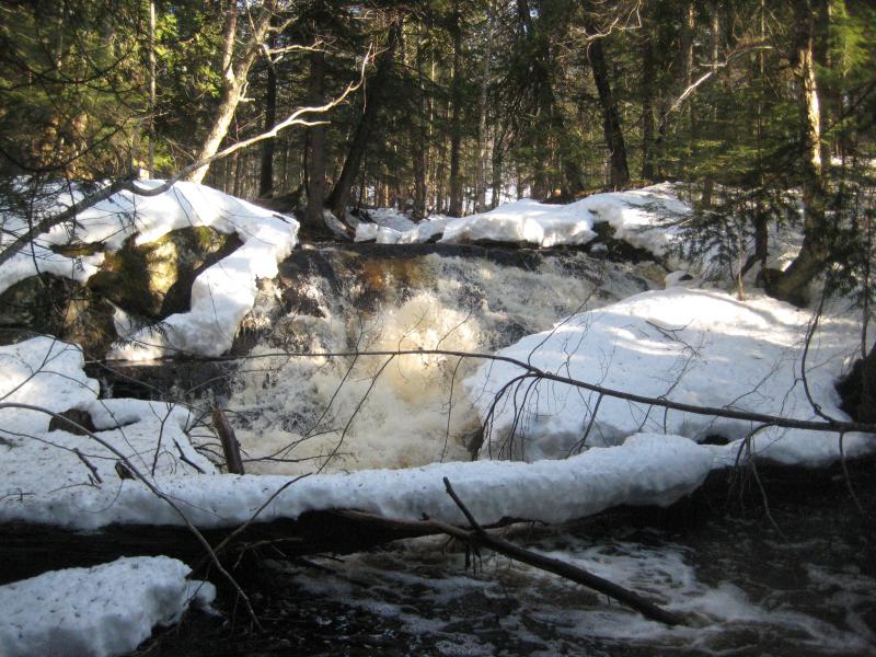
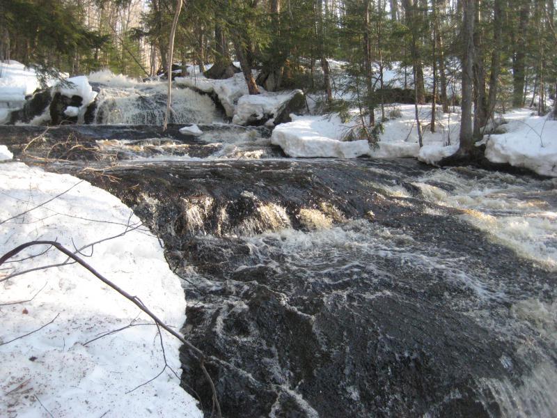
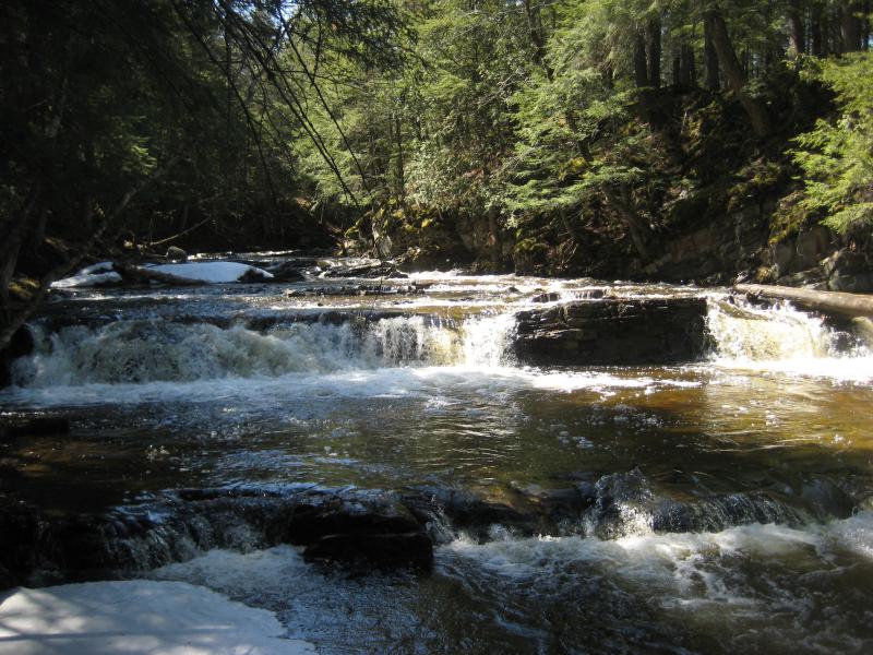
A few showed up right away, about a half mile downstream. They were only a foot or two tall over shelves and boulders that emptied into shallow pools, more rapids than anything else. They did make a long set of cascades that was mildly impressive. We were still at least a mile from the tick mark on the topo map, the supposed actual Leatherby Falls, so I toook a few photos before hurrying onwards.
Small drop into a sandy bed
Long set of cascades
Downstream began to get more cluttered with deadfall and brush. Our river wound back and fork like a lazy snake and I opted to cut off the bends rather than waste time weaving with it. After one particularly wide bend I noticed some open air above us. The river was calm and tending to swamp here, so Logan and I headed up and out of the little river valley.
Logan inspecting the swamp ahead
Exposed muddy road
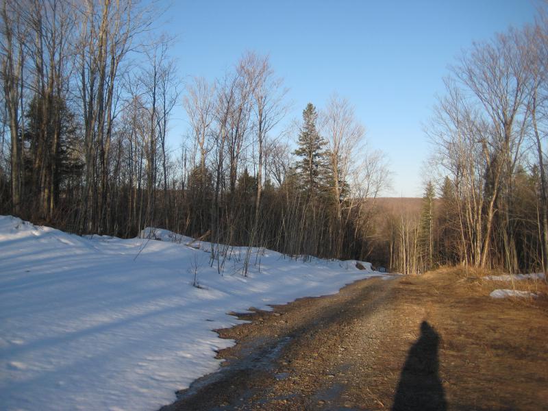
A long swath of clear cut surrounded a muddy track. Climbing over the brush we made it to the track and looked around. The swath was narrow and winding, not offering much of a view in any direction, so we simply set down the road to the north. It felt good to have solid ground underneath us for a while, even if the tick mark would draw us off soon.
The muddy track forked sharply and we headed back to the river. It crossed right where I had parked once last year, back while I was searching for Leatherby Falls too far north. I hadn't found much that day. Logan and I turned and continued downstream and soon found ourselves and a thick swamp.
Barren swampy section of the river
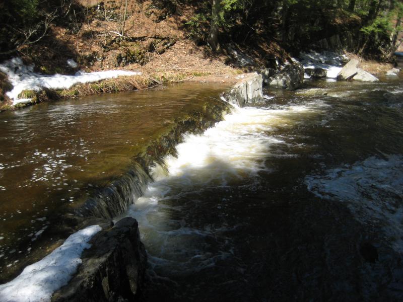
So this is where the topo map thinks that Leatherby Falls is. I couldn't help but chuckle sadly. Well, any questions I had about today's finds were now answered. The real Leatherby Falls was a two-tiered drop off of a logging road a mile upstream, there is an upper drop a few hundred yards beyond, and a few mediocre rapids downstream that could loosely be called Lower Leatherby Falls.
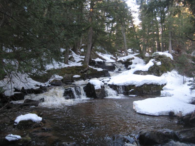
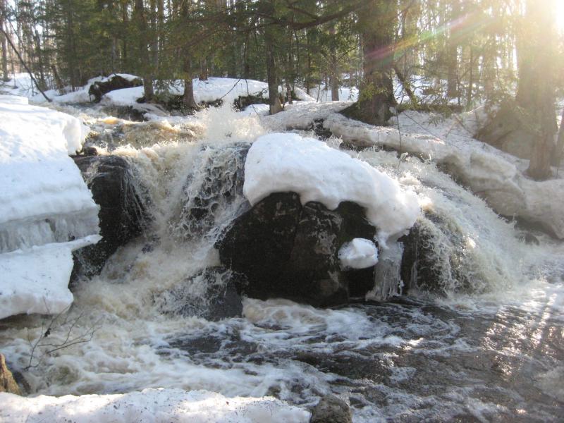
Hacking through the swamp didn't take too long, as it isn't a long section and the tag alders were easy to push through this time of year. The next spot to check out was near the old quarry. There's a cabin by it with a bright gate where I had found some waterfalls last year. A local had pointed it out to me, though I'm not sure if he was just being friendly or trying to deter me from finding the real drop upstream. We passed the small cabin and checked out the bubbling rapids below.
Cascades near the cabin
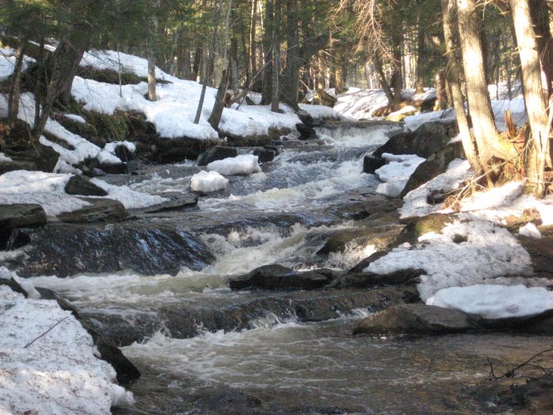
Over the next mile things began to change up. More cabins sprung up around the river that forced us to stick close to the water's edge. More drops sprung up, individual cascades a foot or two tall. Also, the air was beginning to warm up with the rising sun. I took off my big green jacket and tied it around my waist in a fashionable manner. Always look fashionable, even when hiking in mid-April.
Gentle little roll
Small upstream drops between snowy rocks
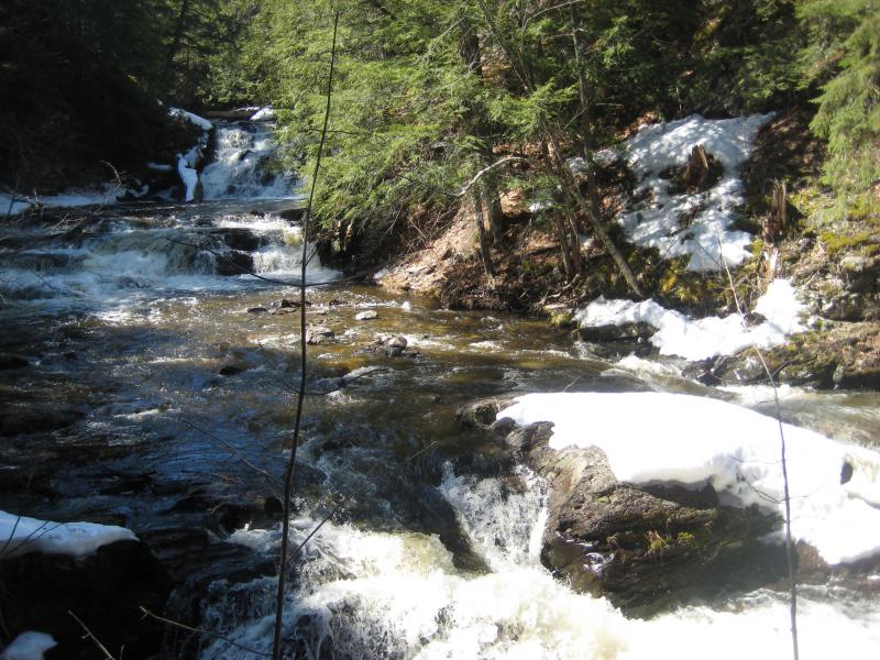
Most of these lower drops over the last mile could be classified as upper parts of Erick's Falls, especially the ones within sight of the bridge. I really didn't want to name any of them, though. The only reason I wanted to call out Lower Leatherby Falls is to show future explorers how wrong the topo map is and help clear some misunderstanding of this stretch of the Huron River.
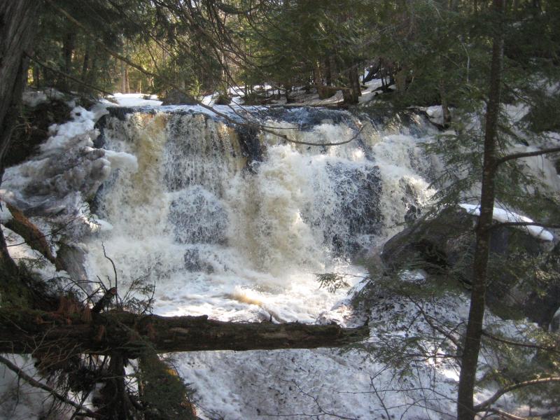
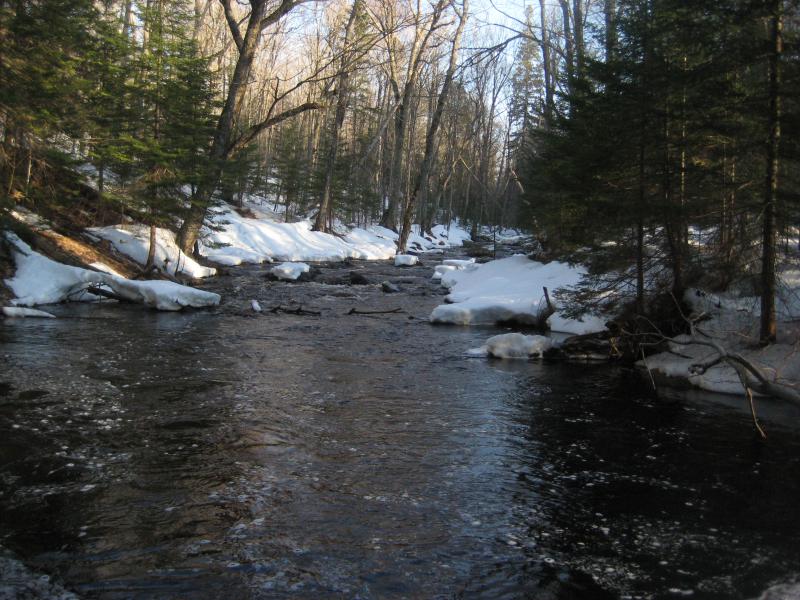
Happily, I climbed up onto the road and dropped off my coat in the car. It had taken over an hour to walk the three miles up the snowy road and two and a half to follow the river back down. Not horrible time at all, and the entirety of this river had been explored. While I was here I dropped down quickly to check out Erick's Falls, the blocky little drop that sits downstream of the road. A few icicles lay near the water's edge, otherwise the banks were free of both snow and ice. This waterfall knew it was spring.
Gushing springtime falls
I briefly considered a change to my plans. I could follow the river downstream to West Branch Falls. It'd be about the same distance as the section I had just hiked, and I could take Black Creek Road back up to my car. There were more than a few promising stretches along the river that could hold drops. But what was the point? I hiked the length upstream to confirm the identity of Leatherby Falls and pinpoint the lower drops. I was fairly certain that I had already found West Branch Falls and that I just had to check out the next hundred yards upstream. Finding more drops would just eat up time, and anything I found would be unnamed. We jumped in the car, drove the four miles north to the turnoff, and parked next to the river.
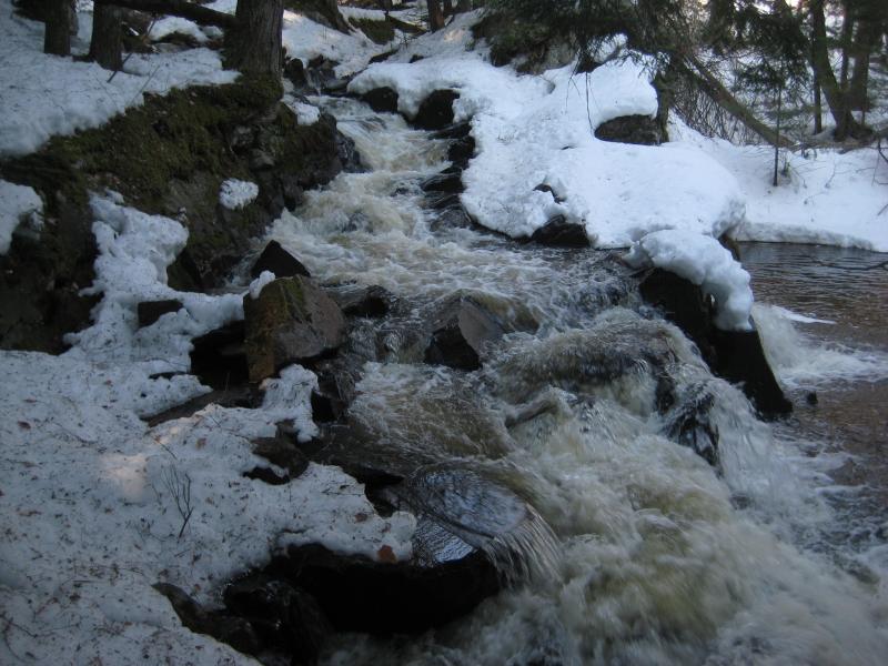
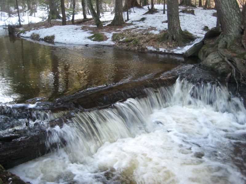
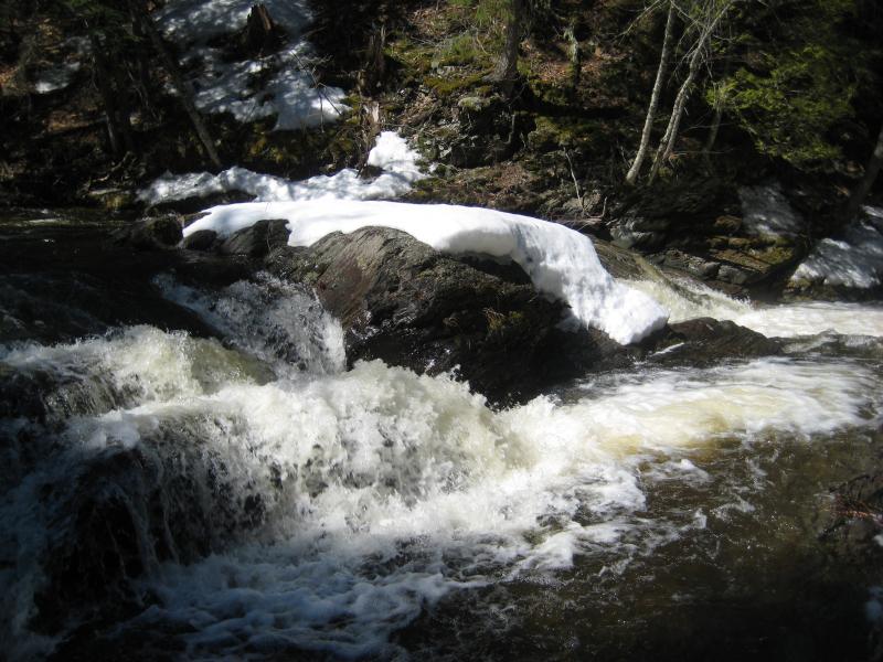
Following the river upstream turned out to be rather easy. Instead of crossing at the ford, which was running calf-high and icy cold, we crossed over a downed tree on the far side of the tall sandy bank. The trails along the east bank were thawed and easy to follow. There was one difficult section, the steep scree bank that forces the river into a sharp turn, that we had to crawl across. Otherwise we made it to the lower chute with no troubles.
An overflowing chute
This is where I turned around last year, right at this lower chute. I had assumed that this was all there was to this waterfall. Today I suspected more. Climbing up the side of the chute was not easy, the crusty snow hiding solid rock underneath, and I had to help Logan up and over. Aside from a steep and loose bank there wasn't anything to see up here.
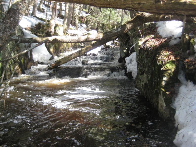
So we walked upstream. The easy paths that we had followed up had now dwindled to narrow tracks that crawled along dangerously close to the water. We creeped along, passing by a small uniform drop across the river and another narrow chute. This second chute was shoved tight against the western bank and was difficult to view. I guessed at a height of a few feet before we climbed up it and continued on.
Side chute across the frothy pond
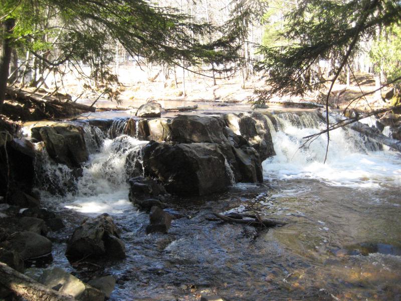
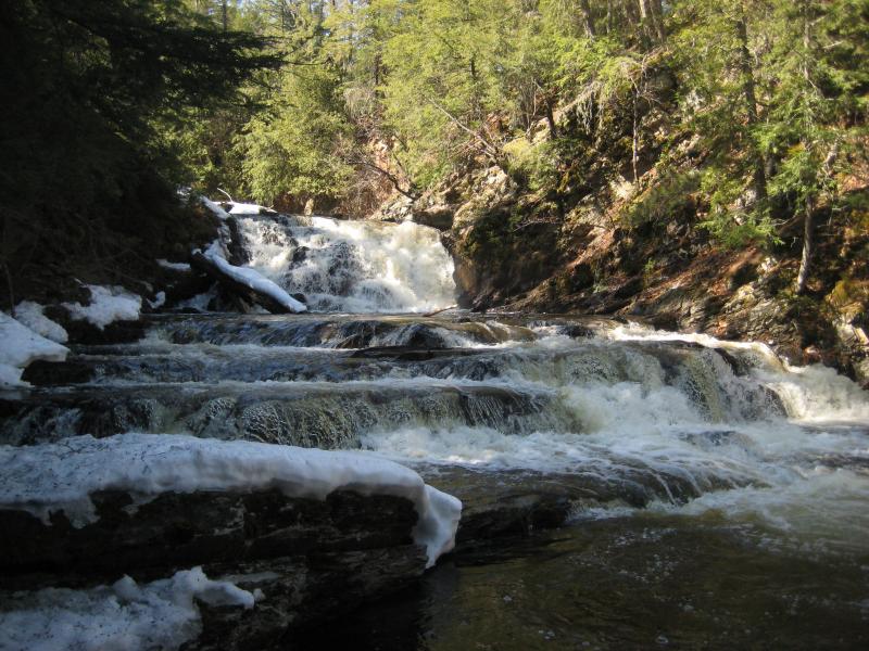
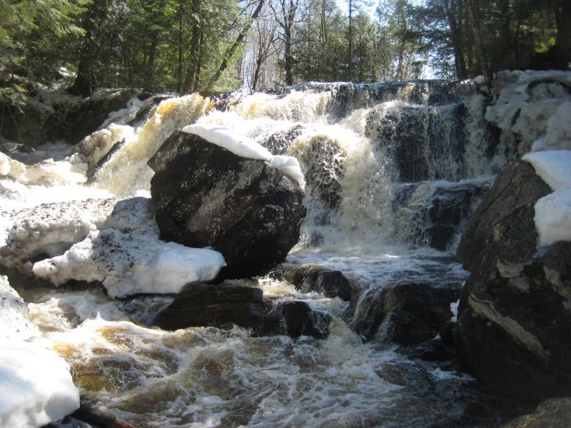
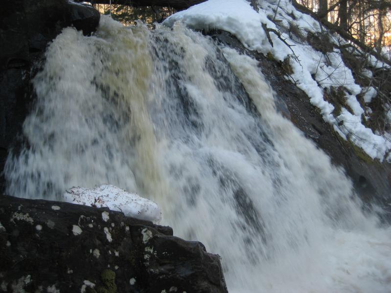
To get over the second chute we had to climb high up on the bank. Looking down I saw a promising pair of domes below and heard something bigger around the bend. We cut down the mossy and wet rocks to get a closer look at the domes when I saw the source of the roar. West Branch Falls, the real waterfall, sat ahead in misty and half-shaded glory. Now that was a drop.
Looking down the steep slab
First view of the main falls
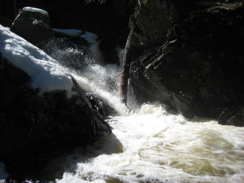
Waterfalls over ten feet tall are not very common in the Upper Peninsula. There are a couple out there, sure, but to find a single drop of that height is rare. To find a drop that height that is practically unknown seemed impossible. I had found no pictures of this waterfall online, just cursory mentions and images of the downstream chute. Yet here it was, sheltered in a rocky gorge, roaring out at me.
Rushing water over the main waterfall
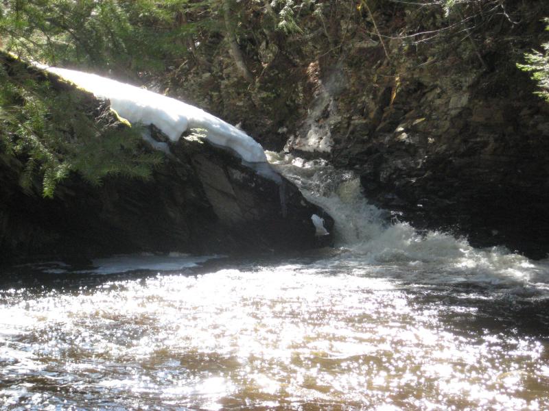
I crept up the side slowly, grasping onto snowy rocks and trusting the icy shore a bit too much. Logan quickly decided that this was too much for him and hung back. I made it to the side of the waterfall, enjoying the cold spray misting my glasses and face, and slowly climbed up and peered over. There were a few decent drops upstream, nothing terribly tall, and it looked like the river gorge was shallowing out. Plus there were a few cabins in this area. I was content with stopping here at this waterfall, anyways.
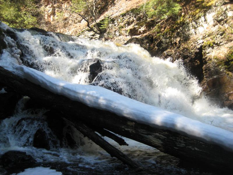
Full and gushing waterfall
We headed downstream past the lower chutes and drops. On a whim I led Logan across near the lower cabin and we followed the drive out, cutting off a few minutes by looping around Black Creek Road to the car. When we piled back in I reviewed my options. It was now well into the afternoon. I was pretty much done with the Huron River for today, not really feeling like tackling the eastern gorge. Also, hacking up and down Ravine River and looking for a waterfall didn't sound like a lot of fun either. Food sounded fun. We headed back to L'Anse and picked up some Subway.
There was one idea that crept into the back of my head as I ordered a meat-filled sub to split with Logan. The Silver River would be flowing pretty good today. It was down by Herman, a bit out of the way, but if I could capture some images of the overflowing waterfalls, especially along the tiny Harlow Creek near the lowermost drop, I'd be pretty happy. Plus the somewhat-thawed forest around Huron River could mean relatively easy access.
As I drove up the old Herman road my excitement began to ebb. There was a lot more snow back here then I expected. The further I climbed in the elevation the deeper things looked. When I parked off of Summit/Lahti road there was a solid foot of white beyond the plowed section. This was looking like a bit more than I had hoped for.
Soft snow on the road
There had been a lot of snowmobile traffic along this roads to help pack down things, though I still broke through every couple of steps. It took me close to an hour to walk the two miles north to where the largest waterfall of Upper Silver Falls was. Descending down into the steep valley was not easy either, as the snow deepened the further down I got, and by the time I reached the falls I was having some serious doubts about this stop.
Full, gushing Silver River
At the least the river was running full today, filling up the waterfall with off-white cascades and plunges. I took a few pictures and weighed my options. I probably would not get another chance to visit Harley Falls to the east, and it was bound to be running today. Reaching it would be tough, as would climbing up along its length, but it would probably be worth it. I left Upper Silver Falls behind and headed downstream.
Harley Creek flows into the Silver River less than a half mile below the main falls. It comes in from the east, which meant that I had to find a way across. There are no bridges along this length, just fords, and there was a downed tree about a mile away that may still be around. If I wanted to cross I would have to wade through the icy waters. Calling Logan to me and scooping him up I trudged through a rocky narrows, doing my best to ignore the cold rushing up to my knees and pouring down my boots.
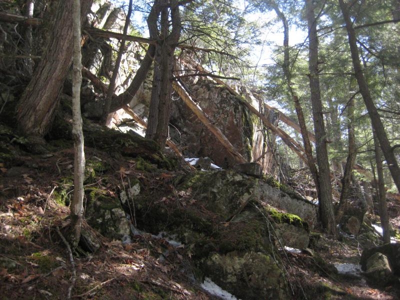
Referencing my map I decided to cut a straight line over to the lowermost drop on Harley Creek. This seemed like a better option than following the curves and bends of Silver River. I was surprised to see a steep rock wall lift up from the woods and tower above here. I didn't think there was any cliffs like this back here. Making a mental note to check this out on the way back I trudged along it until I could cut towards the creek.
Steep outcropping near the mouth of the creek
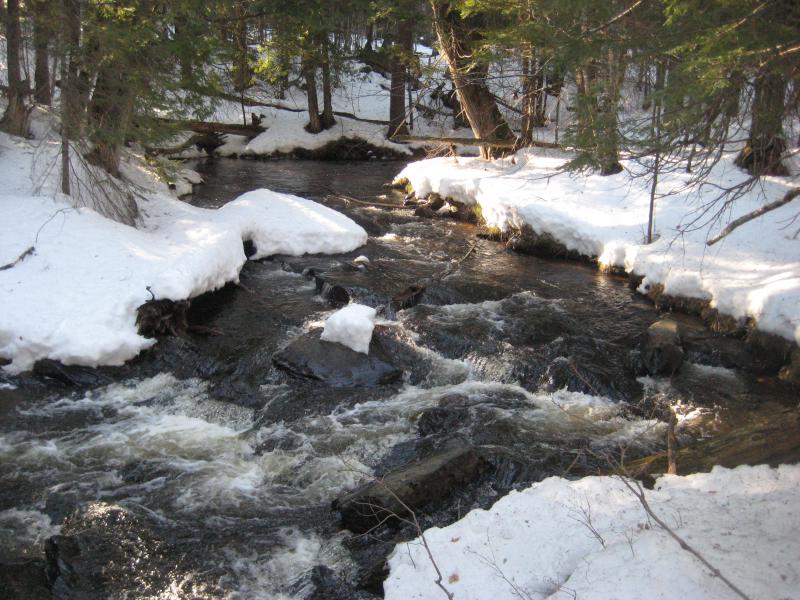
Harley was running full over the smooth builders and drops when I bumped into it. This was good news. Last year I had visited it in July, during the dry and hot summer, and there had been barely a trickly along it. Today would be a nice improvement.
Swollen, snowy lower drops
Frothy sheet of water
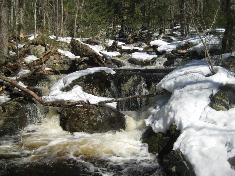
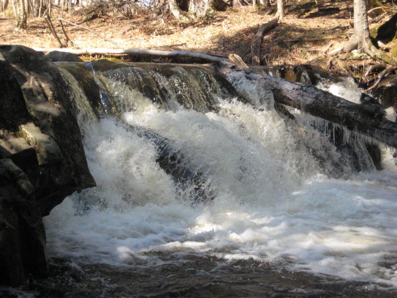
While the lower drops were full and rounded, it was the second drop that really impressed me. A slated rock wall, some six feet wide and high, was completely covered in frothy whitewater. Last year it had been mostly covered in dripping moss with the barest flow down the left side. Today it roared. Feeling better about my decision to cross Silver River and tackle this longer hike I continued on, excited to see the rest of the waterfalls.
The other drops along Harley Creek were also full but were less impressive. There were some overflowing rapids, a few cascading drops, and long stretches of calmer waters. I stopped to hunt around the little box canyon for awhile. The drops in it are nestled at the far end and are impossible to reach without wading through the canyon. Which looked crazily deep. I kept to the snowy banks and craned in for a shot of the waterfall.
Narrow box canyon with stepping drops
An hour and about a mile up the creek calmed down. There was an old road that crossed up here, a track that could lead me back down to the area of the drop on Silver River that I had left behind, yet I decided to set a course back through the forest. I had those rock cliffs to check out. Plus, there was something weird going on in the woods.
Most of the forest was bare from the winter, long grey trunks interspersed with the occasional pine. Yet there was a low hill clustered with green to the south of the creek. I wandered over to it curiously. The hill rose thirty feet up in a long oval, mostly bare on the sides and with a thick crop of pines on the top. This, this was weird.
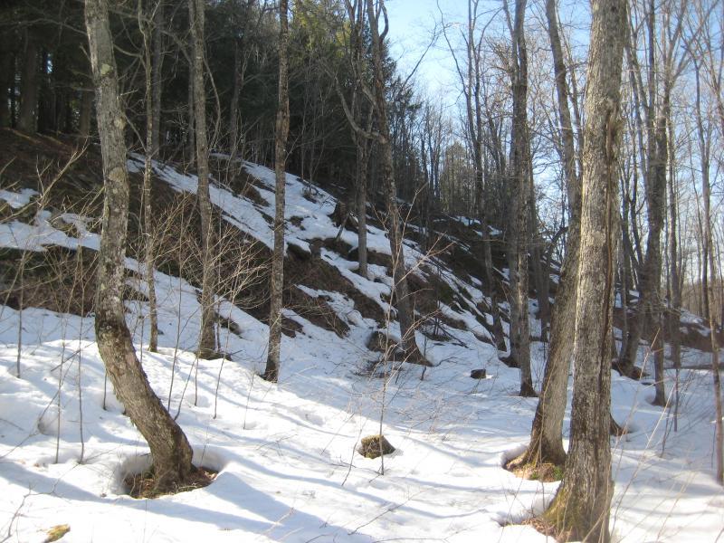
Long hillocks above the snow
Logan and I climbed the hill and reached the top. Thick cover had kept most of the snow off the ground so we walked on a soft bed of pine needles up here. The ground seemed rocky and sandy, and the hillside had also been pretty rocky. So that must be it: this hill was mostly solid rock rising up from below, and the top of it was too rocky and poor for anything but hardy pines to grow on. Satisfied we crashed down the steeper west side and headed towards the rocky cliff I had found earlier.
We walked through the barren forest and re-entered a cluster of pines above Silver River. I eased my way west until the steep rock drop stopped me. There was a partial view of blue between distant hills, though it was so far I couldn't tell if it was Lake Superior or the hills of the Keweenaw under a trick of light. I liked the idea of seeing Lake Superior better.
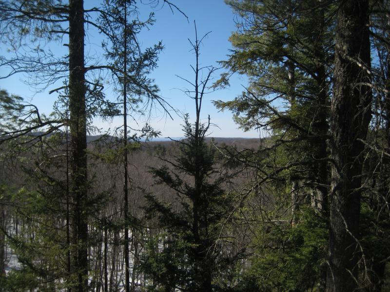
Distant blue of Lake Superior
Descending the rocky formation was not easy. When I finally made it back down to the waterfall over two hours had passed since we had last been here. Daylight was going to be an issue this evening. I took a few quick pictures from the eastern bank, decided to wait for a dry crossing back across, and started walking upstream.
Upper Silver Falls
Full curtain of water over the falls
There are four more waterfalls over the next mile of river, giving Upper Silver Falls a total of five impressive drops. The lowermost one, the one I had been to twice today was the largest and easiest to reach. There are no trails or markers to find the other ones. The best way to visit them all is to just hike the length of the river. During the summer I found it easier to simply walk in the river than hack through the brush on the banks. Today the spring flow and cold waters would keep me on the eastern bank for a good long time, though.
The gap to the next drop is a long way, over a half mile, and it took me over forty minutes to push through deep snow and around the brush to reach it. Spring melt had transformed it. Last time I had been here the waterfall had been a slimy, mossy trickle that slid sideways along a crack. Today it was a beautiful dome into a deep pool. I ignored the evening light filtering through the trees and rested near the pool for some time.
Solid dome of water over rock
Our next stop was only a few minutes upstream, a mediocre slide that crashed into the a snow-covered boulder with a gush of whitewater. The entire drop is only a few feet tall, one of the smallest on the stretch of water, and I spent little time here. I was only thinking of the next upstream drop.
Rounded drop of white
It had taken me a few visits to find all of the waterfalls along the upper Silver River. First I had found the main downstream drop, then the half-dome above it, and finally all four of the upstream ones. That last visit was a real surprise. I had little expectations of finding anything cool upstream of the main drop, thinking that all of the upper drops were less than six feet tall and more rocky cascades than plunges, but the second drop was very impressive.
It starts with a long slide over smooth rocks similar to Cliff Falls over in the Huron Mountains. Then there's a shallow pool over hard rock, and then the plunge. The rock just drops straight down with the river pooling and spilling like an overfull bowl of water. There are several little cuts that let the water spill out, forming multiple plunges at this spot.
During my last visit the river was all but trickling and only thin streams leaked out over the rock. Most of the water flowed down a cluttered side channel under logs and brush. Today, though, I had high hopes. With the high waters I just knew some of those cuts would be flowing.
Multiple plunges of water off the sharp ledge
Busy pools above the plunges
I was not disappointed. A good amount of water did still flow to the side channel, diverted above the shallow pool, yet there was enough to fill several of the plunges. The sprayed down in brown/white streams to splatter loudly on the rocks underneath. This, this was a pretty cool waterfall. I took my time here creeping up nice and close to the rolling mist before slowly making my way around the eastern bank.
Wide and full slides of water
Sun over the boulders and river
Even the upper half of this waterfall was running good today. I could have called it here, with the setting sun and my tired legs, and walked away without seeing the last drop happy. I didn't really have a choice. The best way back to the car was above the last drop, over a bridge and up a road that connected back to Summit/Lahti. I continued on through the snow and finally made it to the uppermost waterfall of Upper Silver Falls.
Gushing uppermost drop
The last waterfall did finally give me a way across the river, even if I had to get one boot resoaked in the process. Logan leaped across after me with ease without getting so much as a paw wet. Back on the western side of the river we cut a line over to the two-track and looked around. There had not been snowmobiles down here, not with the gate over the bridge blocking access, and the snow was soft and deep.
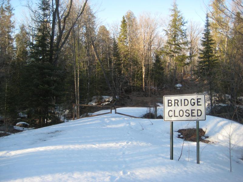
Snow on the closed bridge
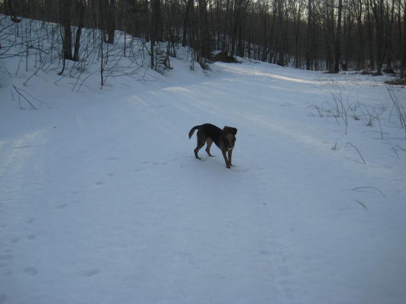
Logan tooling along on the empty road
Today had been a long day, hiking down along Leatherby, up West Branch Huron River, and now all around the Silver River. My legs had been cramping up for the last two hours already. And now we had an uphill mile through soft snow to reach the car. Sitting around wasn't going to help. I steeled myself and pushed up the hill, resting every couple of yards, eventually breaking the crest of the valley to catch views of the flat farmland to the south.
Setting sun over the old orchard
It had been some time since I had an all-day outing. I drove back to Houghton in the dark, stopping briefly in L'Anse for some salty food and caffeine. The day's hikes wore on me. I had been out for well over twenty miles through snow and over hills during every minute of daylight. Even as I hurt my mind raced ahead to the next adventures. If the rivers were running and places as remote as these were accessible, how far could I push it? Would a visit to a place as snow-covered and wild as Mulligan Plains be possible?


Comments (0)