The summer was over half through. I had been to a good number of waterfalls, maybe fifty so far. There were a lot more waiting for me, though. I never had an official goal established, as my destinations continued to push out of the Keweenaw further towards Ontonagon, Bruce Crossing, and Marquette, but my explorations still had holes in them. I enjoy finality, the ability to check something completely off the list, so today I aimed for some low-hanging fruit. Today I wanted to finish up the falls north of the Portage.
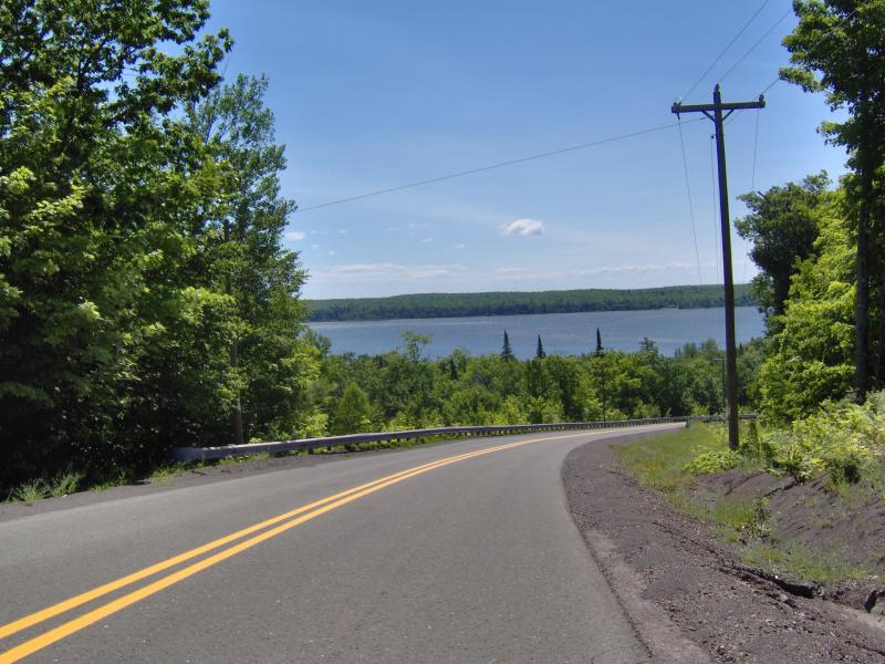
Logan and I left Houghton a bit later than I hoped, both of us sleeping through my first alarm, and the sun was well into the sky before we drove over the bridge. My plan was to follow the curve of the Keweenaw up, hitting one stop at a time until we (almost) hit the very tip of the Upper Peninsula. We had a rough time constraint, as there was a party that evening that we were planning to be at, so I wanted to make sure our route was efficient.
Once we got to Calumet I turned over towards Calumet Waterworks. I had heard that there was a small drop along Gardnerer's Creek out this way. I didn't know much about the waterworks so once we reached Lake Superior I slowed the car down, keeping a close eye out for anything suspicious. Within a short distance of the park a large sign popped up on the right side of the road for Gardener's Creek. Well, that was easy.

Sign for Gardeners Creek
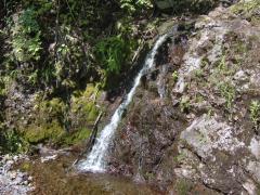
Parking on the wide shoulder Logan and I headed down the trail which happened to follow the creek up. I had an idea of what the falls looked like: tiny. They showed up right under a footbridge, a mossy cascade maybe a few inches in height. Barely a set of rapids, let alone a waterfall, we left after only a few half-hearted photos.

Tiny green cascades along the creek
Disappointed by the first stop we continued on to a more ambitious hike along Eagle River. There are three named drops between Phoenix and the town of Eagle River. I'd already been to the easy ones, Eagle River Falls and Ten Foot Falls, but Fenner's Falls had eluded me so far. Not knowing exactly how to reach it I tried a blunt approach, parking down the road from Ten Foot Falls and following the river. At first I tried upstream, but when the river started calming down and the steep, rocky banks began to subside, I turned and headed downstream.
Following Eagle River was an adventure in itself. The rock is craggy, crumbling volcanic, with steep outcroppings shooting up from the water and tall pines perched far above. Remnants of abandoned industrials littered the riverbed, and piles of poor rock, either from mines or the road commission, poured down the banks at a few places. It was a pretty, tough hike, and I had to carry Logan over several deep fords and particularly jagged rocks.

Overhanging trees and banks on Eagle River

Huge outcropping along the river
After a half hour or so of being gouged by the canyon walls and soaked with repeated fords we made it to Fenner's Falls. The waterfall has roughly three drops that we had to climb down, as both banks steepened to dramatic walls here. The first was a narrow chute, followed by a deep pool that had a tire swing dangling above it. It was easy to climb down that one, but the second drop, a tumbled clash of volcanic plunges, was difficult with a puppy. The last drop, a slide over conglomerate rock, would have been almost impossible to climb over if the entire face was wet. Today the river was contained to a fan on the right side. Carefully Logan and I climbed down the entire waterfall, taking photos of the rugged drops along the way.
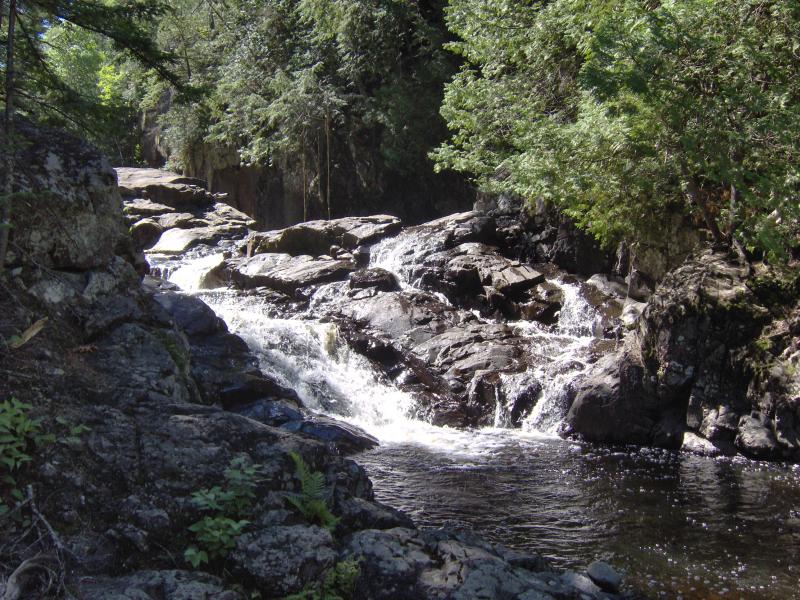
The rugged upper drop

Bright sun on Fenners Falls
Once we reached the base I noticed a trail leading up the roadside bank. There was an easy way to these falls after all. We followed the narrow footpath up and through the woods, coming out on M-26 near a mailbox. It was a quick walk back to the car along the busy highway, but it sure beat retracing the route upstream.
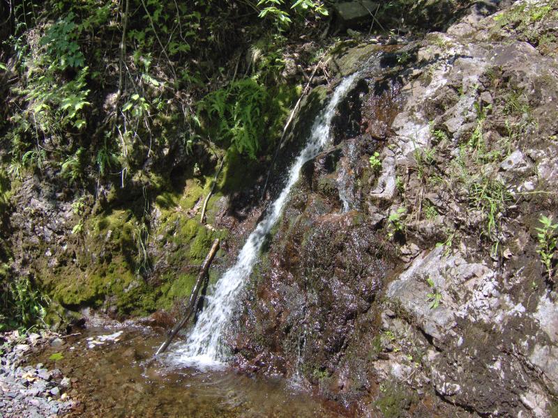
Thanks to our late start and the tough hike along Eagle River it was getting close to noon already. I was too stubborn to stop for lunch so we pushed forward on empty stomachs to Copper Falls. There was plenty of drops labeled 'Copper Falls' on the internet, most of them showing very different waterfalls, so I had no idea what to expect. We drove up Eagle Harbor Cutoff, parking where Owl Creek crosses under the road, and headed downstream. The woods were terribly thick, prickly dry undergrowth clawing at us with every step, even after we jumped into the trickling creekbed in hopes of an easy path. We found a small drop over a jagged slope, surrounded by moss, with rusty remains lying around. I took a few pictures before we retreated back to the car, raw from the prickly growth.
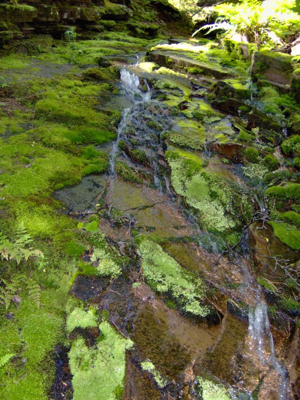
Sliding down the mossy rock
Driving up and over the Keweenaw Ridge along the back roads we made it back to US-41 for a short bit before turning down to Gratiot Lake. I had never been to this area before and we drove up and down the lakeside road for a bit, admiring the cabins and small blue lake. I knew that Eister Creek flowed into the creek from the north but didn't see anything resembling a bridge or culvert under the road. I had to stop and ask some old ladies who were out walking their dogs, one of which was able to realize I was asking about the Gratiot Bluff trail. Thanking her we headed over to the public access for the lake and parked here, ready to climb the bluff trail and find the falls.
The trail up Gratiot Bluff is across the road from the dock. It still took a minute to spot, with tall grass growing up around the sign and masking any evidence of a footpath. Wading in hip-deep weeds with Logan bounding up and down, trying to see the trail ahead, we slowly climbed up the steep path. I was starting to get worried when I saw a small sign for 'falls' pointing off to the left. We peered down the steep bank and saw nothing through the thick undergrowth.
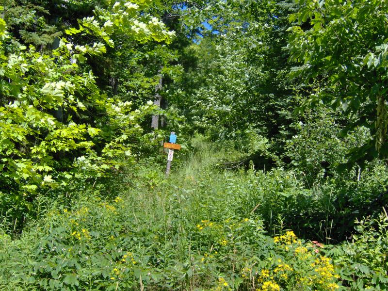
An overgrown trail to the bluff
I decided it was time to bushwhack. We headed down the bank, weaving back and forth on the unsteady dirt. It was slow going, trying to judge the crumbling earth and convince Logan, who had better footing than me even as a puppy, to continue down with me. We were less than halfway down when, with me wondering if we should double back up and attempt a different path, Logan got a bit scared and hopped right into my arms. The extra weight broke my foothold and we slid together, uncontrolled, straight down to the jagged rocks below.
Frantically I tried to dig my feet into the ground and grab at small tufts of grass and weeds with my free hand. Brush and branches passed us by, giving way to my hurried grasps, and did little to slow us down. After a few seconds that seemed so much longer I saw the rocky creek bottom rushing towards us, and with feet to spare I managed to grab a large group of roots and bring us to a jerked spot. Logan, looking almost pleased with himself, hopped right out of my hold and down to the rocky creek. I took a little longer to get down, rubbing my sore butt and checking myself over for injuries. Outside of a dirty pair of jeans and even more scratches I was fine. Logan looked at me curiously, almost as if he was asking 'So, are we going to do this?'.
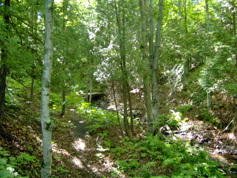
We had slid down near the top of the 'falls' on Eister Creek. I took a few cursory photos of the upper reaches before following Logan downstream. There are plenty of drops along Eister, even if the creek was barely trickling at this time of year. The walls are made up of gravelly soil and some conglomerate, the same rock the creek ran over, which was relatively easy to walk down when dry. It was a pretty hike along Eister Falls, even after the exciting slide down, and I felt let down when the creek leveled out at the bottom and forced us out with thick undergrowth, back up the steep bank.

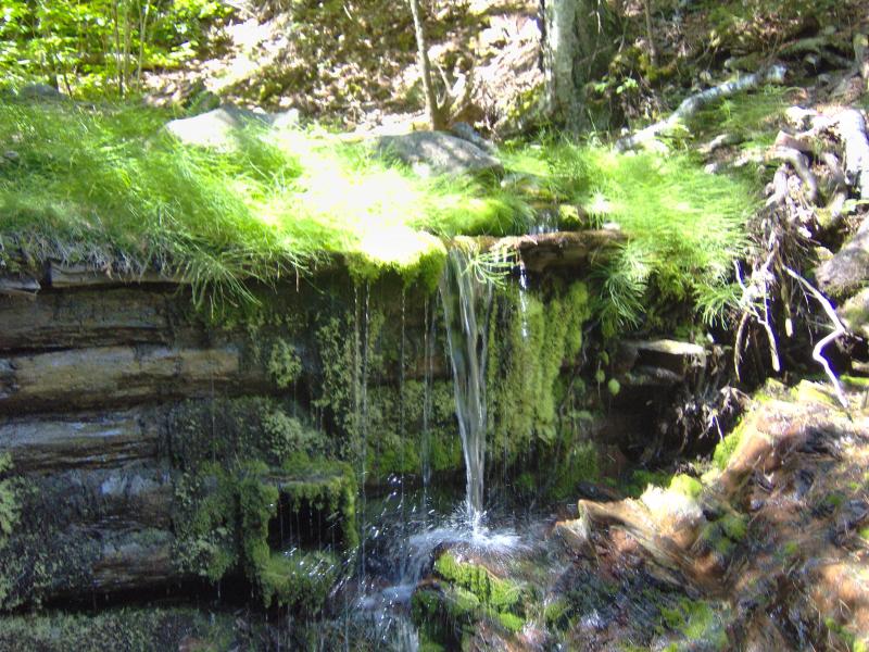
Mossy drops on the creek
It was mid-afternoon now. Logan and I had already been through a lot today and our growling stomachs were starting to sound like small bears. We had one stop left though, one last waterfall to finish up the Keweenaw, and I didn't want to turn back now. We headed up towards Lac la Belle and Smiths Fisheries, back to Montreal Falls.
Montreal Falls had been part of our first waterfall adventure way back in early June. I had some suspicions back then an upper waterfall existed on this river, just upstream, but Katie and Logan were ready to turn back after the lower falls. Even on the walk back we had talked with some other hikers and learned that there was an upper drop maybe a quarter mile away, though the trail was a bit questionable.
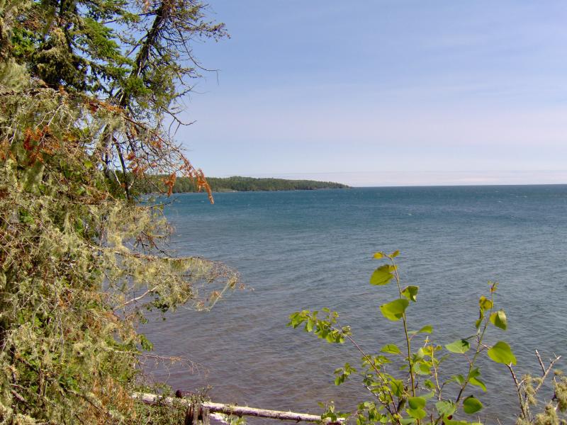
Looking east along the cove
I parked near Smiths Fisheries, the once-scary drive now seeming like an easy route, and we quickly made headway driven by our mutual hunger and familiarity with the area. We passed a few groups of hikers out here, one of which was interested in Eister Falls. I gave them instructions that were a bit easier than our perilous slide and wished them the best of luck. We made it to the lower falls fairly easy and quickly turned and headed upstream.
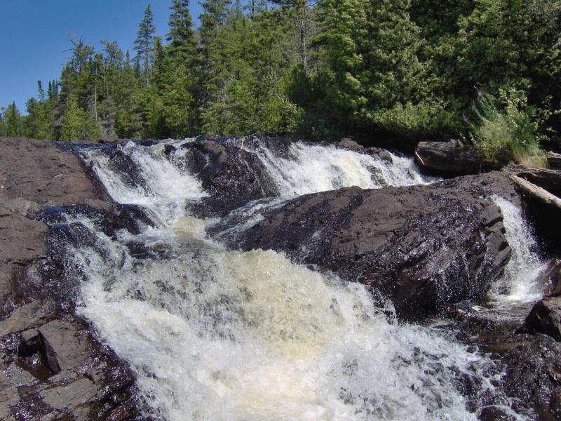
My backup camera (my better one was on loan for the weekend) was starting to fill up so I was careful with what pictures I took on this final trip. The hike up the river was easy, with one confusing spot at the first main bend in the river, and after maybe ten minutes we were at the upper falls. Montreal River is shoved in the middle of a tight chute and pours directly down into a deep pool, with a spur of rock shooting up on the western bank. The scene was perfect and inviting. After a few photos the camera was full, and we turned and headed back. It was time for a well-deserved lunch.
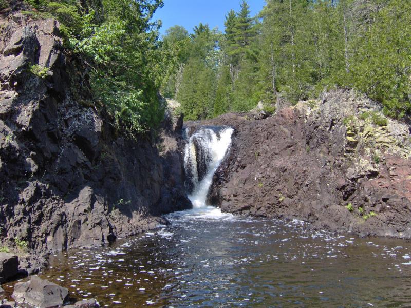
Upper Montreal Falls and pool
About ten minutes from the car we bumped into another group of hikers, This group seemed very knowledgeable about the area, and after trading some information I learned that there was another drop beyond the one Logan and I had seen. There were two 'upper falls' on Montreal River. I was not done with the Keweenaw, not today. It would take me awhile to learn of other drops I had missed, along Silver River, Owl Creek, Eliza Creek, and even one out by Dollar Bay, but this bit of news about one more drop was enough to burst my excitement for today. Logan and I were done for today, running on empty stomachs and no memory for photos, so we left Montreal River anyways. The extra drop here would have to wait for a different day.


Comments (0)