
A GPS. My sister had bought one for me in half-jest as a Christmas present after hearing about me getting lost last fall up near Nestoria. At first I wasn't sure if I would even use it, being proud of my fledgling route-finding skills. Then, slowly, I realized how much this changed everything. No longer would I have to follow creeks and formations and guess at confusing forks. Nor would I guess whether or not I had reached a destination. Now I could venture further, through questionable terrain, and reference my exact path and coordinates afterwards. The waterfall project just went up a notch.
Unconcerned with the deep snow Steele and I headed up past Calumet through spotty flurries. I didn't have to get good photos anymore - I could mark waypoints and scout for later pictures. Our drive was surrounded by high banks of snow, early this year, and the road was more packed white than pavement. Steele's jeep was able to handle this with no problems and we cruised north with Logan lying calmly in the back. He was always a little iffy in new cars, preferring to keep low and just sniff around the seats.

Deep snow pushed off the road
Parking near the start of the Brockway Drive, which was not plowed but had enough room for us to safely park, we headed over to Silver River. There were two reasons for this stop. First, since Silver River Falls is technically two different drops, I wanted to get accurate coordinates for each individual waterfall. The other reason was a bit more ambitious. I had heard some rumors on geocaching sites that there were more waterfalls far upstream past the road, small yet pretty drops in a deep canyon, and I wanted to give it a go. Even if they were frozen solid it would be helpful to get an idea of the area and routes in.

The wide drop under the bridge
It was surprising to see Silver River flowing under the bridge. The water over the upper drops, which are just steep slides over conglomerate rock, was fast and wide enough to escape the winter freeze so far. The exposed drops were narrow, with the snow hedging in from either bank, though they were still visible and rather pretty. I took a few photos before marking the spot on my GPS and heading downstream. The lower drops, blocky with plenty of individual rocks collecting mounds of snow, was not so lucky. Beneath the conglomerate falls only a shallow depression in the snow and the gurgling of water showed the path of the river.
We headed back towards Steele's car. I had a plan for hunting the upper falls. The snow was too deep to attempt pushing through miles of virgin snow along Silver River. Just down Brockway Drive, though, there was the Upson Lake Sanctuary. If we were lucky the trails might be groomed. I wasn't sure if our boots would damage a groomed trail (they do) but thought there might be chance the crust would support our weight (it doesn't). We passed by the car and headed up Brockway Drive, keeping an eye out for Upson Lake.
The outflow from the lake forms a deep gorge. It was completely covered in snow and downed trees that would make a tough crossing. Hopefully the sanctuary would give us easy crossing. When we finally reached a sign we had gained a decent amount of elevation. We didn't see any groomed trails, only blue markers and deep, deep snow.
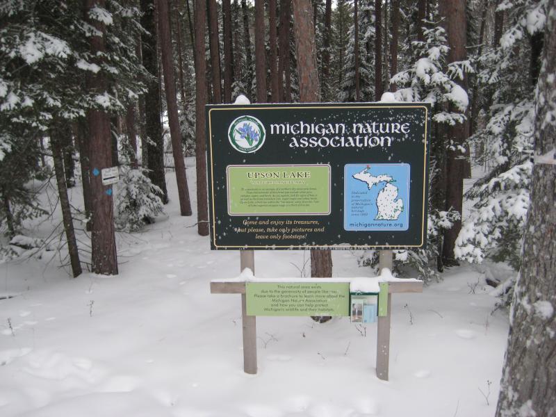
Sign for the preserve
Trying to be optimistic I plunged into the woods, Steele and Logan following my tracks. The snow came up to my knees, brushing against my thighs occasionally. We neared the Lake and were greated to a great view north of the Keweenaw Ridge. After watching the heavy grey clouds drive over the tall wooded ridge we continued on to the other bank and was greeted with thuck, scrubby woods. There was no way we could push through both the snow and this forest for a few uphill miles. I quickly proposed an alternate plan.

Looking across the lake
Upson Creek flows west towards Silver River. If we followed the deep creek we could bump into Silver River and take it south, the more difficult route that I had originally hoped to avoid. Plowing my way west along the protected creek the snow deepened quickly, passing my waist and approaching my chest. This was getting a little crazy. Steele took led after a short time, breaking through the snow like a college linebacker. There were points when the Keweenaw snow was over our heads, piled high around a downed log or over a dip in the ground. This was too much. We crawled and swam through the snow back onto Brockway Drive, the shin-deep snow a true pleasure after our experience, and retreated to his jeep.
On the way back down M-28 I got some more GPS readings of Jacob's Falls and Eagle River Falls. They were right off the road, easy enough to click 'save' as we drove past. Jacob's Falls even had a slight amount of water poking out, a narrow window through the thick snow. The sheer volume of snow here on the north side of the Keweenaw was humbling. Collecting coordinates during the winter would be a truly difficult task.


Comments (0)