Another hot afternoon in a stuffy office. Even with a nasty sunburn from the weekend I was anxious to go out and explore today. Almost a full week had passed since I was out in the woods by myself and the sweltering temperatures felt like a intriguing challenge. Leaving work I quickly headed south of Houghton on the back roads. Twenty minutes down the road I realized that I had left my camera at home.
Cursing, I looped around and headed back to Houghton. I had overly ambitious goals for today's adventure. After my adventures on Slate River, where I managed to visit seven waterfalls in one weekday evening, I hoped to visit eight today. Wasting time driving to and from Houghton wasn't going to help. For a few brief seconds I was tempted to just explore today, leave picture-taking for another day, a temptation that passed quickly. I didn't want to have to re-visit each destination.
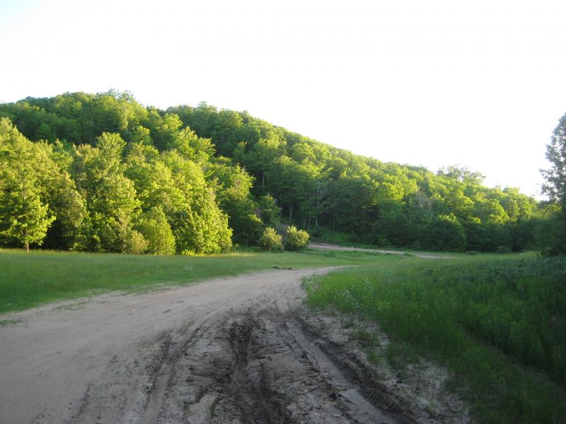
Thanks to the camera delay it was close to 5:30 by the time I reached my first stop. I parked off of Hazel Swamp Road, northeast of Nisula, where the power lines cross the road. From satellite photos this looked like a good approach to West Branch Otter River, a windy little river that feeds into Sturgeon River through Otter Lake. I hadn't used power lines for access yet and I learned quickly what the downfall of open ground was. The break in the trees allows grass and brush to grow tall and thick, with some of the fronds reaching my chest in height. Luckily there was an access road here that ran along with the lines that would take me to the river.
When the power lines reached the river the access road ended but an ATV trail continued west, parallel to the river. I followed the trail for a bit but was not willing to stray that far from the river, the only thing I knew that would lead me to Otter Falls. I cut a diagonal down off the trail. I knew that the river made two big loops to the north before the waterfall, loops that I could cut off and save a lot of distance on, so I tried to strike a balance between keeping the deep river valley in sight without dropping down to the water's edge and following the lengthy bows.
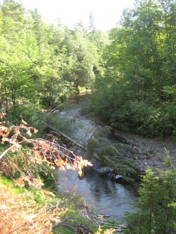
Wide river below
The first loop was easy to cut off, although the banks was deeply rutted and recently logged, forcing me up and down several brush-clogged ravines. Hoping the river would be easier than the rutted forest I did walk all the way down to the river after the first loop. I was excited to see the waters flowing swiftly between the banks, promising decent grade for the potential waterfall ahead. Also, the slope did level out down here, easing my route a bit.
The second loop showed up as the river began to bend back northwards and the riverbank hid the sun. With a sigh I turned and headed back up to the hill. Small red pine forests were clustered here, forcing me to cover my face and push through the scratching branches. I like to pretend that these clustered trees help dissuade the black flies, whose annoying presence had only grown as I followed the river. As soon as I was through the pines I headed back down to the muddy, flat sides of Otter River.
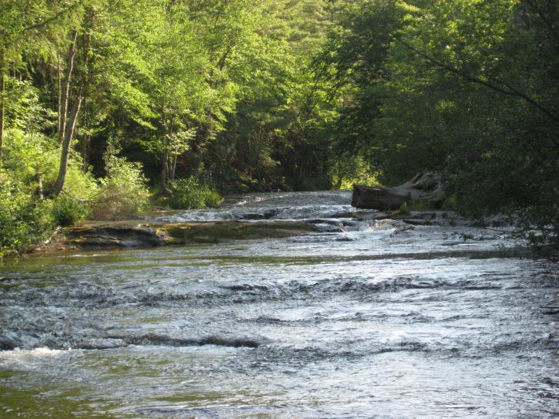
Outside of the large loops the river does have small bends and jags that forced me back and forth. The forest was thick and it was easy to lose track of the river's gurgling. More than once I had to check the direction of river's flow to make sure I was still heading upstream. I was about ready to turn around when I finally bumped into the first few drops.
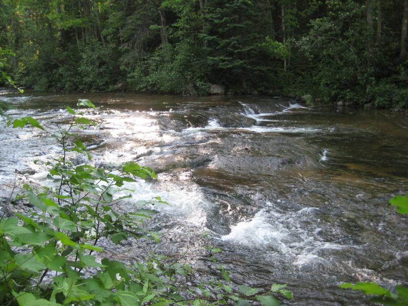
Tiny drops along Otter River
Otter Falls was tiny. Small, foot-high drops were well-worn and rounded, barely breaking the water into white. I took a few photos, wading in the water for a more direct view, before I noticed a cabin on the bank ahead of me. Not only were the falls tiny, but the land around them was private. I turned away before continuing upriver, frustrated.
The hike back was a bit easier, now that I was better acquainted with the bends and loops in the river. I only got turned around once when the river flowed west on a sharp bend but simply stuck to following my shadow instead of the river. I found the ATV trail and half-jogged back to my car, trying to outpace the black flies and get back some of the time I had lost on this long hike.
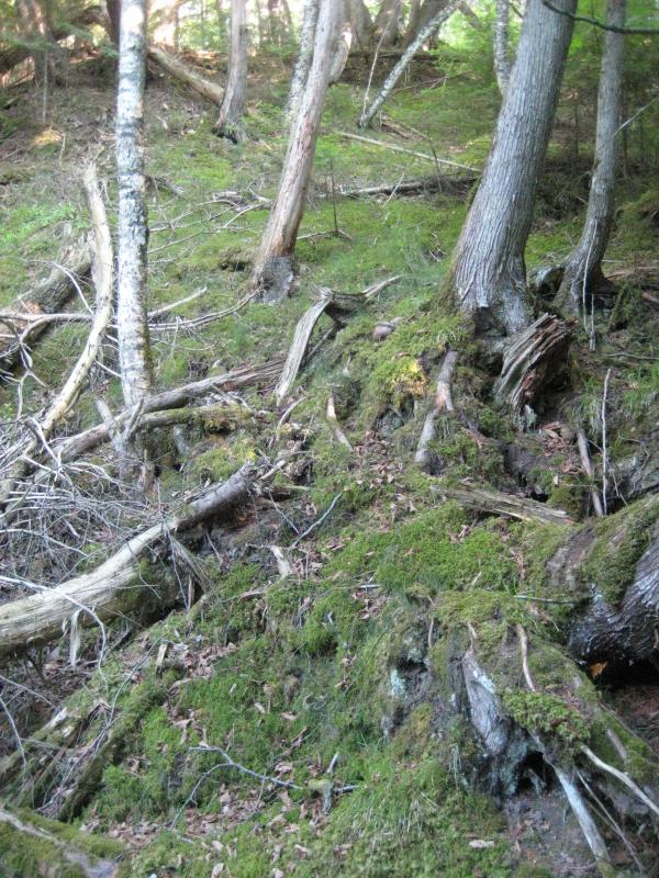
Sagging river bank
It was past 8 in the evening when I finally reached my car. There were only a few waterfalls close enough to attempt a visit this late. I headed north instead, along Donken-Tapiola Road. I was done finding waterfalls for the day and just needed a nice scenic drive home. The road was tough, with deep muddy ruts and narrow wooden bridges, but my little car made it back to pavement just fine.
Instead of going straight back to Houghton I went drove up towards South Range, passing through Baltic on the way. There was a hill I had seen from Houghton a few times, a tall forested hill with a line running up the north slope, splitting it into two equal halves like a brain. I had heard it called Brain Hill before (later I learned its more historical name, Whealkate Bluff). Guessing its location in South Range I drove through the town, parking on Whealkate/Siira Road and heading down the rutted tracks on foot.
I got lucky. After a short walk down the road a huge meadow opened up in front of me with random old trees scattered around the edge. There were a few large bonfire pits scattered around, probably left from high school or town gatherings. The hill sprung up on the south side of the meadow with a too-wide dirt road leading up it. Deep, wide ruts ran up the road, making it impassable for most vehicles. This must be a bit of a playground for ATVs and modified vehicles.
Across the meadow at the hill
After today's frustrations I needed to blow some energy, sunburn or no. I headed to the hill, pocketing my camera, and started running up the side. The dirt was solid and hard to get purchase on, forcing me to either bounce up within a deep rut or cut across to grass at times. One quick stop near the top to catch my breath and soon I was at the top, gasping and gazing out at the view northwards.
Trees framed in the view, not letting me see Lake Superior to the east or west, just framing in a shot to many points on the Keweenaw. Hancock and Quincy Mine were easy to make out, along with Mt Houghton, Bohemia, and maybe even Brockway visible in the far distance. I wandered around a bit, checking out the peak and taking photos, before walking/sliding back down the hill.
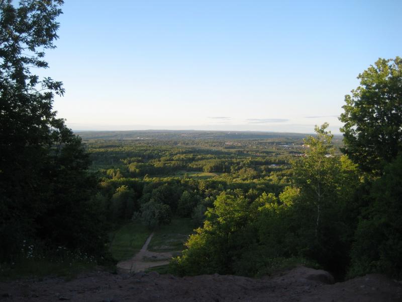
Looking north towards the Keweenaw
The sun was lighting the western sky in deep reds by the time I reached Houghton. My waterfalling trip was a huge disappointment. Instead of eight falls I had barely seen one. The hill at South Range was cool to visit, though, and driving through Houghton with the setting sun was cool. On the drive home I decided to try to be more conservative in my plans, limiting afternoon trips to a few waterfalls and saving the 'big trips' for the weekends. My seven-waterfall Friday adventure was just a lucky coincidence.


Comments (0)