Over four inches of rain had fallen over Baraga County last night. My adventures yesterday had ended prematurely when those storms forced me home early, and now nothing was going to hold me back today. After I got confirmation on the impromptu vacation day with my boss I headed down south to L'Anse, excited about the swollen rivers and a full day of exploring.
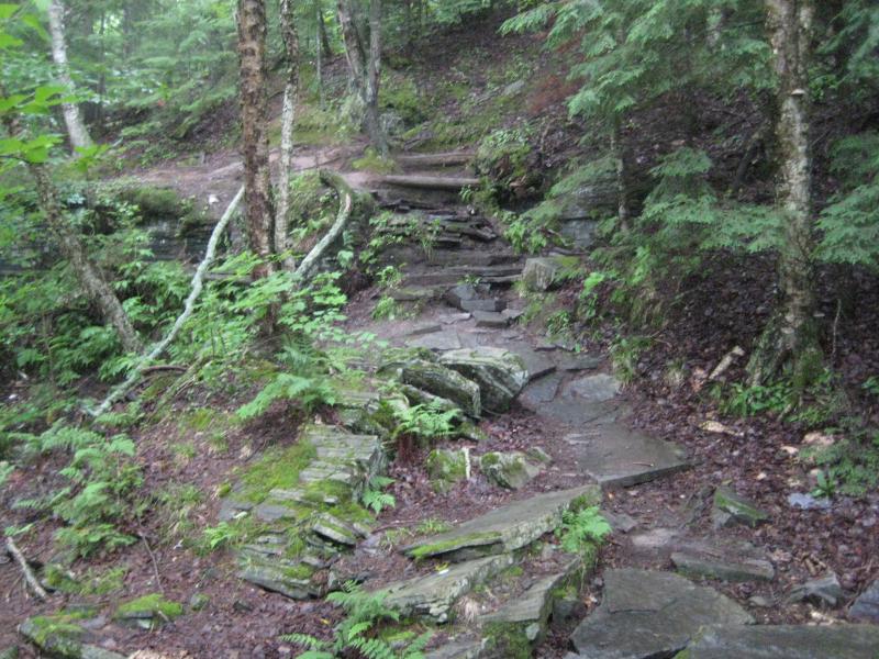
My first stop was a revisit. I had been to Canyon River Falls a few weeks earlier with Katie and Emily. They were not interested in a thorough visit, content with seeing the first drop and sticking to the main paths, so we had turned around prematurely and missed out exploring the downstream canyon. Hoping for some good views and more waterfalls (and to see the mighty Sturgeon River swollen from the night's deluge) I pulled into the empty parking lot early in the morning.
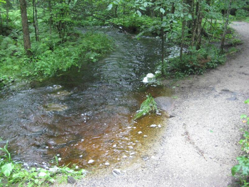
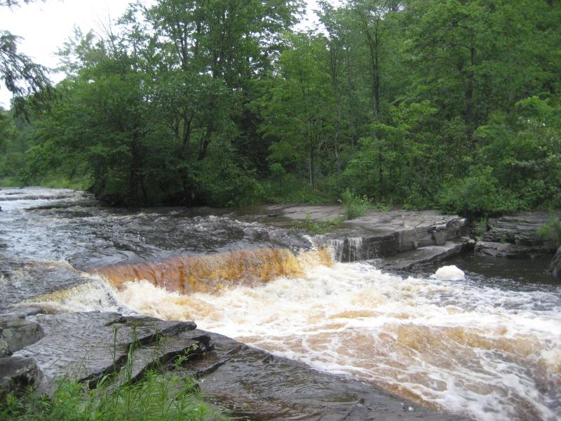
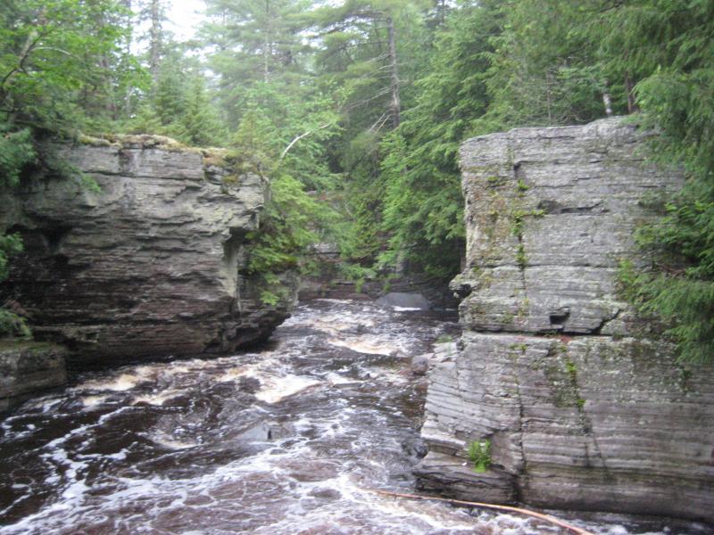
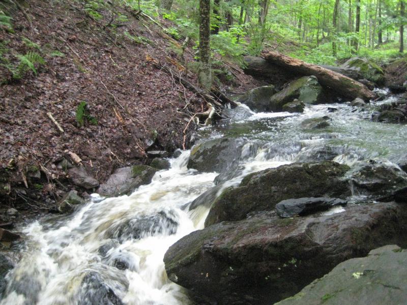
On the path to the falls it was soon obvious that I was in for a treat. Bacco Creek, which flows under a footbridge from the north before emptying into Sturgeon River, was flooding the path in root beer-colored water. I could hear the river well before seeing it, pushing beyond its banks and rushing down the slate riverbed. Canyon River Falls itself was a frothing mass of water hiding the layers of rock underneath in foam and mist.
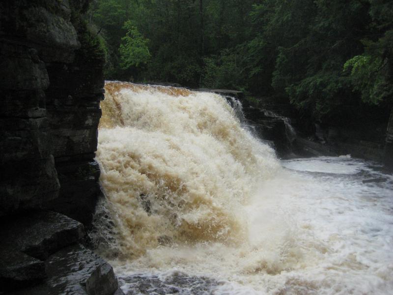
Swollen main falls
I wandered down along the canyon, past the trail's end, following the narrow footpath that continues on. There is a spot for cliff divers that was well-visited along the canyon's edge with a small, rushing drop far below. For most of the path it was hard to get a good view down at the river or at any waterfalls below, with no way down the box canyon to the water's edge (outside of diving off the cliff, that is).
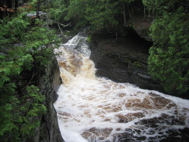
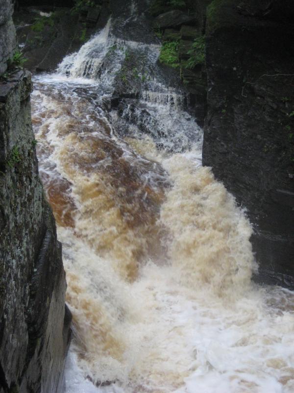
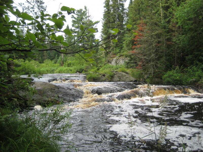
View down at the middle falls
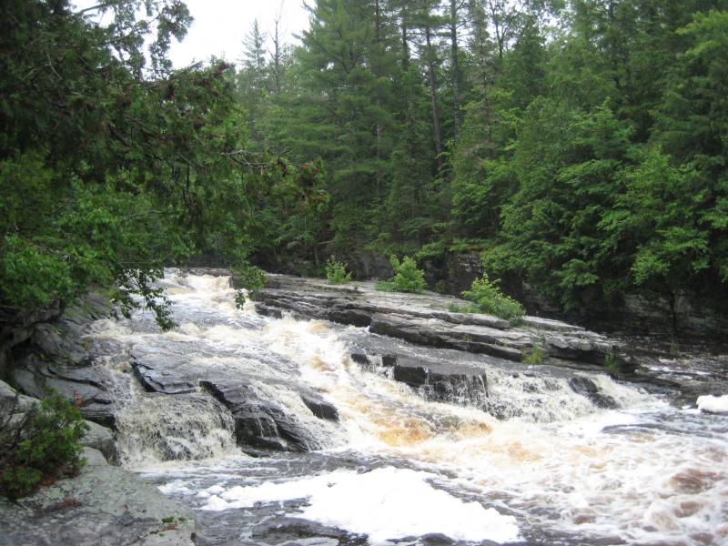
About a mile or so downriver the canyon ends, steep rock walls lowering down to the water's edge. This is also the spot that is marked as Upper Falls on many topographic maps. There is a decent waterfall here where Sturgeon River empties out of the gorge and pours over a long slide into a swampy downstream section, but it's pretty small relative to Canyon River Falls. I took a few photos and headed back to my car.
Alberta is located a short distance back up the road so I circled around and parked next to Plumbago Lake. I had heard that there was a waterfall upstream of the lake but wasn't able to find much information about it, even from Michigan Tech Forestry students who had spent entire semesters at Alberta and frequently canoed up and down the lake. Hoping to strike some luck I headed upstream, along the lake's edge, hoping to eventually find a waterfall far up the inlet.
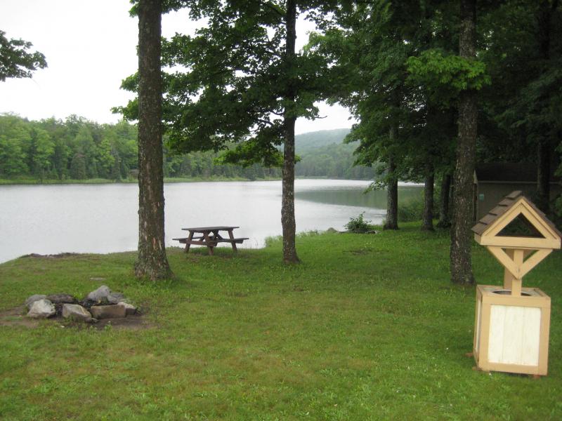
Roadside park near Alberta
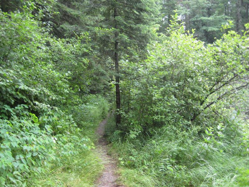
There was a narrow footpath that was hard to follow, winding up and down the steep bank through a variety of trees. It was hard to keep track of the path in the lush, wet summer green, and I found myself doubling back and searching for it a few times. Once I passed the end of the lake, which slowly turns into a swampy, marshy area, the path was pretty much gone.
As I headed down a small gorge cut into the side of the slope I slipped, tumbling down towards the water, barely stopping by landing on a makeshift bridge over a small pond. My left leg landed awkwardly, extending out straight in front of me, pulling something inside of my knee in a quick twinge of pain. I got up and walked around, feeling out the injury. It was deep but manageable.
I stubbornly continued on, ignoring my leg, past the beaver dams and swamps. The water began to quicken below me, raising my hopes that a waterfall would show up, hopes that were dashed by an upstream swamp. This one was smaller and I pushed past it, starting to wonder just how far this hike was going to be. Between the wet undergrowth soaking through my jeans, the steep slope constantly pushing me down towards mud and swamp, and a steadily increasing amount of pain shooting up from my knee this visit was turning out to be more trouble than it was worth.
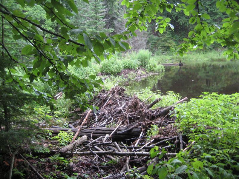
Huge beaver dam upstream
The walls surrounding the small creek began to close in, forcing the creek into a narrow channel and making my route more difficult. I gave up on sticking to one bank and started fording the creek at regular intervals in order to keep a relatively flat path. After a long mile and a half of bypassing swamps, slipping over mud, and wading through the cold creek I finally bumped into a decent-sized set of drops. There was another swamp upstream from here so I took some photos and called it good. With an aching knee I headed up the steep bank to an access road, following it back to the highway and my parked car. It would be close to a year before I learned that the real waterfall was another mile upstream.
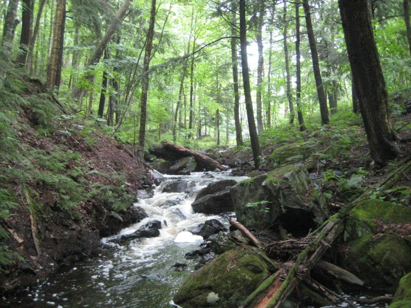
Some rapids
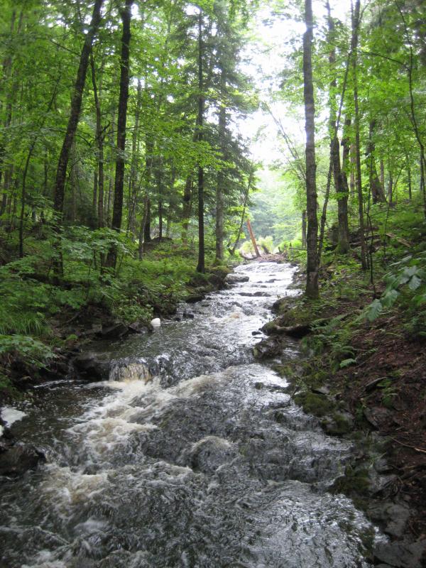
Even more swamps upstream
It was getting close to noon by now. The sun was finally starting to bring some warmth to the cool, damp woods, waking up the black flies and cooking the air balmy and humid. I was tempted to head up to L'Anse and reevaluate today's hike, mindful of the heating temperatures and hurt knee. Too stubborn for that option after taking the whole day off of work I headed south, past Covington, and over to Tioga River Park.
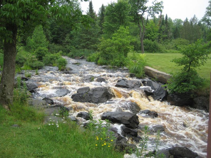
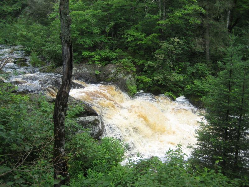
There were two waterfalls here I was interested in. The first ones were easy, right in the park. The downstream drop is a small set of rapids right near the highway and the upper ones a short walk through the woods. I checked them both out, surprised to see how dark and stained the waters of Tioga River were.
Gushing lower falls
To visit the second waterfall, the true Tioga Falls, I had to hike downstream a few miles. I tried the tough way first, crossing US-41 and heading north along the river. The undergrowth here was impossibly thick, swampy ground underfoot and tangles of branches confusing my directions. After twenty minutes of wandering I gave up and headed east, along the powerlines, to a two-track that runs north. While I wasn't sure if this track was a logging road or a driveway I knew it would be easier than the mess around the river.
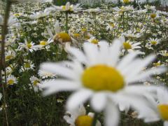
The track was easy to follow, probably nice enough for me to drive my car down, with only a few large mud puddles scattered along its length. I took some time to look around the clear-cut areas, which are always a little devasting to find in thick woods, but also made great stretches for flowers to spring up. Outside of my throbbing knee and a thickening cloud of black flies buzzing around me the hike was almost pleasant.
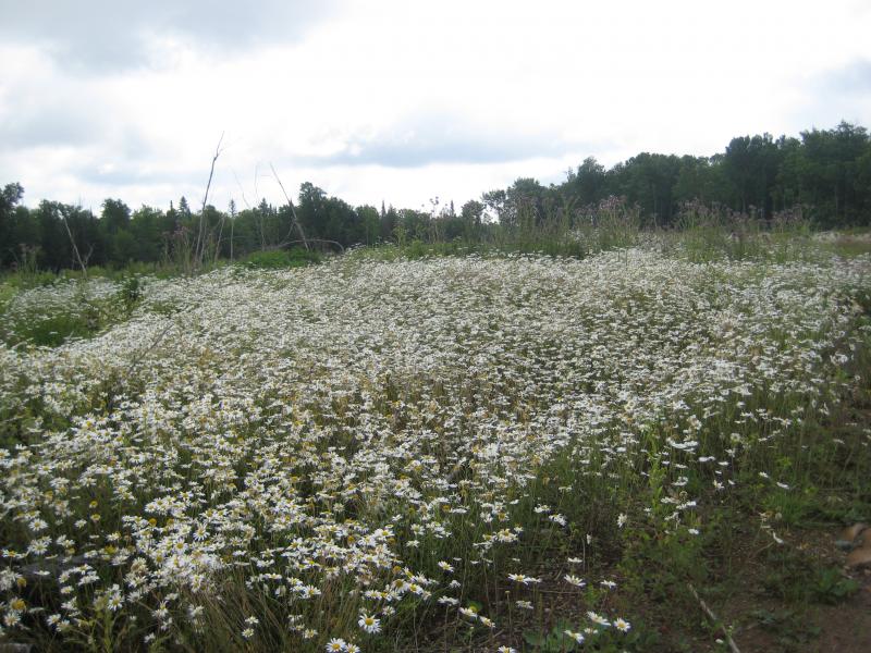
Flowers along the clear cut land
After a few miles I bumped into a sign for no firearms with a gate across the road. I continued onwards, past a cabin for sale, and the falls were right in front of me. A long tangle of rapids along the otherwise swampy creek, Tioga Falls was much larger than the waterfalls at the park (though hardly worth the long walk).
Now I was beat. The distance on my hurt leg was too much. I hobbled back to my car and drove straight back to Houghton. All the other planned stops were put on hold, rain-swelled creeks or no, while I decided to try and figure out just what was going on my knee.


Comments (1)