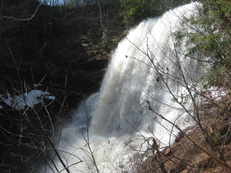
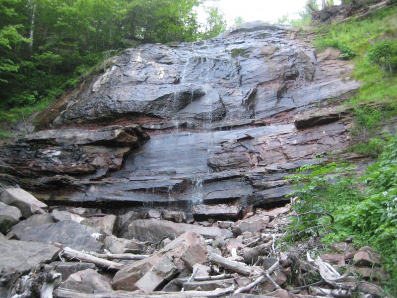
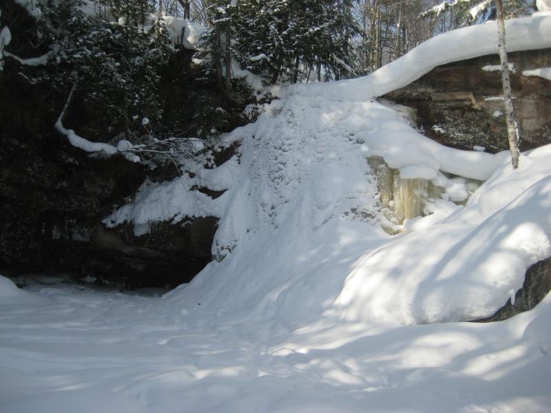
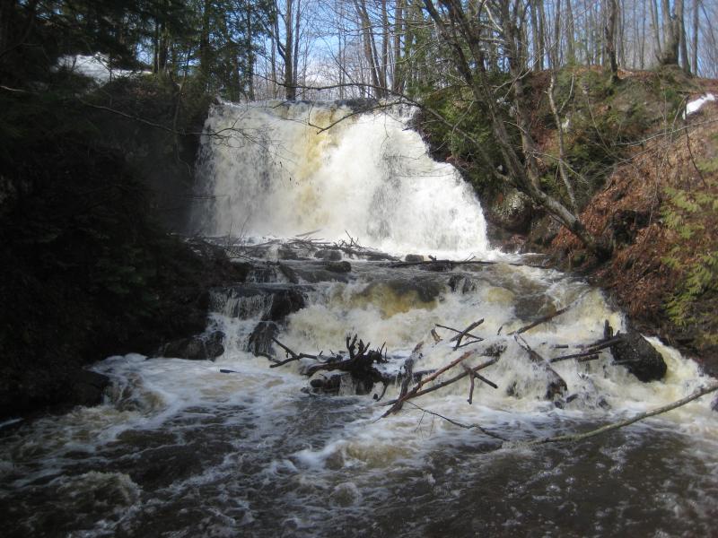
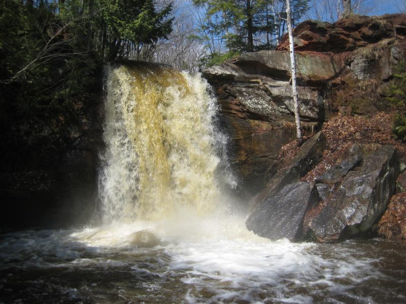

Extending northwest from Tamarack and creating a huge sandstone gorge, Hungarian Falls is one of the most well-known waterfalls of the Keweenaw for locals and college students alike. There are around six or seven drops in all along the tiny Dover Creek, though most people consider the lowermost drop - a stunning plunge close to a sixty feet high - the primary waterfall. The width and scale of this waterfall is hard to grasp with limited views along the gorge wall and a trickling waterflow for most of the year.
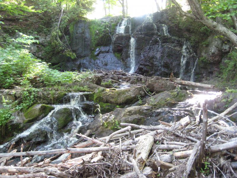
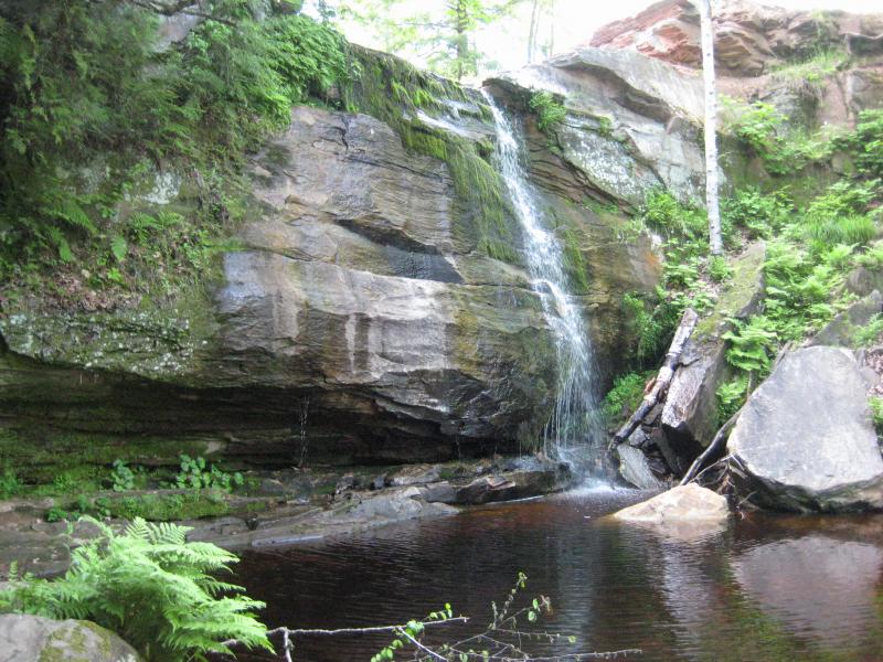
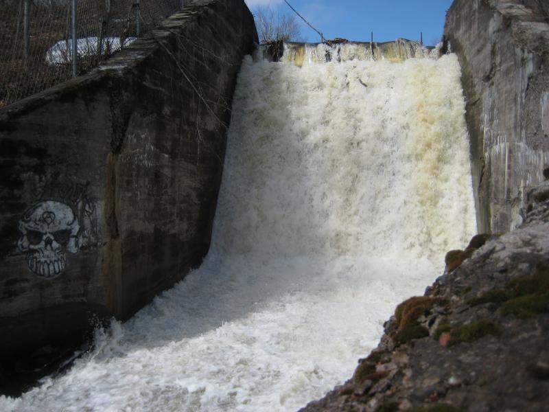
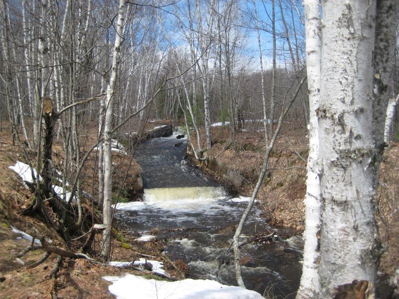
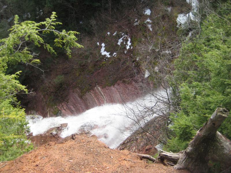
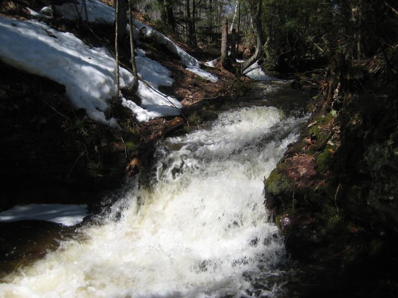
Above the main waterfall there are a variety of drops, from small stairs to other direct plunges over sandstone. Far upstream, past the small reservior, there is a unique waterfall composed of craggy volcanic rocks, the only non-sandstone drop on Dover Creek. This upper drop has good flow for most of the year while the lower drops are best visited during the spring, when the reservoir is overwhelmed by the snowmelt.
Directions
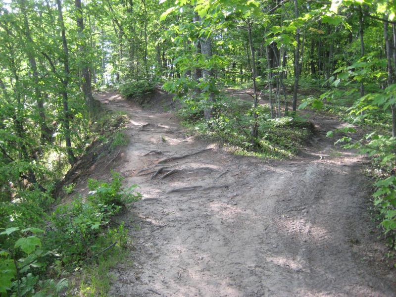
Turn west onto 6th Street (which forks left onto Golf Course Road on its way out of town). The easiest path starts about .5 miles up Golf Course Road at a gated drive. Park here and head to the reservior. The upper falls will be to the right, upstream, while all of the other falls are along the paths to the left. The paths are a bit confusing, weaving and forking around the creek, so just try to keep a close eye on the creek to not miss any of the waterfalls.
-
Jacob Emerick
Sep 3, '14
Great to hear that the water is flowing better - usually its a bare trickle at this time of year. Think I found that side falls on a spring hike (that I haven't gotten up on the journal yet), never approached it from the bottom though. That must have been a heck of a view from the bottom! That drop does seem much taller, plus the huge scoop out of the side wall is a nice change from the sheer cliff of the main falls. Where did you head down to the creek - like, how far downstream were you when you first went down the gorge?
-
Shane
Sep 3, '14
On the trail that runs along the top of the gorge on the north side between the RR grade and lower falls "overlook," there is a side trail that branches off to go down along the gorge bank, eventually reaching the bottom. Pretty sure the trail down is closer to the RR grade, but not completely sure. Regardless, if you are walking the trail from the RR grade up along the gorge the trail down is pretty hard to miss if looking for it
-
Mark Piotrowski
Nov 21, '14
IF conditions are dry, you can actually scramble down and back up the gorge a few hundred yards downstream from the falls. Would not attempt it in wet conditions!
-
Jacob Emerick
Nov 27, '14
Ah, good point Mark. Trying to go down in wet conditions, when the falls are actually flowing, is probably pretty tough!
Add to this discussion-
Jacob Emerick
Sep 15, '15
Hi Lindsey - it's a very short hike, maybe a mile total if you go to all of the drops. If you're worried about distance you should park at the upper gate, which is .5 miles up Golf Course/6th from M-26. That trail will take you directly to the upper reservoir and falls and you won't have to do a lot of uphill walking.
Add to this discussion-
Jacob P Emerick
Sep 22, '16
Hi Michelle - can't agree enough about how neat it is that you can walk right up to, into, and under these falls! That's too bad about the broken glass, though. It's not as much fun to play in the falls (or bring your pets/kids) if you're worried about that.
Add to this discussion-
Jacob P Emerick
Oct 17, '16
Hi Carol, no, the falls are not marked. There are some very good paths along the river, but there's no clear signs and it is easy to miss out on a drop or two. In fact, the first few times I went I completely missed out on the huge lower drop! I'd recommend looking at the photos and keeping track while you're out there.
Add to this discussion