Faith and I were both excited for another adventure after our fun afternoon at Quincy Falls. The snow was melting, the waterfalls were flowing, and there were dozens of spots I wanted to see the snowmelt flood down. High up on the list was the tallest drop in the Keweenaw, Douglass Houghton Falls. And that was also high on Faith's list as well. We drove up to Laurium and headed to the forbidden area.
Knowing how dangerous this waterfall is, and hoping to make a quick and undetected visit, I opted to leave Logan behind. When we parked the car I realized that I had also left my camera behind. Dang, this was going to be one of those trips.
At least we had a route planned. Between the slushy snow and flowing rivers I didn't want to follow Hammel Creek up from Lake Linden. This route is a good summer with a half-trail surrounded by green and darting in and out of the creek bed. Today it would be wet and flooded. Instead we parked up on Normand Road on the north side of Hammel near an old railroad grade. This we could make a relatively easy stroll south to the creek through the remote woods instead of a shorter and public approach from M-26.
There was a house along the grade, one that I didn't expect to bump into, so we made a wide loop west through an open field before cutting back down to the track. It was slow going. There are two old grades that cut down, neither of which have a trestle over the creek anymore, so neither one of them had seen any snowmobile traffic this winter. Our feet sank deep in the soft stuff.
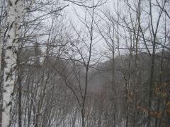
There was another detour to make further along, a gate surrounded by discarded junk, but overall our journey was easy. There were plenty of little ravines that we easily walked over on graded ground. Tiny creeks dig deep channels this high up on the Keweenaw's sandy rise. Soon our path ended with an overgrown and mostly blocked view over Hammel Creek. Now we had a long walk upstream to the falls.
I led us down the steep bank, worried that it would be the last chance to descend. The valley gets sharper as you approach Douglass Houghton Falls. We headed upstream, with me plowing a path through the thigh-deep snow for Faith to follow. I was very happy we chose to avoid this walk until now - trudging up from the town below would have taken forever.
After a long half-mile through bare woods, deep snow, and more than a few knee-deep plows through the icy waters a deep roar began to surround us. A few bends later and a wall of foaming water filled our sight. It was many times larger than when I had it seen it last summer, a huge curtain plunging down the hard rock valley, and we stared in wonder. A camera would be perfect right now.
It wasn't full melt yet, not that I could tell. There was still a lot of snow around the falls and, while the creek looked full, it was easy to imagine it being overfull. Faith and I circled around the bottom and let the cool mist coat our faces. Faith was very impressed, with so many of our past adventures culminating in tiny drops over mossy rocks. This, this was undoubtedly a waterfall.
We took a short venture down the mining adit before we started to look for a way back. Backtracking was an option, one that I had planned on doing, but my hiking partner had other ideas. She wanted to climb the steep rock walls. There was snow clinging to sections, bare rock on others, and a lot of loose wet gravel in between. I agreed to the idea as long as we aimed for the northern side, which would be a more direct climb to our route, and also seemed like one of the safer ways up.
Even with our precautions and plans it was still a treacherous hike. For every three steps up there was a slide back down. Faith crested before me, choosing a better route up near the end, and had to help me up the last few feet. The rocks around the falls is very crumbly and easily gave under the slightest force. The thought of making a direct climb along the waterfall itself, which I know others have made, was unbelievable.
Looking down on the falls was nice, especially from the side, though there was no view down towards Trap Rock River Valley from this side of the gorge. I had gotten a nice view before from the southern bank, though I wasn't willing to plow a path through the snow to get it again. We turned and headed back along the bank towards our way out.
Heading back wasn't terribly hard, with the exposed sections of the bank melted away from the afternoon sun. We made quick time back to the grade and slow time along the grade itself. This wasn't a bad approach to take. The longer hike up from Lake Linden is more scenic and less exposed, and if you were looking for a shortcut than cutting in from M-26 is the way to go (probably via a friend dropping you off), as this approach from Normand Road was just long and a bit annoying. We left Keweenaw happy and accomplished, and more than a little disappointed about leaving the camera behind.
Comments (0)