Time was slowly running out. I had a little over a week left in Michigan before the move to Wisconsin and there were plenty of waterfalls I wanted to visit, dozens alone in Marquette county. So with an expected high of 40° I made the long drive to Ishpeming and approached National Mine just as the sun was starting to wake up. Today was going to be a full day and I didn't want to waste any daylight.
It did feel weird driving down County Road 581 so early on a weekday. Large Dodge and Ford trucks sat warming up in people's driveways as people warmed up their coffee before driving to work while I cruised down the road, coffee already finished and impatient dog sitting next to me, heading to uncertain lands to find a few waterfalls. Oh well. I missed my turn at first, mind elsewhere as I drove south, and had to meander through the side roads of National Mine to turn back to CG and CCU.
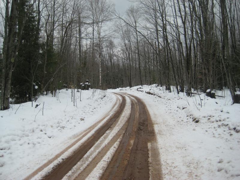
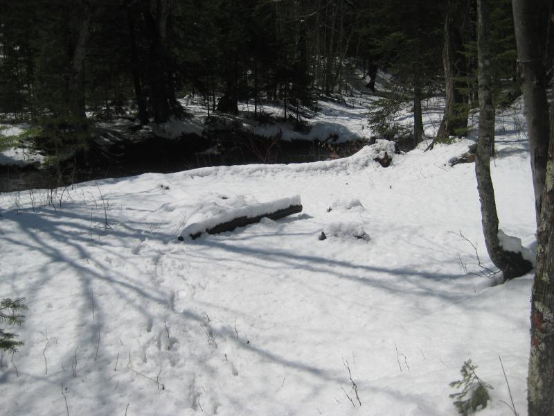
Thick layer of unmarked snow on the road
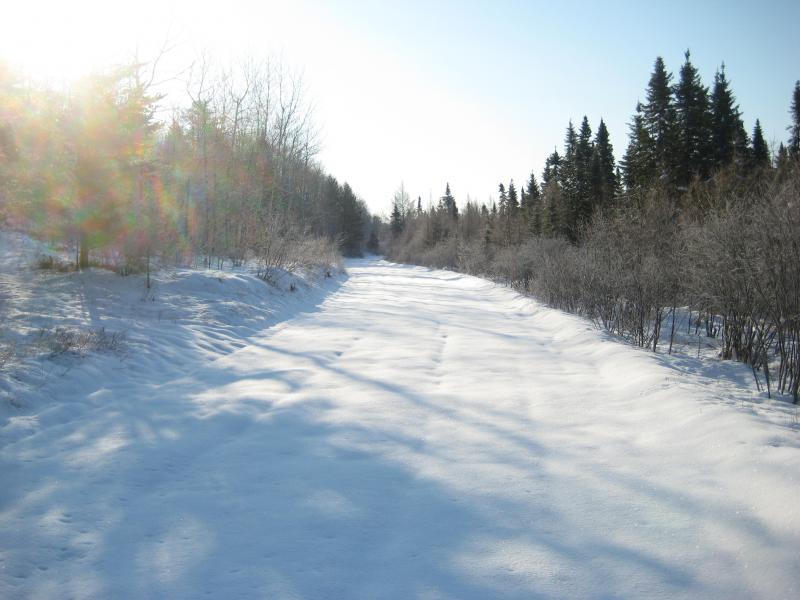
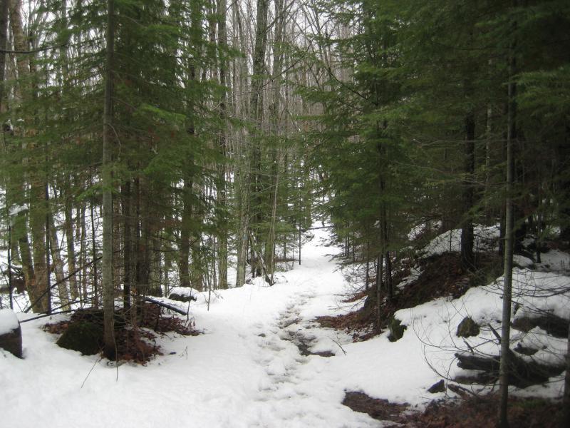
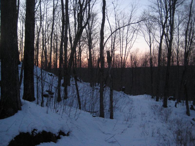
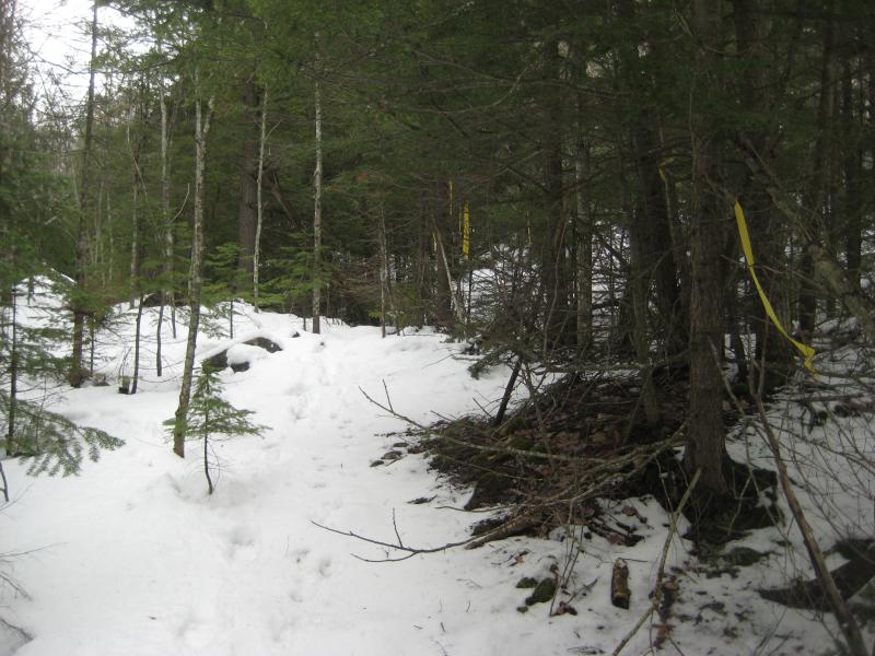
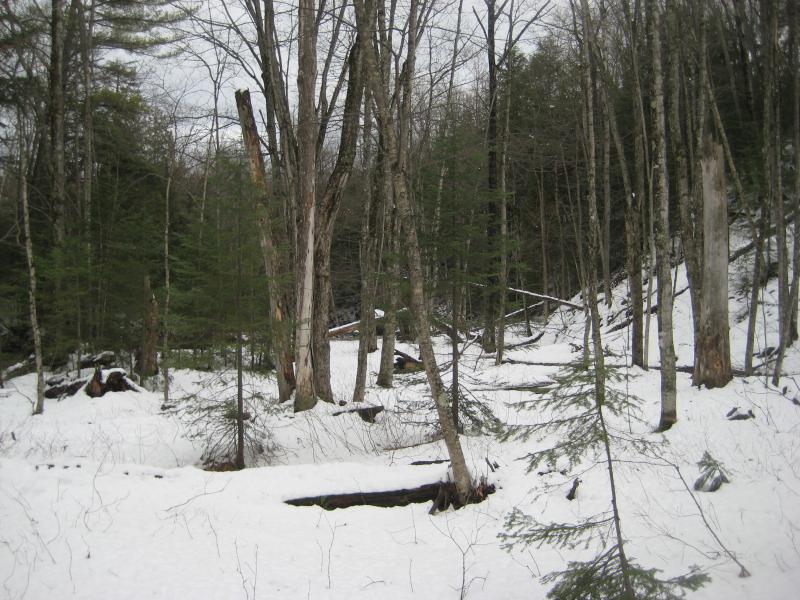
The first mile or so of CCU was plowed. The last three-quarters was not. I parked and let Logan out so we could take a look at the path ahead of us. The road was wide and white, barely a track on it, though everything was cold and crisp enough to promise easy walking. We walked gently along the road trying to find any sort of pack underneath the virgin coating. Our breaths caught in the cold air and the surrounding brush was covered in frost. If I didn't know any better I'd say that we were just shoved back into the early stages of winter.
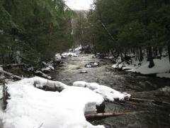
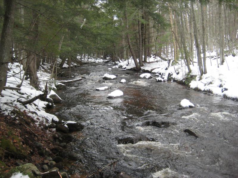
We were heading to White City Falls, the first of a long chain of waterfalls along the Middle Branch Escanaba River that snakes around south of a huge tailing pond for Tilden. There are a few issues with accessing this area. The tailing pond eats up most of the northern access routes, and to the south of the river is a bunch of cabins and private land. I had only learned about these waterfalls by a kayaking website, which may be the only legal way to view them. But I had to check. So Logan and I walked down the snowy road in hopes to see the first waterfall and, hopefully, more beyond.
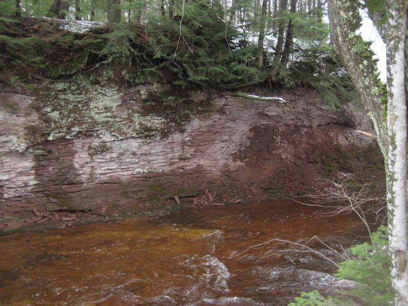
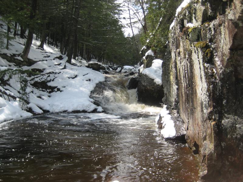
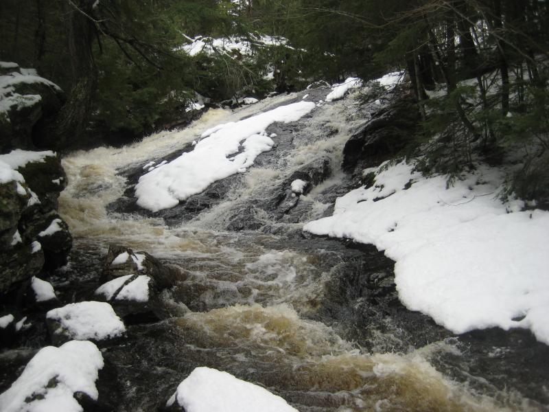
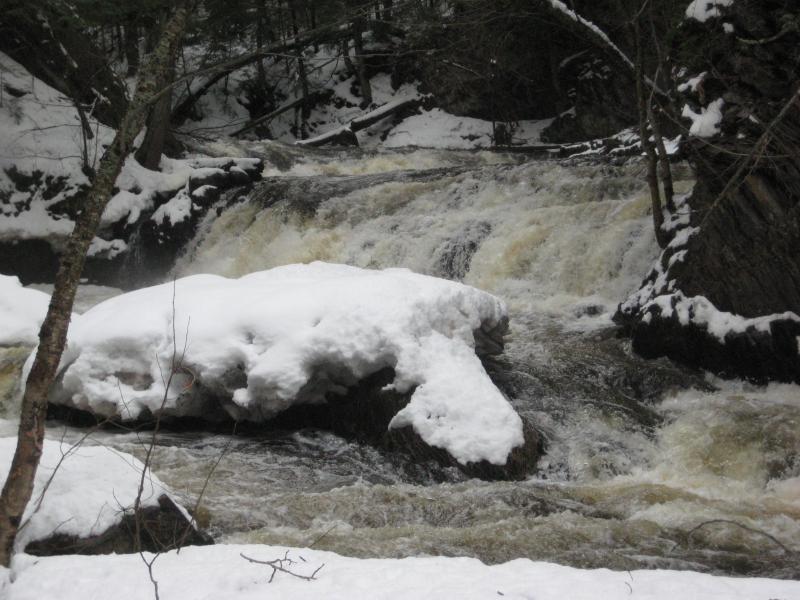
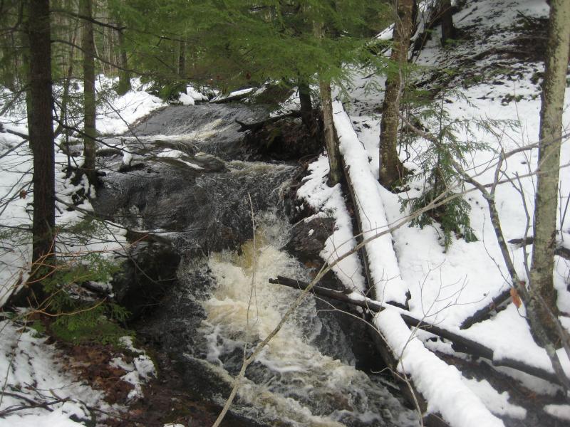
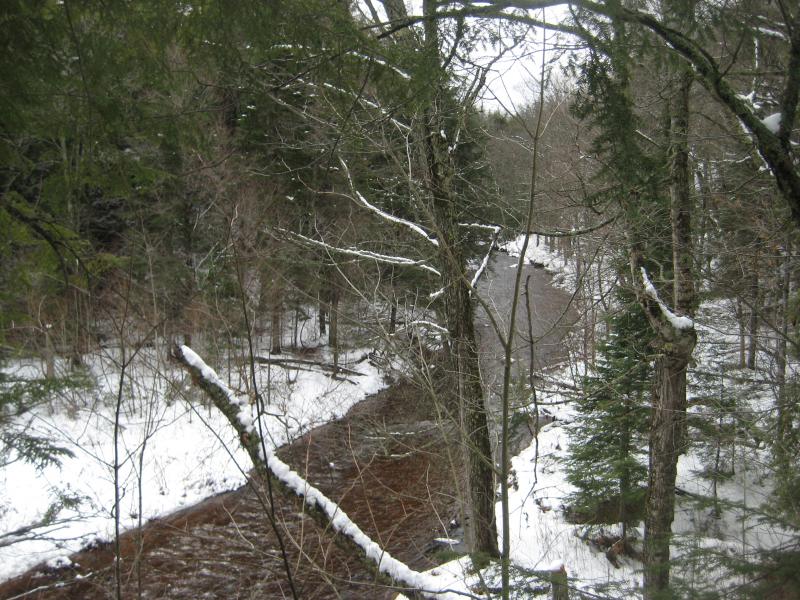
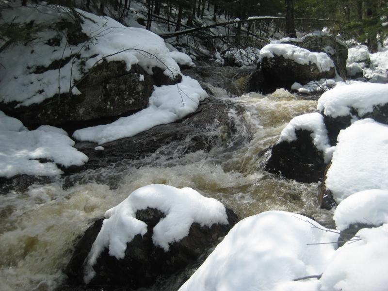
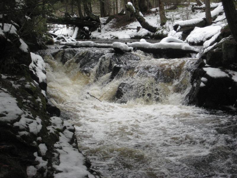
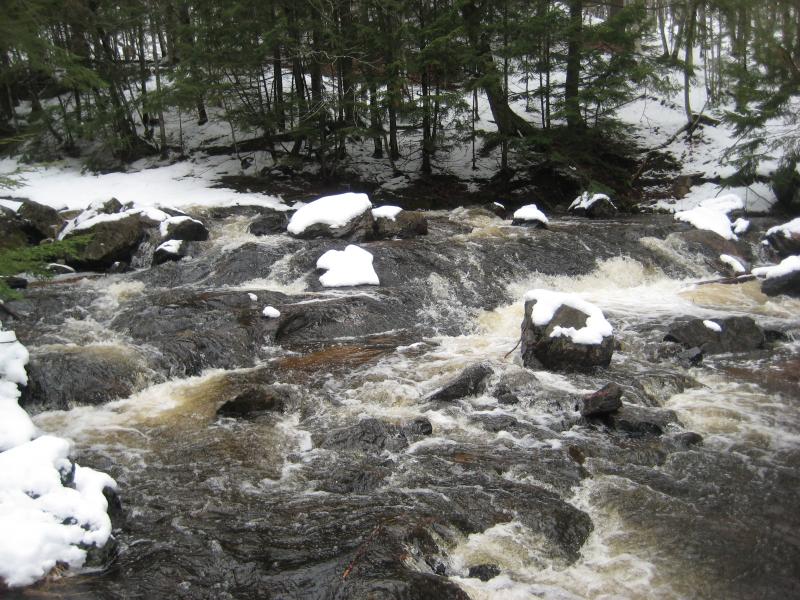
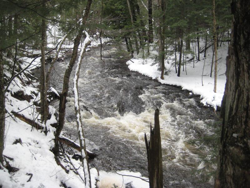
When I heard a roar I cut down to the river, not sure if there would be any easier way to view the drop, and I walked right up to the crest of the falls. The river poured over an odd rock formation to form a sheer three foot plunge between two calm and swampy stretches. The rock I stood on was slightly rounded and curved down to the water's edge, while the opposite bank was sharp and flat shelf that the river poured over. A couple dozen yards downstream was a cabin.
Looking along the crest of the falls
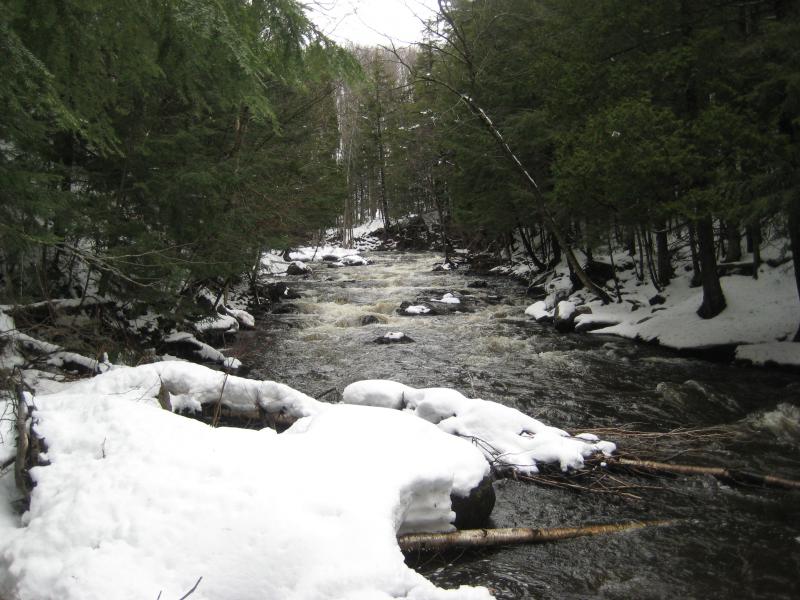
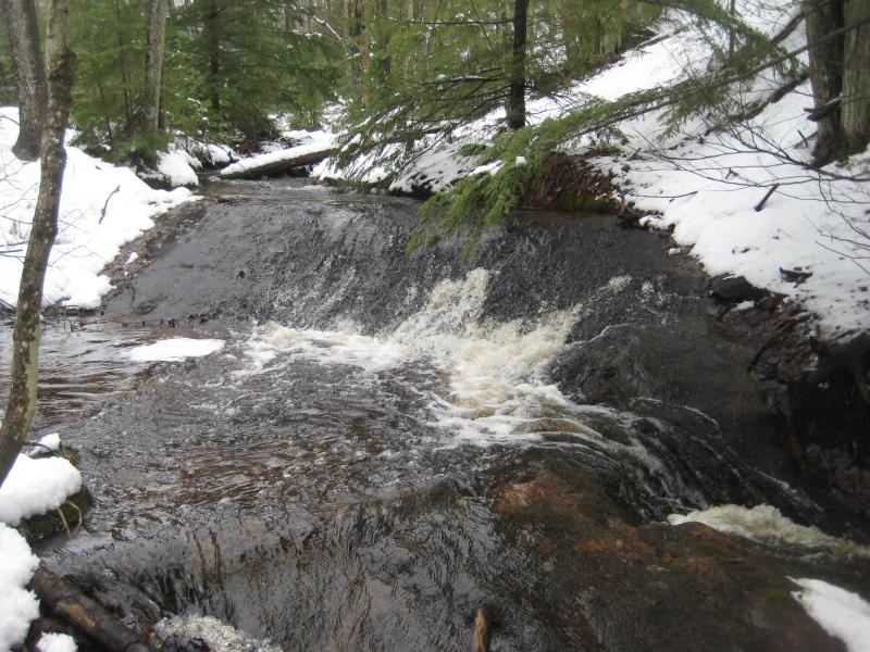
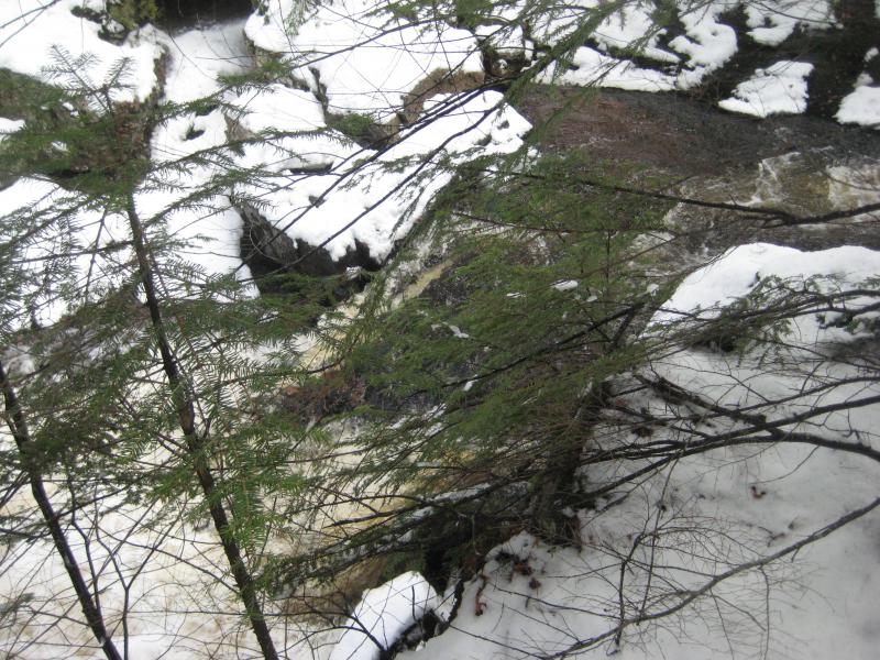
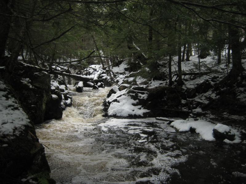
There goes my questions about access to this area. I meandered a short distance downstream and maintained a healthy distance from the cabin. No one had been there for quite some time, if not the whole winter, yet I didn't want to blatently trespass. I walked just far enough to get one quick view up at the falls before beating a hasty retreat. Second Falls and the drops below would just have to sit undiscovered.
White City Falls from the downstream island
Now I had a whole day left in front of me. The early morning would have given me ample time to wander the few miles downstream to visit the major drops along Escanaba River, a wander that was cut short with concerns of trespassing. It's a good think I came armed with backup plans. I headed further east to Marquette and cut north along 550 towards Big Bay. It was time for some sleuthing.
I had heard mention of a Gold Mine Falls somewhere in Marquette County. This county has a rich history in gold exploration, with different claims spiking up from Big Bay all the way down past Diorite, though few lasted long. For a waterfall to have that name I figured that either the area had to be particularly known for its gold mines (like the Diorite area) or for something else to lurk around to remind people of that distant past. It just so happened that there is a Gold Mine Road up by Birch that features a quick little creek nearby. Sure, it was a bit of a stretch, but when hasn't searching for old treasures been more guesswork than solid facts?
Gold Mine Road was plowed but sloppy. I drove up a few hundred yards before sliding over into the first open pull-off to continue on foot. I'd rather walk a little extra then risk getting a car stuck this far out of cell phone range. Logan and I headed a short distance up the road before simply cutting south and tumbling down the steep creek gorge. Whatever hard packed snow we had enjoyed this morning was long gone. All of the white stuff on the ground was soft and slushy.
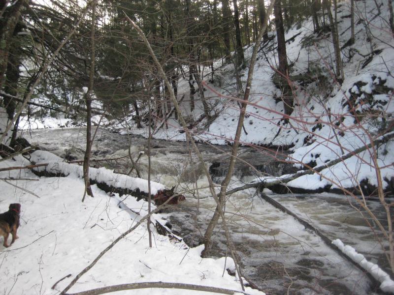
Angled rock drops below snowy logs
The first drops were easy enough to find, a set of angled chutes that curved around a bend in the creek and frothed angrily under snowy logs. Working my way around the bend was not as easy. The creek banks leaned sharp and tried their best to slide me down into the cold and rocky waters. I slowly made my way up, checking out the smooth drops above, and then continued upstream.
Of course, I was also looking for signs of the gold mine. After picking this spot as a likely place for the waterfalls I did a bit of research into the history here. Turns out there were a number of shafts in the area, some lasting several years, and a small settlement started nearby. While that was over 150 years ago, there could be some sign left. I didn't notice anything under the light covering of slushy snow. Logan and I found a second set of drops, some steep outcroppings next to the river, and then it was time to head out.
A cluttered lower chute
Tall rock outcroppings around the creek
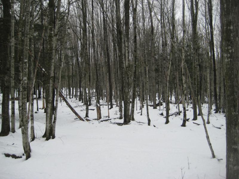
The walk up out of the deep creek was not a lot of fun. Compared to the crisp air of the morning and the hard pack on the way to White City Falls everything here was wet and slushy. I was soaked up to my thighs, my boots squealched as I walked, and even my jacket and shirt were wet. Trotting down the muddy two-track covered my boots in clinging mud that I had to wipe off with handfuls of snow before jumping into the car. I switched out for what extra dry clothes I had and drove over to the next stop.
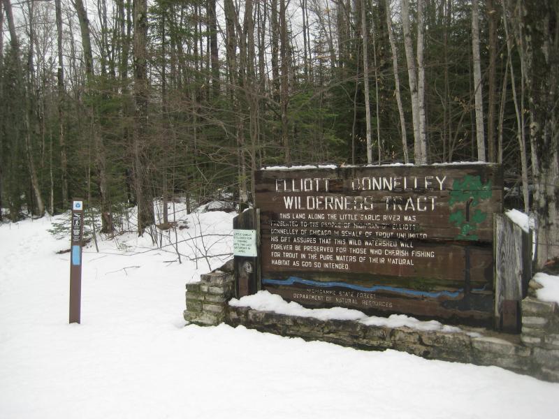
Sign for Elliot Donnely Tract
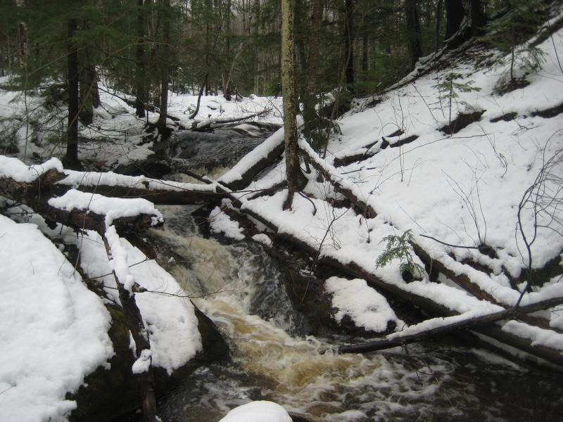
It wasn't a long drive. The Garlic Rivers had long held my attention, as they are both known to have waterfalls along their lengths. Little Garlic River has a drop on the far west side of a nature preserve, and Big Garlic River… had a couple of falls along it. That one wasn't as nicely defined. For now I parked on the side of 550 near the Elliott Donnelley Wilderness parking lot and headed over to the trail.
My knowledge of this land was a little fuzzy back then. I knew that there was a waterfall somewhere upstream, and that there should be a trail that led all the way back to it, and I had a vague idea that a lot of the land outside of the preserve belonged to Granot Loma. Their land ended up being mostly on the east side of 550, including the last half mile or so of the Little Garlic. So my planned route, one that I thought was terribly risky, actually wasn't too bad.
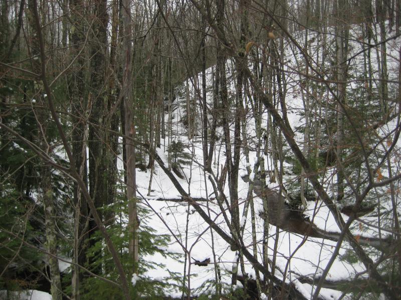
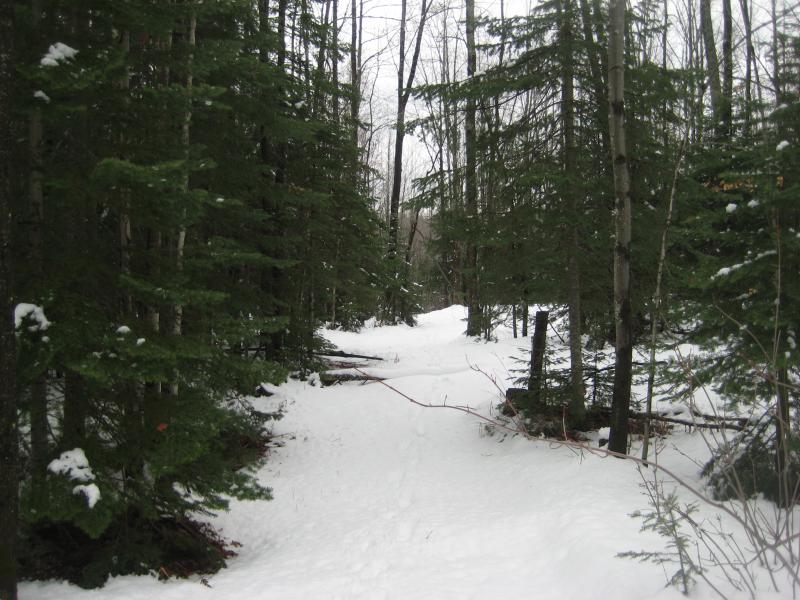
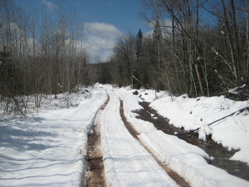
A snowy, sodden path
Steep sandstone banks over Little Garlic River
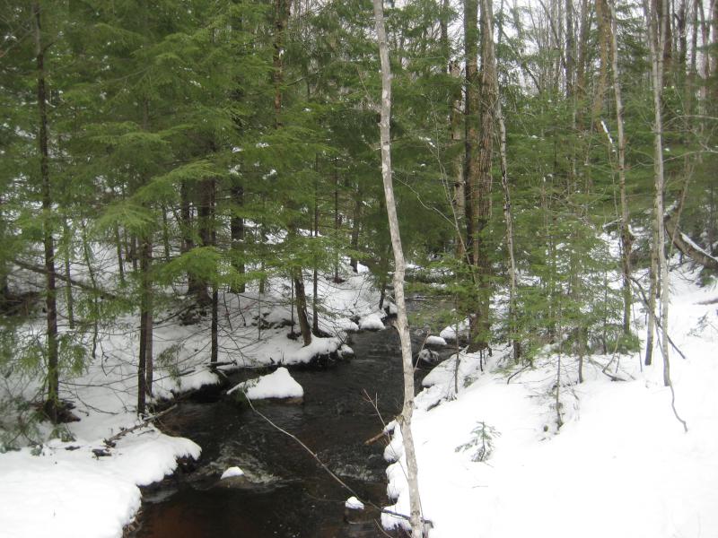
While the path had seen plenty of snowshoe traffic to pack down the snow, warm weather had been slowly turning it into a mix of slush and mud. I slipped and plopped through and occasionally cut a short detour through the woods to avoid wet sections. Next to the trail was a very busy river. It had cut a deep gorge in the soft sandstone, easily twenty feet high in areas, and was noisely rushing along the bottom over the bright rock.
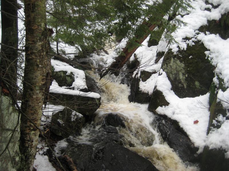
After a half hour in the tract a loud din begin to override the sound of the river. There was a waterfall, but it wasn't on the river. A tributary flowed in from the north side and tumbled down the steep sandstone bank. I had to check it out. Finding an easy way down the bank wasn't too tough, and crossing the wide but shallow river was also easy, and soon I was gazing up a seasonal drop beyond a cluster of downed trees. Logan followed, though he didn't seem quite as excited about the find.
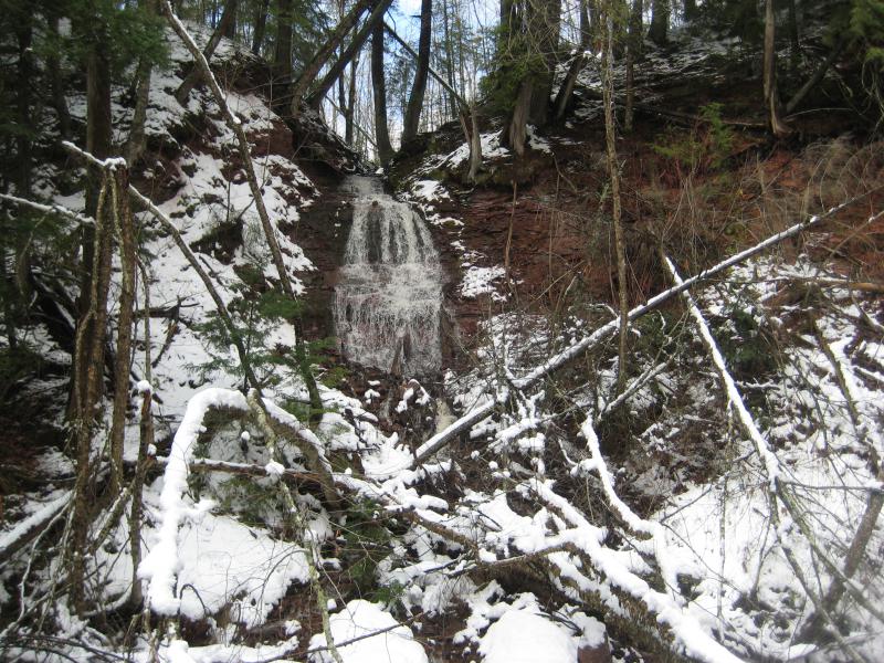
Seasonal waterfall flowing down the sandstone bank
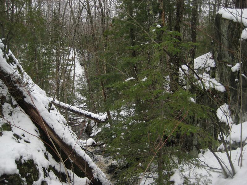
We crossed back to the north bank and continued on the trail. There were patches of green pines and stretches of open forest. There were a few giant trees but not too many. A few larger rapids showed up below on the river, nothing worth heading back down to the river's side. Over an hour in and I began to wonder just far this waterfall was. I passed a road (a road in a wilderness tract? that's cheating!) and ventured into some swampier sections along the river. Less people had ventured this far west and I had to guess at where the path led for a few sections.
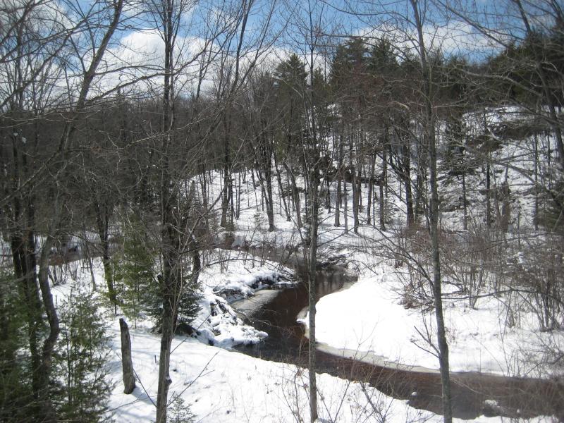
Calm, winding river
When I bumped into a small campsite my hopes grew. Campsites usually sprout up near cool spots like waterfalls. The river made a sharp turn to the west and the little waterfall sprung into sight. And it was little, less than four feet in height. A stoop rock outcropping on the river bank complicated access and with no easy way across I had to suffice with some distant views from across the lower pool.
Falls beyond the pool
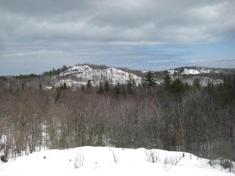
Looking north towards some bare peaks
Unwilling to call this good I turned and climbed up the side of the outcropping, dancing along the edge to keep close to the river, and continued upstream. There were a few more small rapids above and then just calm river. There was no path that led further up nor any hint that more waterfalls would be up there. Maybe the Little Garlic, which drops close to 700' along its short length, only has this one drop on it. I didn't like that, but I also didn't like the idea of bushwhacking all the way up to County Road 510 through the deep slush. It was time to start the next leg of my planned route.
While I was a bit concerned that Granot Loma owned the land around this river there was an opportunity I couldn't pass up. The Big and Little Garlic Rivers run roughly parallel to each other, creating two sides of a square. County Road 550 forms the third side. All I had to do was bushwhack a half mile north and I'd be on the Big Garlic, right near where I suspected a few of its waterfalls to be. I set off northwards through the thick woods and snow and tried to cut an easy path.
North to Big Garlic River
It wasn't easy. Rocky little hills spring up on both sides of a little valley with their long flanks swooping down across my path. I was forced to go up and down multiple little rises, mostly less than twenty feet, and I didn't dare try my luck just jumping into uncertain snow depths. Forty long minutes and I finally crossed the short distance to stand on the rushing bank of the Big Garlic.
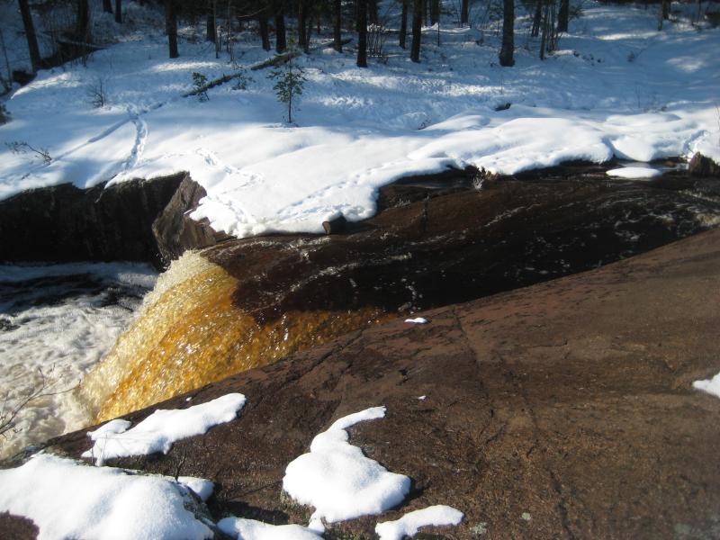
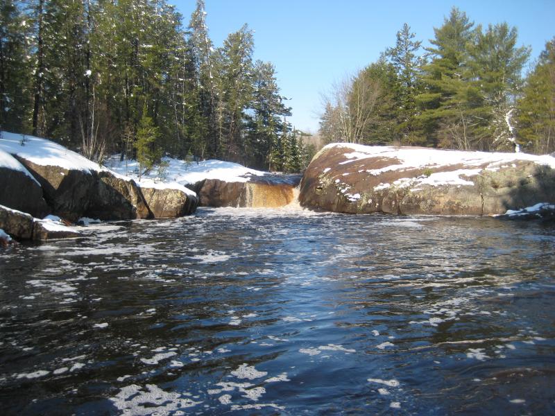
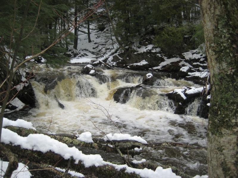
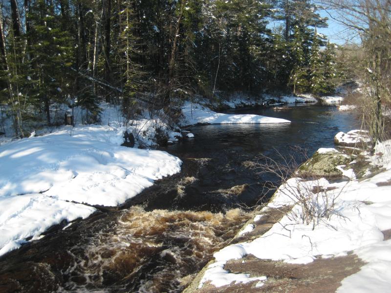
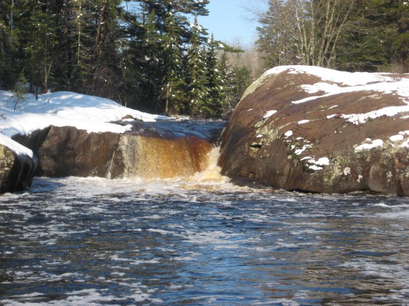
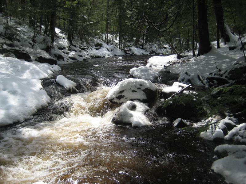
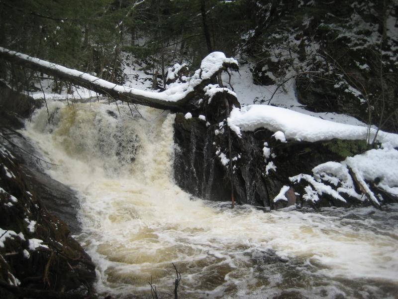
The county road was a short distance downstream so I quickly turned and followed the flow. A few small drops showed up right away, plunges over hard solid rock that made the sister river I had just left seem wimpy in comparison. Then the main drop downed up. An eight foot slide that crashed and frothed at the base of the southern bank. This was easily the most impressive waterfall I had seen so far today. I circled back up the river, trying to get better views, and was rewarded with a gentle spray from the waterfall.
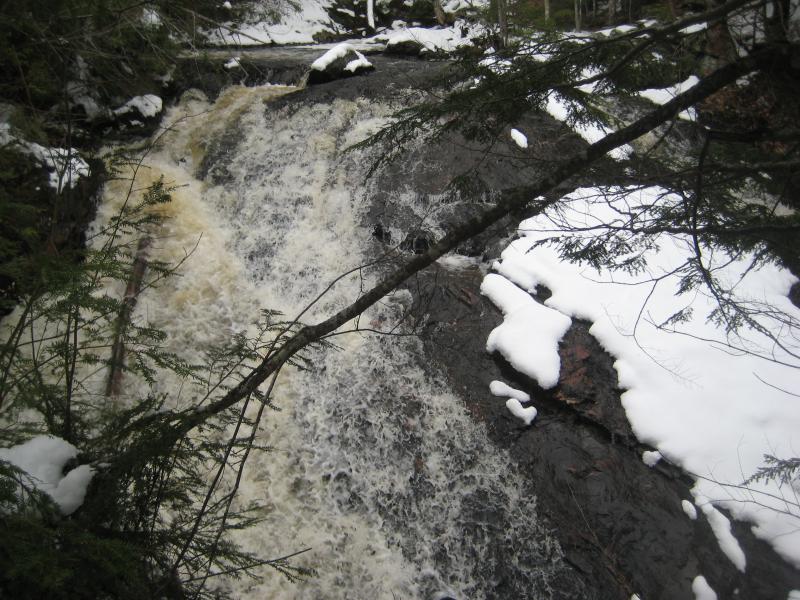
White sheet of cascading water
Sideways slide down the grade
Happy with the find I followed the river the rest of the way to the road, skirting around a small trailer on the way. There's a good chance that this small camp owned the land around the falls, complicating access from the east, which made me feel better about my roundabout route. Once on the road I leashed Logan and set a quick pace down 550. My legs fought against the constant rhythm, more used to the irregular jarring through deep snow, and I was glad to finally make it back to the car. Four new waterfalls found today already and there were still a few hours of daylight left in the sky.
Back in Marquette I stopped and got an obligatory Jimmy Johns for dinner. Somehow it was now mid-afternoon and I had been waterfalling for ten hours. Refueled I debated my options. I really didn't expect to have so much time today. I could go back and try a different approach to the falls downstream of White City, something that didn't sound appealing with unplowed roads and access issues. Or I could check out the Carp River. I didn't know much about the river, besides that it flows near Marquette Mountain and drops about the same height as the Dead River in a shorter distance.
The parking lot across Marquette Mountain was plowed, probably as overfill parking for the nearby ski hill, and there were a few vehicles against the back corner. Curious, I got out and let Logan run ahead into the woods. A few fishermen stood on the river banks casting lines into the wide, rushing waters. One of them, a brave man in waders standing on the far side, had his own dog with him. Logan and this new dog yipped back and forth, separated by the full river, before I finally called him off and we started heading upstream. We had waterfalls to see.
Full river between white banks
There were three drops that I was hoping on finding today. Both Carp River Falls and the dam's drop should be fairly easy - just follow the river upstream. Morgan Falls may end up a little bit more difficult. The creek flows in from the other bank and the grey, stinking waters did not exactly invite me to try a crossing. Maybe there'd be a downed tree or some boulders I could hop across on further upstream.
Soft snow lay deep along my route, often coming up over knees as I slowly forced my way westwards. Between the snow, the cluttered downed trees, and steep banks it was a painful process. Even Logan was having a tough time and was content to follow in my broken path. I kept a close eye on the river below as we headed upstream, both for a crossing and as an alternative. As much as I didn't want to wade in the smelly water it may be easier to walk along the rocky riverbed than force my way through the snow.
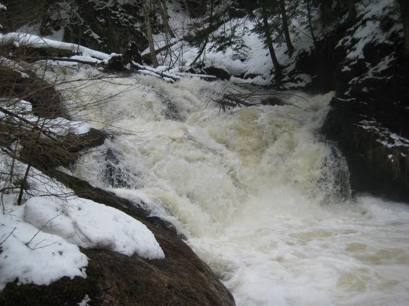
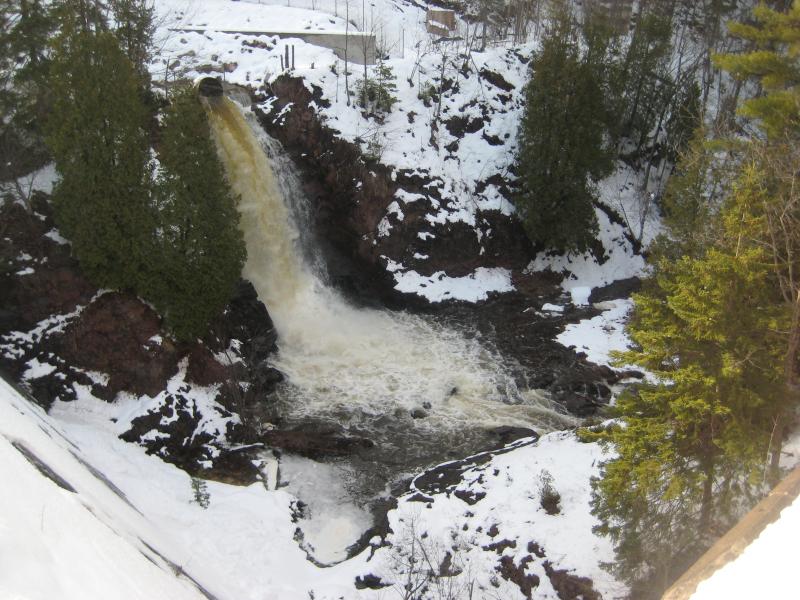
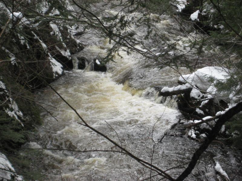
Morgan Falls showed up with a mocking roar that drowned out the larger river it flowed into. A solid curtain of white poured down from the opposite bank to form an impressive drop. An impressive drop that I could not approach. Carp River was too wide and too full to try crossing. Annoyed I continued past the creek, hoping that the other two drops would be worth this adventure.
Lower drop on the river
Slowly the river's rapids grew, eventually forming wide cascades, then some decent sized lower drops. They spanned the entire river in a set of cascades, loudly crashing down between the steep banks and around snowy boulders. They reminded me of the upper falls on this river, many miles upstream, where the blocky grey walk gave in horizontal slabs instead of the Dead River's basalt plunges and chutes. Whatever this rock formation was, the rocks that formed Marquette Mountain and Mesnard, it stretched a long ways to the west to Ishpeming.
A swollen, roaring cascade
Blocky drop
A short distance above the lower drops came a quick succession of drops, each one loud and overfilling with spring melt. The river twisted sharply back and forth here, each twist forming a sharp angle in the bank that was difficult to work around, and I spent a long time climbing up and down from the river trying to find good vantages of each cascade. When I finally reached the end of the waterfall I was thoroughly soaked.
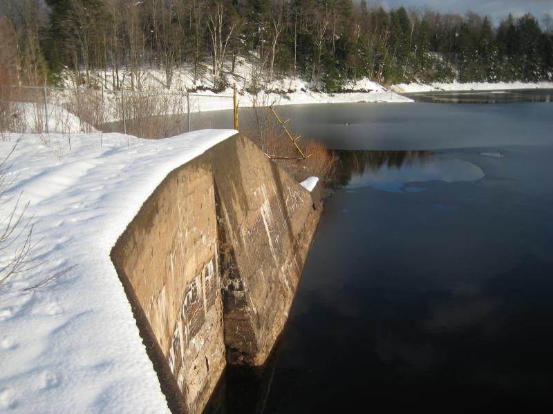
I was over halfway to the end by now. Another half mile or so and I'd be at the dam and reservoir. The gorge was starting to calm down too, banks lessening in slope and even giving me stretches of flat to walk along. It was worth it to continue on. If I got lucky I could cross the river at the dam. There was the penstock on the north bank, and an old access road, either of which could provide me an easier return trip and a chance to see Morgan Falls. All I had to do was make it to the dam and it'd be an easy trip back.
Rushing pipe emptying the basin
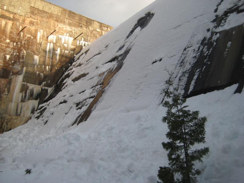
Looking up the snowy dam
There was a problem at the dam. The south bank was fairly pleasant, with easy access to both the cement bottom lip and the top side of the dam. I couldn't cross on the top, though - there was a ten foot drop between the side the lip of the dam. Nor could I cross on the bottom. There was a cliff of slick and crumbling rock blocking the way, after which the outflow pipe showered a heavey flow of tinged water down. I tried briefly to climb the crumbling rock, hoping to find an easy way up to coax Logan after, and slipped after only a few careful holds. There was no way across.
At least there was the outflow pipe, as artifical of a waterfall as one can find. And an explanation to the rancid smell of the river. Not only was there a deep basin on the river, which always gives the downstream waters a bad odor, but a landfill was perched on the north side. An unknown amount of pollutants was probably leaching through the groundwater and spring's melt was flushing it all downriver. I was even more thankful that I didn't try to cross now.
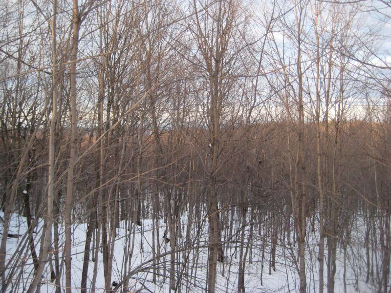
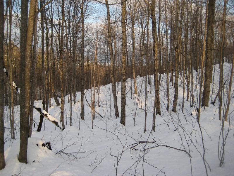
Morgan Falls was out, as well as my easy exit route. All that was left was the south bank. Or the roads. I could walk over to 480 and then up 553, a six mile walk along busy roads that would start off by walking through a private quarry. The southern bank sounded like a better option. Yet there was no way I was about to retrace my steps along the river. Instead I headed due east, staying above the wide river valley, cutting my way through the open forests and rolling hills.
Distant hints of Lake Superior
After about a half hour of pushing through the snow with heavy and cramping legs I bumped into an old logging road. There was no tracks on the road, nothing to pack it down, but the open route gave me some hope and a small bit of energy. Logan and I trudged along, beaten by our long day, and tried to ignore the setting sun. It was going to be dark soon and we were both soaked through.
Cold and ominous ending to the day
It was a good forty minutes after the sunset by the time we bumped into 553. There wasn't much traffic along it this late at night so I simply leashed Logan and walked the shoulder. A few cars passed us heading up the hill, loud and slow with the steep slope, which gave us plenty of time to climb up the snow bank and keep an overly safe distance. By the time we reached the car we were beyond exhausted.
I treated Logan to a hot burger and we cruised back to Houghton and the luxurious warmth of a moving car. Together we had found six new waterfalls in one full, soggy day, in what would probably be our last visit to Marquette County in a long time. I was glad to have gotten so much done along Carp River. Now I could count both the Dead River and Carp River done, complete with tributaries - until I found out about a drop in the Peshekee Highlands and Nealy Creek, some months today. Today I drifted back to Katie in blissful ignorance, content with the day, and looking forward to a hot shower and a warm, dry bed.


Comments (0)