Cold, crisp air surrounded me as I filled up my gas tank in Ishpeming. There was still about an hour until sunrise and the station's lights lit my breath's fog. When the handle clicked I replaced it and rushed into the warm building to pay. As I handed over a few bills I asked the attendant if any of the roads up past Deer Lake were plowed. The young lady looked at me and shrugged. Well, I sure hoped that they were clear, else my long drive down here for one last waterfall adventure would be in vain.
This was the last trip, the final adventure before Katie and I were going to move down to Wisconsin. It probably wasn't the last time I'd be in Michigan - Appleton is only about three or four hours from the Huron Mountains and lands Keweenaw - though this was the last outing in the foreseeable future. So I had to make it a good one. I was planning on revisiting Mulligan Falls on an all-day hike that would take me deep into the wilderness around Silver Lake Basin.
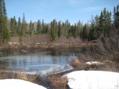
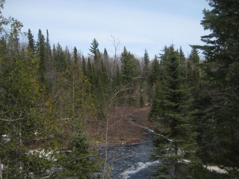
Thankfully, the dirt roads leading north from Deer Lake were cleared of snow. They were rock hard in the cold morning, making my drive that much easier. In fact, the cleared roads laid all the way past the Dead River, the bridge over Mulligan Creek, and even to the base of Mulligan Plains itself. That's where my luck ran out. Both tracks that ran up the length of the plains were still deep in snow. The main waterfall on Mulligan was a good three miles to the north.
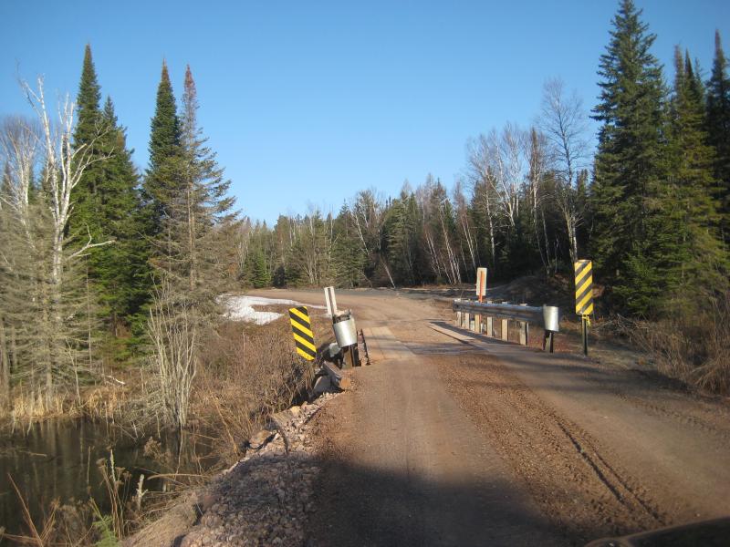
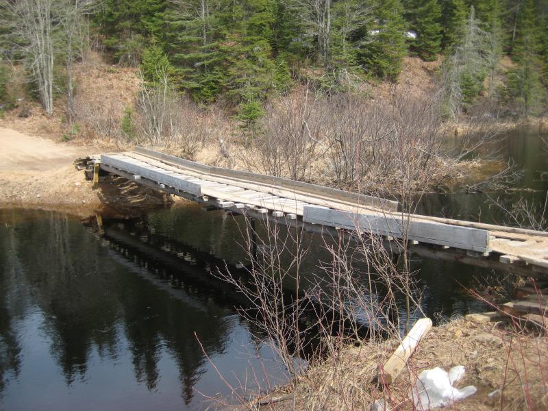
Bridge over Mulligan Creek
The plowed track led further west. Curious I continued driving along. There was nothing else out here. No roads crossed back over the Dead River or wound around Silver Lake basin, nor was there any cabins beyond Mulligan Plains, meaning that there was no reason for this dead end road to plowed. Well, maybe there was work on the new dam over the winter, or logging, but the road didn't seem to be torn up.
I continued driving, slowly winding uphill to the north, and stopped once I saw a snowy track leading left. Both Logan and I were anxious to get hiking. Plus, I had more things besides the falls to check out today. The basin had been empty for six years now and I had only gotten glimpses of it on a drive last summer. I wanted to see what an empty reservoir looked like.
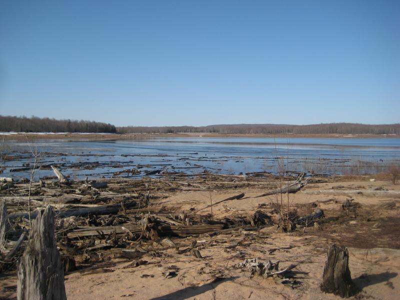
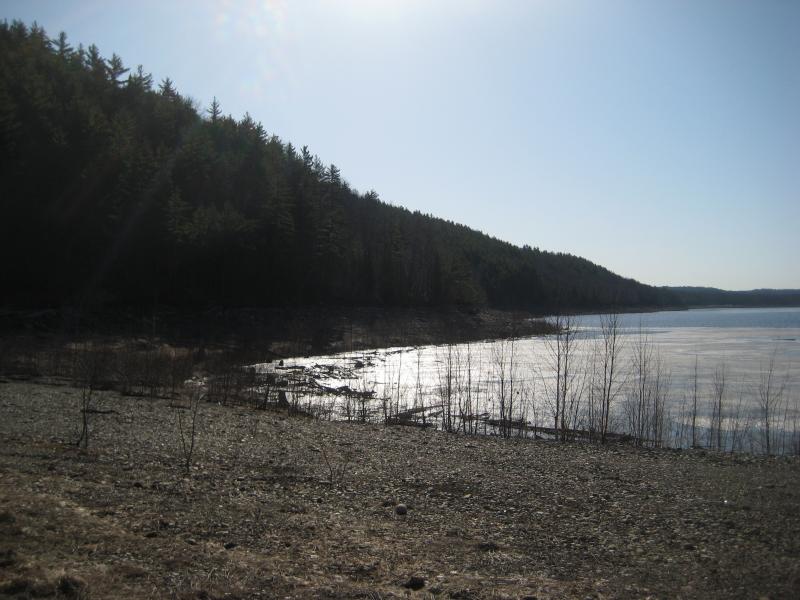
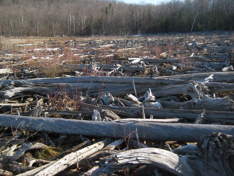
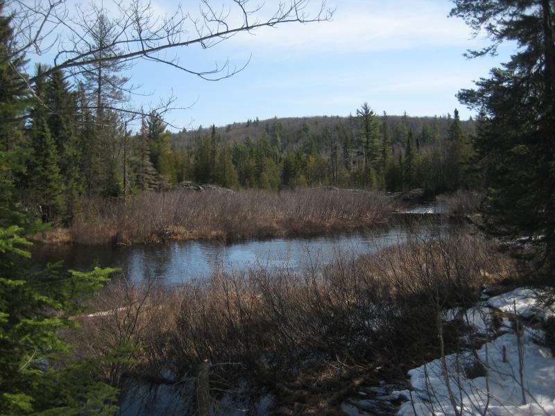
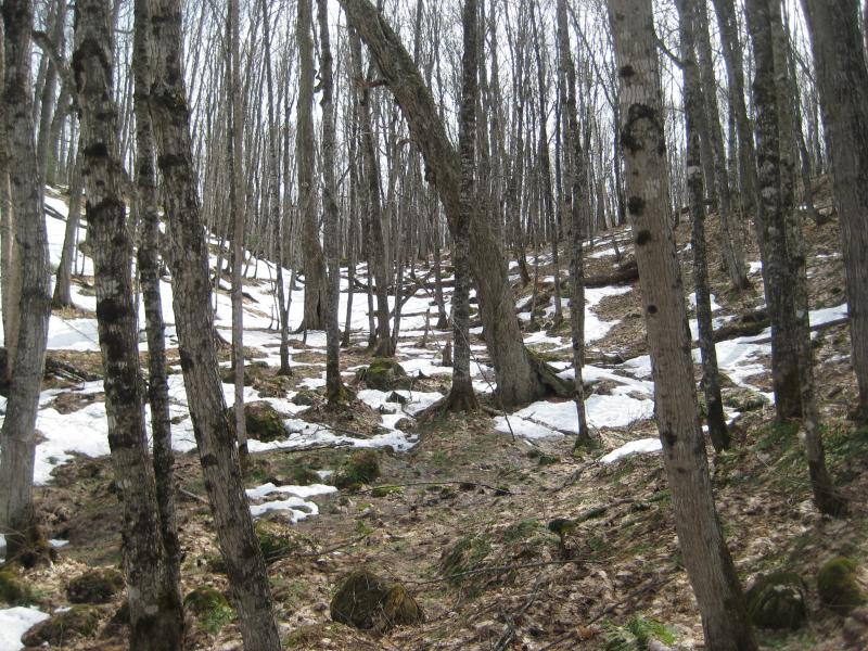
Walking to the basin was easy with hard-packed snow underfoot and the barren hardwoods giving easy views in all directions. I didn't expect my entire day to be this easy. The highs were expected to be in the fifties, which would turn all this nice snow and solid earth into slush and mud. So I took advantage of the easy going and cut a fast, direct line to the basin. The empty reservoir did not disappoint. Small pools of icy waters, frost-covered banks of dead grass, and bleached logs and trunks were strewn about for thousands of yards.
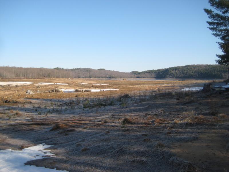
A cold, empty basin
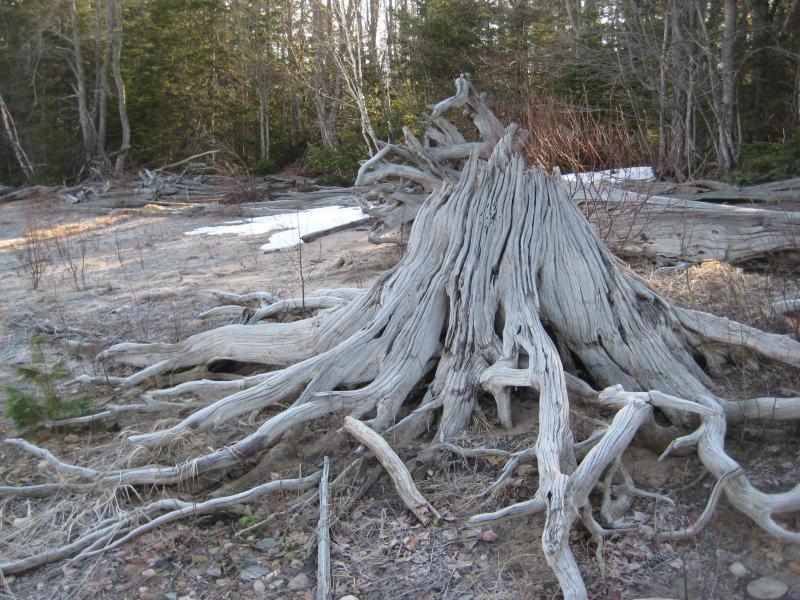
Ancient stump
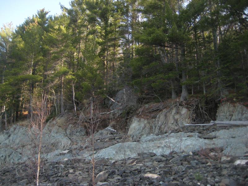
I headed left towards the new dam. The falls would be to the right, past the rim of the empty lake and hills beyond, but I wanted to check out the dam first. I expected it to be a short walk. When the bank opened up and I saw the stone and earth dyke I realized my mistake. This break, the break that I had seen last year from the other side, was where the waters had breached the reservoir and carved a deep path out. That's where all the construction was, to repair the breach and strengthen the dyke. This was not where the dam actually sat. I checked my topographic map to confirm. The dam of Silver Lake was around a curve at least another mile distant. Maybe that could wait. I turned around and started on my way to the northern bank.
For most of the way my path was easy. ATVs and Jeeps had been taking advantage of the empty reservoir to carve new dirt routes along the banks. There were a few hairy spots, when old logs clustered together or rock outcroppings complicated the route, that the wheeled vehicles would have had a hard time with. Still, it was easy enough on foot. I wandered along the bank and drank in the quiet surroundings around me.
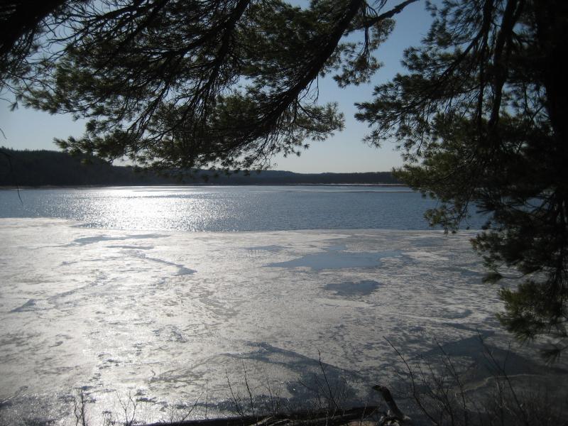
Empty Silver Lake Basin
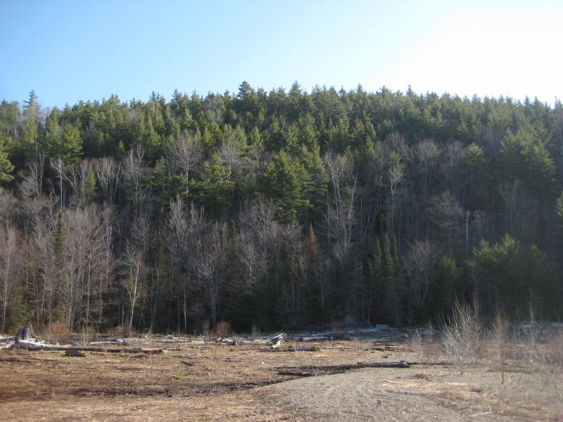
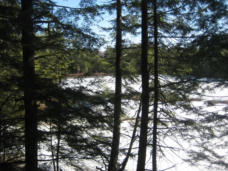
Tall pines west of Silver Lake Basin
The east and north banks were mostly bare hardwoods with patches of green pines rising behind. I could almost feel the silence filtering out from those old woods. The hills on those banks rose up sharply from the lake, steep rock and sharp angles from the sandy shoreline. South and west was a different story. Across the icy blue waters there was only brown-grey forests and relatively flat lands.
My path curved around the northern stretch and eventually began to near the area around the cluster of Silver Lead Mine Lakes. I had half a mind to follow the outflow of those lakes up and look for the old mines themselves. Instead I turned away from the lake and followed a partial path up a crook in the hill. It was an easy, and more direct, route to the upper reaches of Mulligan Creek.
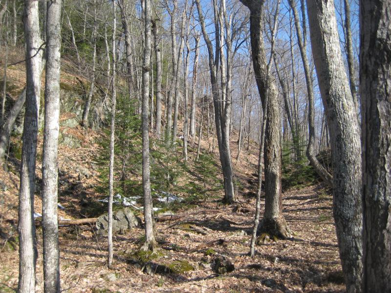
Half-path up the hill
For the first part of this leg things looked good. I was climbing up the south side of a saddle that had almost no snow along it. There were a few spots, patches protected by snow or by a northern slope, that were easy to avoid. It wasn't until the saddle crested that the drifts began to grow. Logan didn't mind, leaping nimbly along and able to keep on the top of the snow with his overlarge paws, but I barely floundered along.
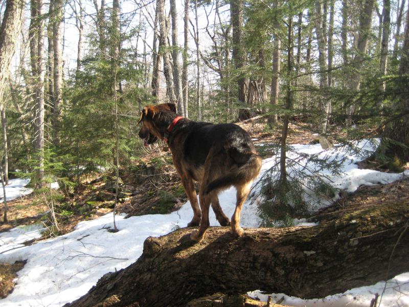
Logan perched on the log
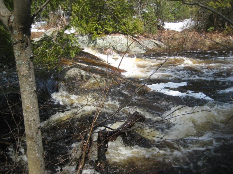
We passed a lonely cabin in the woods with no paths or roads leading to it (so, so awesome) and some ice-covered ponds surrounded by thick cedars. We passed by tall outcroppings of mossy rock and short pines struggling to grow. When I finally heard the sound of rushing waters I broke into a slow trot. It had been a hard walk from the lake and I was excited to start the next leg of this hike. When I finally broke through to the edge of the creek I was both disappointed and surprised. The creek was very full, many times swollen compared to my last visit, though the rushing waters were nothing but a set of mild rapids.
Swollen waters running down
I checked my GPS and map. There was miles of winding river to walk before I'd be back on Mulligan Plains, miles of swamps and hills and possible waterfalls to hunt out. The snow on this bank was impossible. Protected by the north-facing slope was several feet of soft slush to plow through. Mulligan Creek didn't look like it'd be easy to cross either, with the swollen waters and no downed logs crossing it. I slowly turned and started downstream.
Below the rapids was a narrow, yet calm, rock channel that immediately caught my attention. Each bank was a sudden rise of stained rock over ten feet tall and the water flowing between was dark black with depth. Beyond the channel was a swamp with white swirls whose snowy sides made for deceptive paths over deep pools of cold water. I kept a wide berth around the tricky swamp. And then there was more rapids, and another swamp, and so on.

Swirls in the dark swamp
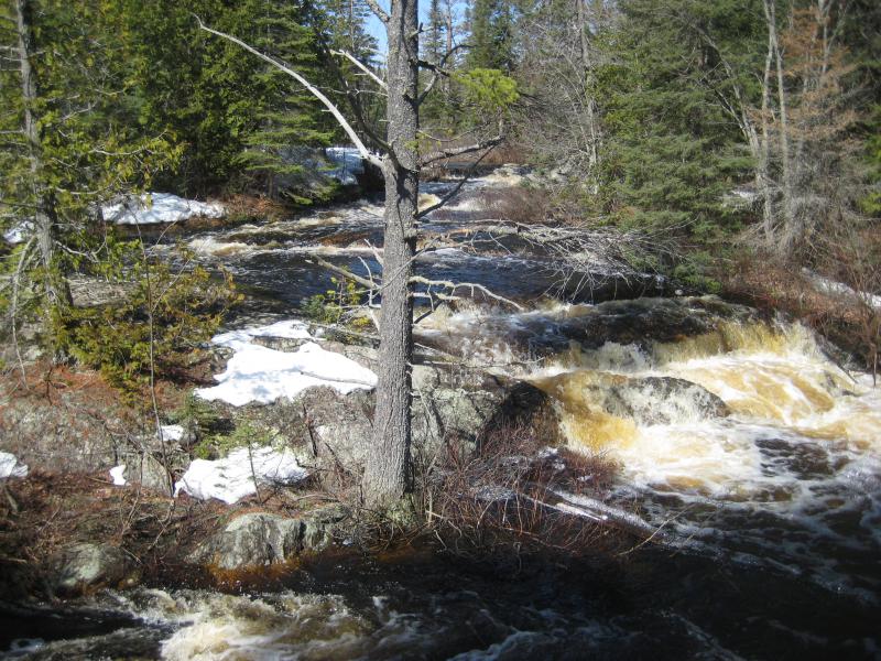
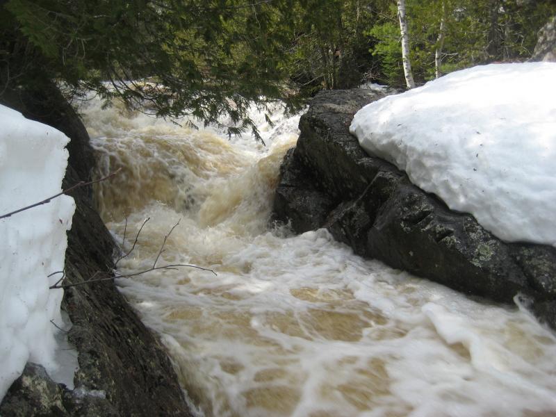
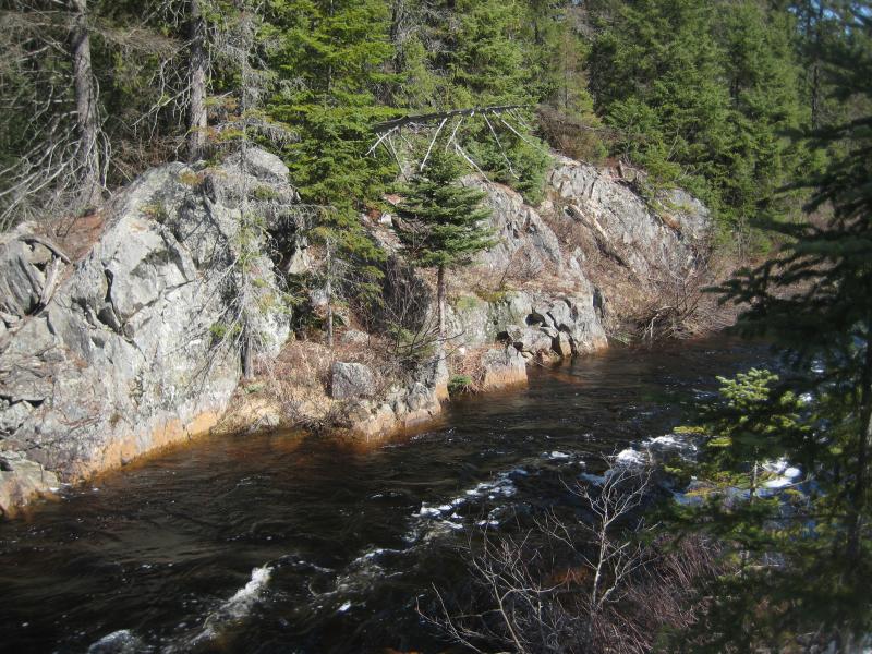
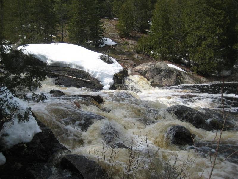
We were a mile into this repetition when something different showed up. Logan noticed it before I did and ran ahead to investigate, then circled back seeming a bit scared. Instead of a snowy/grassy bank all the way around this swamp there was a pillow of solid rock that stretched across to block the creek. The waters in the swamp reached towards this pillow and just ended in a line. Curious, I led the way over to the line. An impressive waterfall flowed up and over the pillow of rock.
Cresting swamp
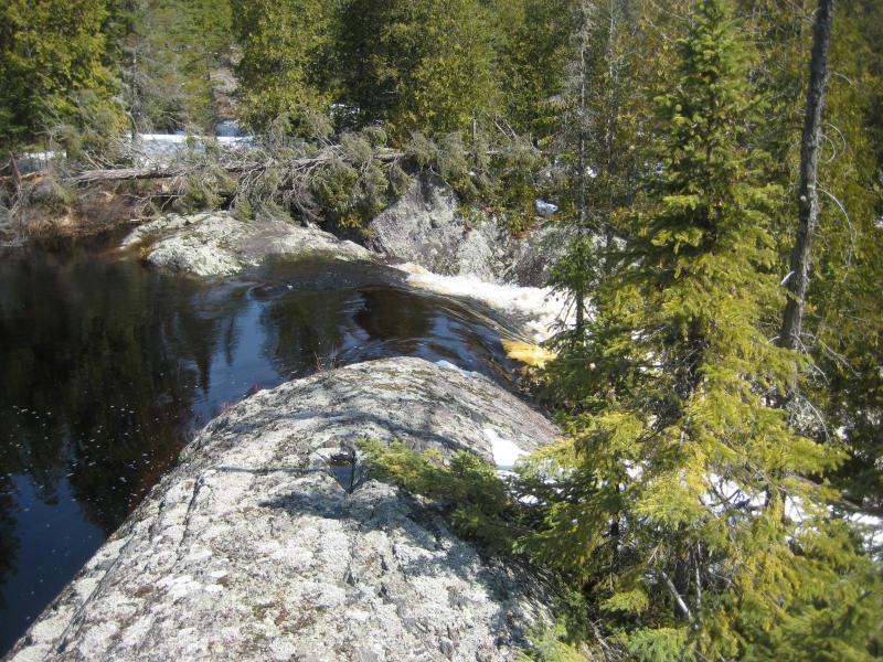
There had to be a better view of this. Downstream of the falls the creek made a sharp turn, ruling out any good views from this bank. I had to find a way across the uncrossable creek. I left the falls and followed the creek invigorated by my new goal.
It took a good twenty minutes to find the precarious log draped across the creek. The brittle old pine was no thicker than my thigh at its base and narrowed down to nothing at the tip. I tested it a few times before scurrying across, ignoring the low sag in the middle that let cold water flow up and over my boots. Logan barked and paced on the south bank as I backtracked to the large waterfall to get a few good pictures.
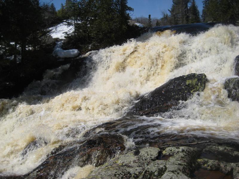
Gushing angry water over the rock pillow
The northern bank was slightly easier to walk along. After my pictures I headed back to the log, crossed back, and tried to convince Logan over. There are times that I trust him enough to keep up with me on the opposite bank. This was not one of those times. I had no idea what lay between here and Mulligan Plains. Swamps would drive us apart, tributaries could create lengthy side treks, and the wrong animal could drive my dog into a frenzy. Logan wouldn't come near me. I called to him, tried to coax him with treats and kind words, but he knew I wanted to carry him across that questionable log. He wanted no part in that.
Frustrated I gave up and we kept to the deep snow on the southern bank. He knew that I was angry and sulked behind me for a short distance. Puppy memories are short, though, and soon he was prancing and playing as if nothing was amiss. I wasn't so quick to forget. This route was tough and my legs ached from the unnatural workout. Plus, the creek had calmed down below the tall upper falls. Now it was just swamps and tag alders. After an hour of boring walking I decided to cut a mile out of our hike and skip one of the larger loops to the north.
Once I reached the middle the shortcut, high up on a hill with a creek on both sides, I found a stump and sat to rest. I was tired. I scooped up some snow to eat/drink and munched on some cheap beef jerky. There was still a good distance to go. We still had to make it past all of the drops that Faith and I had found last fall, and then continue on to the road up Mulligan Plains, and then finally return to the car. I felt my legs cramp at the thought.
Far distant outcropping
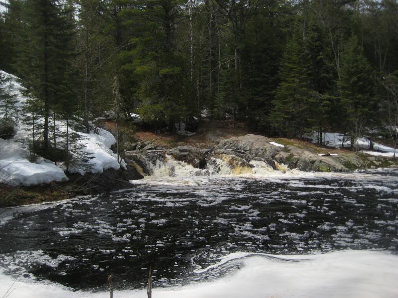
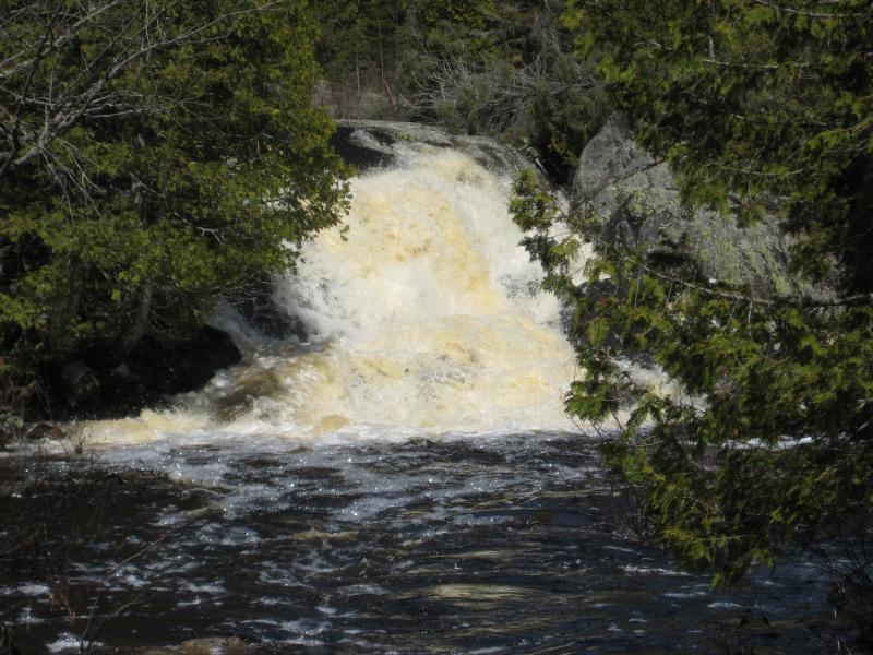
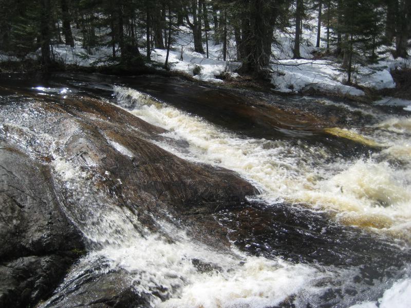
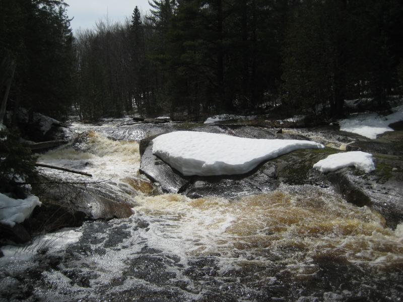
I slowly headed down the hill and returned to the creek, bumping into the water right near a short drop over gently rounded rock. I took a quick picture and continued on. Another drop showed up, and another one, though I didn't recognize anything until I was a few dozen yards from the last one. The chute was flooded, each individual scenic drop covered in a rush of white and froth, but this was the second group of falls that Faith and I had found. A few short minutes more and I was at the last of the waterfalls on Mulligan Creek.
Overfull gushing chute
Drowned Mulligan Falls
Any excitement that I would have felt from re-finding these drops in full flow was dampered by exhaustion. With heavy legs I dragged on through the low brush and over the muddy flats until I reached the road, the easy track that would be the first open path that I had seen for hours. And, of course, there was snow on it.
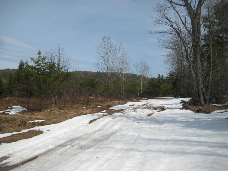
Slushy road on Mulligan Plains
The long walk back was an exercise in patience. I couldn't walk for more than a few dozen yards at a time through the soft slush without stopping to rest my cramping legs. There wasn't a huge rush, though. Katie didn't expect me back for hours and there was more than enough snow for me to suck on. When I did finally reach the car, which was conveniently parked high up a hill next to the basin, I tumbled in and took a quick nap before attempting the drive back down to Ishpeming and Houghton.
A few days later and I was down in Appleton, hours from my beloved hiking grounds. It didn't take long for me to start to plan out return hikes. Over the next few years I made dozens of trips to the Upper Peninsula and began to explore mountains and lakes and shorelines with just as much love and ambition as I once did for waterfalls. Oh, and I continued to hunt down new waterfalls too. Still, from the first outing with Katie to Montreal Falls to this final trip, there was nothing that compared to the adventures of 2008-09. And I'm not sure that anything will ever match the experience of living in Houghton and being minutes from such beautiful and remote lands.


Comments (0)