Less than two months after moving to Wisconsin and Katie and I were already on a way back for a weekend camping trip. We were heading up to Big Erick's bridge, one of our favorite rustic campsites out in the general Skanee area. Thanks to a late start and some thick traffic it was dark by the time we reached the bridge. Faith and Cory met us at the site and we set up our tents by flashlight before an evening of campfire and stories and beer.
I woke up early the next morning and snuck out with Logan for a quick hike up tick mountain. We made it back just in time to enjoy some breakfast with a slowly waking crew and talk over the day's plans. There were a number of waterfalls I wanted to visit, I just wasn't sure what everyone else wanted to do. Faith and Cory were excited and game for a full day of exploring; Katie was hesitant. She stayed behind to catch up on some leisurely reading next to the Huron River while the rest of us piled into the car and headed over to Black Creek Road.
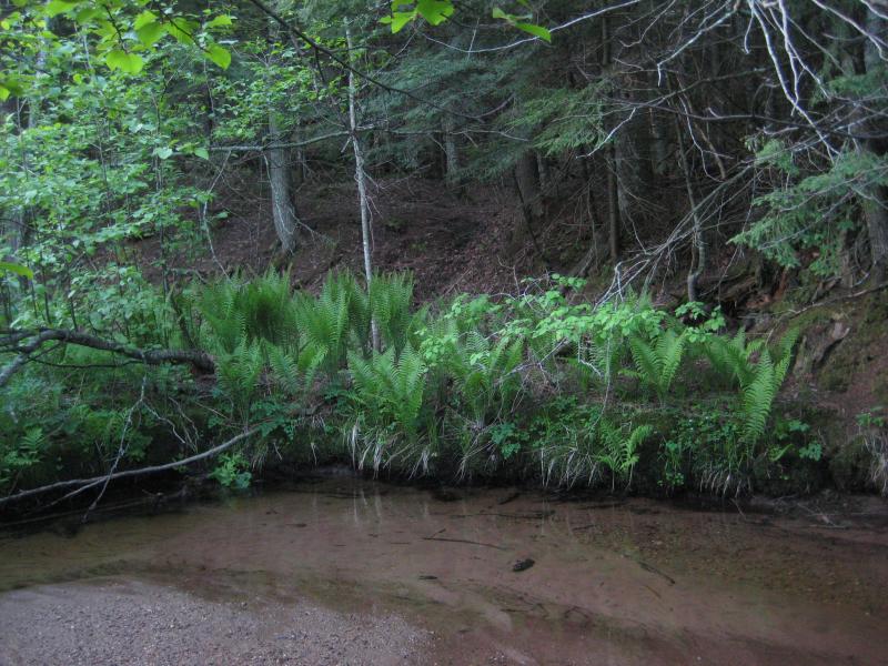
We didn't drive far. The first spot to check out was less than two miles south of Skanee Road. I turned off on the grassy two-track and came up to the bank of the West Branch of Huron River. Checking in quick with my hiking partners to see how they felt about wading across the river I ended up driving across the shallow ford. Neither of them felt like soaking their shoes this early in the day, not when we had miles of adventuring ahead of us. We parked next to the tall, sandy bank and started upriver.
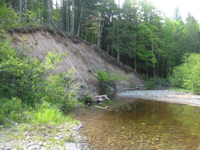
A familiar old sand bank
As soon as we were over the sandy hill I led the group back down to the riverside. The road that led up and over was a private drive and I didn't want to start the day off with a blatent trespass. Now next to West Branch we followed a well-worn path under tall cedars and over gnarled roots. This would be my third visit here and I knew exactly where I was going.

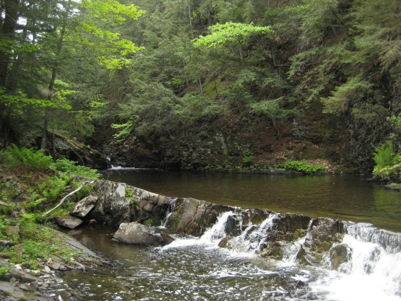
A jagged lower plunge
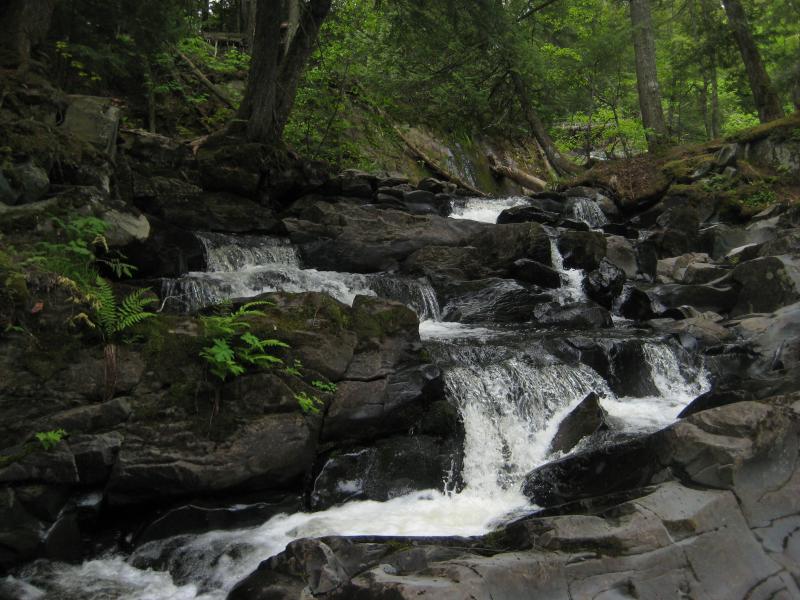
Faith and Cory were impressed with the first drop, the jagged chute between sloped rocks, and I promised them bigger and better views ahead. I had to carry Logan up and over the rocks as it was too steep for him to get purchase. Beyond this first drop the wide riverbed narrowed and the rocks slanted sharply making our journey upstream slow and cautious.
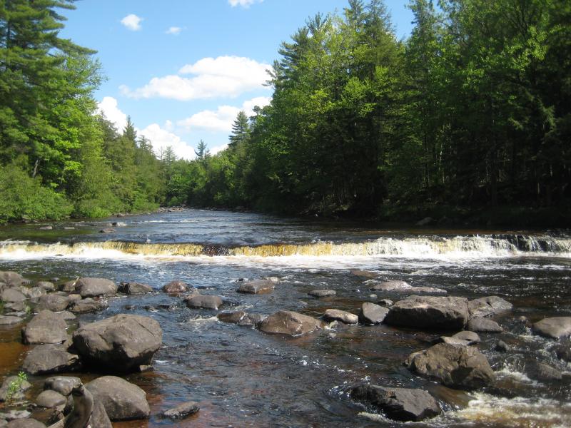
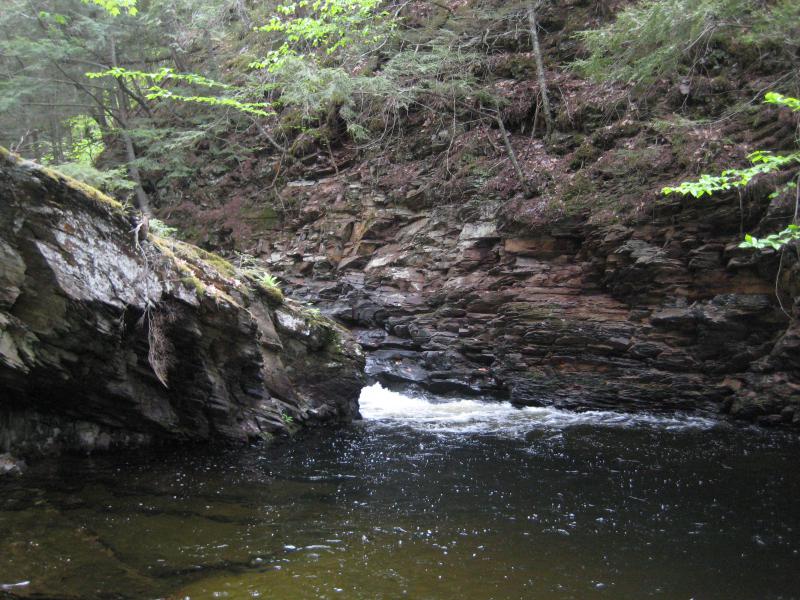
The next few drops were small yet pretty. There was the uniform drop that cut across at an odd angle that seemed too perfect to be natural, and then the smaller chute shoved up against the far bank, and then rapids over bedrock that disappeared around the corner. When we finally rounded the bend we were all surprised. The main waterfall was there, as tall and impressive as I had hoped it would be, though it looked completely different without the spring melt flooding over it. Today the river dropped and split over dark, layered rock, creating a more complex scene then the rush of white I had seen a few months ago.
Looking across the smooth, calm pools
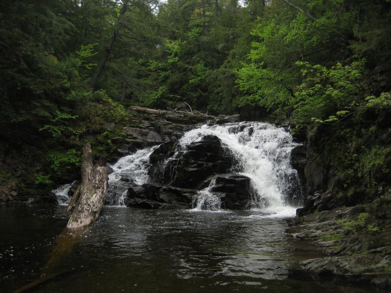
West Branch Huron River Falls
Getting close to the drop proved to be more difficult than I hoped. Snow and ice had helped me edge past some sections that slick rock and moss now blocked from me. If I wanted to climb over the crest and check out the river above the drop I'd have to jump in the water or climb up the fifty foot banks. Neither one of those sounded like a lot of fun. So we merely turned around and retraced our route to the car.
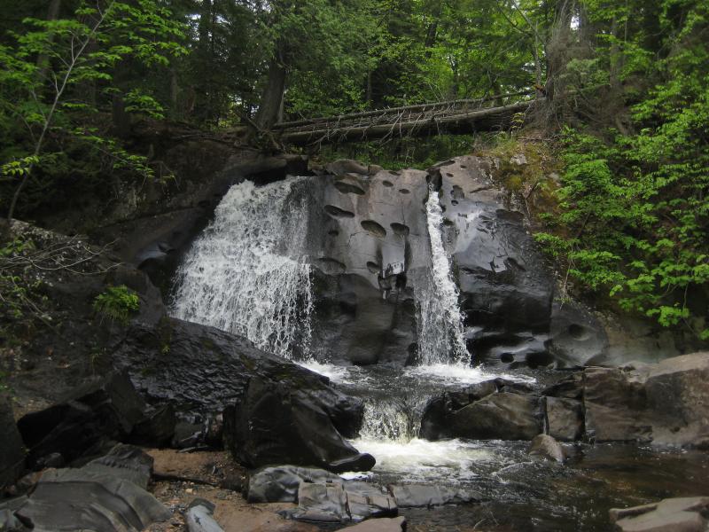
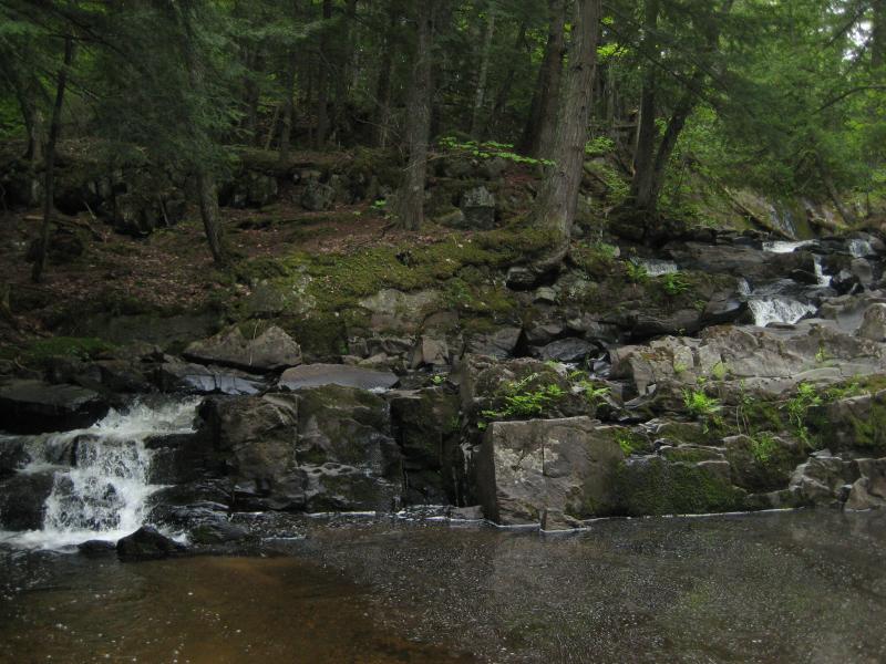
There was other things to check out - East Branch Falls and Big Falls would be easy enough to reach from this side of the river - though we decided to skip them. Faith had already been to both and I had been hinting at how awesome Leatherby Falls was. So we headed up past Erick's Falls and bridge (which none of us had any interest at stopping to see) and drove even further south to a familiar turn-off. By now a few black flies were awake and smacked hungrily against our windows. We headed out quickly and half-trotted to the base of the falls.
Looking up the lower drops
Thin streams of water flowing down the rocks
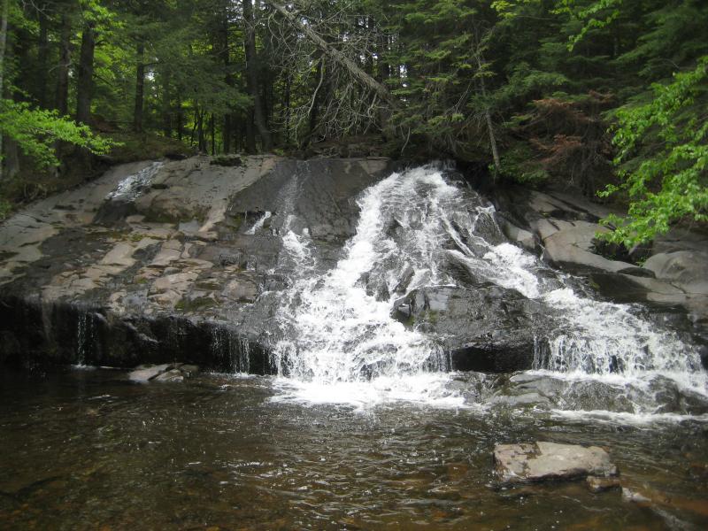
Cory seemed especially interested in this drop, with the weird pits in the face in the deep channels carved in. The pits almost form a small climbing wall. We skipped the tempting wall between pools of water and headed upstream. Even with the black flies buzzing about I wanted to show them the upper drop, which isn't quite as impressive but is too close to skip.
Partial stream over the rock
Following the river upstream was just as difficult as I had remembered, with low brush and scratchy pines reaching out to us along the riverbank. I don't understand why there isn't a better trail between the two drops. Both waterfalls are accessibly from nearby logging roads, but they're so close together that it makes a lot more sense to drive to one and walk to the other along the river. We finally reached the sliding drop, hung out at the deep pool below and commented at how awesome swimming in there would be if the black flies weren't so pervasive, and then started heading back.
It was past time to return to the campsite anyways. I had promised a timeline to Katie that we were in danger of breaking already. Our group made quick back to the car and I drove us back to Big Erick's. A quick lunch of sandwiches and we left again, this time with Katie, and we made our way west through Baraga and beyond.
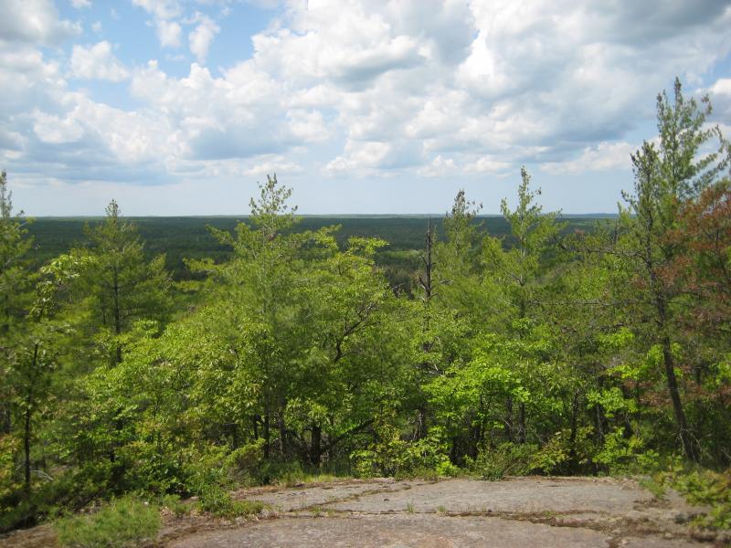
It was early afternoon by the time we were driving down a dusty NF-2270 on the way to Sturgeon Falls. Faith and Cory and I were chatting about the area when I brought up Silver Mountain. This old volcanic mound is located on the way to the falls and was a relatively easy climb with stairs leading all the way up to a mostly bare top. I had only been to it once or twice many years ago and had dim, fuzzy memories of the place. So we decided to climb it.
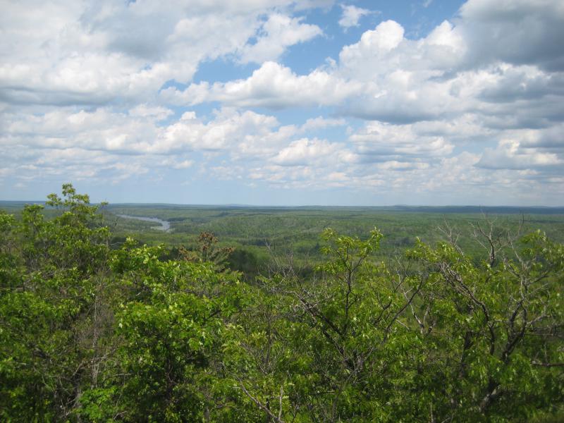
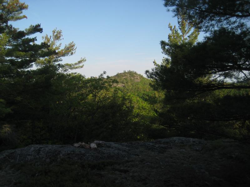
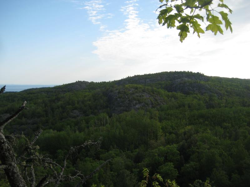
Katie opted to stay behind, uninterested in a staircase hundreds of feet tall, so the rest of us tackled the climb. The green foliage was thick overhead and kept the air under cool and a little stagnant. We all went up at our own pace: Logan ran for the first few minutes and then slowed down as the stairs continued, I took two or three steps at a time because I'm tall, and Faith and Cory stuck together and brought up the rear. We rejoined at the top and ventured around for awhile. There was a few good views down on the forest and the Sturgeon River Gorge, but mostly we stuck together to avoid getting lost. The top of the mountain can be a little confusing and there's no signs to point back to the stairs.
Bald top and view off of Silver Mountain
Looking up the Sturgeon River Valley
The breeze at the top felt good after the climb, just enough to rustle the leaves and cool damp brows, and it was with some hesitation that we started back down the long stairs. Heading down wasn't difficult, but the forest was still relatively warm compared to the peak. Katie was ready to go when we got back and we quickly continued our drive to Sturgeon Falls.
The last time Katie and I visited this waterfall we didn't have a fun time. I got us lost on a wrong turn and we were besieged by mosquitoes near a swampy oxbow lake. Now I knew the path, and while she was hesitant on a long walk down and back up the deep valley, I convinced her that the falls were worth it. All of us headed out of the car, followed the path through the woods to the edge of the valley, then followed the valley rim until the footpath plunged down into the gorge. This is where things got too tough. She didn't want to head down the steep path. The rest of us left Katie behind and we headed down to the waterfall.
A sunny day on the river
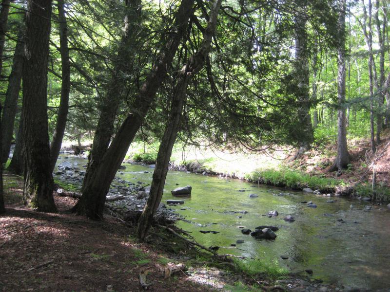
We were at the camp above the falls in minutes and the riverside a short time after that. I led us upstream first and we followed the river down into the chute. The main drop is below the chute, pouring over a bunch of impressive rocks to form a large and noisy waterfall, and I showed Faith and Cory the best way to reach it. I then turned and headed back to Katie. She didn't seem to be having that much fun today, with the rest of us continuously leaving her behind for tougher adventures.
Once the other two rejoined us at the top of the valley we headed back to the car and chose a long way back to the campsite. I drove us through the sandy Baraga Plains, an area that still feels like it belongs more in the Marquette area than here, before we came back up through L'Anse for some dinner supplies. Hot dogs over an open fire was our dinner, simple and easy, and then we headed out again towards Point Abbaye. This was a fairly easy adventure, one that Katie could enjoy with us, and I tried to time it with the setting sun.
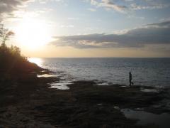
The road to the point was tougher than I estimated and we arrived at the parking lot just as the sun was touching the horizon. We walked the paths through the woods in the gathering dusk, watching out for puddles and sticks that snuck up to trip us. When we finally reached the tip the western sky was still bright with the setting sun even though it was mostly gone behind the distant hills across Keweenaw Bay. There was just enough light for us to play out on the flat rocks for some time and get some good views over to the Huron Islands and Mountains.
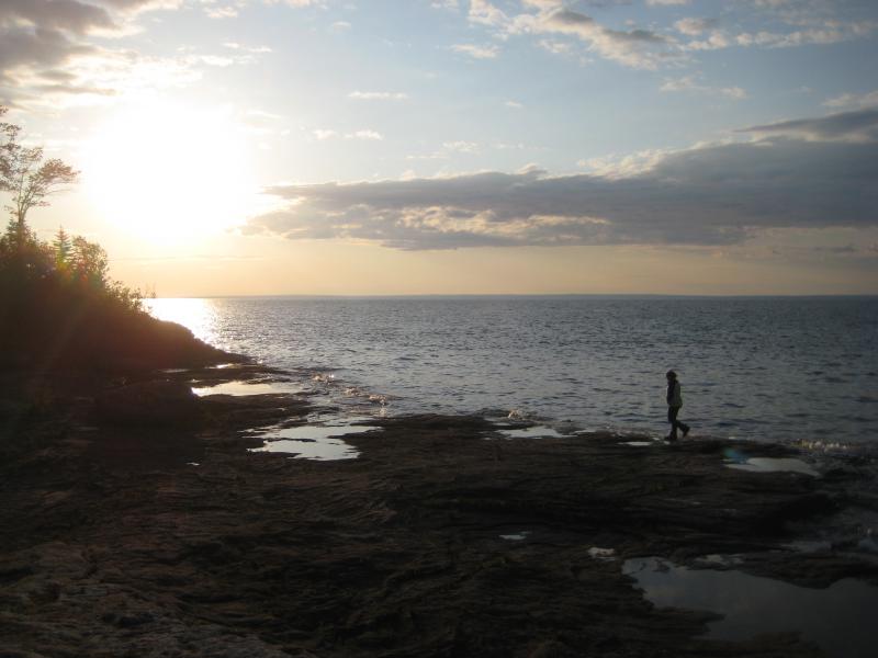
Faith on Point Abbaye
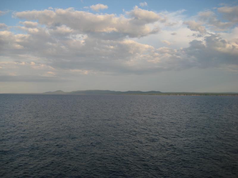
Distant mountains to the south
Dark paths and roads lay before us on the way back to the campsite. By the time we pulled up to Big Erick's it was well after dark, approaching midnight, and no one was terribly interested and starting up the campfire again. It had been a full day of exploring, a great break from the relative dullness of Wisconsin. All of us crashed to our respective tents and slept deeply.
Comments (0)