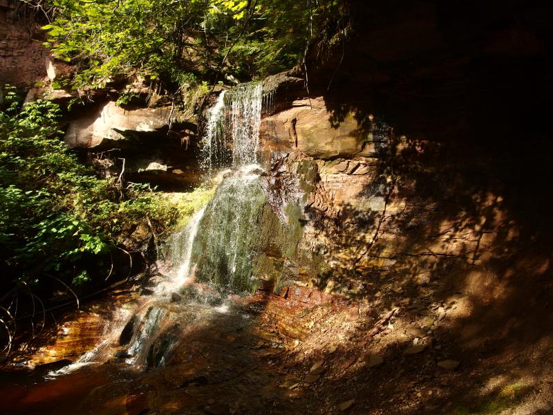
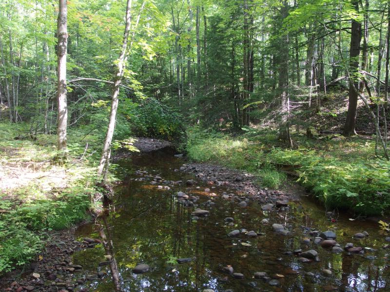
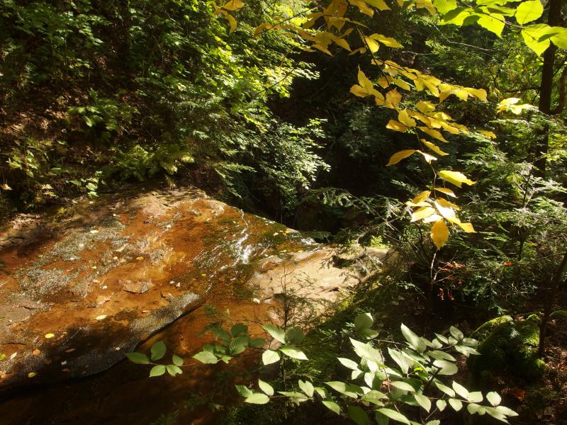


Finding a sizeable river that flows east from Toivola/Twin Lakes is tough - finding a waterfall along one is even harder. Paul's Falls on Sante River fulfills both of those criteria with an impressive drop down into a sandstone bowl. While much of the river is a meandering flow along a gentle rocky bed, here the water plunges over a lip of sandstone and pours down onto a steep slope of mossy rock. The river banks steepen to dangerous levels below the falls and create a descent cave on the north side.
Directions
Take A70 east from M-26 in Toivola, driving past several houses before entering the unimproved road. If your car can't handle the rough gravel, or if the road is not passable, park at the large turn off here. Head down A70 past Thirteen Mile Lake and the power lines to the (unmarked) Glone Mine Road, which is 1.8 miles outside of Toivola.
From here things began to get shady. Jog a short distance to the right on Globe Mine Road and then turn left to continue on A70. Stay on A70 for another 1.5 miles until the woods open up at the old site of the Challenge Exploration. You may find a few piles of poor rock and, depending on how clear the woods are, some old cement foundations here. Take the left fork at the old mine and, after the track passes it, take the first left. Meander along the old logging roads in a general eastern direction, staying to the south of Pine Lake, until you bump into a wide dirt road past the deep ponds.
Turn right on the dirt road and follow it for a few hundred yards before taking to left fork. Stay on the left as it slowly curves southwards and then take the first major left fork. Now heading east, stay on this one until it (again) curves south. Continue on the main track until it crosses over Sante River. Follow the river downstream to the falls.
-
Jacob Emerick
Jul 19, '15
Right? It took me more than a few attempts to find it. I wouldn't recommend going back there without a GPS or a guide. There are a lot of logging roads back there, all in various states of disrepair.
-
Mark Piotrowski
Nov 11, '15
Sounds more like I need to contact Lewis and Clark!
-
Eric
Dec 5, '19
Some of the roads are bermed-off now, which makes navigation easier but it also means you can't take the left fork at the old mine site, not in a car anyway. When I was there this past June, after jogging right at Globe Mine Rd for about 100 yards I continued left on A70, also known as Challenge Mine Rd, for a total of about 2.2 miles, going straight at 1.7 and straight at 2.1, to where the road got too overgrown. From there it's a pleasant hike of about 1.5 miles through the woods to the falls, virtually due east. Rolling terrain, not too dense.
-
Paul
Dec 20, '19
Btw, I'm the Paul of this falls.I use to live in Tapiola and I'm a land looking addict, the aforementioned problem combined with my personal issues with finding remote trout streams somewhat lead to Paul's Falls. A relative of mine, Jim Belote, is an incredible woodsman, he has hiked, paddled and swam nearly all of the U.P. of Michigan. So I use to fish the Santee River at least once a week and I did so because it's about as far as you can get from anywhere in the U.P., no Bush beer cans floating around and the only other signs of humans that I ever saw was a old logging camp. Plus, once a while I'd catch a few trout.So one day I told Jim about this wonderful little falls on a branch of the Santee and since Jim has literally seen 99% of speck of land here he called b.s. because he has seen every waterfalls in the U.P.. Gladly I gave him my best directions on how to get there and off he set.Thus, Paul's Falls.And another time we were on another hike, this time to be shown a cool waterfall, we got super lost, and found another unmarked, unnamed waterfall that was pretty huge. We had no GPS and I believe it was either Bodie Creek or Snake Creek in the keweenaw.
-
Jacob P Emerick
Dec 30, '19
Hi Paul, thanks for sharing that story! I agree, that's a great location to get away from the beaten path. I'm not sure if you ventured into the Huron Mountains or Peshekee, but that's the reason those lands drew me in so much, the utter silence and lack of human sign. Anyways, Jim is indeed the source of the name here, I found a few of his photos on Panoramio or Google Photos or something similar. And thanks for the hint about Bodie/Snake... I'm unsure when I'll be back in Michigan, but that does sound like an interesting area to explore.
-
Paul
Jan 14, '20
Yeah, I've done a little up around the Huron Mountains but not a lot. I've spent quite a lot of time in the Craig Lake area in the Peshekee area and up in the Yellow Dog Plains. So many places to see like the third falls of on the Montreal is the best. There is this really cool chute at the top of it.Lately I have been spending a lot of time in the valleys of the Firesteel rivers south of M26. The hills in there are just steep enough that there is still some virgin woods. Last year me, my son and a close friend found ourselves sitting on this steep riverbank. The cool water seeping out of the rocks was like an air conditioner. Then we noticed the trees- huge cedars bigger around than the biggest White Pines.It's amazing what you can find if you just go looking.
-
Debby
May 15, '20
Hey Paul! You told me & Bob about it too.... perhaps before Jim. We tried several times to find it, and finally did.... Jim & Pete were with us. Bob dropped his hat, Pete said, go get it Daisy! And she did (amazing)! Beautiful falls. I'm so glad you told us about it. I remember you showing us a map, and you put your finger down on it and said, "It's right there!" and you were precisely right. You told us it was Sante River Falls, but Bob & I renamed to "Paul's Falls." I think once you, Bob, and your son, Bob's grandchild, mountain biked there together so that your son could see the Falls we named after you.... Your Dad also told us about Penn Falls.... another beautiful find. Hope you're doing well!
-
Kurtis
Jul 22, '20
I discovered these falls last weekend and it was quite the adventure getting out to them. Originally we tried following an old adventure guide and attempted to come in from Donken-Tapiola Rd. We bushwacked out to the river and had to cross it at the fork. The person I was with didn't feel comfortable crossing the river, so we ended up coming in on A70 as described above. I highly recommend using a GPS to find the falls once you are wandering around in the woods. I also recommend bringing a machete or something to clear the underbrush if you go in the summer because it was pretty dense in some areas. Thank you to whoever put the rope in for climbing down to the falls! It looks like they are working on the trails getting out to the Sante River. A bulldozer was parked out there and you could tell it had been doing some work recently.
Add to this discussion