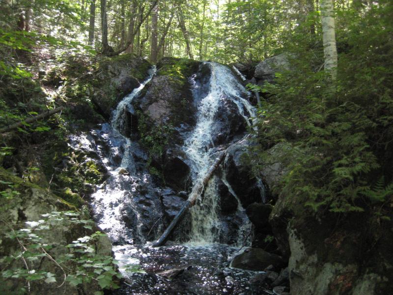
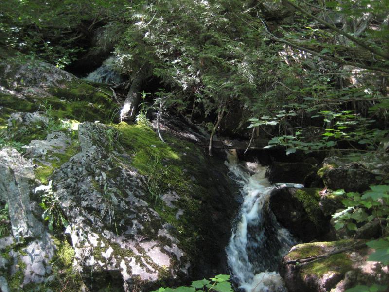


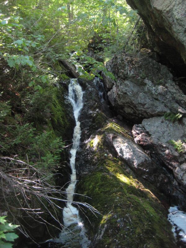


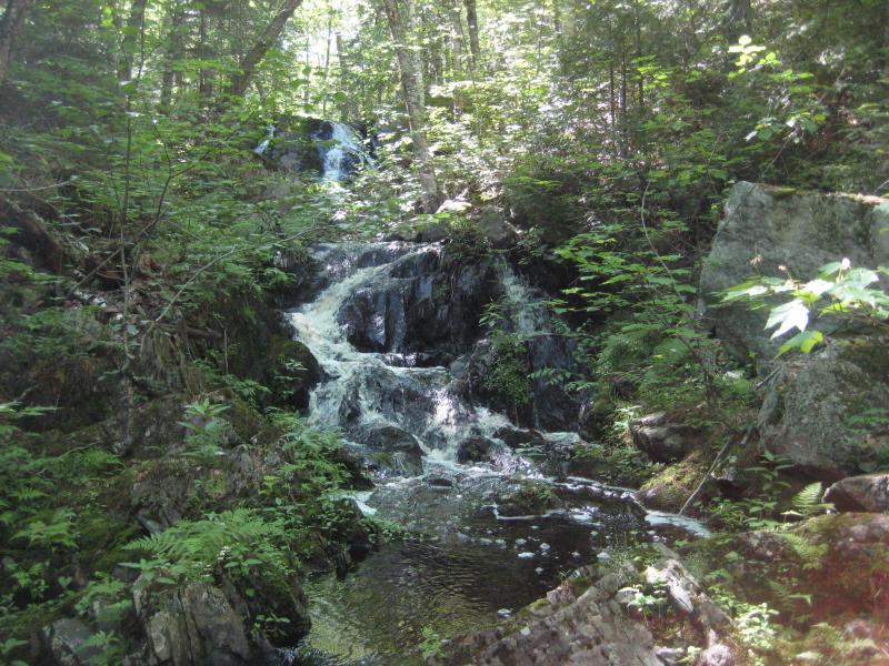
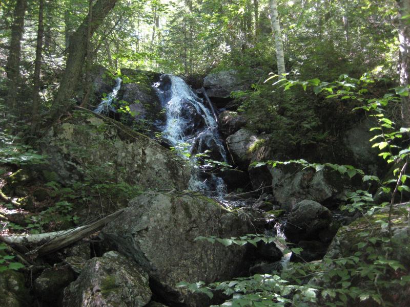
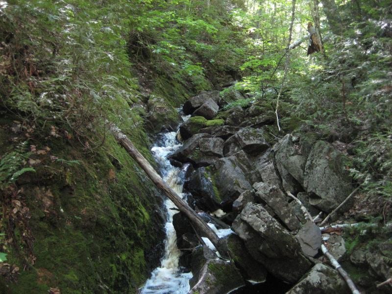
Wildcat Canyon is a steep little rugged gorge on the far west end of the Silver Lake Basin, a very remote area of Marquette County. A tiny creek drains a series of swamps down the canyon and over a wide variety of waterfalls. Some of the drops are tall split cascades over hard rock, some are sideways slides along slabs, while others are direct plunges that foam up as the crest. Huge mossy rocks and tall trees surround the creek and create a wonderfully scenic hike.
Directions
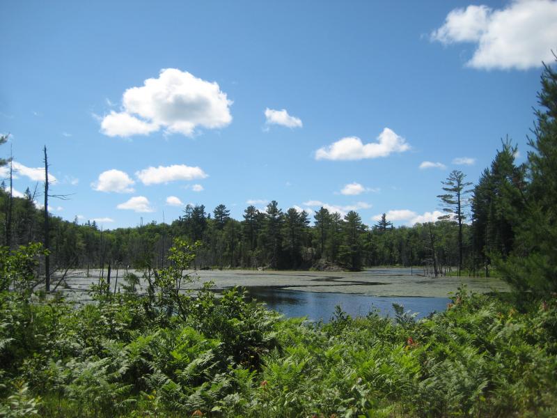
Head north on County Road FX (or Wolf Lake Road) from US-41 for 8.7 miles until the road starts to curve west up past Brocky Lake. Turn right on Grapevine Road, following it's loop for 1 mile before turning left at the fork. Take a right at the fork at .3 miles. Keep on this 'main' dirt road for 5.3 miles before turning right down a small track that leads over to the Dead River's inlet to Silver Lake Basin. Park at the camping spot.
Follow the track across the river on foot, walking along the western end of the basin. The track gives out after less than a half mile, continue on the shoreline until you bump into Wildcat Canyon Creek. Follow this creek up the hill, crossing the North Country Trail on the way to view the uppermost falls.
-
Jacob P Emerick
Jul 12, '18
Few hundred yards at best, it's very close. If you can still drive the "main" road (which used to be in great shape) then you can definitely get to the camp (and the falls beyond).
-
Garrett Moore
Jul 4, '21
I was at silver lake basin fishing a few weeks ago and I was wondering if I could beach my boat on shore and hike to the falls? how far would I have to go?
-
Jacob P Emerick
Jul 17, '21
Not far at all! And there are a bunch of waterfalls along the creek, so you can always turn around after the first few if the flies are getting bad.
-
Mark Piotrowski
Aug 17, '23
Of you some further observations. The North country trail local chapters map puts it at less than one and a half miles from wildcat canyon road to The crossing of the creek. From there it's approximately two and a half miles further to the silver lead area. The NCT crosses wildcat canyon road a little bit South of the creek. There's a parking area marked on their map near here. That would insinuate to me that access is available from that direction. Might actually be easier than the website directions! My question to Mr Emerick is if he has any knowledge of the seasonality of these two creeks. I am hoping to explore the area in September, do you remember what time of year you were there and what kind of water flow to expect? Thank you so much for continuing to allow access to your wonderful website Jacob, I know we now have Mr Stagg's books to help us out, but you have a number of Falls and other information that is not in those books, and I appreciate the resource greatly!
-
Mark Piotrowski
Oct 1, '23
Did the hike in September 2023. It is about a mile and a half of moderately strenuous hiking from Wildcat canyon road to the creek along the north country trail. There is mention of a few hundred yards in one of the comments above, there must have been confusion about the question. All of the drops are downstream from The crossing, other than a couple of little cascades. I believe these Falls are under estimated here. There are 15 to 20 ft drops, some of them linked together. It is difficult to access the canyon in any way other than to hike down it in the creek
Add to this discussion