Marquette County and a vast numbers of remote waterfalls in the Huron Mountains was still unexplored four months into this project. I had only made one journey that far east, a disorganized attempt to find Mulligan and Dee Lundeen that ended in the Yellow Dog Plains and a desparate, dangerous evening drive down the Triple A. There were still dozens of areas to check out, waterfalls that would seen be inaccessible with the coming winter's snow and sloppy spring roads.
Faith and I had our trip planned for weeks. There was a whole list of falls, from Bulldog up to Alder, that would handily deal with the center and northeast corner of Marquette County. We left Houghton hours before the sunrise. I drove us in the dark past Skanee and down Ford Road to the McCormick Tract to reach our first destinations of the day. We were going to find the upper falls of the Yellow Dog River.
Finding the parking lot was more luck than anything else. I was only vaguely familiar with Ford Road, let alone the roads past Anderson's Corner, and hadn't been able to find the the north entrance to the McCormick Tract on any maps. I had to piece together broken stories and posts into one cohesive drive from L'Anse to this spot. With the sun just starting filtering through the yellow leaves I guessed on the last few turns, ending at a Ottawa National Forest sign. I'm not sure if I could find it in broad daylight today without a few wrong turns.
Dark trailhead
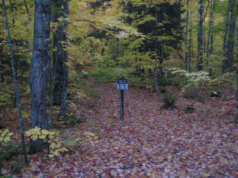
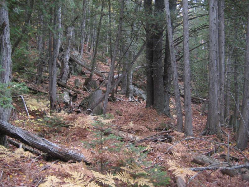
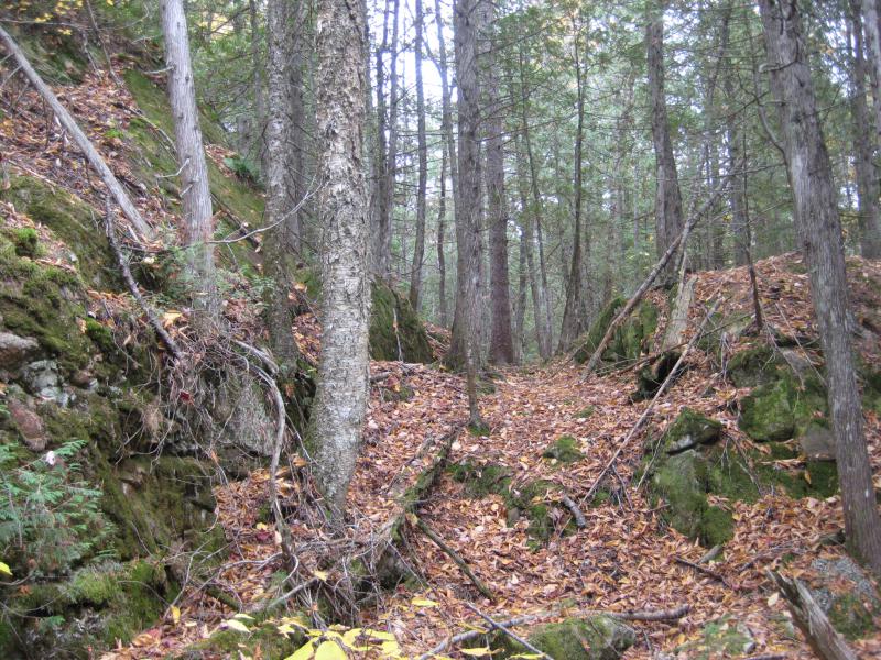
We parked and headed east along the overgrown footpaths. They don't mark trails in the McCormick Tract, preferring to let things go natural, which made it even harder for the two of us to keep on track. The thick layer of bright leaves on the ground didn't help, either.

Early morning on the McCormick Tract
Most of the trees in Houghton County, especially close to the lake level, were past their prime. The leaves that did still cling on were most orange and red. These trees, though, were mostly bright green-yellow and still held most of their foliage. The colors of the leaves that had fallen blended in with the low ferns, which were the only help we had finding the trail. A straight line with no peeping ferns meant a path, but with the leaves and young sunlight, and it was hard to chart a course. I had to bend over several times to sweep the leaves away and search for hard packed earth to make sure we were still on route.
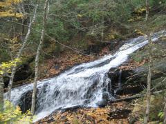
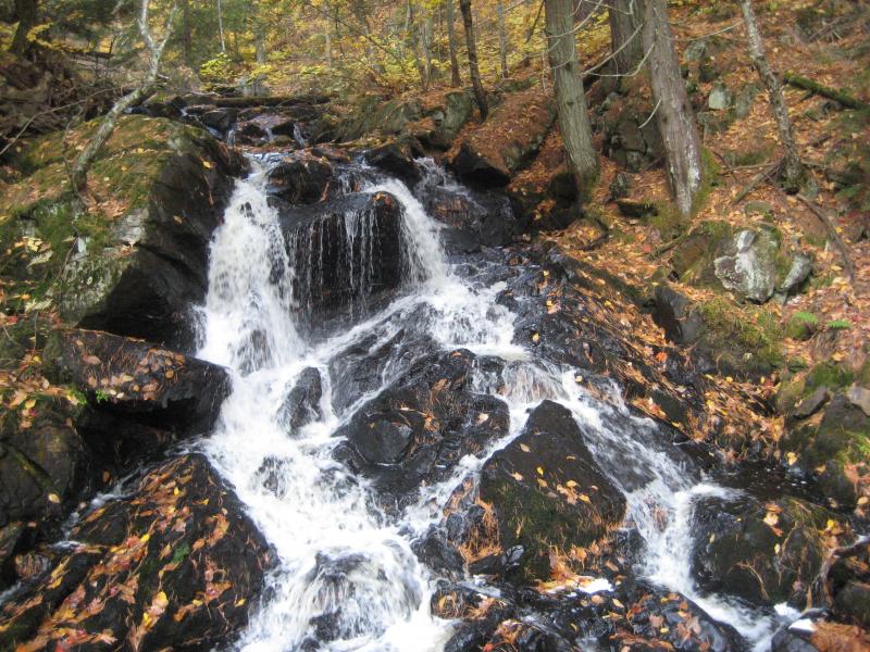
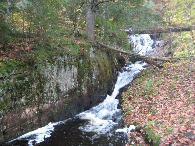
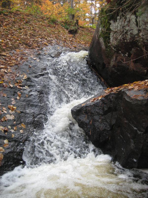
After a half hour or so of walking through the quiet woods we suddenly came upon a wide creek. This wasn't the first creek on the way so I wasn't sure at first if this was West Branch Yellow Dog River. A faint noise drifted in from the right, down from the steepening hillside, beckoning us upriver. A short walk up brought us right to the base of an impressive sliding waterfall.

Slides and drops on the West Branch
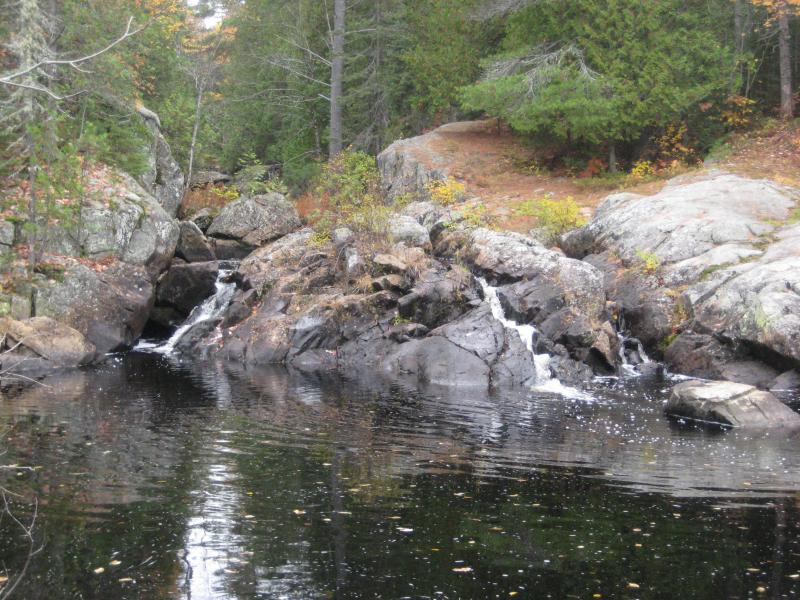
West Branch Falls slides down a slab of smooth rock bumping into a hard protusion on the east bank. Its tall yet not steep for most of the slide, with a single prominent plunge near the top. We headed up the side of the falls, careful on the slanted rock slickened by the dead leaves, admiring the remote waterfall. There was a log percariously perched above the plunge, a tempting point to cross, but the thick layers of moss and giving wood did not promise a safe passage.
We turned and headed back down to our trail. I had heard that the main path heads up from these falls over to Bulldog Lake and wanted to avoid it; the lake is far upstream of our next destination. It would be a good six years before I visited that lake and didn't want to rush things. After a quick couple of photos from the east bank, with an angle that was difficult to view the different slides from, we looked around for our trail up and down the river. On the second pass we found it, way down past the base of the falls, where we had first bumped into the water.
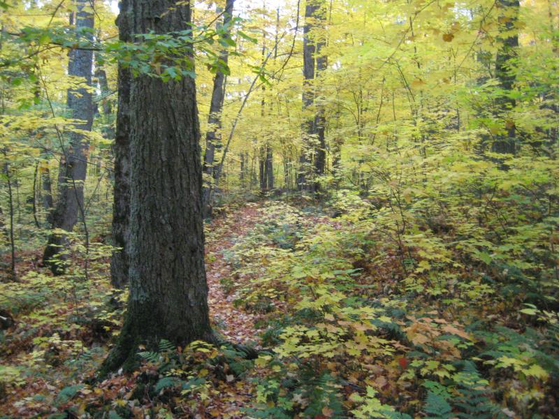
Faint path through yellow trees
We had further east to walk yet. The Yellow Dog River has two main tributaries in the McCormick Tract, West Branch and the main branch. West Branch drains some swampy areas below the Acropolis and was our first stop. To the east the main branch drains White Deer Lake and Bulldog Lake, the heart of the McCormick, and flows over Bulldog Falls. This was our next stop, far on the other side of the wilderness area, deep into unmarked woods.
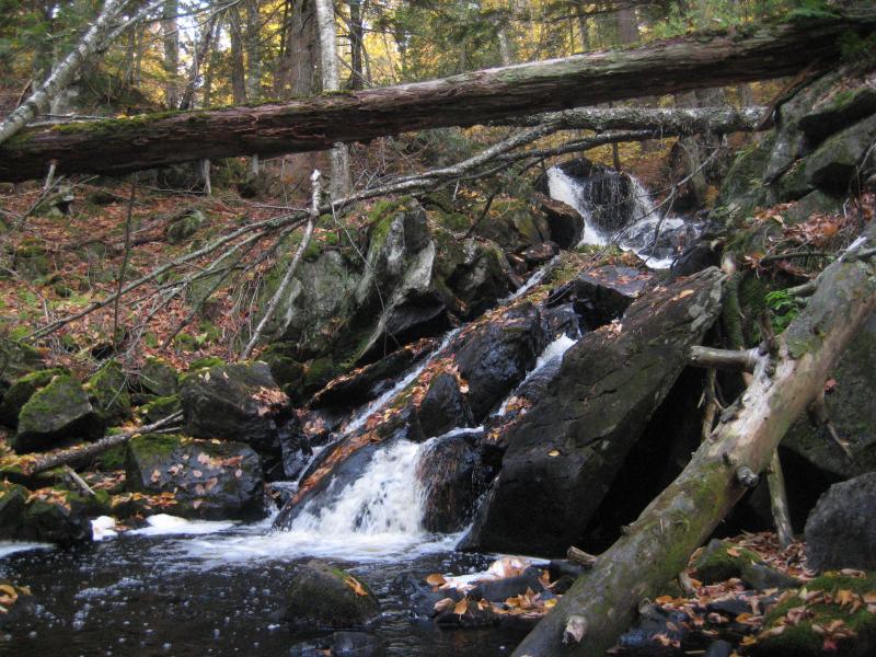
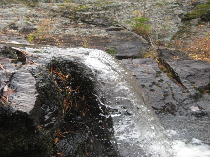
The path was getting easier to follow as the sun continued to light up the world around us. It didn't take long to find Yellow Dog River or identify it, as there was an cedar bridge over it that was being overrun by moss. It was still sturdy enough to carry our weight, even though it was at least fifty years old. Heading upstream here, to the south now, we passed by some sets of rapids through leaf covered boulders before we reached the lower drop of Bulldog Falls.
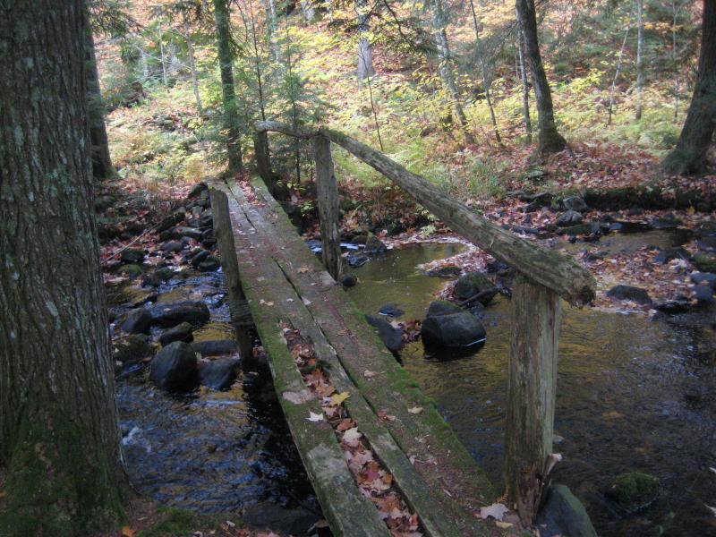
An old cedar bridge
Middle drop on Bulldog Falls
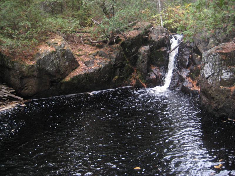
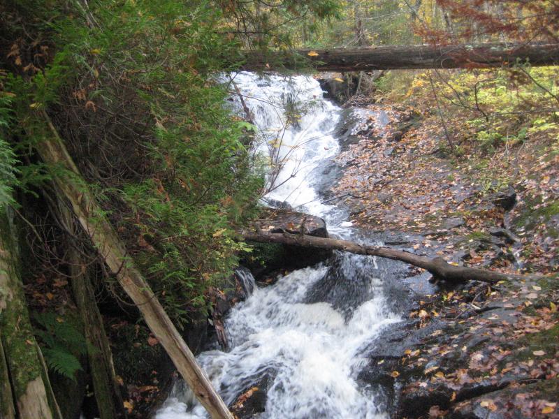
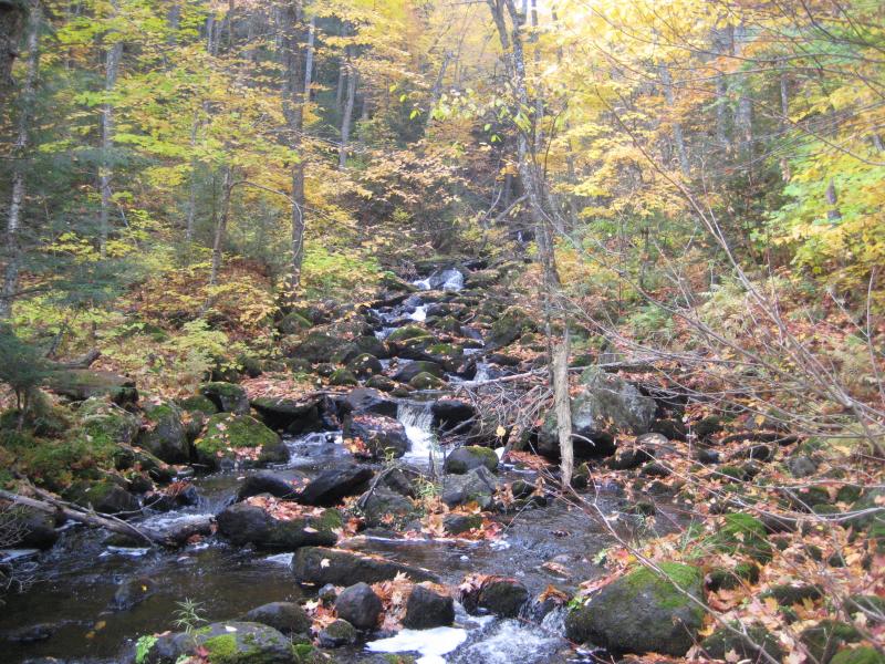
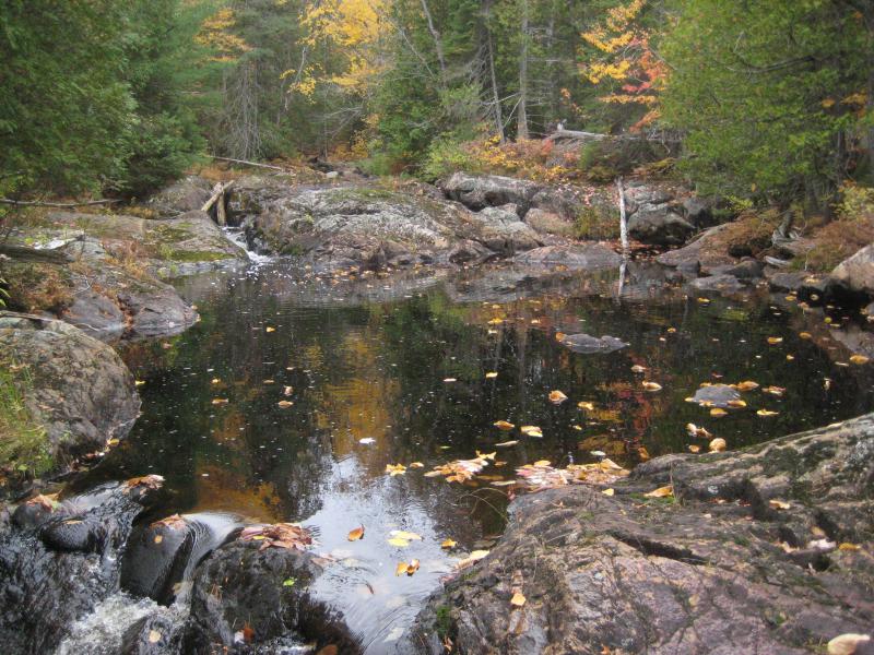
Unlike its partner to the west this waterfall is a long chain of drops connected by rapids and, at times, deep pools. The lower drops are more rugged, over jagged rocks and loose boulders, while the upper drops slide down the bedrock itself. The going was tough up the river, leaves and ferns covering the uneven boulders underfoot, but the entire hike up the falls was incredible. Every couple of yards a new wonder would show up, whether it was a huge boulder towering over us, a giant tree too big around to hug, or a plunging waterfall surrounded by color. Feeling giddy in the crisp fall air we chatted excitedly, thoroughly exploring the magical area.
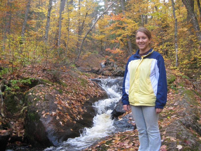
Faith surrounded by fall colors
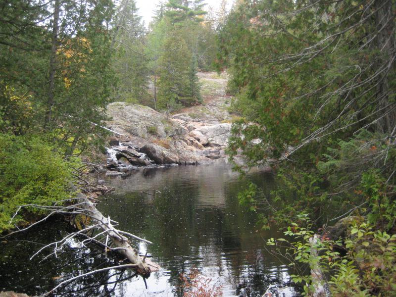
When we reached the final drop and saw swamps upstream it was a snap of hard reality. Of course the waterfalls wouldn't continue on forever. Also, we had been out here for over six hours without food or water. It was time to head back, time to leave the McCormick Tract.
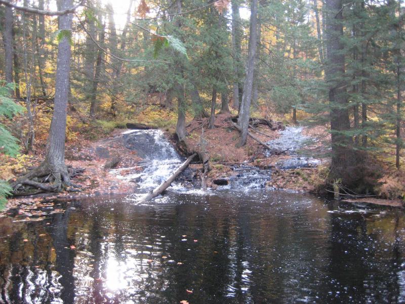
Split drop into an upper pool
The hike back wasn't too hard. I didn't worry too much about the trail this time. As long as we kept the slope on our left and the swampy lands on our right we would make it back to a road of sorts. This air of bravado usually ended quickly when I realize that I'm completely lost or heading in the wrong direction, but today was different. We made it back to the car with no mishaps, keeping to or near the trail the entire time.
Our stomachs were grumbling so I grudgingly agreed to skip out on the other hikes in this area. Wylie Dam was really starting to annoy me, now the last waterfall on Yellow Dog River that I had left to visit, and this being the third and possible final trip here this season. Instead we cruised through the Yellow Dog Plains and turned down County Road 510, enjoyed the colored canopy overhead, and grabbed a quick sub in Negaunee. Wandering into Subway wearing torn, muddy clothes with grubby hands and sweaty mops of hair never gets old.
There were several stops along US-41 that I still wanted to visit before we headed back to Houghton. Daylight hours were now over half gone with the impending solstice and we had to choose our routes carefully to avoid getting stuck in the dark (like we did at Montreal). One possible destination stuck out. Mulligan Falls was a location that I had found little to no good resources on in a area of Marquette County that I had gotten lost at earlier this summer. We decided to head north to Mulligan Plains, starting the first of many trips to this remote little corner of paradise.
The drive was a pretty one, along Deer Lake Road up past the Dead River. I recognized portions of the drive from my earlier trip, frustrated at how close I had actually gotten to finding the right way. Once we found Red Road we headed north where I had turned east before and, after a few stops to check out the reconstruction of the Dead River nearby, parked at a dead end facing Mulligan Creek.
A friendly group of four-wheelers were prepping here for a trip to their cabin on the far side of the creek. I asked for directions to the falls, something I usually try not to do. With the lack of information I had today, though, I definitely needed the extra help. One guy rattled off a quick set of information: cross the creek here, follow the trail for a bit, cross back on the creek on a beaver dam, follow the path up to the remains of an old homestead, then follow a foot path back down to the creek and falls. I nodded, trying to picture the complicated route, and decided it focused on one thing: go upstream.
Shaky bridge over Mulligan Creek
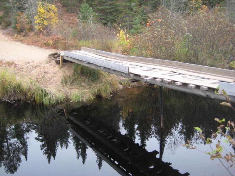
Before we could do this, though, we had to cross Mulligan Creek. We had a choice to make. The road technically continued past the creek to the right, fording the sandy river. I could only guess at the depth from the banks but it would have been at least up to my knees if not thighs (or Faith's waist). The other path was a rickety bridge just barely wide enough for an ATV propped up on two thin metal posts. It's hard to say how the sluggish flow of water underneath didn't push this over, let alone how it was able to support its own weight.
Neither one of us minded jumping in the water, but it was chilly out and we had kept dry all day. We decided to cross on the bridge. Even though it swayed alarmly under our weight the bridge remained upright. Turning up the road on the opposite bank we headed upstream, following the same path the four-wheelers suggested.
I kept a close eye on the left side of the trail, towards the creek, and was able to make out a small path leading down the bank after ten minutes or so of walking. Reluctantly I led us down the bank to the creek, somehow finding the beaver dam here. I didn't plan on following the directions exactly, figuring we'd just push up the thick riverbanks, but it was nice to find this reassurance. Crossing atop the dam we made it back to the south bank and looked for any sign to the old ruined homestead. We didn't find it.
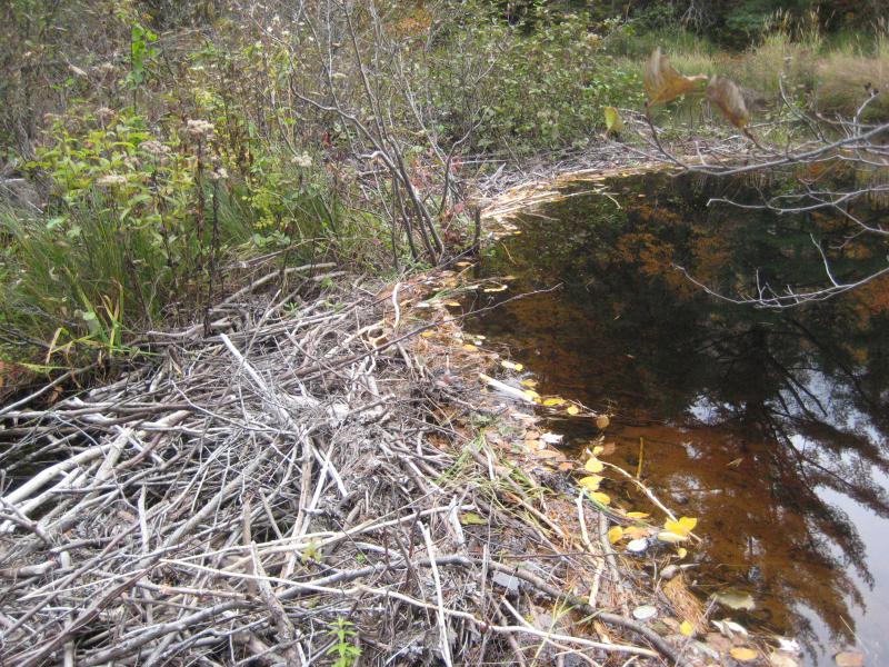
Crossing over the beaver dam
Faith was starting to get worried about the time and the dimming light. During our drive to Mulligan some clouds had collected overhead, cutting off the sun and making our judgement of time fuzzy. After the bright sun on the McCormick this change in the sky seemed overly ominous. I convinced her to continue on a while longer and we pushed up the thick undergrowth, cutting from one animal path to another and ducking around the brush. Just when I was starting to consider turning around the faintest sound of running water crept through the swampy creek. It could have been another beaver dam but I had to give it a chance. We pushed back to the water, which we had drifted away from along the tough upstream hike, and found Mulligan Falls.
This waterfall is not a single impressive drop or a series like our earlier stops. Instead we found a long chain of dozens of drops, most around a foot or two tall, all buried within a dramatic rock gorge. They varied a lot, some plunging off of narrow shelves, others sliding down smooth grooved channels, while still others tumbling between boulders or within jagged chutes. Some deep, dark pools were scattered along the creek, tainted to a black from the upstream swaps.
Mulligan Falls
The view in front of us at the base of the falls was crazily beautiful. Tall mossy rocks with patches of lichens rose up from the swamp, promising a jagged change to the creek ahead, and the water poured out from a deep narrow canyon over separated channels into an evil-looking pool. The differences of colors, the scattering of bright fall, white falls, stained rock, green pines, and blackened water was a sharp change to the dull brown of the dead swamp vegetation. We just stood here, amazed, taking in the scene before eagerly edging around the pool and plotting our route upstream.
Once we crossed over these lower falls we headed upstream on the north bank, which was lower to the creek's bank, and repeatedly paused to check out the drops. There was one in particular that was striking, a narrow chute of white emptying into a dark pool surrounded by black-stained rock.
Tiny chute emptying into a deep pool
After the first set of drops a second large, deep pool opened up. We edged over to the right, staying on the north bank, taking photos of the drops across the water. The rocks here were more open, exposed and worn bare next to the drops, and once we reached them we sat and enjoyed the quiet woods and open pool in front of us. It had been a long day, an early start and a full day of hiking, and everything had just been simply awesome. Unfortunately we were running out of time now, even with so much potential here and so many more places to visit. We got up and headed further upstream, along this shorter set of falls, and turned around at the third pool above. The drops on the other side were little more than gentle slides, possible marking the end of Mulligan Falls.
Large, calm second pool
On the way out we stayed on the north bank. I had a small hope that we could find another waterfall on the way out. Rumor had it that Stager Falls is near here, flowing down from the highlands above into Mulligan Creek near the first drop we found. Once we reached a trickling rocky tributary right by the falls we veered off of the creek and followed the trickle north. Just as it was starten to steepen and show some promise (except for the water flow, that is) we were led up to an ATV trail. This tiny creek, which we had thought was Stager Creek, merely emptied a large swamp.
Instead of turning around and following Mulligan Creek I took us onto the trail. After all, there was only so many trails in the woods, and as far as I knew my car was parked at the only nearby access to the woods. We followed the trail and turned right at the first fork, soon finding our path and the bridge over Mulligan Creek. I had guessed right.
We made it back to Houghton after sunset and enjoyed a delicious homemade soup that Katie had prepared for the three of us. Faith and I have been a lot of waterfall trips, some before this one and even more after, yet this will always be the best one. The new finds, the fall colors, the remote area: everything was just perfect today. It didn't matter that we only visited two spots or that I had many more place left on my list. Mulligan Plains and the McCormick Tract made for an amazing, unforgettable trip.


-
Jacob Emerick
Jan 20, '09
Agreed. I'm kinda hesitant on going back in fear that it won't be as cool the second time.
Add to this discussion