One week had passed since my last visit to the Upper Peninsula and I was already anxious to get back. Part of it was the spring thaw, the time of year that every waterfall up there would be flowing and busy. There were plenty of seasonal creeks for me to check on. The other reason was a bit more personal. I had hurt my right knee on the last visit and wanted to prove to myself that I was still capable of a weekend of hiking. So, in typical stubborn fashion, I headed north with a full itinerary and a basic, untested knee brace.
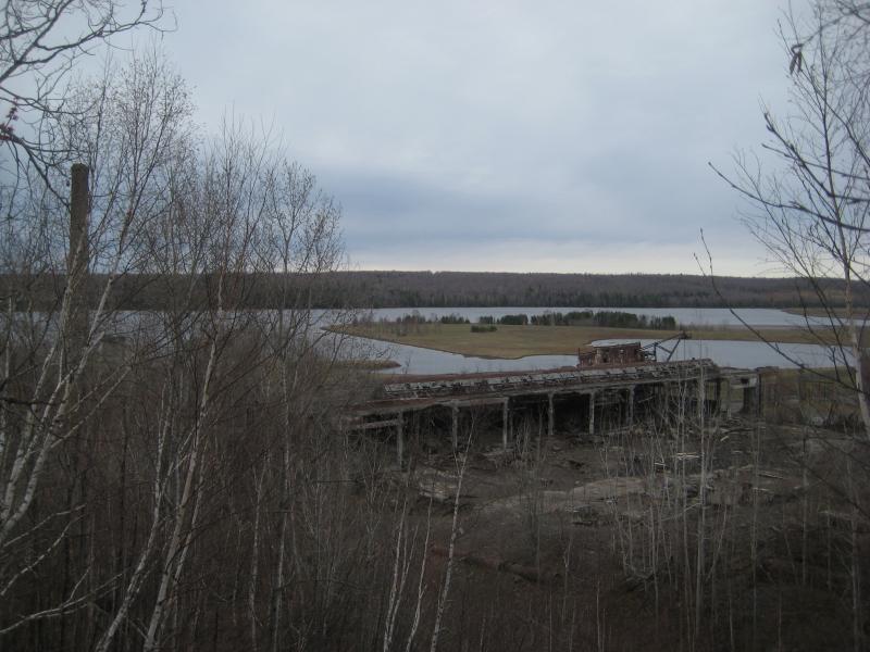
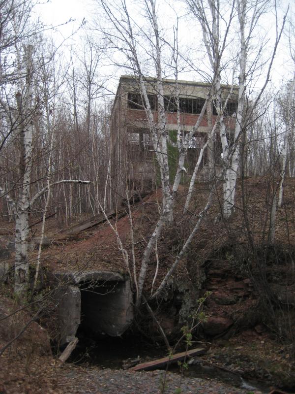
A long car ride through the night and I reached Quincy a mere hour after the sunrise. Driving beyond the Portage is never a lot of fun - it takes three hours just to reach Covington from Appleton (on a good day) and another hour to do anything beyond the bridge. Which meant hitting the road around three in the morning. Once the old Quincy Mill finally came into sight I quickly parked on the side of the road and got out to stretch. Hiking along this creek would be a most welcome change from sitting in my small car.
I scurried past the ruins of the old mill under the dim grey sky and crashed down next to the creek on the railroad grade's far side. During past visits I had taken my time here, had wandered through the mill and along the grade and into the nearby buildings, but today I was in a rush. My goal was to visit the uppermost waterfall, the tall and impressive drop that Faith and I had found a year ago in the snow, and to get a good shot of it flowing without snow and ice to hide it. There was one problem, though - the creek was barely running.
Mossy covered rocks in the creek
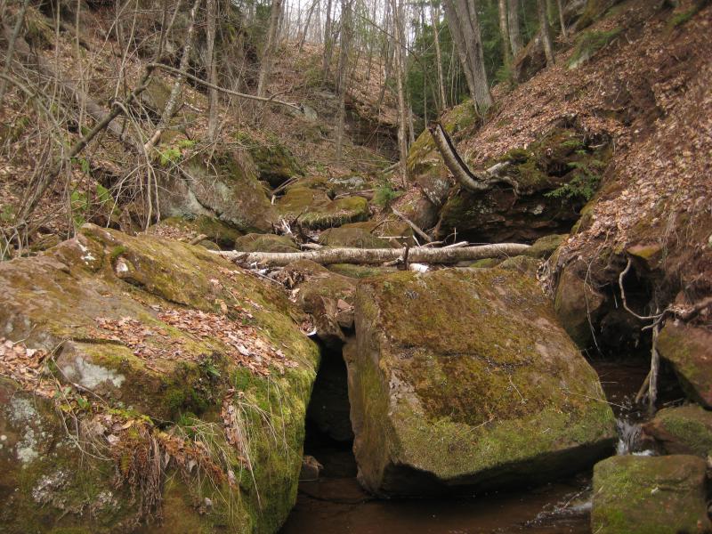
Dull leaves still coated the ground from the fall and few patches of green were poking through in the muddy creek gorge, and at the bottom a boring little trickle of water snaked around mossy boulders. It was more than the dry summer months, sure, yet it wasn't much. I slowly started upstream, slipping and sliding over the dead moss and muddy rocks, already regretting making this stop.
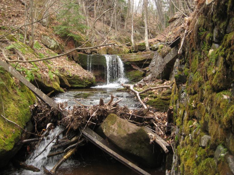
Small dam and tire swing under bare trees
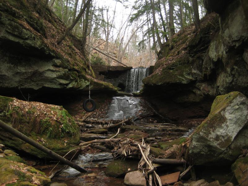
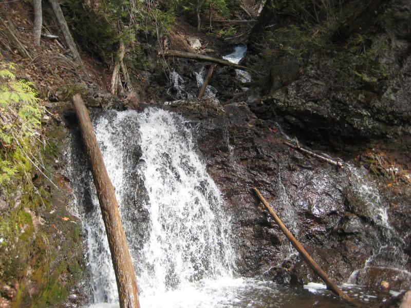
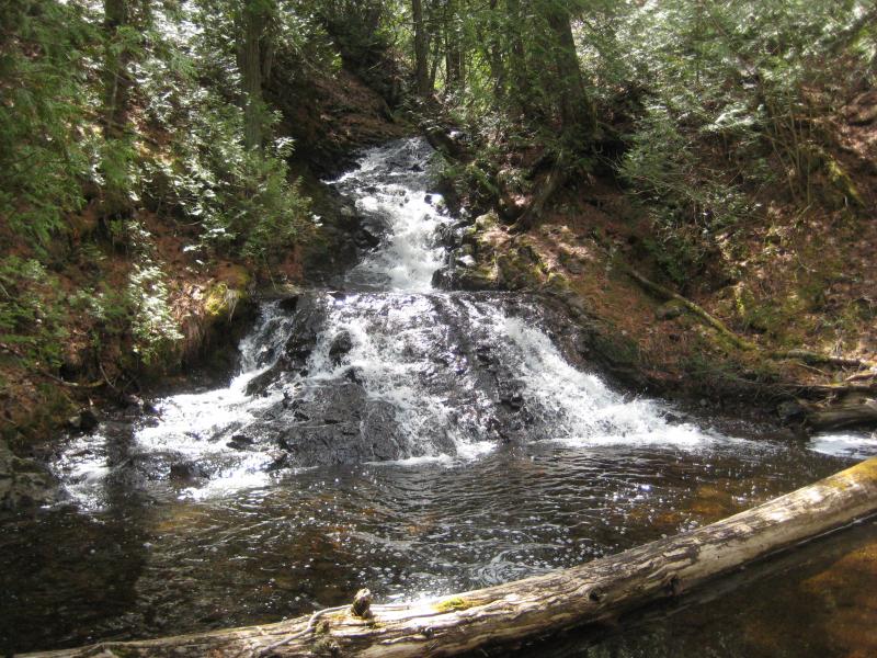
Enough water flowed over the dam to raise my spirits. This waterfall is always a pretty one, with the manmade dam creating an even drop before the creek slides over a mound of smooth stone. On each side the gorge zooms in with rock faces to create mirrored overhangs. A tire swing, something that I didn't remember from previous visits, slightly tarnished the idyllic scene. Didn't mind the swing too much - not only is this a pretty waterfall, getting over it is a fun challenge that involves both crawling and climbing.
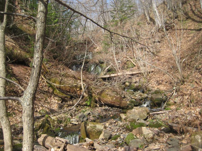
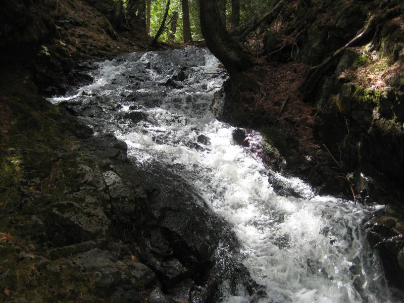
Above the dam is a long stretch of river that can get boring. There are tiny drops, some swampy sections, and nothing that promises anything significant upstream. The first time I visited Quincy Creek I had been very tempted to turn around here and head home. The only thing that kept me going was the gorge. The walls still reach thirty to forty feet high on each side and it seemed likely that the creek had to 'drop in' somewhere. And it does, though it takes over a half hour of sloppy walking to reach it.
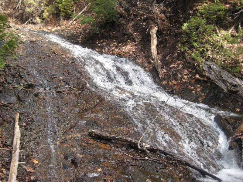
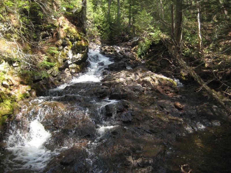
The water wasn't terribly low, I guess. It was more than I had usually seen flowing in Quincy Creek (except for during the snowier time of spring melt), it just wasn't what I had hoped for. Gooseneck and Dover Creek turn into raging rivers during spring melt, why can't Quincy? Maybe I missed that time of year. I finally made it to the impressive third drop, skipped over, and after another five minutes was at the final upper waterfall.
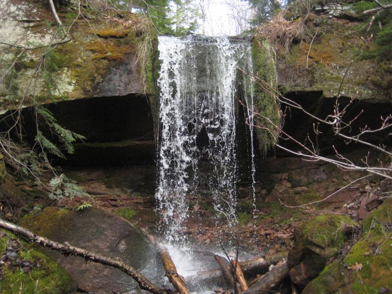
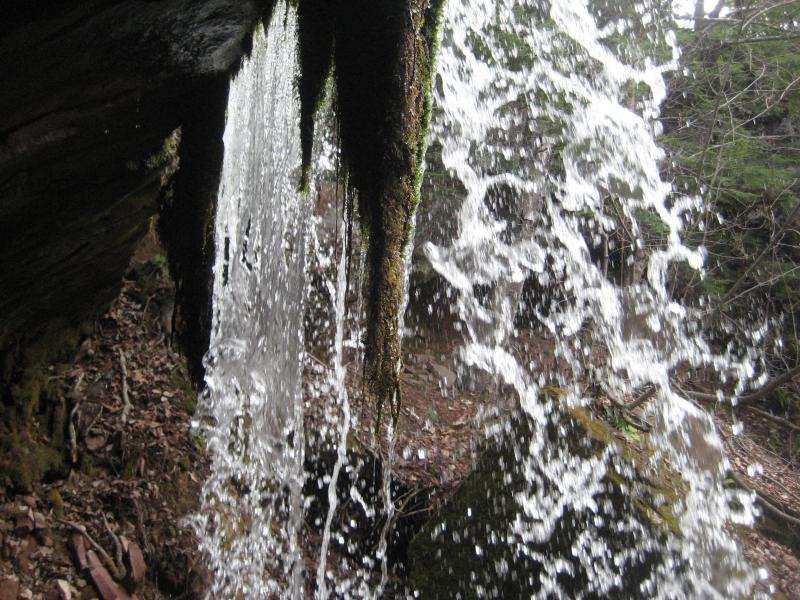
Mossy upper drop
Not quite as scenic as I had hoped, the tallest drop on Quincy Creek was a splattering mess flowing over thick dregs of green growth. The green gunk stunk something fierce. I crept closer, doing my best to ignore the stench, before turning around and heading to the bank. This wasn't quite as fruitful as I had hoped. At least I got some snow-free photos and some useful coordinates.
Walking along the top of the gorge was only mildly easier than the bottom. This far upstream and the woods were still young from recent logging and fought against my passage. When it got too clingly I would just drop down a bit and walk on the slanted gorge wall itself. When I returned to the ruins I took one quick view of the mill and dredge before dropping back to my car. One waterfall down, three to go.
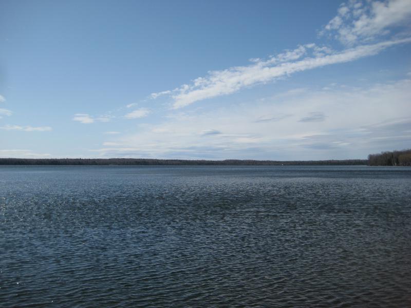
Torch Lake below
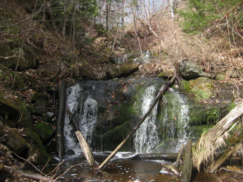
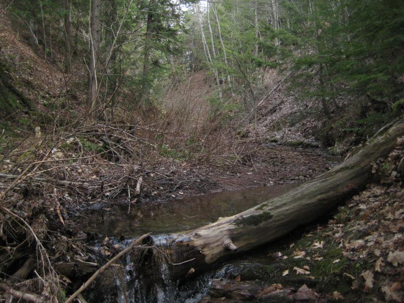
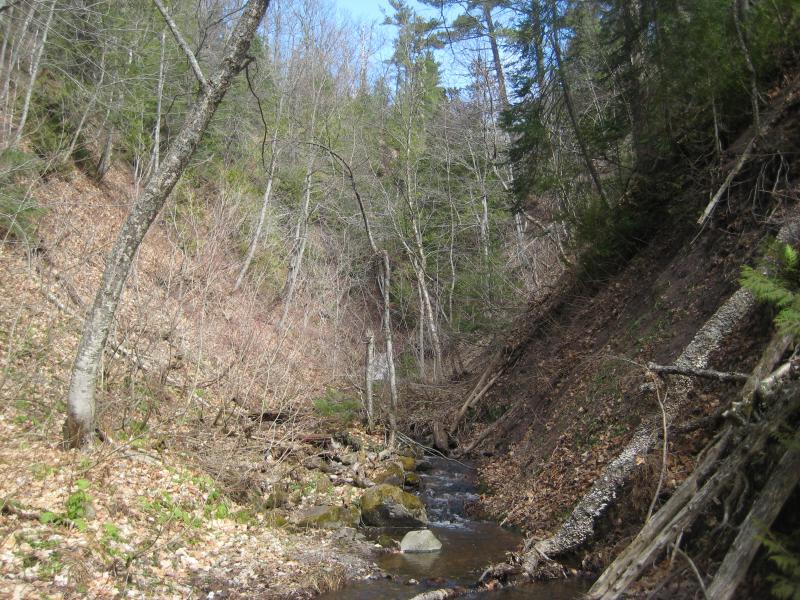
The next drive wasn't long at all. Seven miles up M-28 through Lake Linden with a quick jaunt over on Gregory Street and I was walking again, along the same railroad grade that was down by Quincy Mill. At least I thought it was the same grade. They tend to fork and merge a lot. Anyways, this grade goes over a deep little gorge near St Louis Hill that I had found last year, a little gorge with a creek that I've been calling St Louis Creek. I crossed the grade, found a good descent, and tumbled down to the creek.
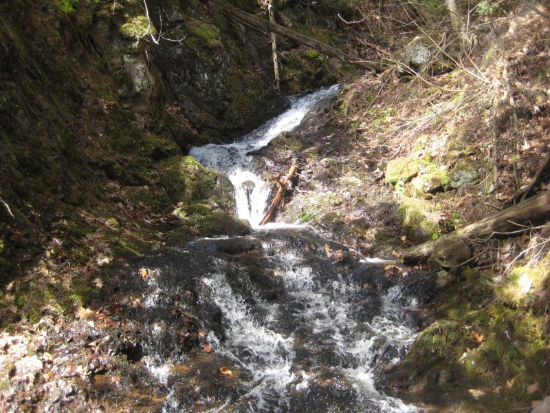
This creek was flowing quite a bit more than usual. It's not a big one, a small watershed barely touching the outskirts of Laurium, so to see a decent flow that riveled Quincy Creek was uplifting. I followed the creek upstream, making a quick stop at the old car wreck on the way, and stopped at the mossy little drop.
Rocks and mossy logs around the creek
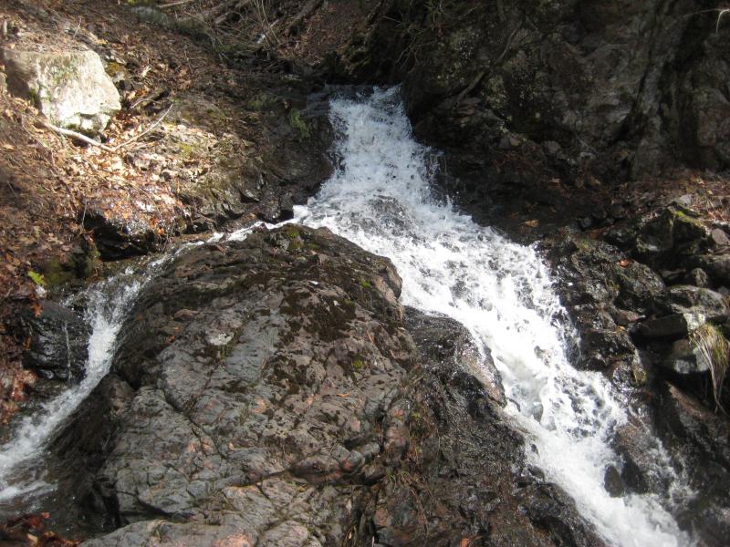
This was the first time I had visited this one outside of snowy winter so I took some time at each drop. There are three altogether, though the bottom one is the most impressive and the top a more humble chute. I was briefly tempted to continue upstream, to follow the gorge and see where it led, but I didn't. There are cabins along the western bank that always made me a bit uncomfortable here and nothing that promised more drops up there.
Instead of heading upstream I headed up the steep bank and found the old track up there. After the railroad grade crosses this creek a narrow two-track spurs off and goes north along the top of the creek. There's a track that goes south as well that quickly ends at a fantastic little cabin, too. Back to the northern route. This little track follows the top of the creek a short distance before winding away and entering a wide, open clearing. I climbed up into this clearing and made quick steps towards the center of it.
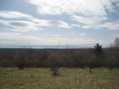
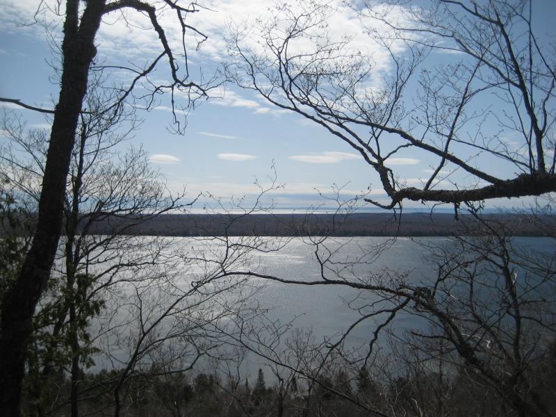
The view south is great over Trap Rock River Valley and, with some imagination, Lake Superior beyond Traverse. More immediate was the decaying remains of an old trolley. I'm not sure where it came from, though Copper Country Explorer has dedicated some time in finding and explaining the history of it. I made a wide circle around the remains, being sure not to step on any old pieces or anything. Plus there was an odd depression nearby that looked like an old well that I didn't feel like falling down. Then I stopped, sat down on the grass, and ate a little lunch. The trolley and warm sun made good companions as I gazed southwards.
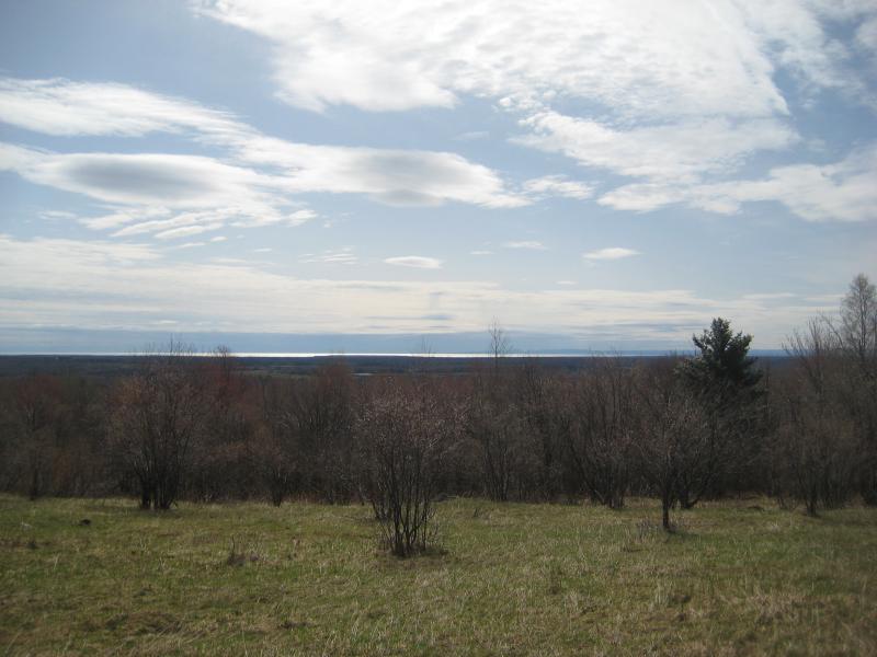
Lake Superior in the far distance
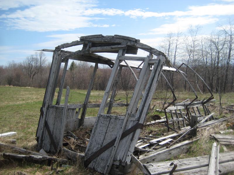
The old train car
My knee was beginning to bug me already. That knee brace would come in handy, as my day was only going to get tougher. My next two stops had more elevation change, rougher terrain, and longer distances than the morning. And the last one was a big unknown. I was guessing that there were waterfalls along Eliza Creek outside of Eagle Harbor and was considering hiking the several miles up to Madison Gap to find it. Several miles of bushwhacking along a conglomerate-bottom creek was starting to sound like a bad idea.
Lunch was over. I stood up and headed back to my car and made the long drive north to Gratiot Lake. Before exploring Eliza Creek I wanted to make a quick return to Eister Falls, a spot I had been to twice already. The first time was during a hot and dry summer, and the second was with snow and slick rocks that made most of it impassable. Today I wanted to hike the full length of the deep little gorge.
Getting to the base of the waterfalls was easy enough after so many visits. I followed the trail until it began to steepen, then cut right and made a lazy semi-circle around a sudden ridge until the creek came into view. The brush here gets pretty thick and requires some fighting to break through to the lower drop. And then things get fun.
Looking up the lower drop
Climbing up the lower drop requires some scrambling and a willingness to get a little wet. And once in the gorge there is little choice but to walk (or crawl) over slick conglomerate or hug the walls to continue upstream. The tough going is worth it. There are dozens of individual drops along the way ranging from tight chutes to spread-out fantails. I took my time heading up, careful of my knee and enjoying the multiple falls.
Water fanning out over the rock
Zig zag drops along the conglomerate creek
Near the end of the gorge I turned and made a tough climb out. I couldn't quite get over the last drop - it was just too narrow and jagged for me to attempt today. Besides, my path was now up. I wanted to climb up to the top of Gratiot Bluff. The trail I had started on near the bottom is a little loop for this bluff and should have a decent view of the lake below. Once I got out of the gorge I re-found the trail, started uphill, and swiftly lost it again. The thick layers of last year's leaves and the intermittent trail markers left me wandering and confused near the top of the bluff. I found an okay view, took some photos, and then headed back down to my car.
Gratiot Lake from the bluff
One last stop to make. The knee brace didn't help much at Eister, not with climbing up hills and scrambling around the conglomerate gorge, so I wasn't feeling optimistic as I drove up and around Delaware Mine. When I parked and stepped out of the car and looked around I quickly decided to cut this visit short. Any weight on my right side caused a small shot of pain through my knee, enough to keep me worried. Fifteen minutes of walking around and I would call it a day.
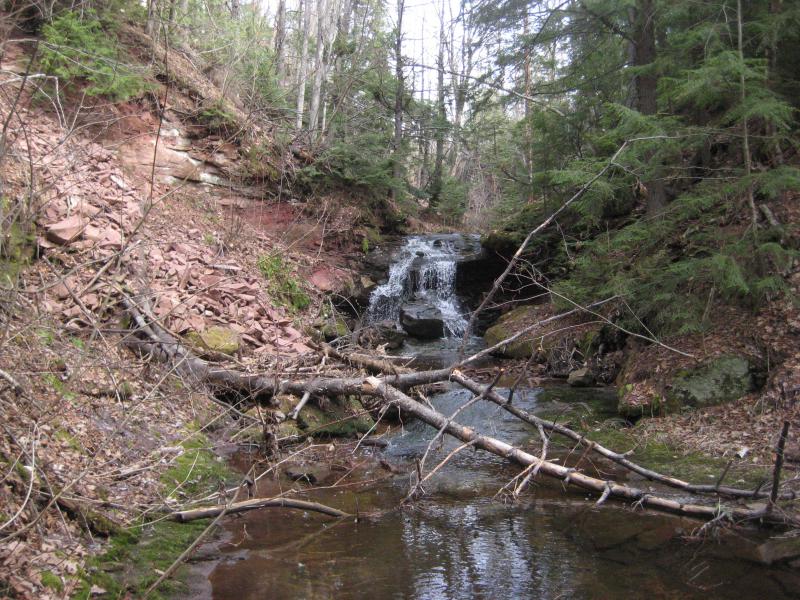
Downstream seemed more promising, so I crossed Eagle Harbor Cutoff and headed down to the creek. And immediately found a scenic waterfall sliding into a perfect little pool surrounded by dark rocks and green moss. Dang, if this was accessible right below the road I'd love to see what was further downstream. I took some quick photos, glanced downstream, and then retraced my steps up. Further downstream would have to wait for another day.
Fanning drop into a deep pool
Before heading out I wanted to see what was on the upstream side of the road. I came back to the car and then dropped down to the creek and found some minor slides and rapids here. Also, there was some old remnants of mining activity here, a rusty wheel and pipe. I wasn't aware of any mines in Madison Gap. I took some photos of the busy little creek before sticking to my fifteen minute limit and limping back to the car.
Bumpy rocks on Eliza Creek
So my right knee was in trouble. My left knee was always a bit iffy, after that slip down by Alberta, and now the right one was hurting too. A doctor's appointment would be in the near future. For today I headed south to Houghton and Michigan Tech and called up some friends. I was done hiking, done with putting more stress on my knees, and it was time to catch up and relax. Maybe I'd visit some more waterfalls tomorrow.


Comments (0)