Montreal Falls and I have a tough relationship. This waterfall was on my first waterfall adventure, all the way back in June of 2008. On that trip Katie and I only made it to the lower falls, unsure where or if there was an upper falls. A few months later Logan and I hiked up Montreal River, visiting both falls, only to learn that there was a third drop even further upstream while we were on our way out. Today I wasn't playing around. Faith and Cory came along, more intrigued by the wild lands up here, but I was determined. I wanted to finish up Montreal Falls.
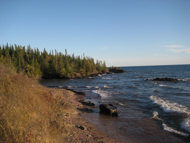
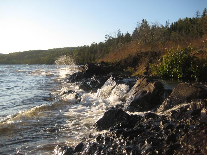
Summer hours were over at work so we didn't get on the road and up to Smiths-Fisheries Road until after six in the evening. I zipped and rocked down the rugged track, anxious to get started on the hike. When we reached the parking lot and started heading down the shoreline path, though, Faith and Cory's infectious excitement over the area got to me. The sun was still high in the sky, there was no one in sight, and the rugged area was asking for a meandering hike. We headed down to the lake and the rocky shoreline, playing with the waves of Lake Superior, and wandered slowly up the shoreline.
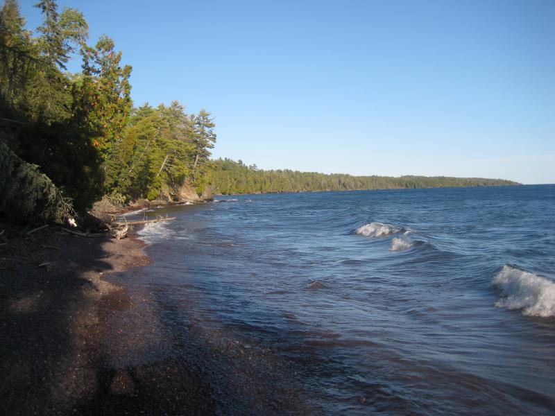
Rocky beach along Montreal Bay
The rocky shore is too tough to stay on, though, with random outcroppings poking out into deep waters. After climbing up and down the banks a few times to continue our eastward route we decided to stick to the cedar footpath for most of the walk. The air was warm yet not uncomfortable and the winding footpath was fun to follow. Between our chatter and the pleasant cedar-scented route time passed quickly.
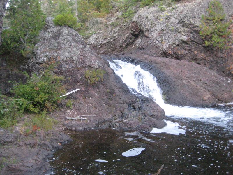
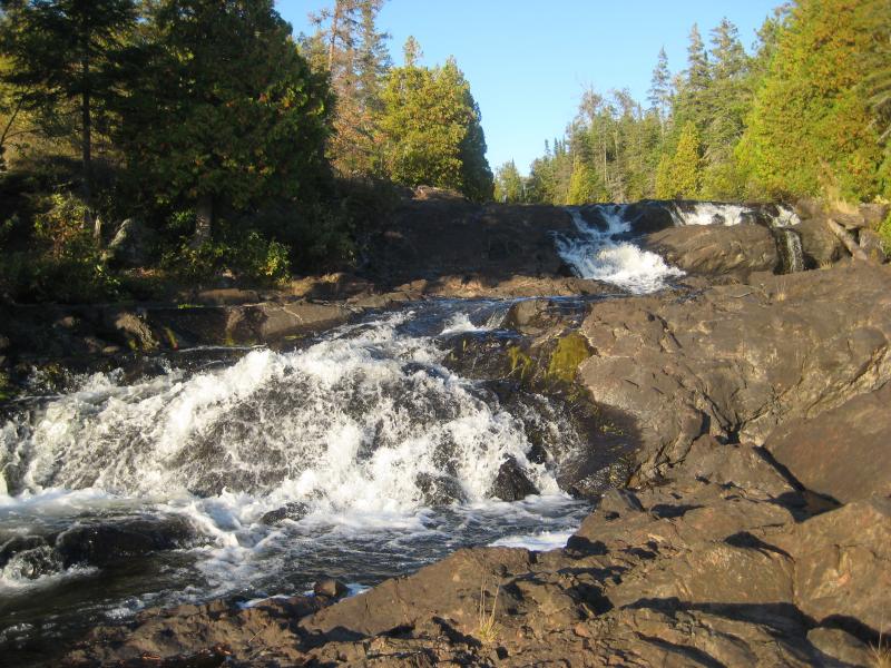
We had fun at Montreal Falls. The water was low enough to climb around the falls, getting nice and close to the different cascades, and the setting sun cast a warm glow over the entire scene. I was getting a little worried by that, not sure how much daylight we had or how exactly far upstream the two drops were. I shoved my concerns aside, choosing to enjoy the setting and company instead.
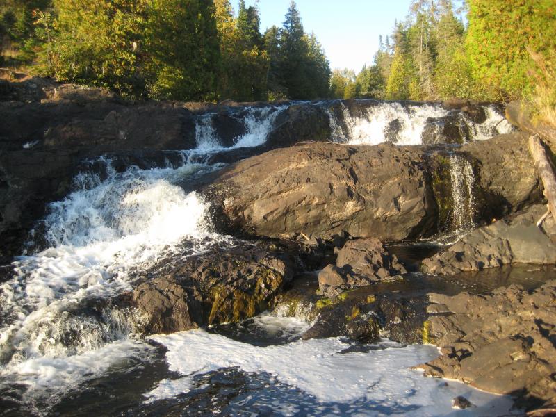
Dry rocks on the falls
Hiking to the first upper drop was easy. The footpath faded into the brush a few times, not enough to get too lost or confused by. We were all impressed by the waterfall, a sharp plunging chute much more dramatic than the rolling cascades of the lower drop. Getting around these falls were a bit difficult, with a sudden outcropping shooting up on the west bank, so we just climbed to the top of the outcropping and checked out the trees rolling away from us. We couldn't see the lake, just the darkening sky as the sun dropped out of sight.
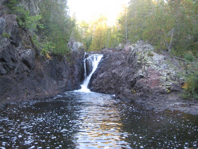
Across the pool at the tall upper falls
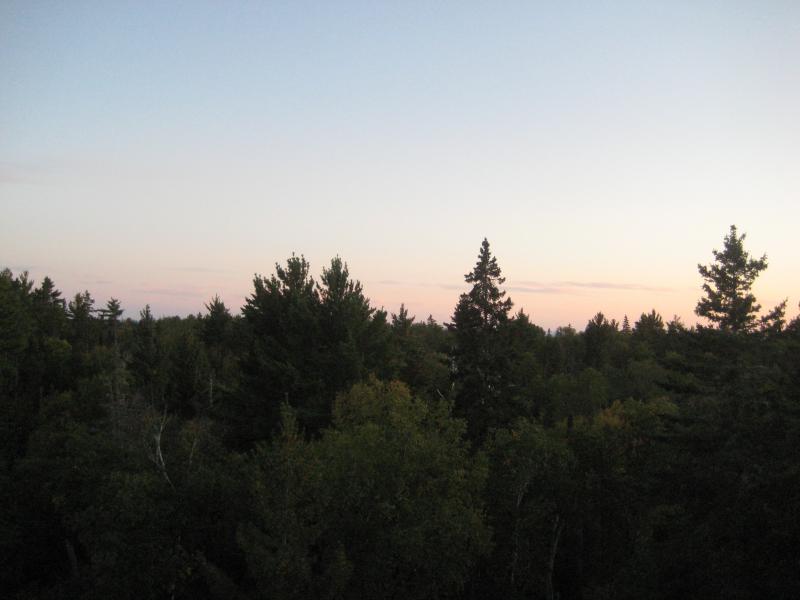
Quickly continuing upstream we had to scour and double back a few times for the path. It was hard to tell if one even existed this far up or if we were connecting animal tracks. None of us wanted to avoid acknowledging that we were just bushwhacking now. Brush in the Keweenaw is terribly thick, all low-lying, clawing branches and scratching weeds. It was well after sunset when we finally reached the upper half of Upper Montreal Falls, a tiny plunging chute.
Small upper drop between conglomerate
There was an even taller outcropping that we wanted to check out in hopes that Lake Superior would be visible to the south. I held some small hope that there would be an easier path visible from here, maybe a nearby logging road that wound back to Smiths-Fisheries. One of my tricks while exploring out new areas was to find the waterfall, even if it meant terribly bushwhacking or wading through a river, and then trying to find paths leading to the waterfalls. It's not always easy to pinpoint where people park or where the different paths in start, but the trails all ended in the same place: the waterfall. And if there was any place these paths would end, it would be this hunk of rock sitting next to the falls.
To get to the outcropping we had to first creep up the side of the chute. There was a narrow, jagged shelf of rock just under the water's surface that we could inch along. We were doing fine until my foot slipped. My right leg fell out from underneath me, plunging into the cold water, and my shin came down hard on a jagged spur of rock. I couldn't get up right away and had to have Cory help me lift up out of the water. As soon as my shin was in the open air blood streamed down, soaking through my jeans and sock with shiny red. Fun.
There was no sense in crying over a cut shin. We continued up to the outcropping and looked around for a path in the deepening twilight. No luck. Lake Superior also was not visible, hidden by the tall trees and rolling hills that we had spent the last hour walking past. Resigned to the bushwhack we headed back down the river, more careful, and retraced the slow bushwhacking route.
Looking south from the outcropping over Montreal River
It wasn't easy hacking our way in the fading light. When we finally reached the taller drop we set off in a quick jog, thankful for the minimal footpath, even if we could only make out the outlines. The jog didn't help much. Stars were poking out of the sky by the time we made it to Lake Superior.
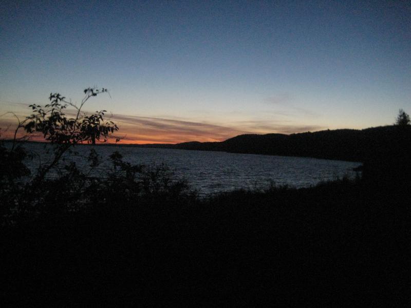
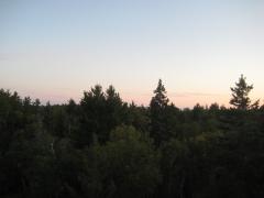
Sunset and dark skies over the lake
Of course it had to be a new moon tonight. The stars were bright and sky was clear, yet without a moon there was no hope of light along the cedar path. We inched our way on the pitch black path, tripping over roots and rocks. Lake Superior was audible but the steep shoreline was completely invisible. If it wasn't for Logan's keen nose carefully tracing our path in we probably would have either tumbled down onto the rocky beach or wandered off into the woods. We managed to make it back to my car after only a few painful run-ins with low-hanging branches.
Driving back on the logging road was also tough, slopes and quick twists making my already weak lights even less useful. All of us let out a big sigh of relief when we finally made it back to the main roads. It was a few hours after sunset and my shin throbbed, and we were safe. On the way back I realized that this was the last waterfall in Keweenaw County. I had finished an entire county! This was before I learned of the extra drops on Jacob's Creek, or the real Copper Falls, or had even heard of Madison Gap, but for a brief time I felt a sense of real completion. Keweenaw County was done (but not really).

Comments (0)