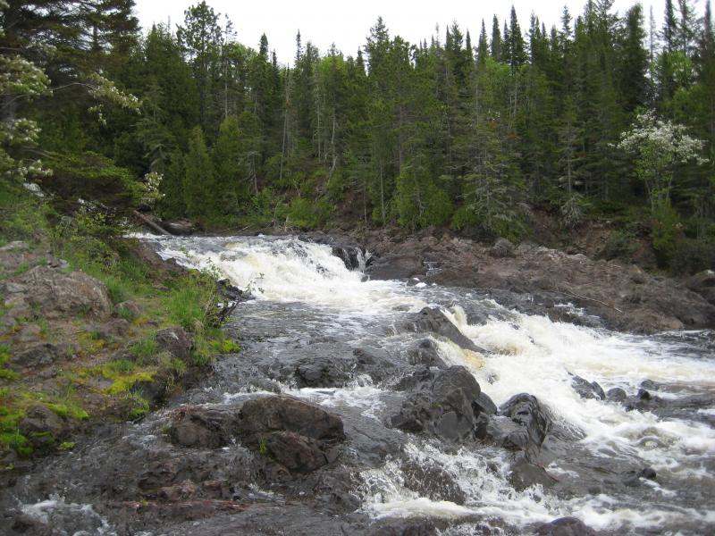
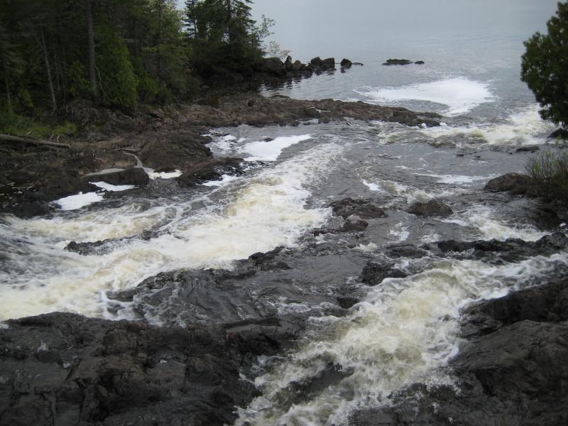
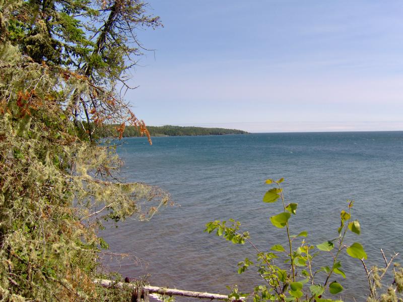
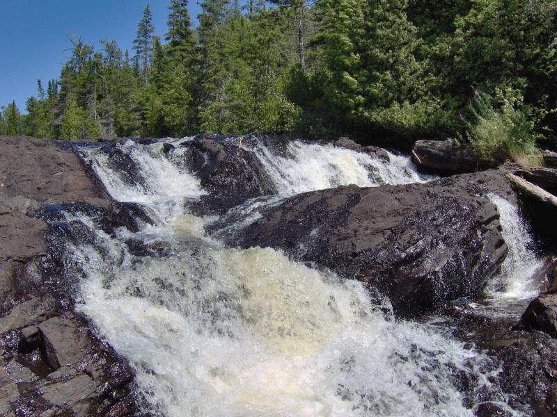
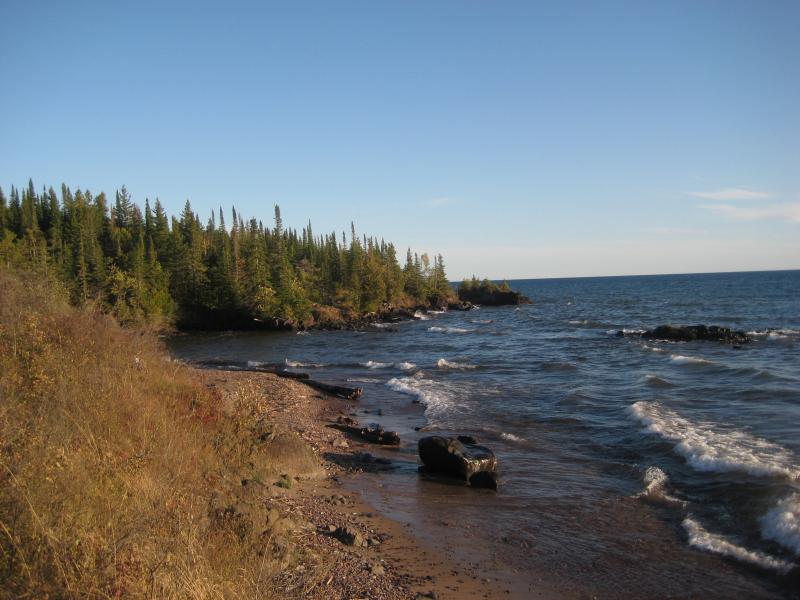
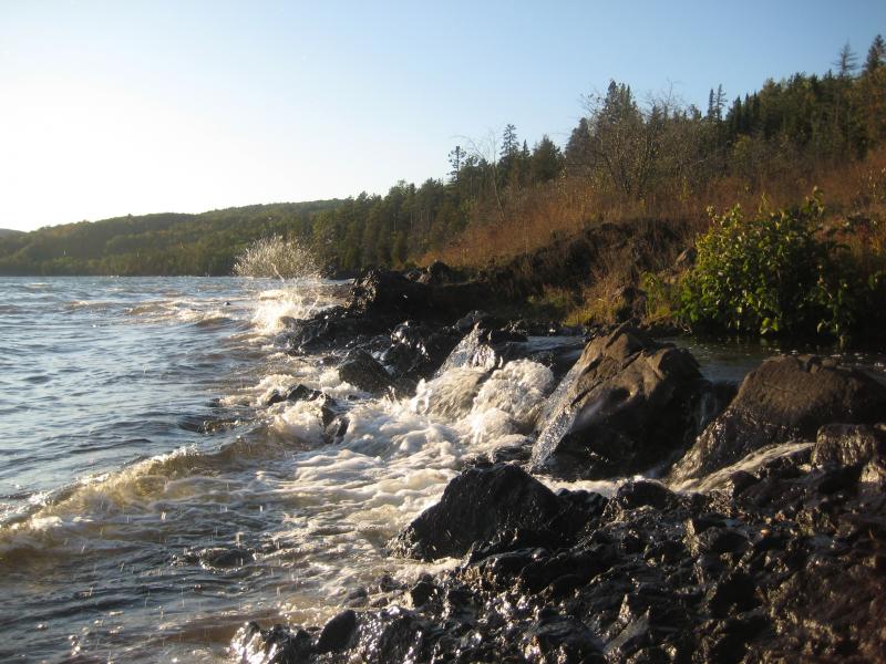
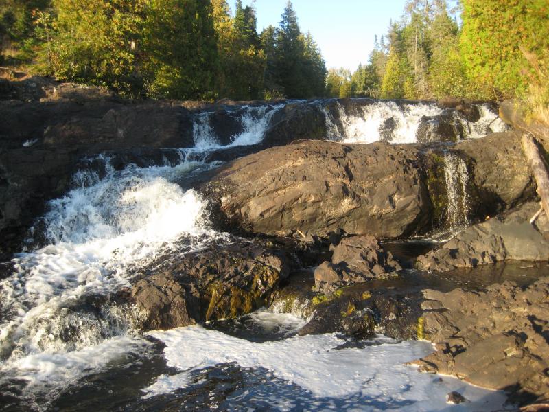
Located right at the mouth of the Montreal River as it tumbles into Lake Superior, Montreal Falls is a rugged, beautiful cascade over blocky volcanic rocks. The views over the lake are incredible: to the west you can see Bare Bluff and Mt Bohemia rising along the lake shore, to the southwest the distant side of Bete Gris Bay, and to the south (on a clear day) the Huron Mountains ripple up above the lake. The drop sits at the last easily accessible southern spot on the tip of the Keweenaw, with Fish Cove, Keystone Bay, and Keweenaw Point a tough drive/hike beyond.
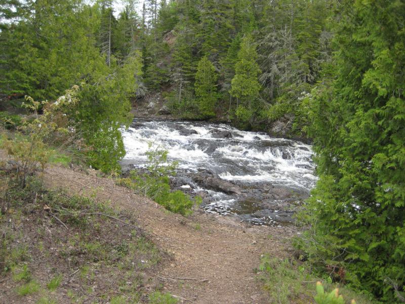
Some flat ground for camping sits on the shore of the waterfall, complete with a few fire rings and a convenient beach for kayakers, and during summer weekends a few tents can be found near the falls. A narrow trail leads up along the river towards Upper Montreal Falls, more traveled by fishermen than anyone else, and an even fainter path can be found leading further east to Fish Cove.
Directions
Turn right onto Lac la Belle Road off of US-41, just over 20 miles north of Calumet. Follow Lac la Belle Road for 4.3 miles, bearing left at the fork, and then turn left on Smiths-Fisheries road about 3 miles after the fork. This road is not marked but is the last two-track before the paved road turns sharply right with Bete Gris beach. Drive down Smiths-Fisheries road, keeping on the main track and bypassing the parking area for Bare Bluff. The road ends at a berm after 4 miles near some fenced-off cabins.
Follow the trail past the berm along the lake shore. For a while the trail is the remains of a rocky two-track, blocked by the berm from erosion concerns, before turning into a footpath winding through a cedar forest. The walk to the falls is about a mile. If you want to visit the upper falls too you can continue on the path upstream, which stays on the western bank.
-
Jacob Emerick
Aug 11, '16
Man, this sounds awesome. Very happy to hear you made it out there, Terry.
-
Carolina
Jul 8, '18
Totally agree with Jacob on this one, Terry. So great to hear that you had such a great time. Thinking about heading up there this weekend myself. Will let you know how it goes. Thank you for posting this. Good day!
Add to this discussion-
Soren Schmidt
Jun 25, '21
Unfortunately…I just tried to get back there again today (June 25, 2021) as I have many times each year and there is now a huge gate blocking the way to the parking area. It’s erected about 1/4 to 1/2 mile before the parking…with no place to park OR turn around. It essentially cuts off access to the falls. I pray that somehow this is alleviated for all parties: private land owners and public access to the falls. Soon. Please. It’s a place I love to center myself and I would love access still and for those to please respect that access given so others can continue to enjoy it also!
-
Jacob P Emerick
Jul 17, '21
Oh no! Thanks for the update, Soren. I wonder if the landowners put up the gate - I feel like the last 1/4 mile of the road was technically private so they may have put up the barrier.
Add to this discussion-
Judy
Oct 1, '21
There is parking available at the ‘new’ gate area. It is a longer walk than before because they moved it back. Follow the road to the old trailhead/parking. Then the 2.8 miles , then back to car.Fairly long hike. I’m Going there today! Oct 1.
Add to this discussion