When I started the waterfall project an end goal was not really defined. As June drew to a close I knew one thing for sure: I was behind. A full third of the summer was almost over, and with it the one month with the longest days and best water flows, and I had visited less than a dozen waterfalls. While the goal of the waterfall project was never set to a certain geographical area, be it the Keweenaw or certain counties or a specific distance from Houghton, there were a lot more than a dozen waterfalls that I wanted to visit. Between that and my failures yesterday at Slate and Silver River I tore out of Houghton alone on a Friday afternoon feeling dangerously ambitious.
All day we had thunderstorm warnings, warnings that did little to deter my spirit. After all, I didn't have Katie or Logan to worry about on this adventure. It would take more than a spot of rain to stop me. On the drive south to L'Anse the dark, low-hanging clouds over the bay were a bit worrying, as was the soaked pavement and dripping trees, but I continued steadfast. A quick stop by Subway for a dinner sub and I was ready for my first waterfall off of Dynamite Hill Road.
Yesterday I tried to approach Middle Silver River Falls from Skanee Road (by taking Dakota Farm Road south). Today I tried a new approach, parking near the bridge over Silver River. There was a house on the west side of the river so I headed down the east bank. A gravel pit provided an easy trek to my right, but I stuck to the woods and the river. I wasn't sure how far downstream the falls were and didn't want to miss them.
Small drops along Silver River
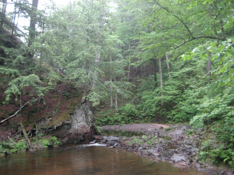
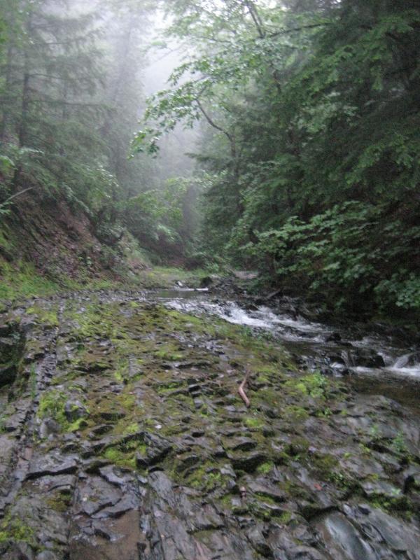
Initially I tried to walk through the woods, following one animal trail to the next. The woods were thick. Once I passed the house on the west bank I moved down to the riverbed itself, skipping down on rocks and the clear riverbanks. From my research I knew that Gomanche Creek would flow down, meeting Silver River from the west, and form a small waterfall. As I hiked carefully downriver the distant thunder grew in volume and arcs of lightening splashed through the forest, promises that my adventure was going to get difficult.
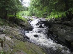
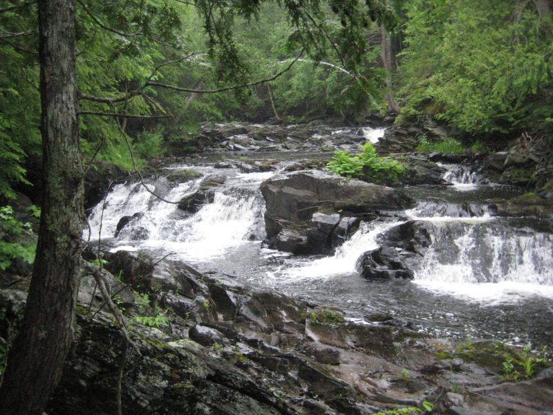
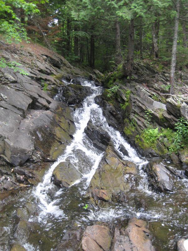
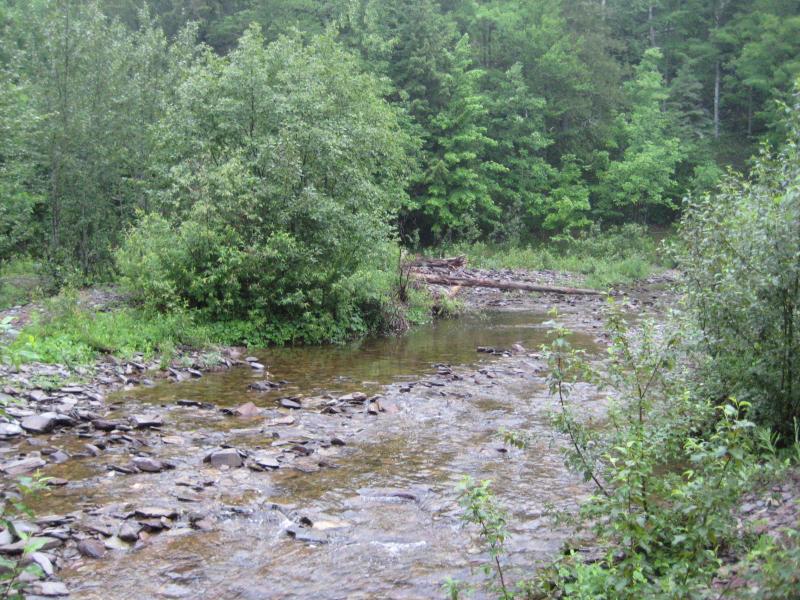
There were a few small drops along the river on my route. Most of them were rapids over loose rocks. Once I passed Page Creek, flowing into the river from the east, they started increasing in size. Near Gomanche Creek Falls the Silver River takes a series of sharp turns, hitting a solid chunk of hard rock that shoves it around for a bit and gives it a couple of sizeable drops. It was hard to work my way around this slab of rock with big, intermittent drops of rain slickening up the surface. I almost passed by Gomanche Creek, too focused on careful footfalls. A deep pool lay between me and the creek so I continued downstream until I could cross, than backtracked to the creek's falls. They were small but pretty, direct plunges over layered rocks.
Sudden cascade of Gomanche Falls
By now the rain was coming in steady and the thunder was deafening. The lightening was growing too close for comfort, bringing the darkened woods into sharp relief every few minutes. Instead of braving the open air again to cross the river I stuck to the west bank. An ATV trail showed up, probably leading from the house upstream, and I followed it. This side of the river steepened considerably, and while I heard some waterfalls far below me I couldn't see or reach them. It didn't matter anyways, as the rain was coming down too heavy to even think about taking pictures.
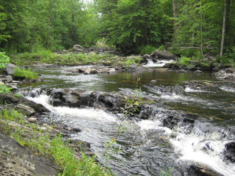
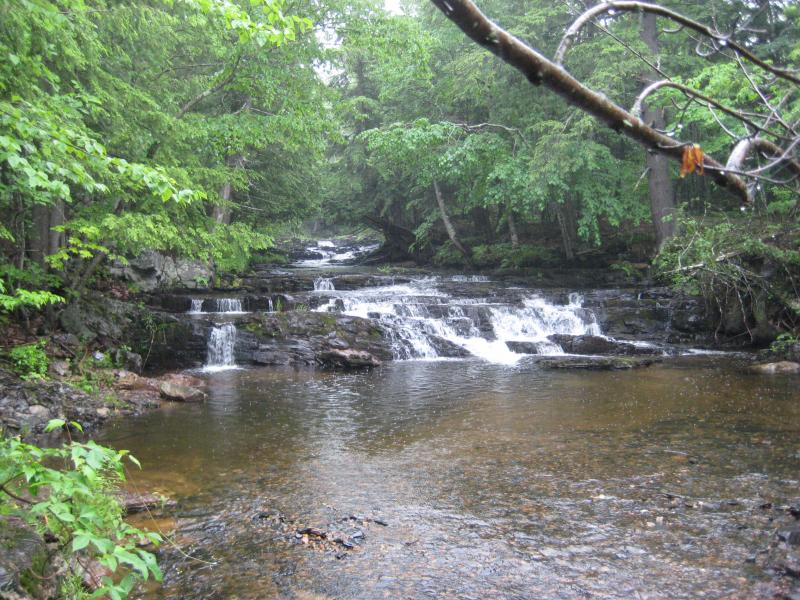
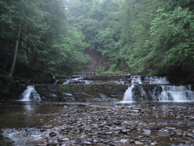
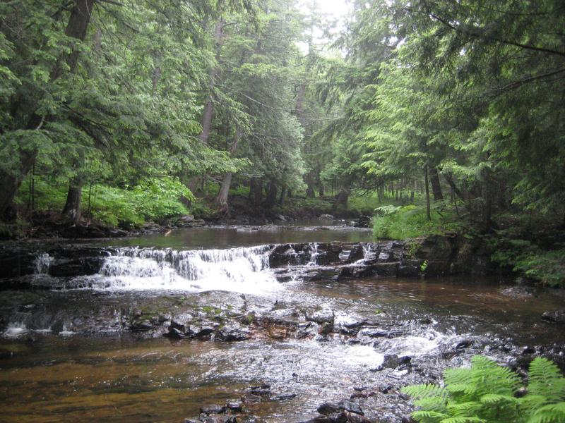
After a period of nervous jogging my path leveled with the river again. The calm waters and sandy riverbanks made it obvious that I had passed by all of the waterfalls. I turned and backtracked along the river, cutting back to the east bank under overreaching trees. The lower falls showed up, a set of blocky drops surrounded by cedars. While they were very scenic it was hard to spend much time here with the heavy rain, even though the storm seemed to be letting up.
A rainy lower falls
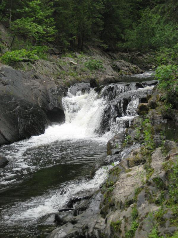
Sticking to the east bank I headed upstream to the next set of drops, where the river is shoved hard against rocks to the west and is forced north. These were the drops I had heard from my path on the western bank and couldn't come down and see. Again, the rain was coming down too hard to stay long, but I did snap a few quick shots before continuing.
Wet rocks around the waterfalls
Finally I reached the area around Gomanche Creek. By my estimation there were three groups of drops - the lower straight steps, the middle sharp turn, and the smaller ones near Gomanche Creek. There are plenty of other small cascades and chutes in between, yet these groups are the main ones. My exploration complete I cut up the bank here to the gravel pit to the east.
For a jittery minute I considered running through the pit back to my parked car. Even though it probably doesn't make a difference I decided to stick to the woods. The lightning strikes were scarily close in proximity again. I didn't even have time to think about counting seconds before the roaring thunder swept through the woods after each flash. I ran parallel to the open land, plowing through the thick woods, and made it back to my car completely and utterly soaked.
Ripping off my jean jacket and shirt unabashedly I threw them over the back seat in a vain effort to dry off. Bare-chested I drove down Arvon Road. I felt pretty awesome, even if I was sitting in soaked pants. I had just survived a pretty nasty storm and had two of the more difficult drops finished already. Now it was time to visit two rather easy ones: Quartzite and Blake Slate Falls. All I knew was that they were near a bridge over the Slate River and that they were supposed to be easy to reach, which was more than I had known about Middle Silver Falls.
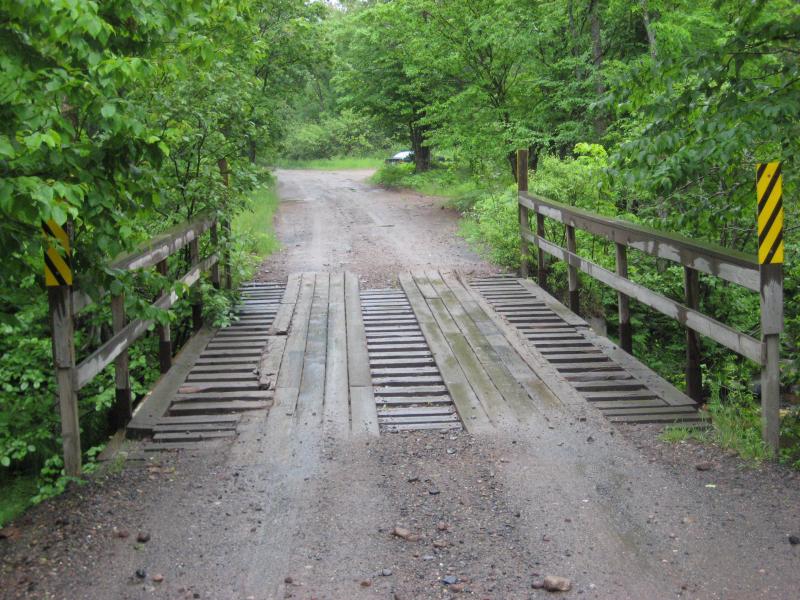
Wet wooden bridge over the river
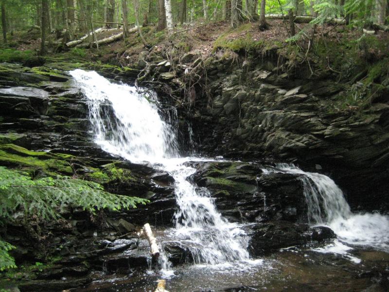
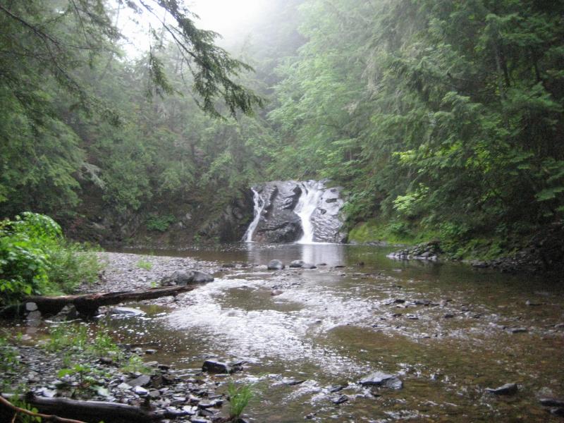
Once I reached the wooden bridge I parked on the far side, pulling my cold, wet shirt and jacket back on. The thunder and lightning were distant but the rain continued, turning into a steady cold drizzle that could continue on for hours. I headed downstream first, following a sign for Quartzite Falls along a well-maintained path. The falls were easy to find and very pretty, a concave plunge onto a slide that empties into a deep pool that begs to be swam in. I spent some time taking pictures here, both from the far end of the pool and on the falls themselves, trying to ignore the rain still pelting down on me.
Looking across the rainy pool
For some reason I thought that Black Slate Falls would be further downstream. I continued on faltering paths through marshy land, keeping quiet from the cabins on the far side of the river, looking for any sign of waterfall. There were none. Once the paths gave out and the ground was more water than earth I turned away from the swampy land and headed upstream.
There were no sizeable drops above Quartzite either. Confused I made it back to the road and stood on the bridge. Downstream was Quartzite Falls, and upstream… Was a sign for Black Slate Falls. Duh. I could even make out the falls from the bridge.
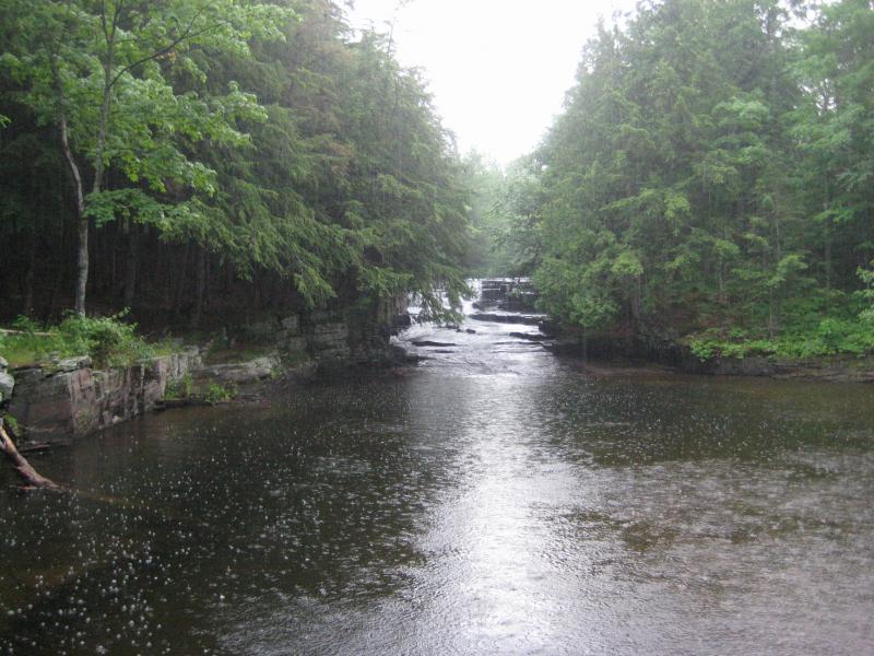
Steady rain over the calm water
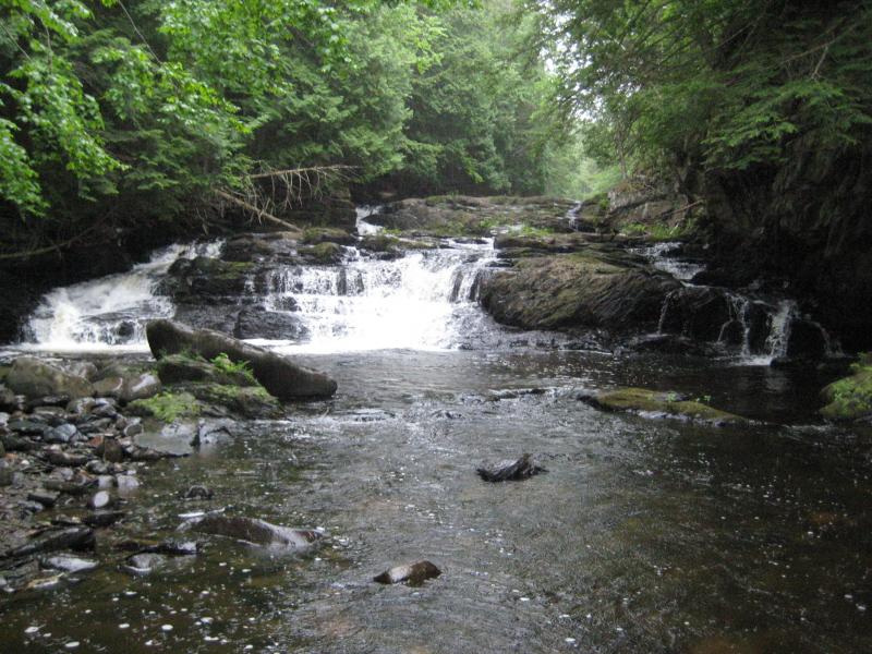
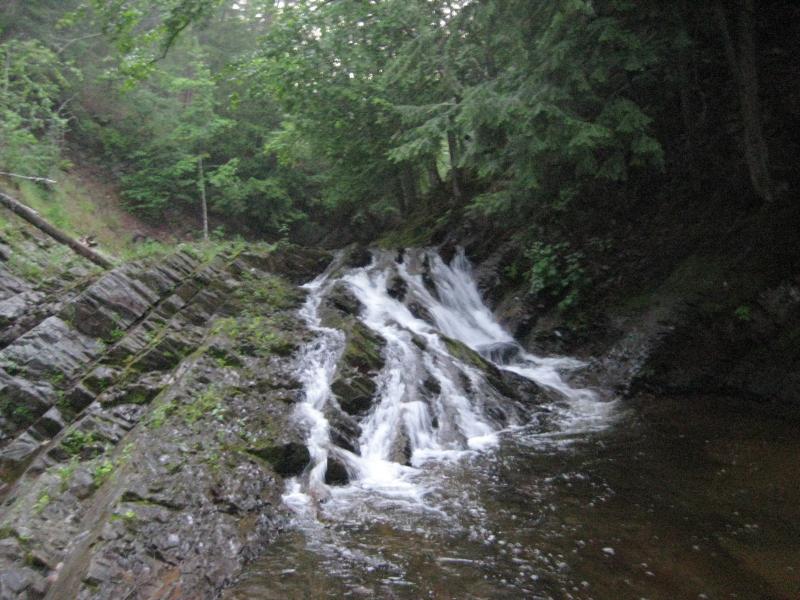
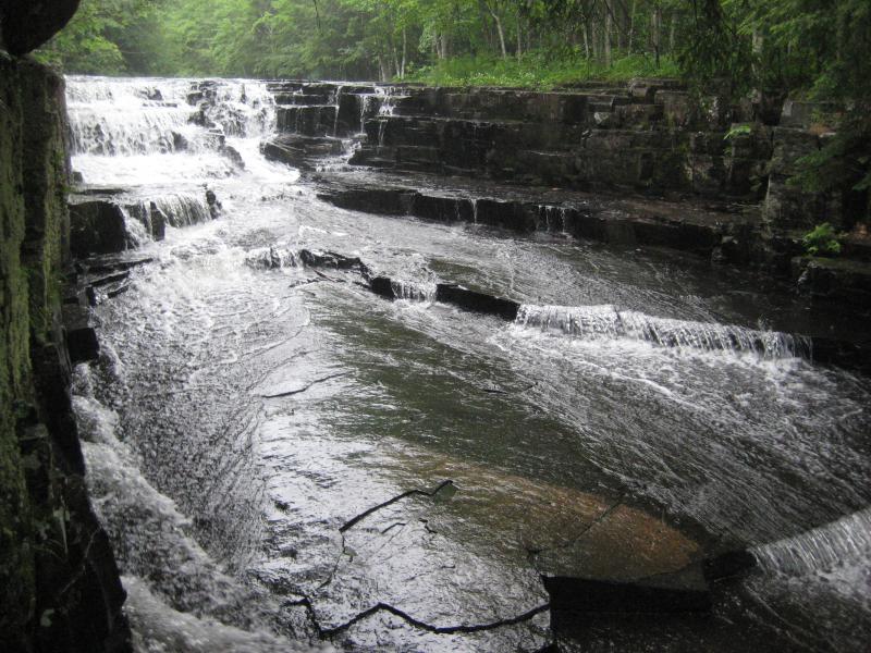
I headed down to the river again, this time on the south side of the bridge. This waterfall was more broken up into different drops, plunges separated by clear pools, so I just meandered up the river taking photos of different areas until the river mellowed out. The largest drops are visible from the bridge, although they are much nicer to view from the riverbank.
Misty, rainy Black Slate Falls
I didn't bother trying to dry off when I returned to my car this time. Hopping in I continued down the road, passing a young couple along the way looking for Mt Arvon. I gave them approximate directions (I hadn't been up that mountain myself) and continued east to an unnamed drop on Ravine River. I did find the drop, a tiny plunge of water visible from the road. If it wasn't raining heavily this evening I doubt that the falls would have been running at all.
Turning northwards on Roland Lake Road I searched for a bit for Ravine River Falls. By now the sky was starting to darken from the coming night, not just the heavy clouds, and I didn't have a lot of time to spare. I parked near a turn on the road and headed into the woods, giving a cursory look around for the river. There was no river in sight. I gave up (too) quickly and drove on to Slate River.
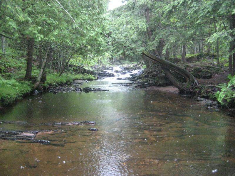
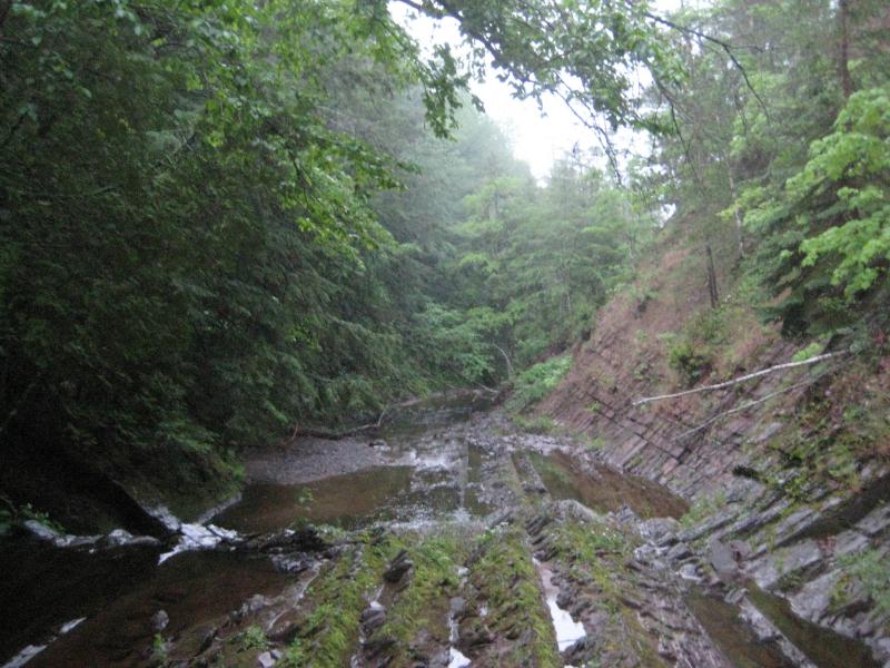
The rain, which had drifted away during my drive along Ravine River, had come back as a light drizzle by the time I parked near the Slate River bridge. I re-donned my wet jean jacket as if the soaked, heavy cloth could protect me from the elements and headed up the river. There were a few half-hearted paths along the water, mostly directly on the riverbed along dry sections, which gave me an easy starting hike. It wasn't until I was directly below Slate River Falls that I was forced to walk in the river itself, fording through ankle-deep water.
Looking up the misty, unearthly gorge
The first waterfall was a scenic drop into a deep, clear pool. The gorge, which had risen up as soon as I left Skanee Road, sharpened to mossy slate walls with tall pines perched on the rim above. It was an incredible sight to behold, straight out of some fantasy scene, especially with the misty rain drifting down and lightly peppering the surface of the pond.
Dreamy view of Slate River Falls
To continue upstream I was forced to climb up the side of the falls. When I reached the crest I made the mistake of not stopping and continued my climb, scaling the soggy wall all the way to the top of the gorge. I was close to a hundred feet above the river now when I looked back now and noticed something disheartening - a small waterfall a short distance upstream from Slate River Falls.
I turned to head back down the gorge, cutting a descent that would take me straight to the smaller waterfall. I made it barely twenty feet before a soggy bush gave way under my hand and I slid, clawing the whole way, down thirty feet of wet, muddy dirt that barely covered the hard slate underneath. Somehow I managed to stop myself on a network of tiny roots hidden the wet dirt a few dozen feet above a sharp, jagged set of rocks that promised broken bones. Shaken, I slowly hauled myself back up to the top of the gorge.
After I regained my composure an alternate route was planned, further downstream beyond a river bend. I made it down, much slower this time, to the river. After I reached the water I was more than willing to get my feet wet instead of trying to climb up and down the muddy gorge walls so I plunged into the water, heading downstream to the small fingered drop I had so desperately tried to reach earlier.
Fingering, sliding drops
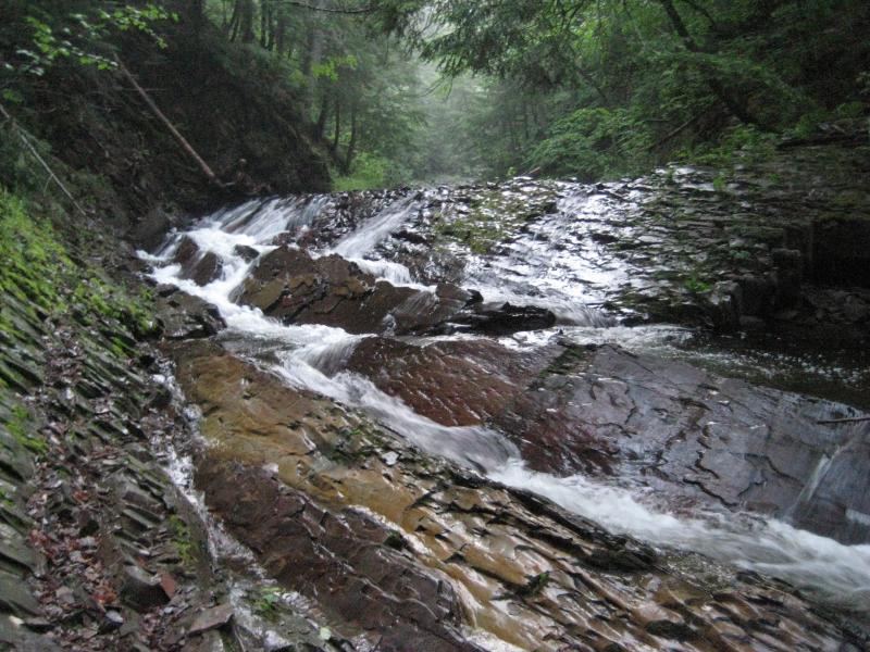
The hike upstream was almost dream-like. This gorge was ridiculously tall and the trees on the edge stretching even taller. Misty rain drifted down onto me and the river and softened thing in the distance. Also, I was still a bit shaken from my hard slide. One drop after another showed up behind ever river bend. I didn't do a lot of research on Slate River so I wasn't sure what the names were, but when I bumped into an incredible set of wide, stepping drops I decided to call it a day. I was soaked and the night was on its way. A quick climb up the west bank brought me to a logging trail and, eventually, back down to Skanee Road in the dark.
The many drops of Ecstacy Falls
There were some waterfalls that I missed out on today. I would find out later that I only saw half of the Middle Silver River Falls, Ravine River Falls lay only a few hundred feet from where I was searching, and that I turned away from Slate River Falls at Ecstasy Falls (which is only the second of four drops on this stretch). However, this adventure was exactly what I needed. There was a big dent now in my list of Baraga County waterfalls and I visited seven waterfalls on a single weekday night, something that I would have thought impossible before. It was exactly the sort of progess I needed.


Comments (0)