Faith was getting a bit stir-crazy after a long week, especially with the changing colors and mild temperatures outside, so we decided to head up to the Keweenaw for a quick weekday adventure. I picked Copper Falls as a destination. Keweenaw County was finished already; all of the named drops were visited (that I knew of up at the time) and even the pesky uppermost drop on Montreal Falls had been rooted out. Copper Falls, though, was a bit questionable. The drop I had found earlier this summer was meager at best, a trickling slide down jagged, mossy rocks, and I was certain there had to be more to this waterfall.
Parking on Copper Falls Loop, a tiny dirt track that runs south of Eagle Harbor Cutoff, we headed down to Owl Creek in front of us. The creek was pretty but very dry, the trickle of water even weaker than during my summer visit. There was a bridge over the creek, more suited for ATVs than vehicles, and we stood on it for awhile deciding which direction to go. The tiny drop I had seen was downstream, north of Eagle Harbor Cutoff, less than a quarter mile to the north. We decided to head upstream on the dry creek.
There was a small apple orchard back where I had parked and we had filled our pockets with small, crisp reds. Munching on these apples we followed the mostly dry creekbed south and passed by interesting rock formations and the trickling flow, finding nothing worth stopping at for too long. When poor rock started seeping into the creek from the east bank we climbed up, more curious in the loose, shifting rocks than Owl Creek.
Up on top of the bank there was a small two-track that continued south. This was a much easier route than the overgrown creek below. We followed it along the east bank until it forked. I still had some hopes that Copper Falls was somewhere close by so we headed on the right fork, towards the creek. Our route had been an uphill one and the creek gorge was relatively deep, so it was really odd that the water flowed over our road. Somewhere along our hike we had passed a significant drop.
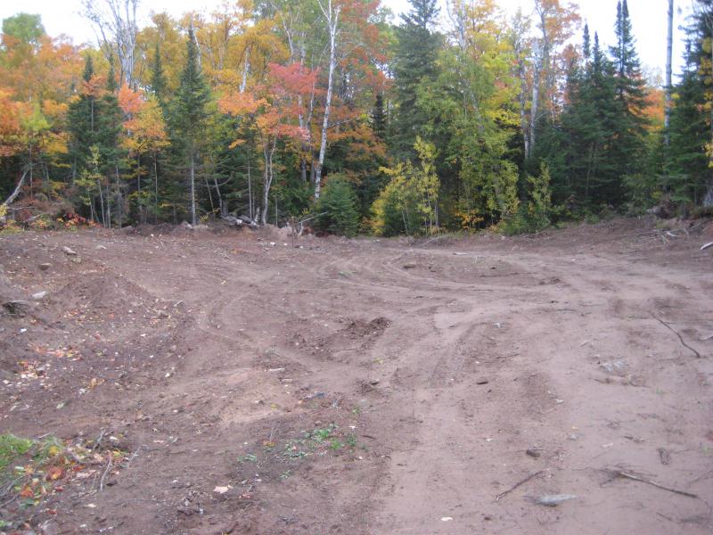
Sandy clearing above the falls
A clearing opened up ahead. While I wanted to get down into the creek and look for the drop a weird pole in the opening was enticing. Looking closer we could see the words 'Cu Falls' welded into it. Judging by the bulldozed sand and open clearing we must have been near a shaft or other buried mine feature. I found out later that this was the site of a massive cave-in on the old mine here, one that had only recently been re-covered up.
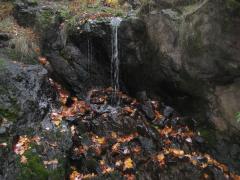
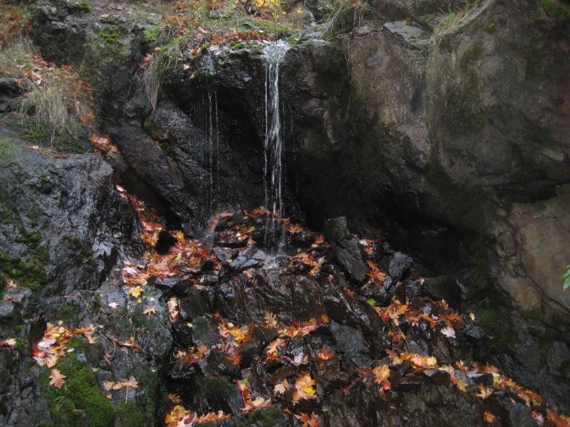
With the clearing explored we headed back to the creek, following it downstream from the two-track, until we found the waterfall. Owl Creek was still little more than a trickle, a thin thread of water pouring over a volcanic chute and plunging down onto a pile of broken rocks. There was something strange about this scene. First, some scribbles of spray paint was half-buried on one of the rocks. Second, the creek below was dry. The rocks were swallowing up every drop of water. Not only were we by Copper Falls Mine; the waterfall was pouring directly into a rock-plugged hole in the ground. Intrigued but unsettled Faith and I admired the falls at a safe distance, avoiding getting too close to the rock pile. We didn't want to fall down into the old mine today.
Instead of backtracking down the creek I led us back out to the clearing and followed the track out to the west. This path took us past the trademark blue shaft with a bat cover and through a small gravel pit before running straight into a nice gravel road, the Brockway-Central Cutoff Road. There was a much easier way to reach Upper Copper Falls after all.
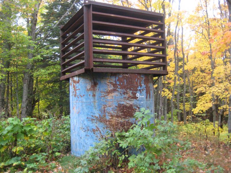
Bat cage over the shaft opening
Not wanting to walk the shoulders back we cut northeast through the woods instead. Even though I didn't have a good lay of the land we were in a safe box, surrounded by roads on all four sides no more than a mile away. This direction led us up some odd rocky hills, most likely overgrown piles of poor rock, before we bumped into a mowed lawn behind a cabin. Maintaining a wide berth around the cabin we found ourselves right back at the orchard and the car. We both grabbed a few more small apples we took off, happy to finally find a decent waterfall on Owl Creek.
The original plan was to venture over to Douglass Houghton Falls, a long hike that we didn't have the time for anymore. An easier hike lay over on Mont Ripley. I had been to Ripley Falls already this year but was curious if there were more drops further up the hill, as the waterfalls I had seen were small and close to the bottom.
Parking near the old schoolhouse we headed up the needle-covered trails up along the bank. When we cut down to the lower waterfall I was immediately disappointed. The creek was barely flowing, water covered up by leaves and undergrowth. We still climbed up the steep bank, hopping over the huge boulders and ducking under branches, eventually reaching the very top of the ski hill. Along the way we had found a deep canyon with an impressive drop along it, one that I'd consider to be the main drop of Ripley Falls, but the water was so faint on the rocks that I didn't even take a picture of it.
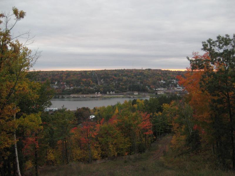
Fall colors over the Portage
Our mountain climb was still fun, though. When we made our way up the steep riverbanks we were rewarded by an impressive view overlooking the Portage and Houghton. The fall colors were incredible from up here. Walking down the mountain along a wide open track was a nice break from the narrow creek gorge. We strode down the darkening slope, content with the outing and talking excitedly about future autumn hikes in the coming days.

-
Jacob Emerick
Feb 7, '09
Yup - and it was not the best route by far. It wasn't a long walk, just very difficult. The easier route is to drive south along the Central cutoff road from Brockway Mt Drive about a half mile and follow the two-track on the left in. That will take you right past the mine shaft cover and the pipe. Also, you seem right about the visitors thing - I'm definitely not going on that loop next time.
Add to this discussion