Logan and I had spent the first half of our weekend up in the Keweenaw finding some relatively easy waterfalls. Today I wanted to take up a notch and tackle some more ambitious locations. So far we had stuck pretty close to home, venturing east only to Huron and Cliff River, and there were dozens of drops over by Marquette waiting for us. Waking up with the sunrise we headed south towards Michigamme, excited for the challenges before us.
Our first stop was at Dee Lundeen Falls, just north of the Michigamee Reservoir. I had heard rumors that this waterfall was on private property. I wanted to scope it out for myself, just in case there was a roundabout way around the property to the falls. The winding roads north of Michigamme were confusing, though, and when I bumped into an angry orange gate I gave up. There was no river or swamps in sight, and without a clear view I had no idea where the Peshekee River even was.
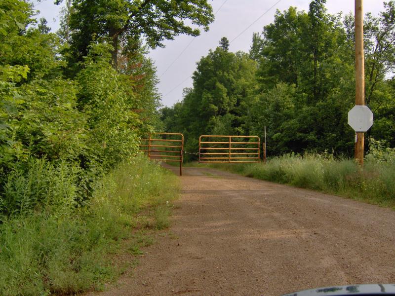
Angry orange gate near Michigamme
We turned back and continued east on US-41. Once we entered Ishpeming I started following some rough printed directions to Mulligan Falls, following North Lake Drive to the left past some train tracks and old buildings. This road eventually led to Deer Lake Road, or County Road 573, and took Logan and I up through sandy plains and tall, tall trees. Without a road atlas and only vague directions I got confused rather quickly. I didn't care. The land we were in now was beautiful.
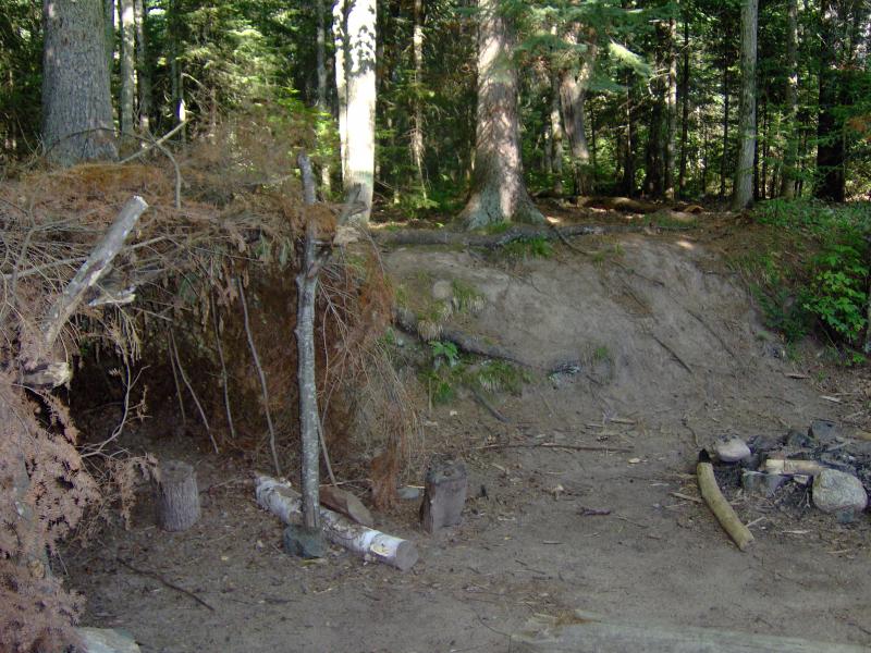
Somehow we ended up by Silver Lake Basin. Five years ago a break in the dam had washed down the Dead River, creating massive damage to the downstream river and even blowing out a second dam, down by Tourist Park. Today there were large machinery and major operations here as they continued to build up the earthen barriers and reinforce the banks. There were a few signs warning of danger but I got out anyways and wandered around, checking out the area and having a small (and completely ridiculous) hope that I would just run into some hint of where Mulligan Falls was (hint: it was at least three miles from here).
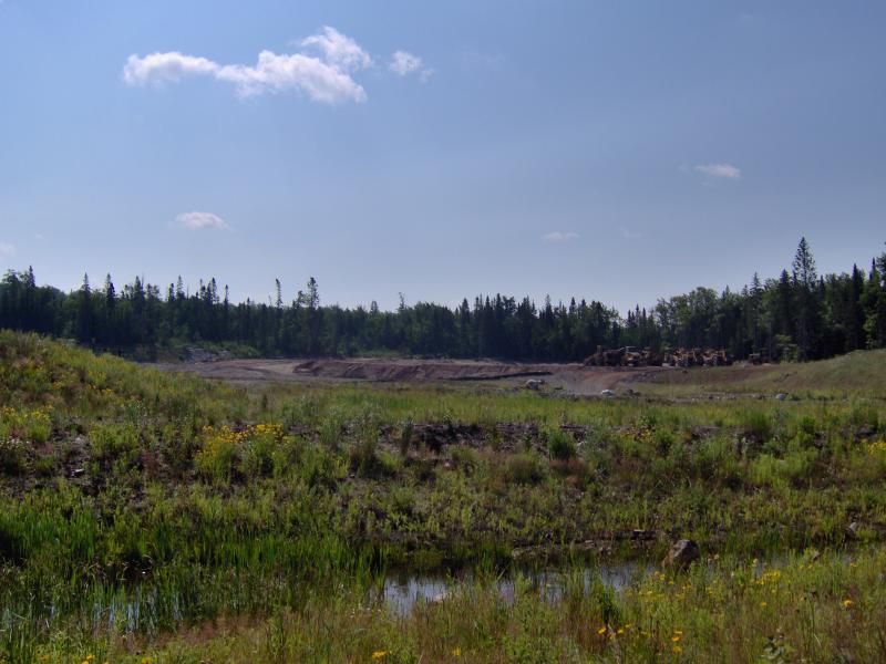
Big equipment working on the basin
Figuring that I might as well just keep driving I ventured onto Red Road, then turned left on County Road 510. At the time I still didn't know where I was and was only trying to get my bearings again. After long, winding dirt roads I finally came out on County Road 550, the first road in hours that actually had a sign on it. Now, with my bearings set, I turned towards Marquette for a lunch break.
Up until this point in my waterfall adventures I had depended on printed Google Maps directions. A lot of the road names had been correct in the Houghton/Keweenaw area and I had seldom run into issues. Now in Marquette County, though, the lack of signs and twisting logging roads were proving to be too much for Google Maps. After grabbing lunch at Arby's I headed over to Shopko and picked up a detailed road atlas. Armed with the atlas and comparing my printed directions with the plotted map we headed back to the woods, north towards Yellow Dog Plains, hoping for a more productive afternoon.
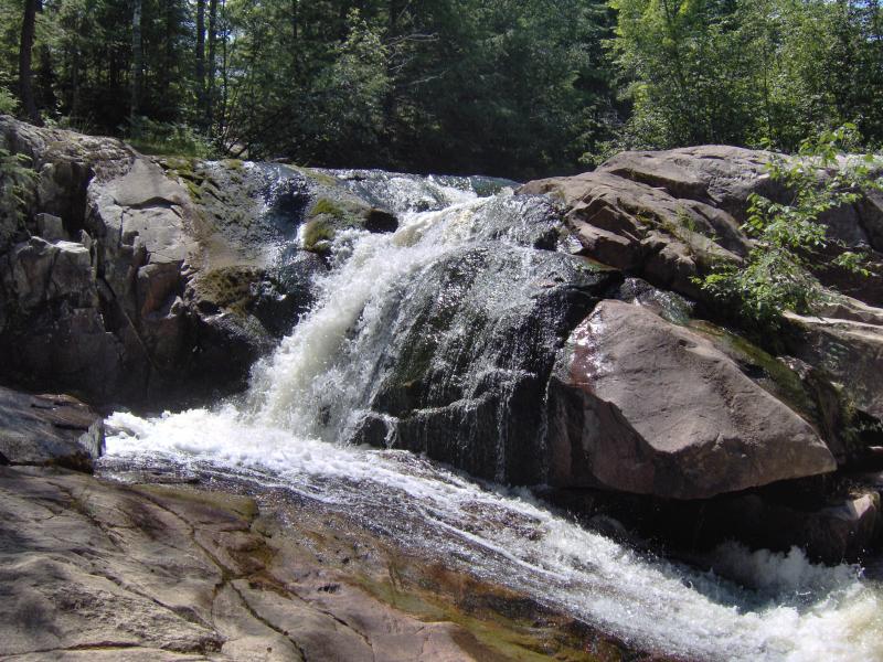
Our first successful stop of the day was Big Pup Falls. This waterfall is a small roadside drop, easy to find, as the creek flows under County Road 510 before tumbling over the drops. Logan and I spent a little time here climbing down the steep banks and enjoying being out of the car after wasting all morning driving around lost.
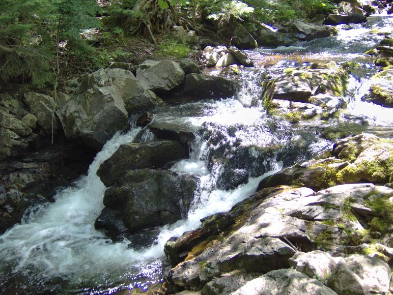
Lower drops on Big Pup Creek
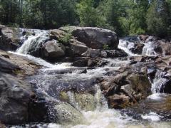
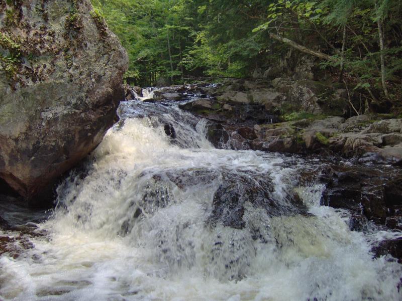
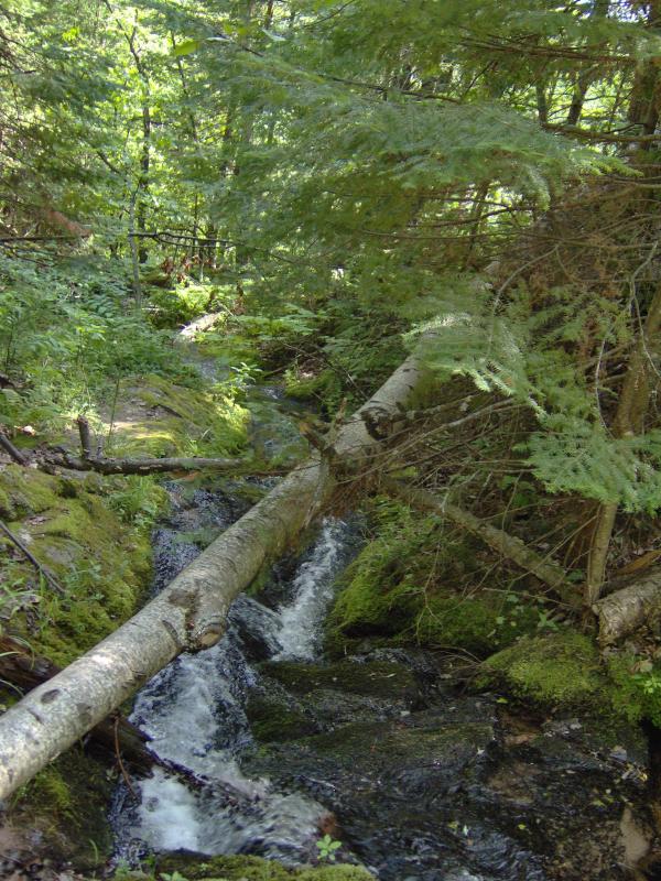
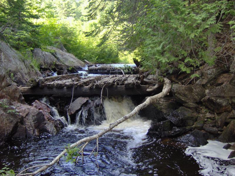
A short distance up the road was our next destination, Yellow Dog Falls. This waterfall is a fairly popular tourist attraction complete with a large shoulder for parking and well-trod footpaths down to the first drop (also known as Hill Falls). There are more drops downstream, falls that few visitors are interested in, so we continued down a narrowing path probably made by fishermen. By the time we reached the fourth drop we were pushing through the thick undergrowth. I could make out the outline of a path on the other side so I scooped up Logan and we crossed over a thin log perched above a roaring chute.
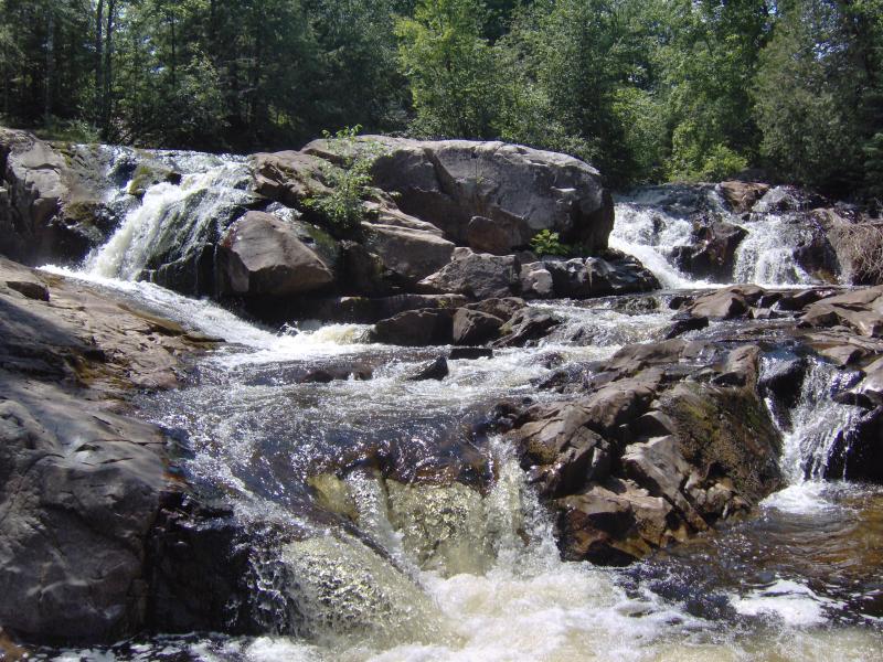
Multi-tiered drop on the Yellow Dog
Tough crossing over the Yellow Dog
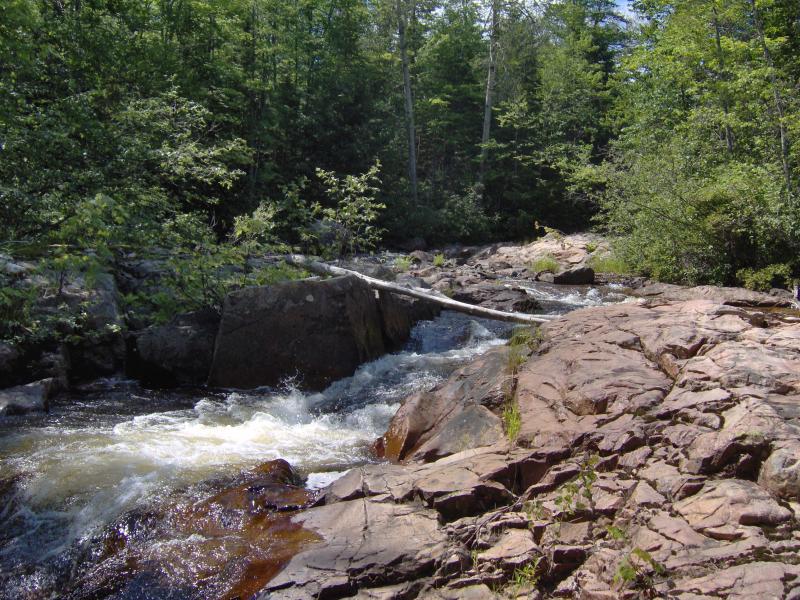
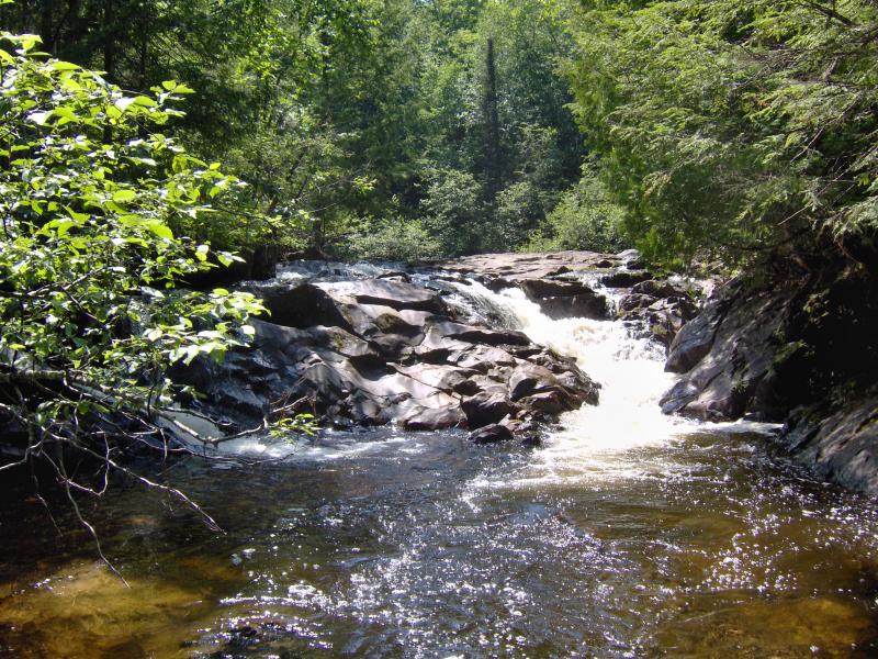
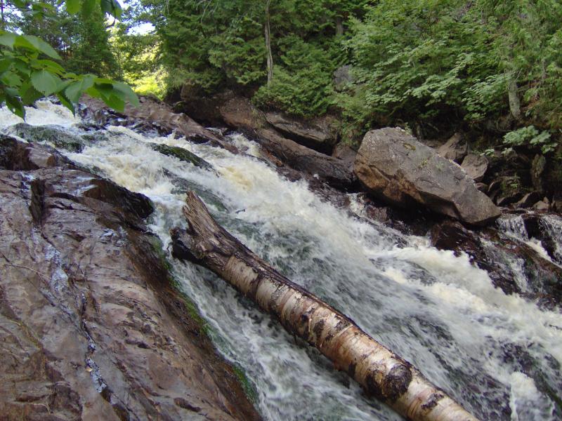
Bushy Creek flows into the Yellow Dog River below the last waterfall so I knew that was our turnaround point. While the falls on the Yellow Dog were pretty, the hot sun and tough hike was starting to dry me out. Finally I bumped into the sixth drop, circling around a sharp bend in front of a riverside cabin, and I could see Bushy Creek just a little further. The creek has a small, fanning drop right as it pours into the river, and we spent some time checking out Bushy Creek Falls and the seventh, last drop on Yellow Dog River.
Looking sideways at the drop
On the way back we crossed at a safer spot, up by the third drop. A few groups of hikers were up by the main waterfall, including several older women who were new to Marquette and fell in love with Logan. By the time we made it back to my car it was mid-afternoon. Logan and I wasted no time in gulping down a half gallon of water.
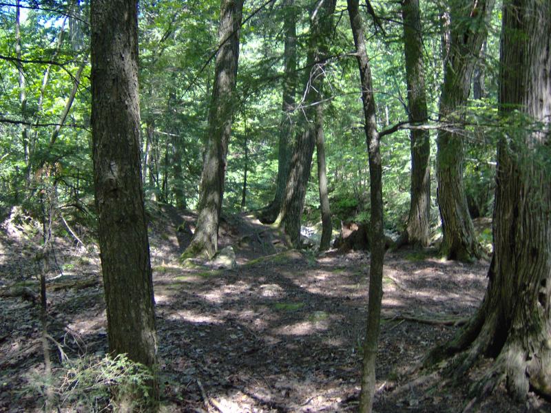
I had two more waterfalls on my list for today. Using the atlas I navigated over to the Triple A and we headed up the Yellow Dog Plains. This was my first time in this area. The flat sand and planted pines were similar to my earlier lost wanderings along Red Road but there was one big difference. There wasn't a cabin in sight. The sandy road just wound and stretched ahead of me, surrounded by trees, and no other person was in sight.
Guessing at the turn off I drove south towards Pinnacle Falls. The track was bumpy and narrow but well-traveled. After several forks I got a bit worried and parked on the side of the road, hoping that the falls would be easier to find on foot. After walking for twenty minutes I bumped into a group of older people, all of whom were well dressed as if they had just stepped out of a city cab.
After the wild drives and humble sites I had met so far today it was jarring to see and hear this group so alien in this environment. Surprisingly, they were looking for Pinnacle Falls as well (to scatter the ashes of their father), but they weren't sure where the waterfall was either. I took my grungy, hand-drawn map out from my tattered and torn jacket and handed it to a man with manicured fingernails wearing a designer piece. Neither of us could connect my scrawling with the roads around us. So we all just walked down the road together, trying to get our bearings, an odd combination with a common destination.
The road ended at the edge of a deep gorge. It was obvious that a large river had carved this so I decided to head down through the thick forest. The group decided this route was too much for them, so they headed back to a fork we had passed a half mile ago. It took five minutes for me to regret my decision.
The first few minutes was a quick slide down a steep, grassy wall, an easy bound for Logan and I. At the bottom, though, was an impossibly thick swamp that reached out and grabbed at us, knotting Logan's leash and slapping me from all sides. The only way I could make any headway was to scoop Logan up and physically lean backwards on the brush, pushing it to the side, then snaking and weaving for a few yards before doing it again. Once we came upon Yellow Dog River I didn't think twice about jumping in, thigh-deep, to escape the dreadful undergrowth.
A calm, deep river above the falls
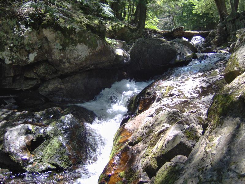
I waded maybe a quarter mile through the river. While most of the water stayed below my waist there were a few stretches that came up to my chest, forcing me to loft Logan above my head so he wouldn't struggle against the encroaching water. We probably looked ridiculous. When I saw a towering spire of rock on the north bank I got excited, hoping that the falls were close by. We climbed back up on the bank right before the water pours over an ancient timber crib above Pinnacle Falls.
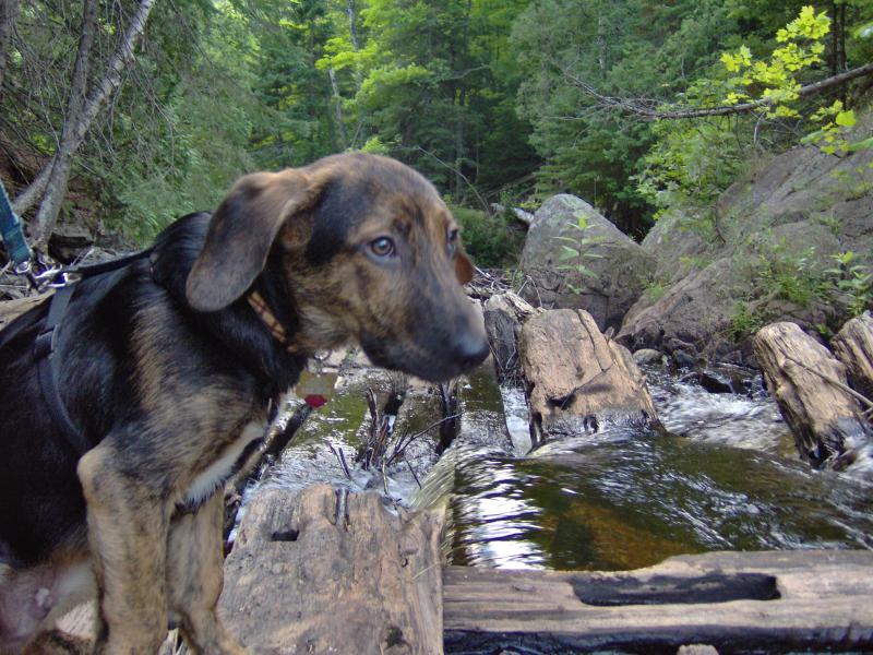
Logan judging the timber crib
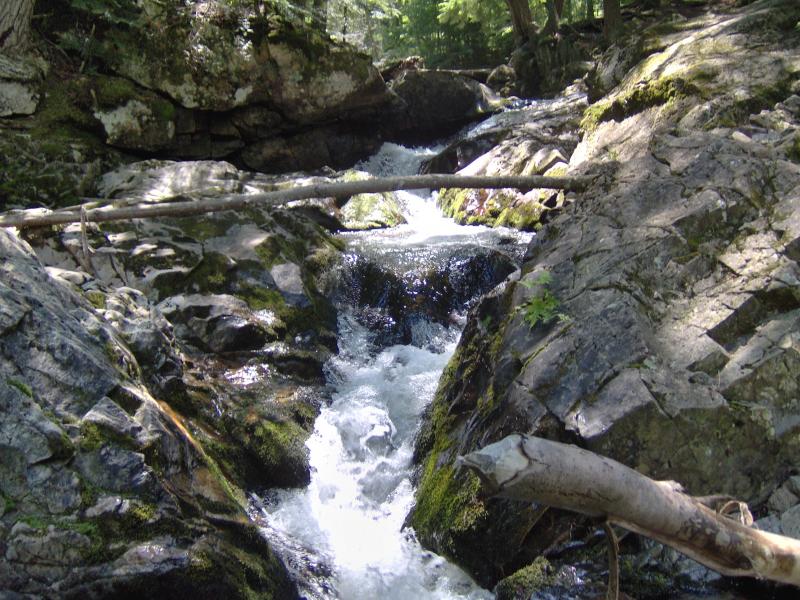
We slid and dropped over the falls along the bank, not bothering to stay dry at this point, and looked back. Pinnacle Falls was impressive. A tall slide over jagged rock, hemmed in by a sharp spire on the north side, it was well worth the dip in the river. After taking some photos and letting some of the water drip off of me we headed up the river bank, climbing the pinnacle right away to check out the view before taking a footpath up the river bank. About halfway up I bumped into the group from the city, who had already found the correct path, visited the falls, scattered the ashes, and were now on their way back to their vehicle.
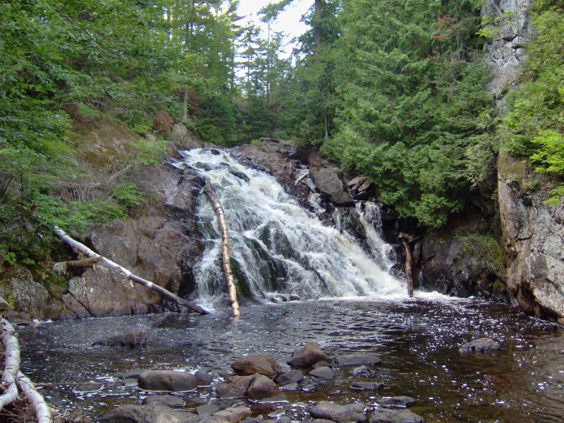
Logs on Pinnacle Falls
They gave me a few odd looks, as both Logan and I were soaked and covered in mud, but didn't ask about our hike. They were nice enough to offer Logan some water out of their cooler (which had many more bottles of alcohol than water) as well as a ride back to my car, something we both appreciated a lot. When we reached my car we wished them a safe travel and parted ways again, worn out from our long and eventful day.
There was still one more waterfall I wanted to find, Wylie Dam Falls, a few miles upstream from Pinnacle. We drove down a few dirt tracks and set out on a half-hearted attempt down a gated path but found nothing but swamp. I wasn't terribly torn up about this, as both Logan and I were more than ready to go home.
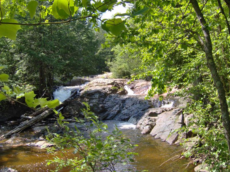
Sun setting through the pines on the Yellow Dog
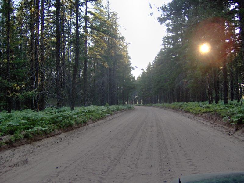
The Triple A along Yellow Dog Plains is in pretty good shape. It's bumpy and sandy, but there's nothing that really slowed our drive too much. Once we reached the far end I chose to go straight instead of heading north along Ford Road. It was a mistake I would deeply regret over the next few hours. Multiple forks and sudden twists started cropping up, completely loosing what bearing I had on our atlas, and the road turned to hell. This was the Triple A that people avoid.
For a while the road threw deep, muddy ruts and steep slopes of rocks at us. I was able to creep up and down the steep sections, not letting the larger rocks do too much damage on the undercarriage, and plow through the muddy ruts. There was one section that was too swampy for dirt so people had thrown huge logs down to drive over. These logs were not level any more, tilted at a sickening angle, and I was forced to drive with one side of my car up on the log and other two wheels in the opposite ditch. When I got closer to Arvon the swamps started invading the road. I had to get out, poke around with a stick or wade in to find the best routes through. Only once did I get into any trouble when my car started sinking in the bottom of a puddle, but some desperate rocking and a lead foot got us out okay. Somehow we made out near Greenhouse and Roland Lake without breaking anything or getting stuck, something I doubt I could ever repeat in a two-wheel sedan.
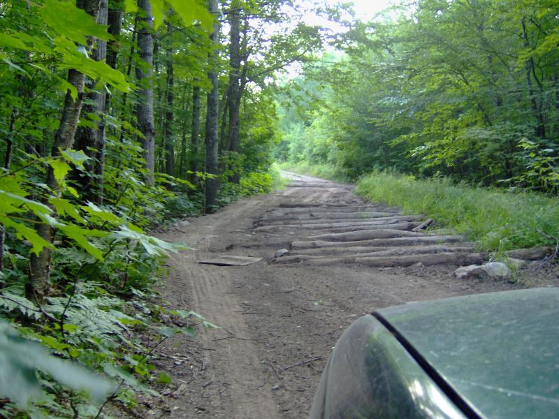
Logs on the Triple A
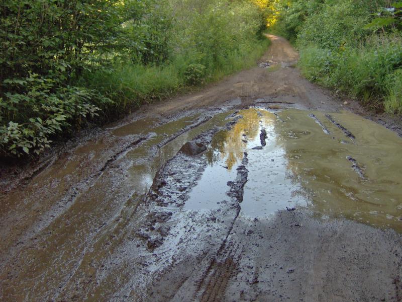
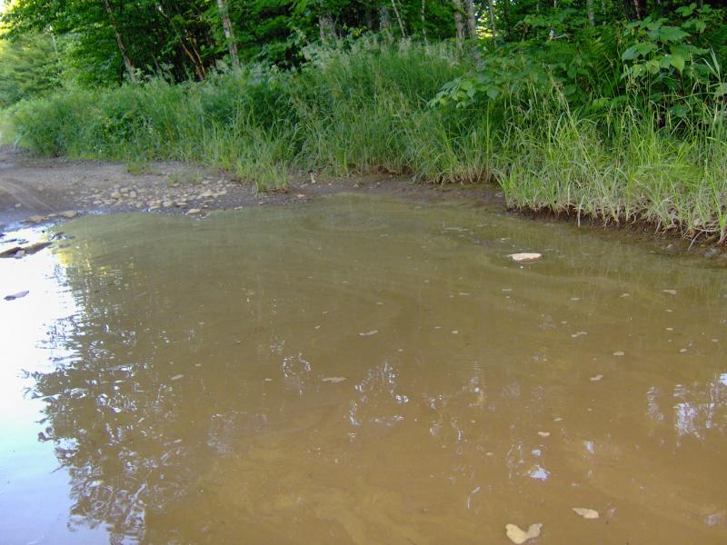
Slimy mud puddles
The moon was out before we saw another paved road. We grabbed dinner at L'Anse and I treated Logan to several plain burgers after the long day. Even if we wasted the morning getting lost and the evening damaging the Taurus it was still a solid end to the weekend. I had finally pushed into the Marquette area and visited some of the more remote destinations in the Upper Peninsula, even if it meant being out from dawn to dusk.


Comments (0)