
There was a group of falls in the central and northeast corner of Marquette County that were starting to become troublesome. I had been out on the Yellow Dog a few times now and just kept running out of time to hunt down these spots. Today Katie, Faith, Cory and I set off in the early dawn, well before the sunrise, hoping to find these last few spots. Little did we know when we drove south out of Houghton that we wouldn't be returning that night and that our little trip would end in a terrible ordeal.
Faith and I had just come back from a ridiculously awesome trip on the McCormick Tract a week earlier. We were both really excited to return to these woods even if it meant driving along nasty logging roads in the dark. Our enthusiasm did little for Cory and Katie, neither of whom are morning people. The four of us barreled down to L'Anse, past Skanee and over Big Erick's Bridge, eventually turning left onto the Northwestern Road.
My knowledge of the roads in this area was slowly improving. I knew that Ford Road was pretty decent all the way to the Triple A on Yellow Dog Plains and that the Northwestern looped around the plains on the north side. What I didn't know, though, was that the Northwester Road was horribly maintained and not in the shape for most vehicles. We made it to Cedar Creek just fine, through a few ruts and rocky patches, but beyond our route degraded to the faintest shadow of a logging road.
I don't quite understand why this road exists at all, especially as a thoroughfare. Even if it was freshly graded I doubt a logging truck could handle the slopes. It bucked up and down, swung sharply on blind curves, and had multiple boulders and trees blocking sections of the road. My knuckles were a bright white in the still-dark air as I aimed the tires carefully over the rocks and revved up to climb the tricky slopes. This wasn't a road. It was a crafted mechanism to destroy vehicles.
Two things kept us moving forward. To go all the way around on the Triple A to Dodge City would take at least an hour and was far out of our way. The bigger reason, though, was the thought of the rough terrain we had already gone over. Even though every bend brought a new obstacle our way I held onto the hope that we were almost there. After all, this bad stretch of the Northwestern Road is only 3 miles long.
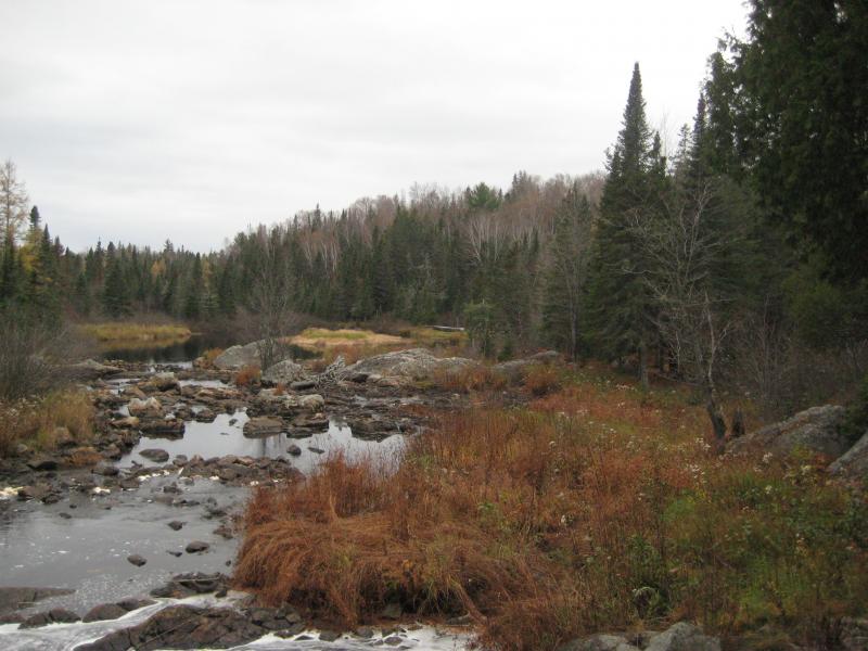
We finally reached the far end and pulled into Dodge City with the sunrise. All of us tumbled out quickly, shaken by that tough stretch. A two-track led north from Dodge City, along the Salmon Trout River, but a few deep ruts showed up after only a few hundred yards. After our tough drive down the Northwestern no one had any interest in pushing our luck down another rugged road.
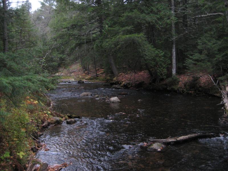
All together we set off northwards. There was maybe 3 or 4 miles to walk down the winding wooded trail. Faith and Cory took the lead, being fast walkers, while I stuck back with Katie. Logan ran back and forth between us, excited to be part of such a large group. For the most part our path was easy. There were a lot of forks and branches and it was easy to tell which was the main one and which would fade away after a short distance. The barren trees around us also helped out, as I could roughly make out the geography in the distance. East Branch Sturgeon River was to our right, within a deep valley, so as long as the the land to our right went downhill we were good.
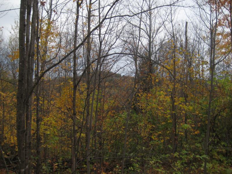
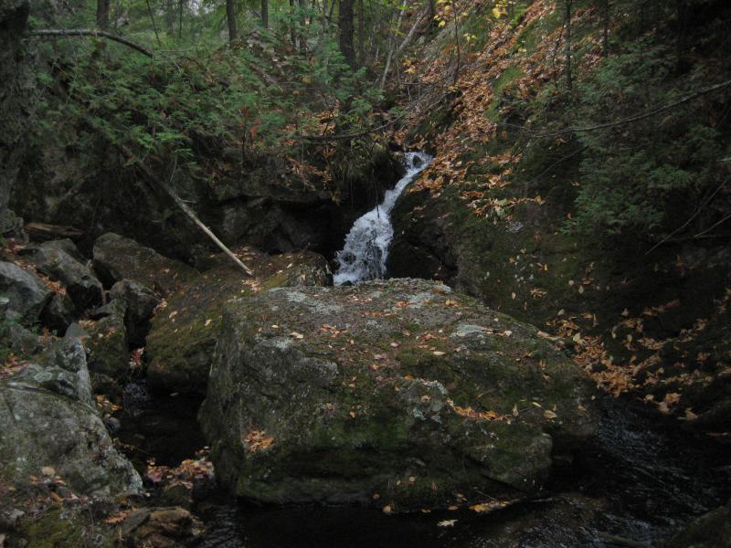
Hiding outcroppings in the fall colors
The foliage around us varied a lot. Sections were heavily forested with large old pines surrounding sharp outcroppings and other areas were open, sick-looking swamps. After a few miles the woods shaped up into a more uniform hardwoods with colored-leaf carpets underfoot and tall bare trees stretching high above.
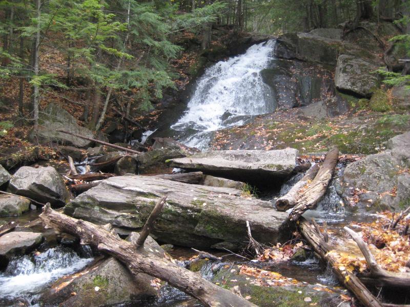
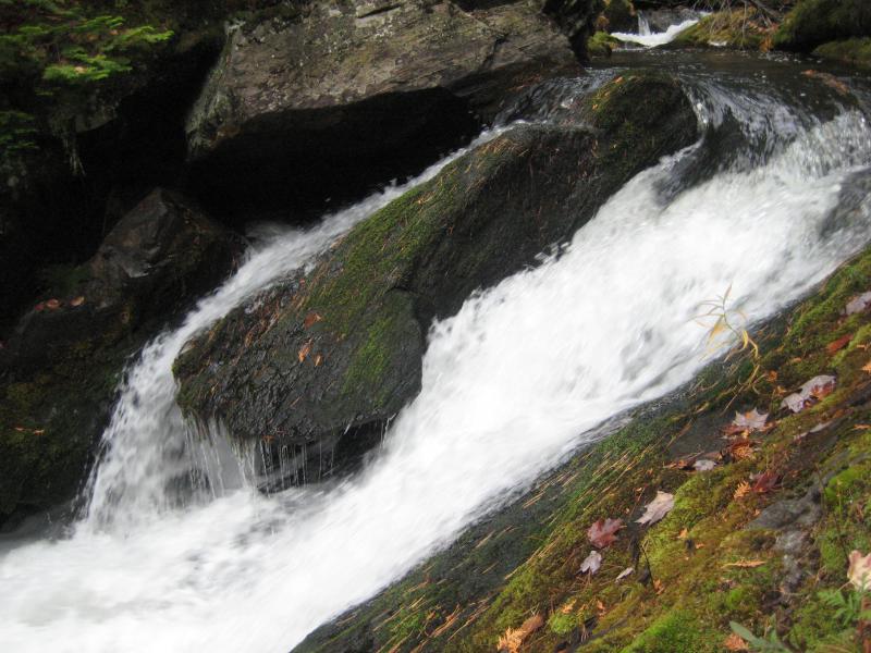
Our only point of confusion was with the last fork. The main path we were following circled around and started heading back south while an overgrown and unmarked track led down the riverbank. On a guess I led Cory and Faith down the hill. Katie decided to stay up on the hill, not willing to tackle the steep slope. At the base I saw a yellow tied marker on a tree branch. Taking the hint we walked towards it, bushwhacking through the thick woods, finding more beyond that stretched eastwards. They led us right to the Salmon Trout and a narrow, unique waterfall.
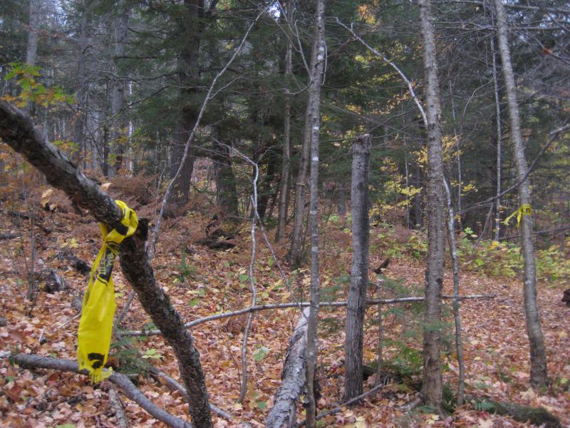
Trail markers on the way to Twin Falls
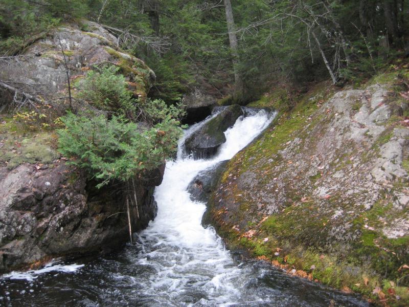
Frothy white squeezed between rocks
I assumed that this drop was Hogsback Falls. I had heard that Hogsback is on Huron Mountain Club property so we treaded lightly and made our visit a quick one. Later I learned that this was actually Twin Falls and that Hogsback was further downstream, past the Club line. I do plan on revisiting to confirm, although the remoteness of the area does not lend itself easily to quick visits.
The three of us and Logan climbed around the falls. Huge cedars grew up from the eastern bank and soft, spongey moss and lichens covered the rocky outcroppings. We enjoyed the wild change to the relatively boring sandy stroll, only heading back up the trail when we thought about Katie waiting for us. She was impatient by the time we climbed back up the hill. As she was still not interested in walking down the steep hill to see the falls we turned and headed back to Dodge City.
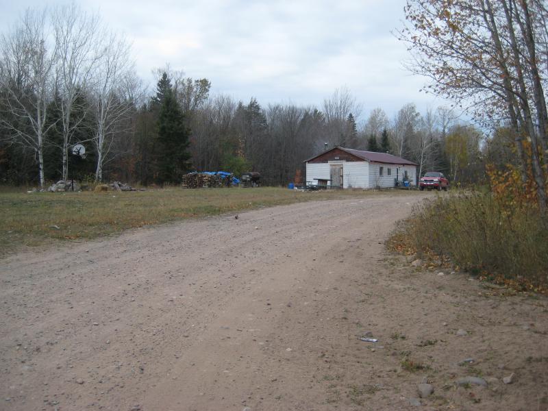
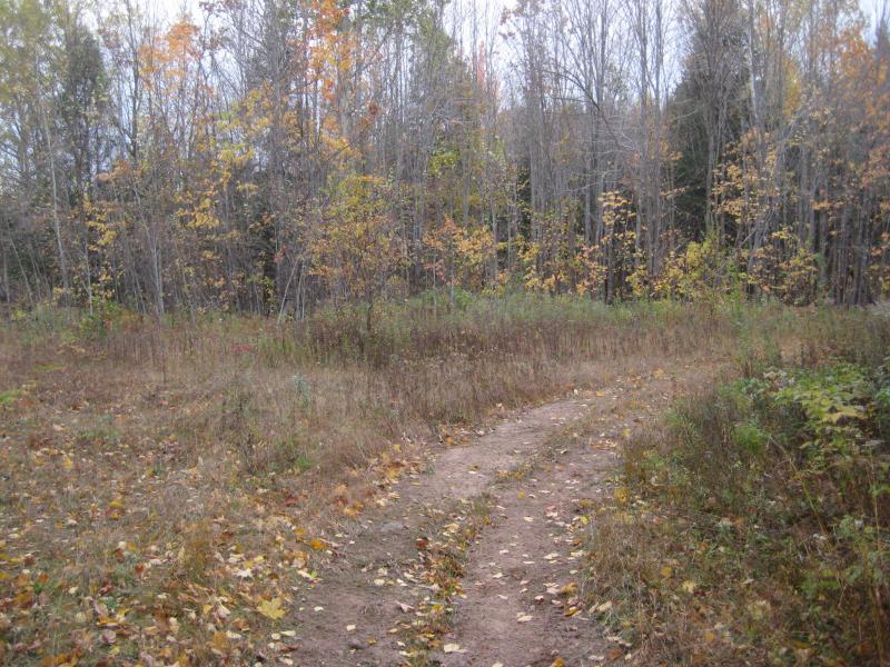
Dodge City down the road
After a quick bite to eat at the car we drove further east on the Northwestern Road. From this point on the two-track was very passable, an easy sandy drive with no real tough spots. When we hit the Triple A I tried to convince the group that we should double back for Wylie Dam so I could finish the Yellow Dog Plains area for the year. They were hungry for real food and didn't want to dally in the wilds too much longer. Plus, the long drive and hike to Twin Falls had set us back hours.
Instead we drove straight over by Big Bay and Alder Falls. The two-track leading back to the waterfall was hard to make out, being right next to a house and looking more like a driveway than passable road, but I found it on the second pass. It was sandy and pushed us around a bit. Compared to the Northwestern, though, it was a dream.
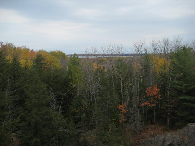
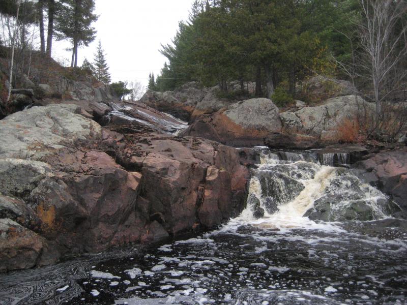
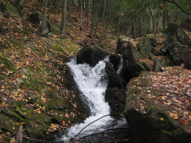
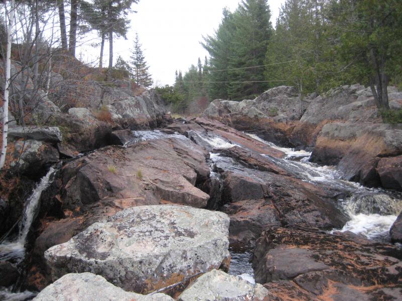
I parked at the pull-off with a small but clear sign for the waterfall. Katie wasn't feeling that good after Dodge City and the early morning so the rest of us headed down the steep, steep path. We bumped straight into the tall lower drop. Amazed by the size and easy hike we paused here, taking in the impressive fanning drop before heading upstream. There were three more drops upstream and we found each one by sticking close to the river. A deep pool sits below the third drop, with steep rock walls too sharp to get around, forcing us to climb up and over tall outcroppings to reach the small upper drop. The detour was worth it. Thanks to the bare trees we were able to make out Lake Independence and Superior far to the east. Happy with this relatively easy stop we bounded back to the car, excited to continue on.
Looking at the main curtain, speckled with fall leaves
Lake Independence visible through the bare trees
Since we had skipped Wylie Dam in favor of a very late lunch in Marquette I figured we had enough time for two stops on the way back to Houghton. None of us were in a rush to tackle the logging roads back, even knowing that Ford Road was a much easier route than the hellish Northwestern Road, so we heading down and around the typical 41-through-Michigammee route. About thirty minutes from Marquette I turned right onto a small maze of logging roads and brought us near the swampy Lake Arvid area, parking in the middle of a wide clearing.
Dee Lundeen Falls was somewhere to the north of us. I got out and walked around a bit, seeing an orange gate with a huge Keep Out sign. I poked around a bit and found a small path fifty yards to the right, looking like it may lead us straight to the Peshekee River. Faith and Cory joined me and we headed through some thick brush before deciding that this path wasn't going to lead anywhere.
We floundered around a bit, veering north as much as we could, when we bumped into a wide logging road. I had no idea if this was the gated road or not but figured it was worth the risk after pushing through the tough brush off-trail. The road led over a small creek and right to a group of cabins on the river. This was awkward.
Cutting a wide berth around the cabins we swung north to avoid angering the landowners. I had no idea if they were home or not and was in no particular rush to find out. Dee Lundeen Falls is located just upstream of the cabin. I took a few quick photos and we took off quickly, feeling unwelcomed here. It was more than the cabin. The woods and river felt thick and eery, as if it did not want us here, and we were more than happy to oblige. I've heard some eery stories about these falls, about ghosts and murders and mysteries, and after visiting I've got half a mind to believe them.
Odd, stained rocks around Dee Lundeen
There was a few more hours of daylight left. I drove up the Herman-Nestoria Road and parked past Summit on the Tama-Siding Road. I wanted to try a new approach to Upper Sturgeon Falls, a destination that had slipped out of my grasp too many times already this year.
Cory, Faith, Logan and I headed down past the gate near Tama Creek. From my hand-drawn map we wanted to follow a right fork a short distance down the road which would take us near Sturgeon River, right above the falls. The last bit would be a bushwhack but it wouldn't be far. The day was relatively warm, warm enough for light jackets and long-sleeve shirts, and we were in good spirits. It had been a fun, if long day already filled with a lot of adventure. When I saw the fork in the road it felt too earlier and we turned left instead. This was the first mistake.
We continued down the road, not focused too much on our route, when I decided it was about time to cut off the path. The river couldn't be that far away. We picked a spot where the forest seemed clear below and headed down a steep grade. After ten minutes of walking we noticed a thick section opening up in front of us, thick enough to hide the road behind us. Cory came up with the idea of leaving our sweaters as trail markers, the second mistake After all we were moving quickly and the temperature wasn't too bad. He draped his sweater over a branch, high in the air.
The forest was thicker than it looked. We were forced to crawl in sections, winding and weaving through the thick woods. When things finally opened up we all breathed a sign of relief, even though the river still wasn't in sight. A second thick forest blocked our sight a few hundred yards away. Instead of giving up we tackled it, pushing through the older, thicker forest, another mistake. During this leg of the hike I left my jacket and sweater behind as markers.
When we pushed through the woods it was right on the banks of a large, dark swamp. It was progress, even if there was no visible sign of moving water. We headed to the right first, to a beaver dam that stretched across, and found nothing but thick swamp below. We then backtracked to the upper side of the swamp and found nothing but grassy wetlands above. There was no waterfall here.
It was starting to get dark now. A bit scared we attempted to backtrack through the woods. We couldn't find either one of my shirts, although we did find an open section of woods. It seemed familiar so I shrugged off the omnious sign of losing my warm clothes and we continued onwards. Twenty minutes later we broke out of the brush onto a brand new swamp. This was not a creek we had seen before. We were not backtracking. We were lost.
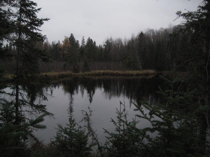
Another pond, this one bigger and darker
That night was hellish. We ended up spending the entire night huddled around a flat rock next to the swamp. The temperatures dropped close to freezing and we got hit by a sleety rain past midnight. We called the emergency line for help and they ended up finding us around four in the morning, leading us to fire and warmth and Katie's waiting scolding. It may have been left over bad luck from Dee Lundeen Falls or the long-waiting result of overly ambitious adventuring, but whatever it was that night was hellish. We drove back to Houghton beaten and docile, no interest in discussing future adventures.


-
Jacob Emerick
Jan 20, '09
Depends on your definition of hike. The hiking and waterfalls were excellent - the sitting in a dark, cold, wet swamp not so excellent.
Add to this discussion-
Jacob Emerick
Jan 12, '22
This is still one of my favorite UP memories, now that the trauma has (mostly) worn off. I'm totally stoked for your return, hope it's a good one.
Add to this discussion