Today was the last day before deer season. Well, bow-hunting had been open for some time already. I never worry about bow season. You have to have a good look at your target before you loose an arrow. Regular firearms were a different story. Not only do bullets travel far but it's more likely that a novice hunter would be out during firearm season, letting bullets fly into moving brush without sighting a clear target. With the vast majority of my waterfalls out in the woods, on public access land far from city limits, I knew today could be the last day of safe exploring before winter gripped the Keweenaw.
Katie, Logan and I headed down to Marquette early in the morning. We did get a bit of a late start, between some last-minute packing and a sick dog on the drive (he was too excited to eat his breakfast). The cloudy sky was well-lit by the time we reached our first stop off of Wright Street.
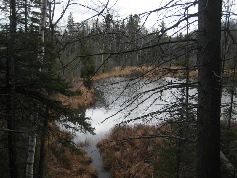
Penstock stretching upriver to Forestville Basin
The Dead River drops around 1200 feet from headwaters in the McCormick Tract down to Lake Superior. There are dams that hold back some of this drop, including the Hoist Dam that covers one of the largest waterfalls in the Upper Peninsula. I haven't been able to find a historic picture of Great Falls. I've heard it was so tall that it was impossible to shoot logs down during the spring melt. The logs would bust and splinter open on the jagged rocks below. Hoist Dam was originally built to stop the logs and featured a hoist that would lift them out of the water and onto a nearby train. Over time the dam and retained water needed to be larger to hold all of the logs being sent down from Mulligan and the Peshekee Highlands, so there were several expansions built. And then they built the cement hydroelectric dam. I'm not sure at what point the falls were submerged, either during or after the logging years, but it's been well over a hundred years.
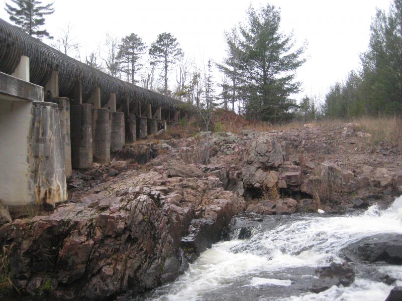
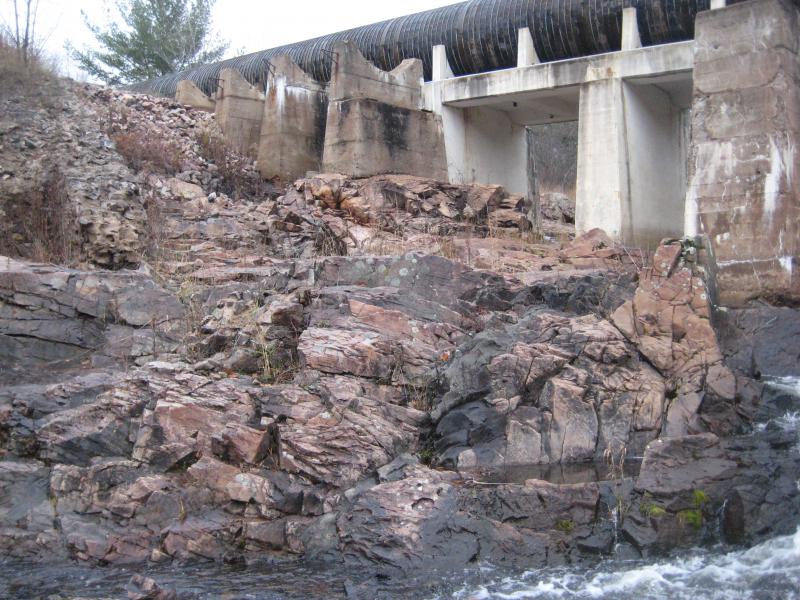
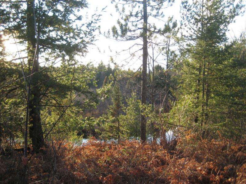
Aside from Hoist, McClure, and Forestville Dams there are a few sets of waterfalls left on the river. Today we were visiting one of the lower ones, a chain of small, rugged drops collectively called Wright Street Falls. We parked off of Wright Street, right at an access road and bridge that led over to the Forestville penstock, and headed over and down to the river. Along the way we checked out the brazen graffiti splayed across the penstock and discarded chunks of cement. It was interesting that people would leave their marks so close to town, within clear view of passing vehicles on the busy street. We reached the river and saw the first of the waterfalls.
Jagged upper drops
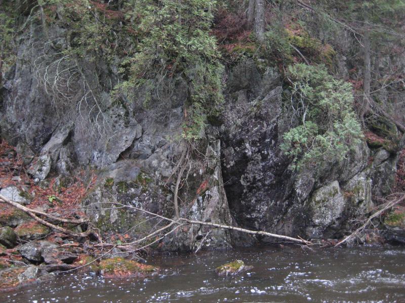
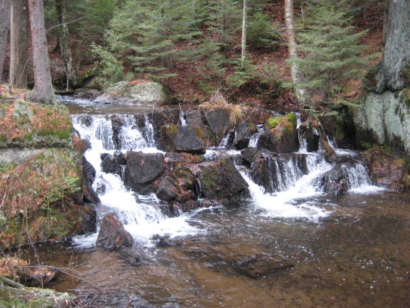
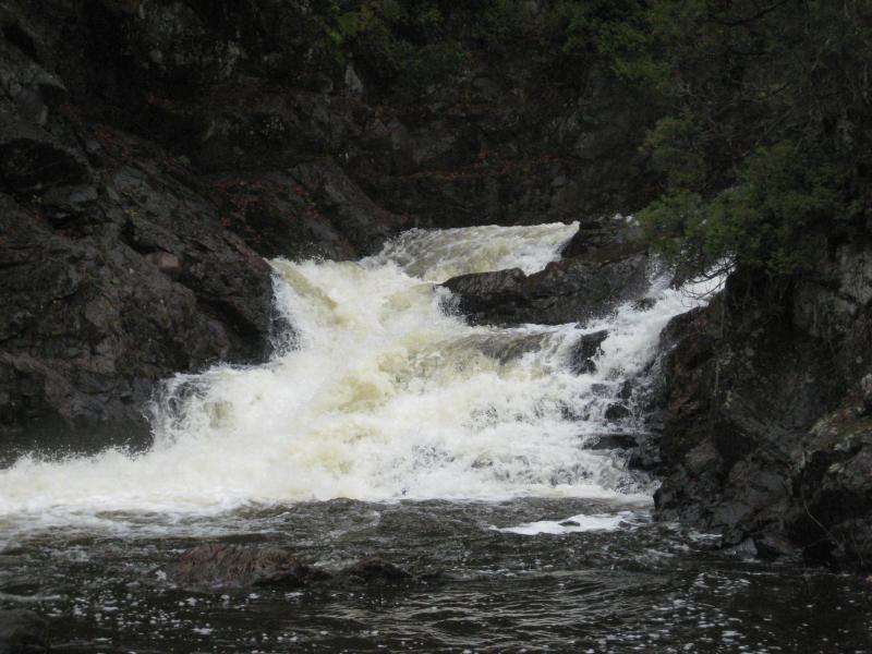
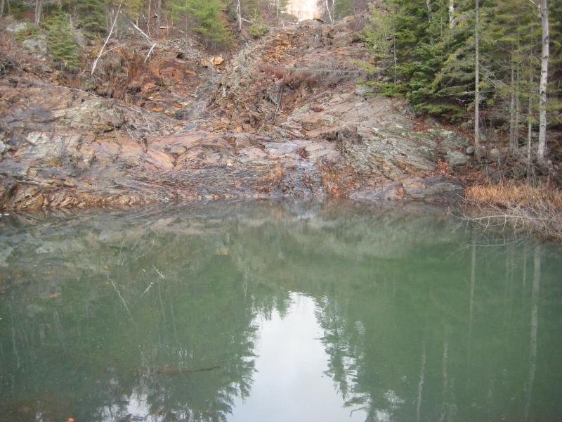
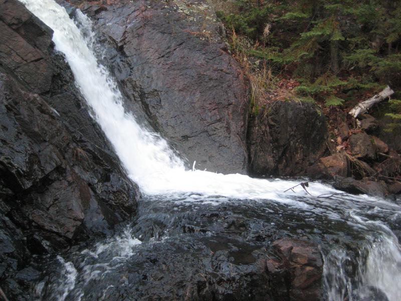
Starting just on the other side of the penstock, tumbling over the jagged rocks, was a pretty but small set of cascades. If you add up the entire half of the upper drops, which were spread on either side of the penstock, there might be 10 or so feet of vertical. I expected more out of the Dead River, the river with so much distance to drop. I carefully walked down to the river alone, as they were slick with water and ice, and and took some pictures of the different drops. I did not want to slip here, with multiple sharp angles sticking up randomly around in within the river's flow.
Craggy rocks around the river
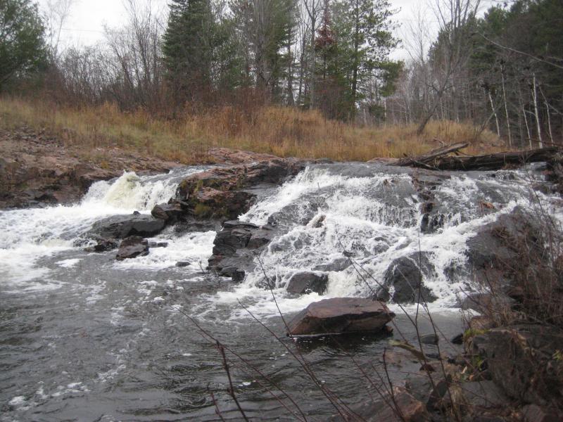
Katie was content with staying up on the bank, even as I headed down to the lower drop on the other side of the bridge back by the car. They were small, a pair of chutes split by a large slab of jagged rock jutting up from the river bed. Much of the river here was being diverted to generate power, and I suspect that much of the exposed rock would have been covered if they let it all downriver. The falls would have been slightly more impressive with a full sheet of water cascading down instead of a broken streaming flow. After a thorough exploration we headed back out of Marquette.
I had considered adding Dead River Falls, which is just upriver from the Forestville Basin, to our hikes today. We weren't particularly in the mood to revisit that waterfall yet. Also, since it was technically in city limits, I had little fear of going there during deer season. I was estimating several hours for that waterfall, an amount of time that I was not willing to waste today, not when there were so many remote falls that would soon be cut off from me. Instead we headed even further upstream, outside of Marquette, to the McClure Storage Basin.
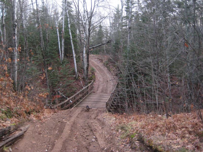
After a decent amount of research on this area I was able to navigate the roads with little problem. We easily made it down to the dam past the numerous residential roads and parked near the chain link fence. Rumor had it that there were three waterfalls here: McClure Dam, Upper Dead River, and Trestle Falls. Of the three I held the most doubt for McClure Dam, worried that there was no waterfall here, just the dam and maybe a small overflow chute.
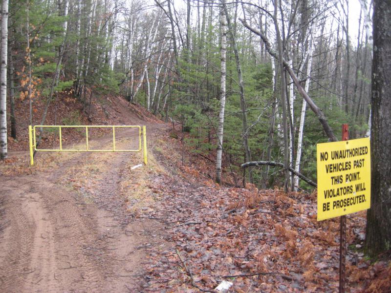
Gated access track
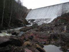
All three of us headed down along the base of the dam avoiding the chain link fence. There were a few routes down but we took the easiest one, just doubling back to the gated access road and following the underground penstock back to the falls. As we approached it I noticed something unexpected: the entire dam was overflowing.
Thanks to a leak in this dam's penstock they had closed it off, completely shutting off the power generation from this spot. The extra water was too much for the overflow pipe and the water was flowing over the top of the dam forming a solid curtain of white. It was a magnificent view. This sight also meant that the Dead River would be fully flowing below here. No diverted water would be drying up the river banks like Wright Street Falls.
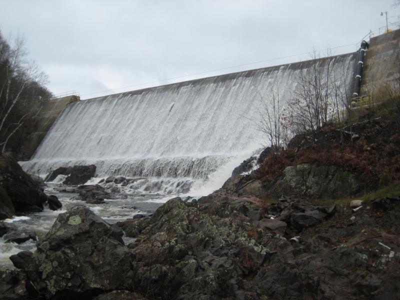
An overflowing dam
The water flowing over the dam itself was impressive, a wide and tall sheet evenly coated. The cement was not perfectly smooth, causing a long strings of white foam and sprays scattered randomly over the surface. At the bottom of the dam it curves out, forming almost a slide before the water hits the natural bedrock in a delightful crash. An overflow pipe on the right side, the one that usually contains the only water from continuing downstream, was gushing water out in a long, dramatic spray. We spent a good amount of time admiring this view alone before continuing downstream for a more natural waterfall.
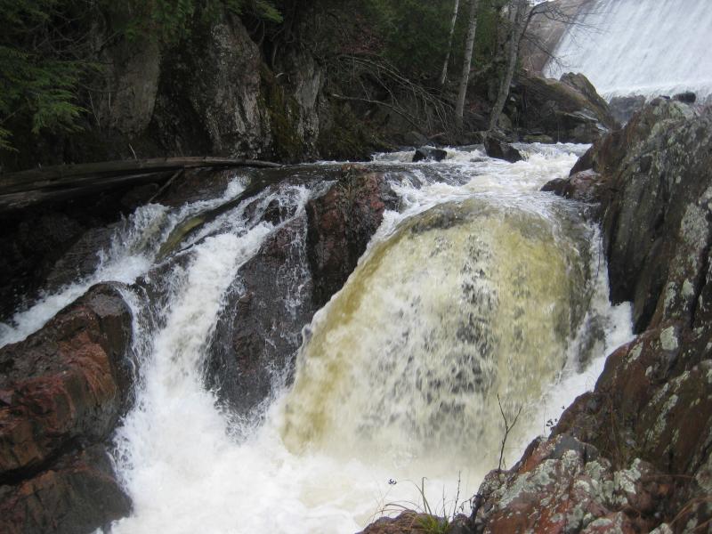
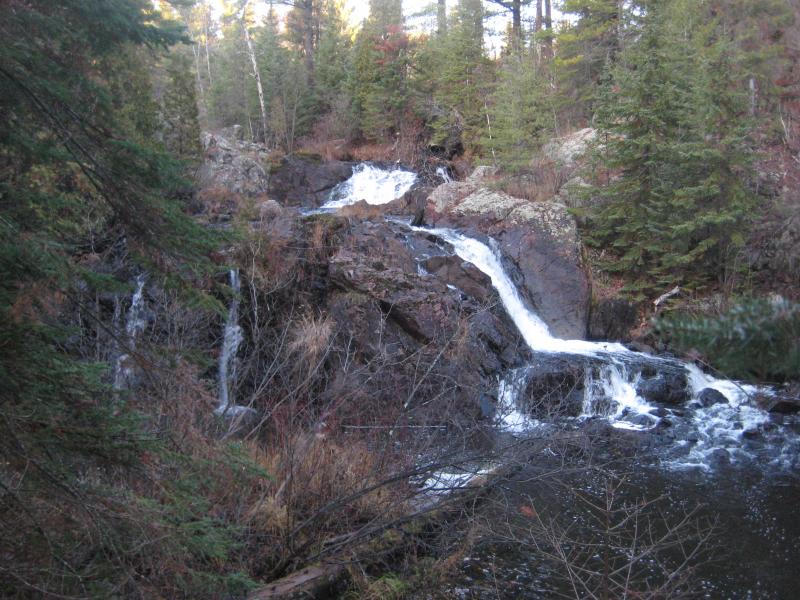
McClure Dam Falls didn't take long to find. The hard bedrock banks narrow quickly below the dam, funneling the wide river down into a small chute with a plunge in it. I first approached it from above, carefully creeping in from the side, but wasn't able to get a good angle on it. By coming in from below I was able to get a decent photo. The rocks were wet and slick and I didn't press my luck, not with the powerful water pounding down that chute and the deep cold water below.
Downstream plunges
After the dam, the waterfall, and the cool bedrock surrounding the river both Katie and I were excited to see what waited for us downstream. The riverbed narrowed and our nice bedrock route disappeared and I found a footpath leading up along the bank, keeping within a few dozen feet of the water. A small testing site showed up, a shallow box collecting red sediments from a nearby tributary. That must be what the path is for, scientists checking on their experiments here. Beyond the test the path got steep and some ropes helped us up the dirt climb. It was a pleasant surprise, finding this path, as I half-expected the entire hike to be a bushwhack.
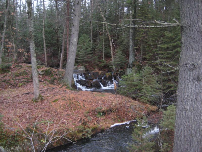
A second test site showed up just below Upper Dead River Falls. Things got a little hairy here. First, this waterfall was located at an inconvenient bend in the river that hid most of the drop from the banks. Looking over to the waterfall was humbling, as it was a truly jagged set of cascades that looked more than a little frightful. Second, this test site was hemmed up by a wall of crumbling rock that was very difficult to walk across. We managed to get past it and I tried to get some decent photos of this waterfall from across the downstream pool.
Stacked falls across the river
Our nice footpath was gone now and we were left to fend our way alone. Some large outcroppings and downed trees forced us up and down the riverbank multiple times. As the going got rough and the river calmed down I decided that it was time to head up the banks and find some level ground. Katie was not a fan of this rough type of hiking and I didn't want to continue wasting daylight. I was only glad we were not on the south side, which appeared to be composed more of soaring cliffs than actual river bank.
Steep southern bank
Once we reached the top of the bank I found us a nice logging road to head east on. It wound a bit up and down the hills. Compared to the river route, though, it was easy going. We crested one particular hill and saw an amazing view of Lake Superior through the barren trees. It's easy to forget how close the lake is out here or how high you really are when you're pushing through the thick forest of the Huron Mountains.
I headed down the hill alone. Katie was more interested in taking a break than climbing all the way back down to the riverside. My aim through the forest was true, breaking out right where the LS&SI starts over the trestle. Giant signs warned not to attempt climbing out over the river. I wasn't worried. It was what was below the trestle that interested me.
Getting back down to the river proved rather difficult. The trains that run this length come from the mines by Palmer and carry iron ore pellets over to Marquette. The tracks and steep rocky river banks are covered with these pellets and form a excellent surface to slip and crash down. I crept along the banks slowly and carefully, choosing my footholds carefully while gazing around at this awesome site.
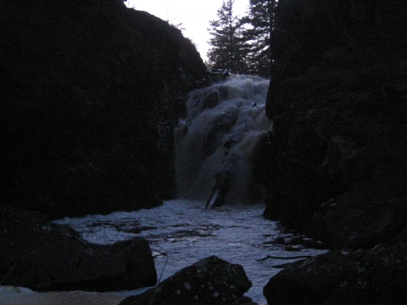
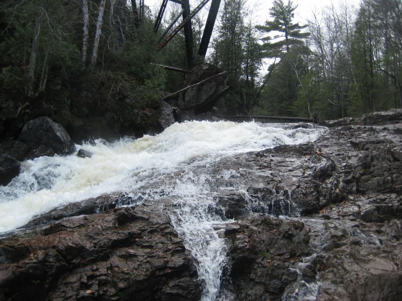
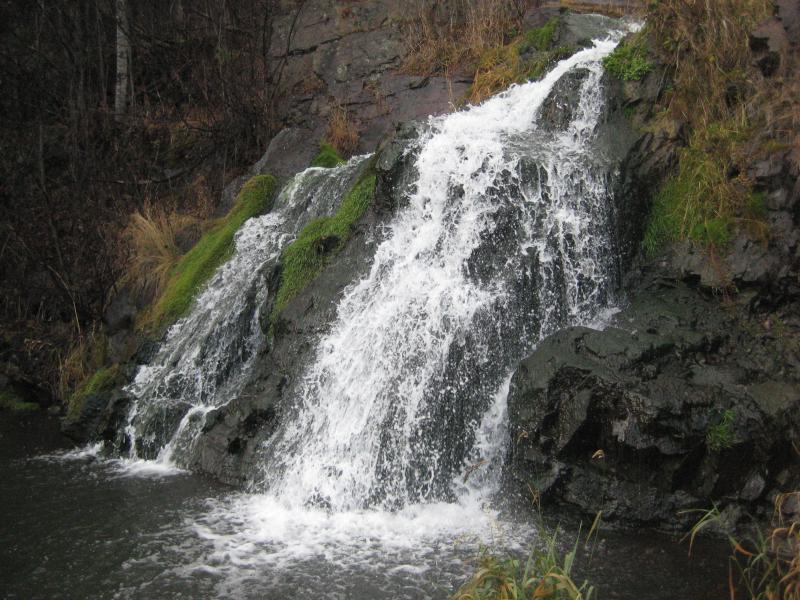
The Dead River flows between a steep sheer cliff and a rounded hunk of bedrock deep within a gorge. As soon as the river passes the trestle it flows over a massive two-tiered waterfall that is easily the single largest drop on the Dead River today. The trestle soars up from the top of falls, framing in the river, the solid supports looking flimsy as it rises from the solid rock. I took my time once I reached the falls, enjoying the huge waterfall and the nearby overflowing trickles, glancing up at the tall trestle multiple times. The entire scene was incredible.
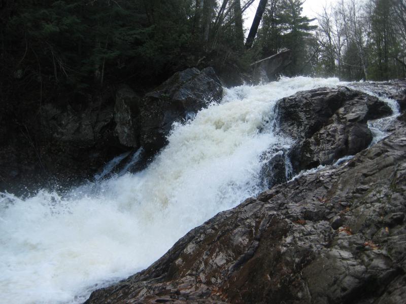
A sudden, roaring plunge
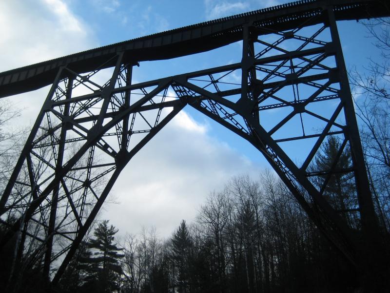
Trestle against the blue skies
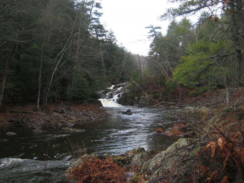
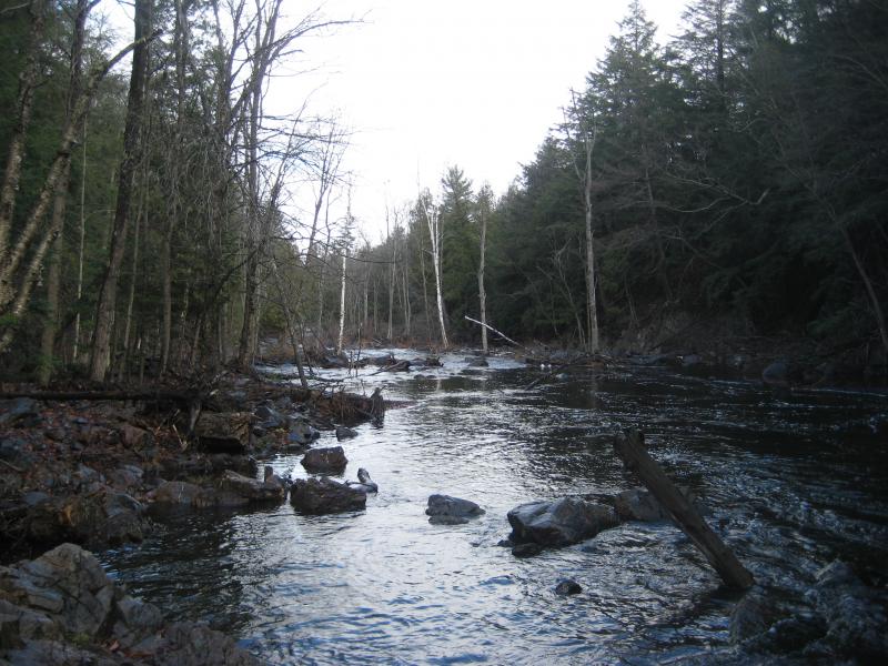
Knowing that Katie would be getting worried and bored waiting for me I finally decided to head back. On the climb back up I glanced several times at the land below the falls. The river quickly changed into a wide, flat swamp, reminding me of Sturgeon River emptying out of the Canyon River Falls box. This swampy section continues on to Dead River Falls, just a few miles downstream. That might be an interesting hike some day, to hike from Marquette's Dead River Falls upstream to the McClure stretch, connecting two of the Dead River's five dams.
Once Katie and I met up we started heading back. Instead of retracing our steps, taking the hard way back, I decided to try out these logging roads. They led us right over to the covered penstock and an easy walk back. On our way back we heard several gunshots, loud and close by. Since we were both wearing bright clothes and out in the open I wasn't too worried, though the pressing knowledge of deer season made things uncomfortable.
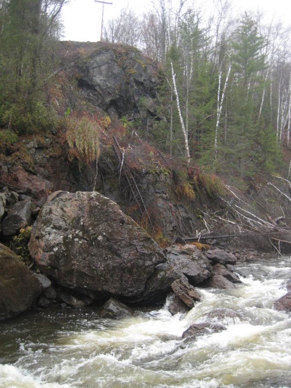
By now it was early afternoon. I was anxious to continue on, with plenty of stops to make in the south, and we were both ready for lunch. Before driving back to Marquette I headed over to Hoist Dam. After so much luck at McClure Dam I had high hopes that Hoist, with its history and impressive size, would have some nearby drops. Parking up by the outhouse we walked down a gated access road, ears and eyes peeled for waterfalls. There were none to find. Water flowed out of the power plant at the base of the dam over a smooth, gravely riverbed. With the exception of some brightly hued bedrock at the base of the dam there was nothing to see here.
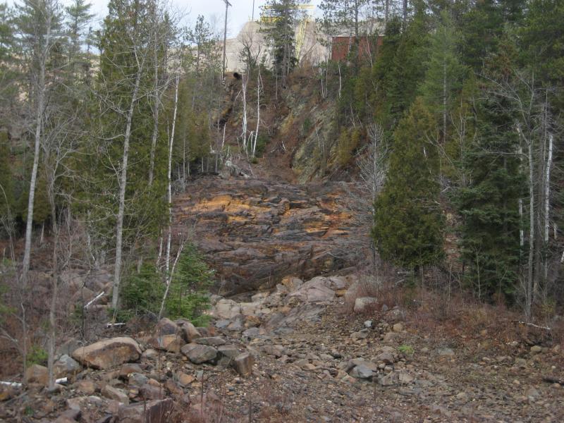
Colorful rocks and dam
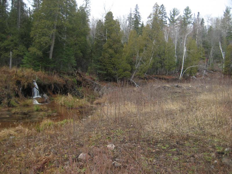
I took some quick photos of a tributary flowing in from the side over the dead grass and we left. There may have been a huge waterfall here once but today there was just a dam. We headed over to Marquette and grabbed some subs while I plotted the next stops. The lofty goal was to visit both Carp River and Morgan Creek, both with several waterfalls on their length. We were starting to run low on daylight, though.
Hoping to get at least one of the two waterways done today I headed over to the land around Enchantment Lake. My planned route was to follow the power lines over to Morgan Creek, find a swamp, and follow it downstream. When I reached the swamp I started to realize just how futile this plan was. The undergrowth around the water was thick tag alder and the uncertain ground beneath rolled with scattered rocks and dead logs. I did push my way down to the base of the swamp and found an impressively tall beaver dam before retreating against the growth.
Large swamp near Enchantment Lake
Time to try the alternative approach. We headed south to an unnamed road, a rough little dirt track that follows Morgan Creek to Carp River before taking a ridgeline down to the ski hill area. I had heard bad things about the quality of this road and was planning on avoiding it but now it appeared to be the only access to the waterfalls here. The drive there was weird, changing from thick woods around Enchantment Lake to sandy plains with a tall radio tower and fenced off mining complex sitting out in the open. When we reached the power lines, the same lines I had just found twenty minutes ago, I took a deep breath and headed down the access road/ATV trail in Katie's SUV.
The conditions were not as bad as I feared. It had been dry for several days now and the large, deep holes that could easily create sucking pits of mud were just more bumps in the road. There were few rocks on the wide, sandy road, and we easily drove north to Morgan Creek. Taking the right fork we followed the road, which did worsen over the distance but was never impassable.
I had no idea how far to drive down this road, only knowing that Morgan Meadows Falls was somewhere along this stretch of creek. It was a pleasant surprise when, after crossing a culvert, a small pull-off showed up with the sounds of a waterfall drifting in from the other side. The falls were within a dozen feet of my car. I took some quick pictures, venturing downstream a short distance to look at the taller lower chute, before consulting with Katie.
Small blocky drop on Morgan Creek
Morgan Falls was downstream from here, before the creek runs into Carp River, and I wanted to continue on the road in hopes of finding it. She was okay with the road's conditions so we continued driving. Morgan Creek flowed close to the road and I hoped we'd be able to hear or see it right from the car.
A questionable bridge over Morgan Creek stopped us after less than a mile. Neither one of us wanted to test the load-bearing capacity of the rickety structure. The drive was over. In hopes that we were close to Morgan Falls I got out and walked downstream along the pleasantly wooded creek and found nothing but a sandy creek bed. Out of the four waterfalls here I wanted to finish up we had found one. We retraced our route back out of this area, frustrated.
Steep drive over Morgan Creek
There was an hour or two left of daylight so I rushed southwards to Palmer along M-35. On the way we were greeted with the huge piles of poor rock surrounding the iron ore pit, something we had both glimpsed from 41 but never been so close to. They towered up above the road, a humbling reminder of one this area's founding industries. I had heard that there was once a mountain here, Summit Mountain, and that this mine had chewed through it and was working down through its roots. I wondered if Summit Mountain had been taller than these piles. Who knows, it may have been a contender for the state's highpoint at one point.
Warner Falls is a pretty little roadside drop just south of Palmer. There is a wide shoulder to park on and, while the drop is visible from the road, a few paths leading down for a closer view. While the waterfall was pretty to look at, a fanning drop over solid rock, I couldn't help but feel the nearby mines overbearing presence. The piles were visible from the creek, the vegetation looked sickly, and the water was too foamy and stunk. I didn't stay long here.
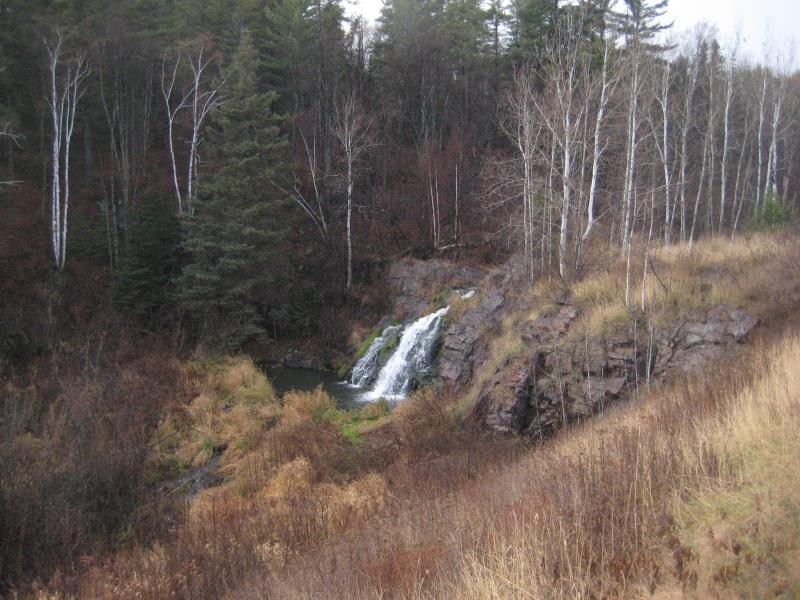
Down at Warner Falls from the road
A short jaunt further south brought us to Schweitzer Falls. I had only a vague idea of where this drop was, never a good idea for a hike in unfamiliar lands, but it was only a few hundred yards off the road. Parking on a two-track I headed down a narrow ATV trail, looking for a marker or path to lead me down to the falls, and found nothing. The trail led me straight into a loop on Schweitzer Creek, water and swamp on both sides.
An upriver swamp around the bend
With a deep sigh I cut to the right, through the thick woods, and followed the creek downstream. After the undergrowth and prickly branches gave me an unwelcome response to my intrusion I was able to find the rocky outcropping, the two-tiered waterfall on the creek. They were not made to walk on. A deep pool sits between the drops, forcing me back into the woods to get around, and the lower drop is a sheer rock face with stagnant water and slick rocks at the base. As much as I enjoy remote waterfalls I found myself wishing for some sort of footpath or animal trail, anything besides this cluster of tag alders and briers.
Dark skies over the the waterfall
The sun was setting by the time I finished pushing and yanking my way through the thick brush around Schweitzer Falls. Getting back to the car was not easy either. The ground is too lumpy to figure out if I was heading in or out of the river valley and there were no paths from the waterfall. When I finally broke free from the woods I was scratched raw and trailed weeds and branches behind me. Katie looked at me, questioning, and I simply told her that I found the waterfall and we were done here. Some places are just not worth a repeat visit.
Dim light was still spilling through the trees and I convinced Katie that we could make one more stop. We were already fairly far to the south of Marquette, in an area that I don't frequent much, and Black River Falls was only a few miles away. By the time we reached the parking area it was truly evening, the sun gone from the sky. All three of us got out to walk the easy trail.
Getting down to the waterfall was quite difficult. There are two wooden walks down to a small island below the drop, providing a relatively easy route, yet both were steep and icy from the river's mist. I slowly made my way down to the island, holding onto the railings tightly, and took some quick pictures of the waterfall. The white water barely showed up in the dark.
Dark, foaming waters
We were definitely done now. We had been to 9 named waterfalls today, 9 brand new destinations for me to check off my list. And we were both exhausted. On the way back to the car we played with Logan a bit in the dark, tag and fetch and whatnot, happy with the day and even happier to be done. Deer season would be starting in four hours, marking an end to at least some of my adventuring for the year, and we had finished it with a bang.


Comments (0)