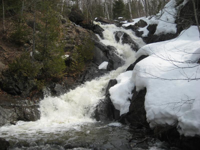

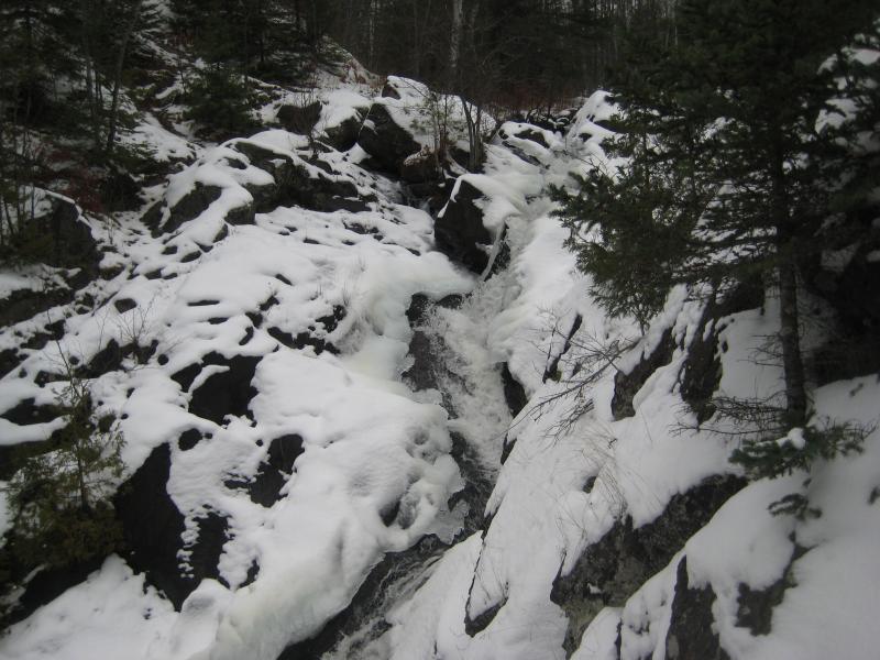

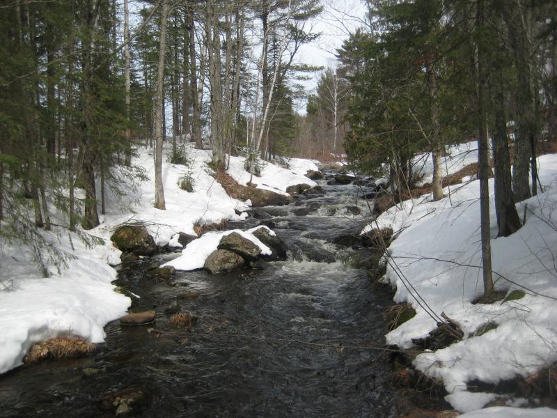
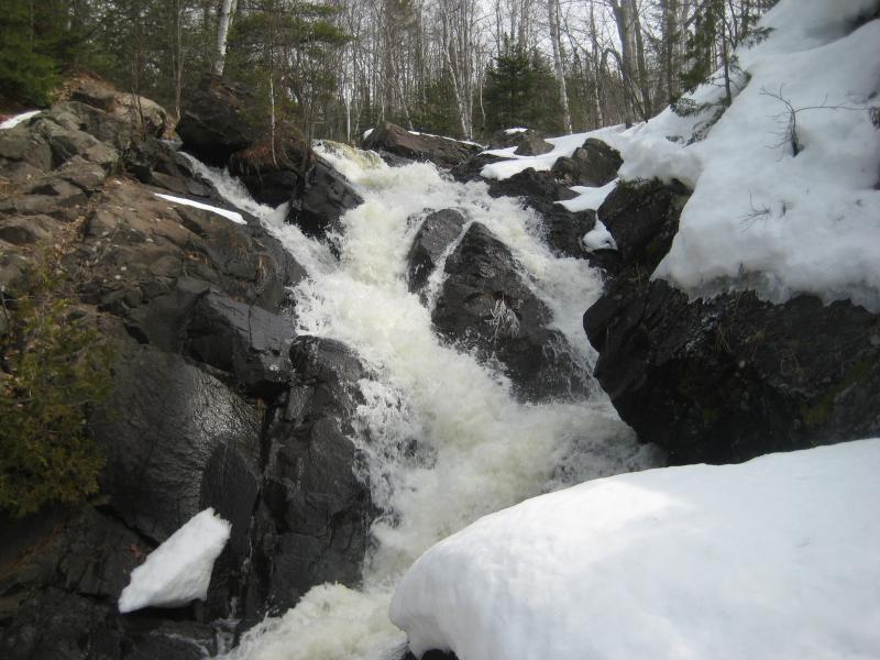
Few people visit Queen Anne's Falls, tucked away from the main tourist stops of the Copper Country . This tall cascade over blocky chunks of volcanic is unique to the Keweenaw and fits in more with the rugged drops of the Huron Mountains far to the south. The creek drains some large expanses of swamp around Copper City before pouring over this sudden waterfall, surrounded by thick woods, and then flowing gently down to Trap Rock River below.
Directions
Copper City is a small little town a few miles northeast of Calumet, just off the main drag of US-41. The main road is actually 3rd Street, which connects to the town to 41. Head down one block to 4th Street and park near Allouez Street, which is on the west side of town. There is a convient utility pull off here with a few meters.
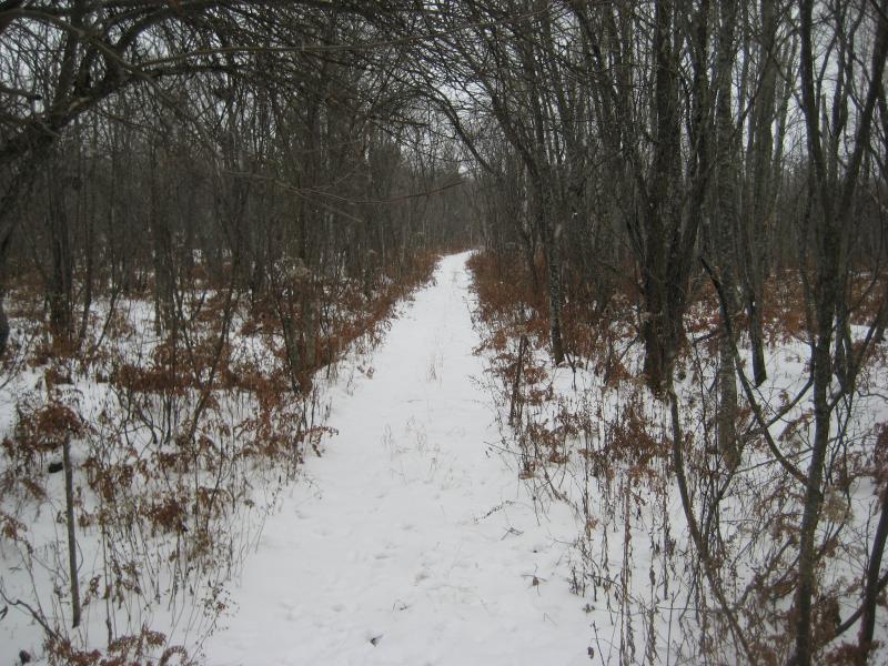
Near the parking area an unmarked dirt road with a narrow wire across loops below the town to the old dump. Follow the dirt road around the bottom of the field and take the ATV trail near the small piles of trash into the woods. This trail leads southeast through the woods into a small meadow. Bear right here to the far corner and cut through the woods. Slaughterhouse Creek is just beyond the treeline and the the falls a short distance downstream.
-
Shane
Sep 1, '14
*ATV trail that is, -east of the falls
-
Jacob Emerick
Sep 3, '14
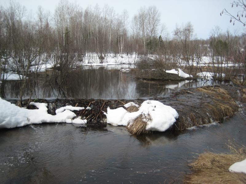
Hi Shane, thanks for the extra info! Yes, I've bushwhacked in before too, had a lot of trouble near the upstream beaver dam. Got more than a little muddy back there. Glad you ended up finding the falls.
-
Mark Piotrowski
Nov 11, '15
Actually, the clearing Jacob speaks of is a bit northwest of the dump on Haltunen. I do think following the trail to the right of the gate to the dump Shane speaks of is the shortest and easiest route(it is marked private, but you will be off that property in 30 seconds). I believe the original directions are a bit off, from the utility area, the path heads southEAST into the woods.
-
Jacob Emerick
Nov 20, '15
Thanks Mark - I've changed it the directions to southeast.The clearing I referenced is at the end of the path, right before the falls. There is that large one outside of town, the one that almost looks like an old baseball field with a bit of imagination, though I don't know near enough history of this town to claim that for sure.
-
Mark Piotrowski
Nov 21, '15
Shane is correct though, the atv trail from the dump leads right to the falls. Only problem is technically starting out on private property, although all paths probably cross private property that just is not posted as such....
-
Shawn
Mar 15, '22
The falls is on private property. You are not allowed access.
Add to this discussion-
Eric
Jun 30, '21
Thanks for tip about Scales Creek Falls, Mark! Wish I had seen this post before I visited Queen Anne's Falls Sep 29, '17, the flow was better then.
Add to this discussion