
Hours of darkness still hung outside when I forced myself out of bed. I had a determined resolve today. Upper Sturgeon Falls had been a target of mine for months, the last waterfall on the Sturgeon River and one of the last in Baraga County to hunt down. Already it had cost me a half a bumper, a lost night in the Nestoria Swamp, and countless hours of planning and hiking all in vain. Today I had my route and there was no question: I would find the upper falls today, even if it took me the entire day.
It was a short, lonely drive down past L'Anse. There were maybe three other cars on the road this early. I parked down on Tama Siding Road with over an hour left before dawn. This was intentional. Daylight was in short supply now, so close to winter, and I didn't want to waste the light on the 'easy' part of the hike. The first part of my route was a pitch black stroll down the Tama-Siding line, a remote set of railroad tracks south of Summit.
Armed with a small flashlight and a several layers of clothing against the frosty air I headed into the wilds. The tracks were only a few dozen yards from the car, though a swampy creek lay in my way. Shining my light down at the ground I tried to judge my footing carefully, stepping from one large tuft of grass to the next, the ground rolling and bucking under my boots. With my boots only minimally dampened I made it to the tracks and clambered up the rocky grade.

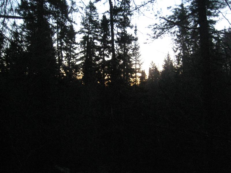
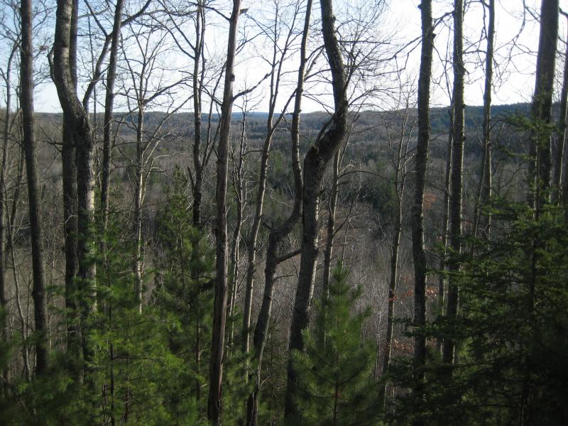
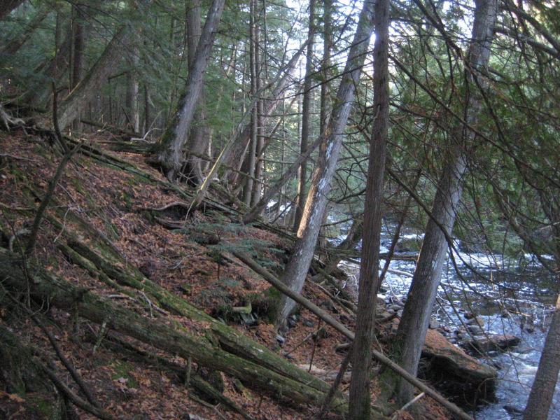
First hint of light over a foreboding forest
I didn't want to use my flashlight, hoping that the stars and moon would be enough to light up the tracks underfoot. The moon had set, though, and the long drive had shot my night vision. I kept my light and eyes trained down to avoid tripping over the ties. I was incredibly jumpy in the dark, walking past dim outlines of outcroppings and tall trees mere feet from the tracks, and frequently stopped just to listen and reassess my position. Crinkling leaves and moving brush kept my nerves on overdrive, even though there was probably nothing larger than birds and squirrels out of sight.
My path was relatively simple. Tama Creek flows back and forth underneath these tracks three times before Sturgeon River came in from the east. If I cut off the tracks after the third bridge I could easily make it to Sturgeon River a few hundred yards to the east. Then it'd be a short upstream hike to find the suspected waterfall. All I had to do was follow the tracks, make a quick bushwhack east, and I would finally find Upper Sturgeon Falls.
Walking down the Tama-Siding Line was not easy, with rail ties and rocks slickened with a thin layer of frost, but it was a long sight better than bushwhacking. When I crept across the third bridge, bending over to maintain balance, the sky was greying up just enough for me to turn off my light and feel somewhat safe cutting into the woods. There was a problem, though, as the a large rock outcropping rose up near the tracks with Tama Creek pooling underneath. I could either climb a sheer face of rock with my numb fingers or try inching through the thick undergrowth below the rock. Figuring that the latter would be easier I eased over the crest of the grade, slowly sliding down the loose rock. It took five seconds for me to lose my grip and slide thigh deep in the frigid water of Tama Creek.
A cold wave soared up my left leg moments before I felt the water penetrate my jeans and pour into my boot. Flailing wildly I tried climbing back up the grade, the small loose rocks giving way like sand to my desparate grasps. Reaching up to a large, solid rock, I managed to pull upwards with my left leg dragging behind like a piece of dead wood and lay gasping for air.
It was well below freezing in the morning air. I didn't think I was in too much danger of hypothermia or anything, though. My left leg was completely soaked, the boot heavy with water, and it protested angrily to the shock of cold water. I took off my boot, upending the stinking water, and quickly laced it back up with dull wooden fingers. This was a setback yet not a stopper. I chose to take the longer route around to the right to avoid both outcropping and creek and made it into the woods.
A dark trek into the woods
Letting adrenaline course through me I set off in a half-jog through the woods. They were reasonably clear, although the leaves covered uneven rocks and thin branches were invisible in the thin light. Tripping, stumbling, and slapped around I tumbled through the woods, easily creating more noise than any healthy or wounded animal would. The little dip in the cold water had turned me into a cautious hiker on the train tracks into a stupid and reckless force.
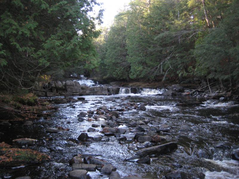
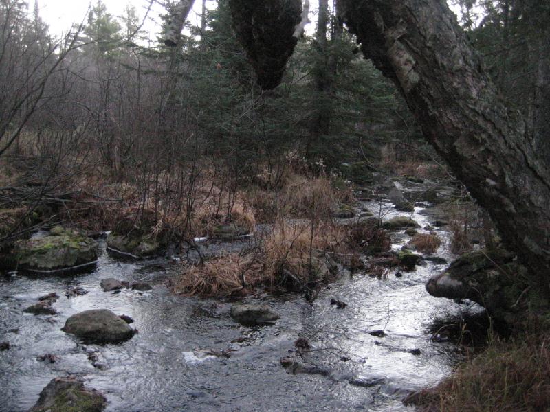
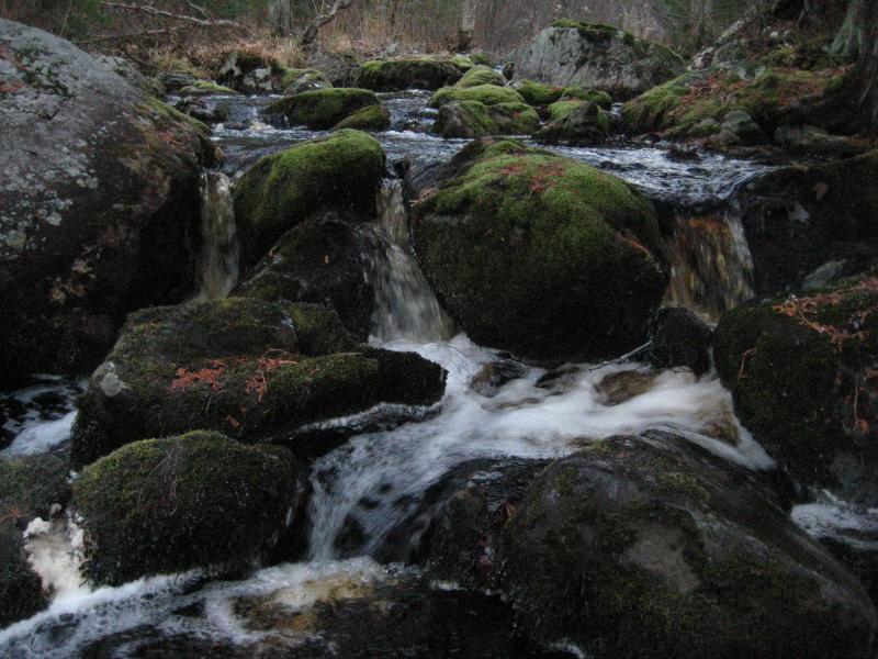
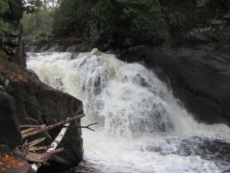
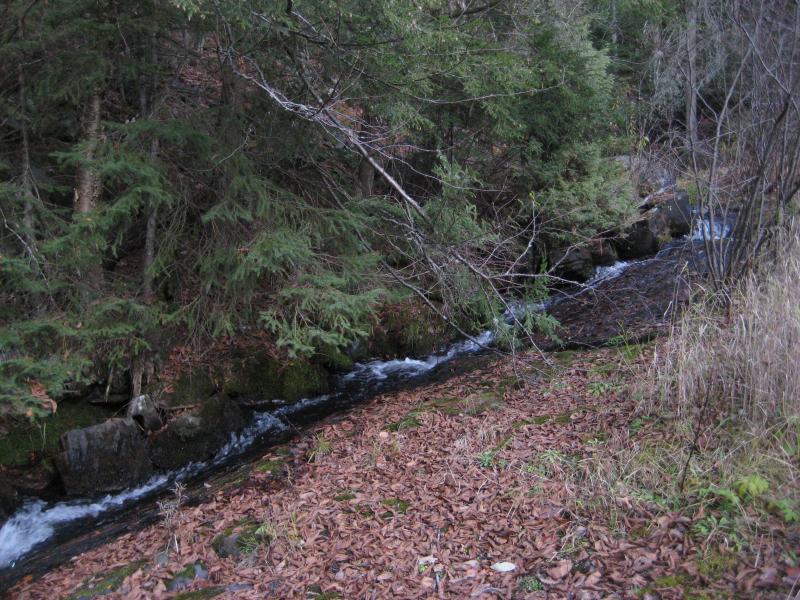
When I bumped into Sturgeon River I veered to the left, following it upstream, slowing down as the shock waned and my left leg began to numb up. Wide, grassy swamplands surrounded the river, making my route difficult and slow. I got excited when I realized the river was bending eastwards, knowing from memory that I was approaching the falls. Then I saw them. The drop was so small that I saw the tiny fleck of white before the sound reached me.
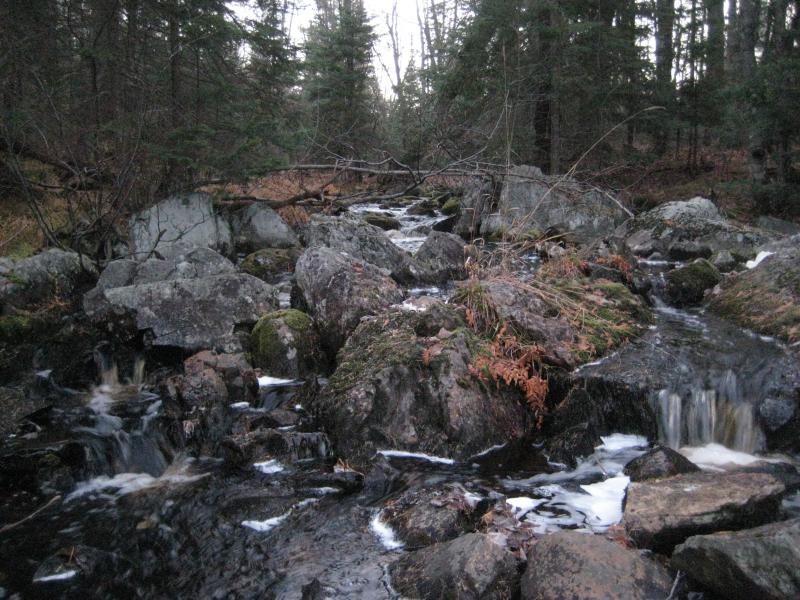
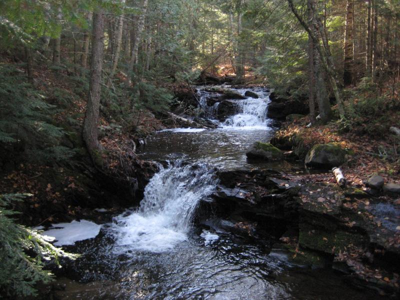
A disappointing jumble of rocks and small drops
Upper Sturgeon Falls is made up of two sets of drops. Neither one of them truly deserve to be called rapids, let alone waterfalls. The lower set tumbles around small boulders and splits occasionally along the swampy undergrowth. It does have a single tiny drop over bedrock, an inch or two high, near the bottom. While I crept along the drops I made sure to carefully photograph each tiny trickle of water in the predawn light, promising myself I would not return later to get better pictures.
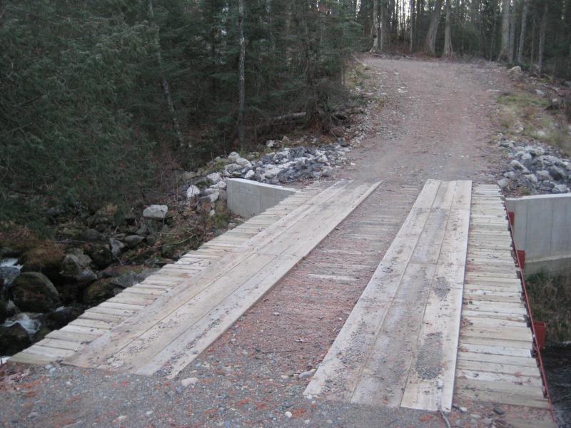
A bridge over Sturgeon River
When I reached the top of the lower set I stopped, shocked. Beyond a small pool of water lay a bridge. There was a bridge, a road, over the falls, the waterfall I had bushwacked miles, had gotten lost, and had spent so long finding for. And today I stood, cold with a dripping leg, after hiking in pitch black, in front of a bridge. Beyond disgusted I took some photos of the upper drops and checked upstream to make sure the 'falls' were done before storming up the road. As I crested the first hill on the wide, sandy road, the sun finally peaked over the trees and mocked me with its warm light.
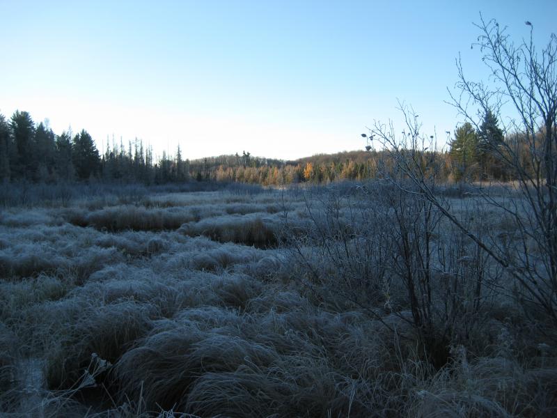
Following the road took me less than an hour to return to my car. This two-track ended up being one of the branches from the road Faith, Cory and I had tried a few weeks ago when we got lost out to the east. Knowing more about the area didn't lessen my frustration. After I walked through a sparkling field of icy grassy over Tama Creek I drove off angrily. At least I had finally found the damn falls.
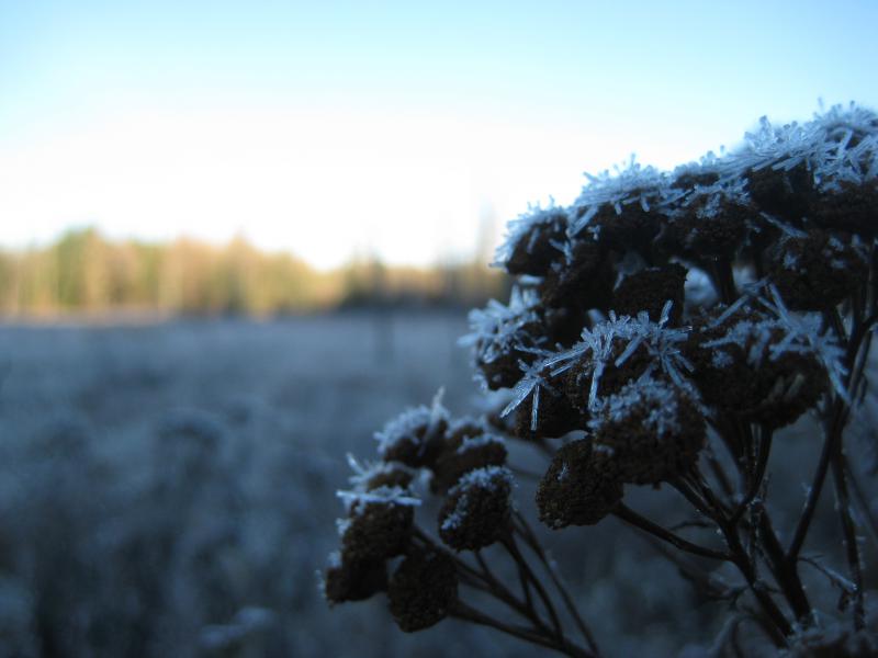
Frosty weeds on the grassy swamp
The main driver of today's hike was now done. I had a few other ideas of where I wanted to go, mostly clean-up spots around the county, but I was still cold and jumpy from my morning's experiences. I drove all the way back to L'Anse and grabbed a warm breakfast to calm down before making a quick stop at Powerhouse Falls. I had been here plenty of times already this year but figured it would be a nice place to relax. Logan and I walked around a bit, stretching our legs, while I regrouped and planned the rest of the day.

Old cement and rock formations
There were three unfound waterfalls still out there: Vista, Gleason and Sandstone. All three were a bit of a drive westwards, with two of them sitting all the way over in Ontonagon County. I was in no rush for a long drive today and decided to stick to more familiar destinations. We left Powerhouse and headed over to Dynamite Hill Road.
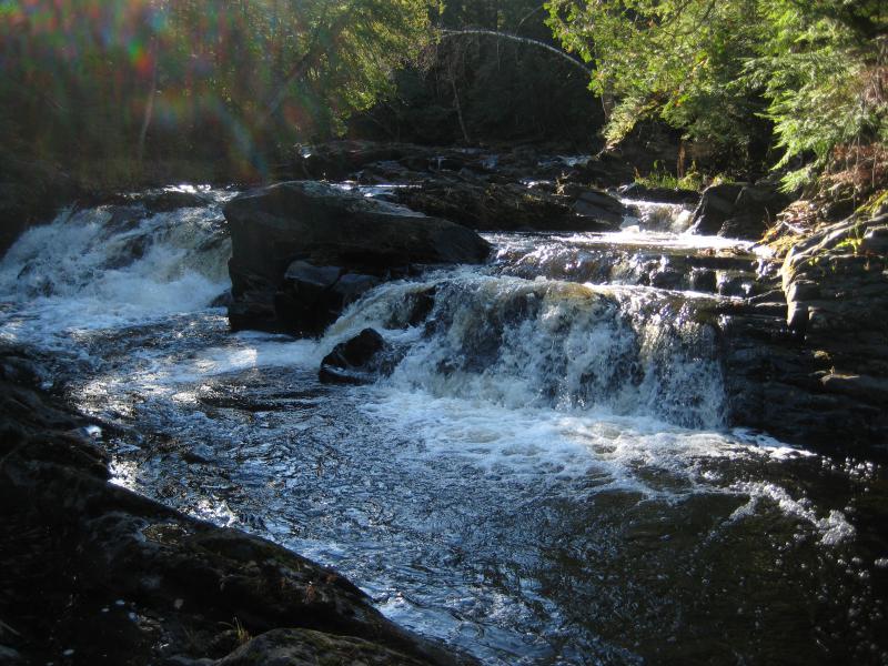
Dakota Farm's gate was unlocked so I decided to park right in the gravel parking lot near Middle Silver Falls. The last time I had visited these waterfalls I had started from the bridge on Arvon Road and followed the river downriver. Today I figured I'd try a different route and stick to the ATV trails leading north from the gravel, slowly weaving up through the trees and over to the river. The trail conviently ended near the lower falls, forcing me down the cluttered pine banks to the river right below the last drop.
Looking up at the lower falls
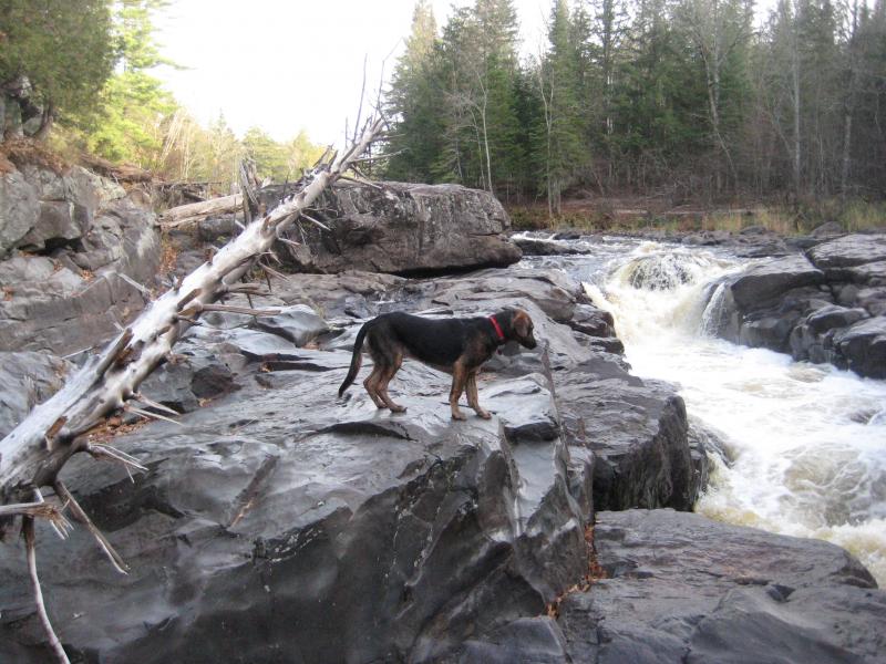
The rocks near the falls here are incredibly smooth basalt, worn from years of overflowing flood waters. Even the hard blocky outcroppings sitting in the middle of the river's flow had gentle sanded tops. With today's cold tempertures these rocks made a treacherous riverbank, though. I had to creep carefully along them, grasping onto the overhanging roots to maintain balance, pausing for the occasional photo of the nearby drops. I had just gotten past the first few drops when I looked behind me and watched Logan slide sideways in slow-motion, plunking into a deep pool between two of the drops.
Scrambling on all fours I quickly reached him. I had to bend down, almost flat against the bank to reach underneath his belly between kicking legs and haul him back on the bank. He wasn't going under or anything, being a decent a swimmer, but there was no way he could of gotten back up the icy banks alone. Slipping and sliding I got us both up on the dry dirt banks above the rocks and stripped off one of my sweaters, patting his soaked coat and keeping a close eye on him. He was obviously shocked by the cold but doing okay, alert and jittery, and I let him run around me to warm up.
Both Logan and I had now taken a cold dip on this cold day. I kept the photos to the highlights of the river, quickly moving up the river now, not as excited about this stop as I had initially been. I overshot the approach to Gomanche Falls, which is located on the far side of the river, and decided to save time and just cross the river in the knee-deep current. I knew it was cold and a stupid idea. I just didn't care any more.
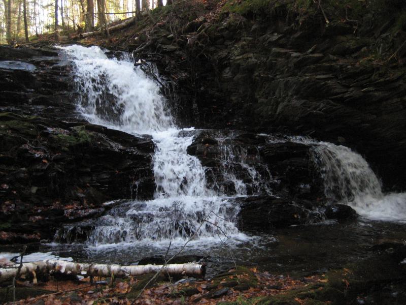
Split drop on the middle set of falls
Fall at the falls
Once I visited Gomanche Falls and we saw the last of Middle Silver Falls I led us back up the steep river bank to the gravel pit. I was soaked once again, right up to my thighs, and Logan was still damp. Even though there was still frost in the shade the sun was doing a good job at warming up the morning air, making our cold and wet states less urgent.
Before heading out I decided to a bit of exploring and we drove down Indian Road, which runs parallel to Silver River upstream. The road climbed a lot on this stretch and the bare trees gave away the rugged land surrounding the river, promising more waterfalls up here. I wasn't in the mood to fully explore the four mile stretch today and we drove away, storing this as a future destination to tackle later on.
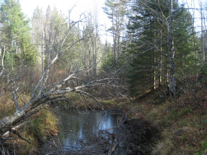
The afternoon had snuck up on us during our wander out here so I headed west to Vista Falls. We parked at an overly familar overgrown two-track off of Laird Road and walked north, than west, parallel to the swampy river. The dead undergrowth and bare trees gave us an eerily deep look into the stretches of barren swamp and forbidding woods, which seemed to ignore the sun's light and remain dreary. I walked farther on the two-track than I had ever gone before cutting down to the river, a bit worried that I had overshot the potential location of Vista Falls.
Thick, brushy pool ahead
When we reached the tiny river Logan and I scoured the area. It looked like tough going, pushing through thick woody undergrowth with a tiny flow of water seeping from one deep pool to the next. After an hour of hacking through this I decided to change tactics and just focus on the banks. Maybe Vista Falls was actually on a tributary flowing into West Branch Sturgeon River. However, there was no tributaries flowing today. After another hour of fruitless searching I pushed my way out angrily, promising not to get sucked into Vista Falls again (I would be).
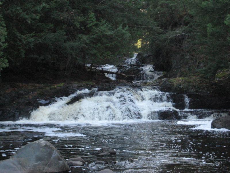
By now it was starting to get late and I was getting tired. Even Logan, who is always romping around in the woods, was starting to give me big tired eyes when he wasn't napping in the car. There was still a few hours of daylight left, though. Time enough for an easy nearby hike. I drove us over to Strugeon River Falls, just a short distance to the east from Bob Lake.
Looking across Sturgeon River gorge
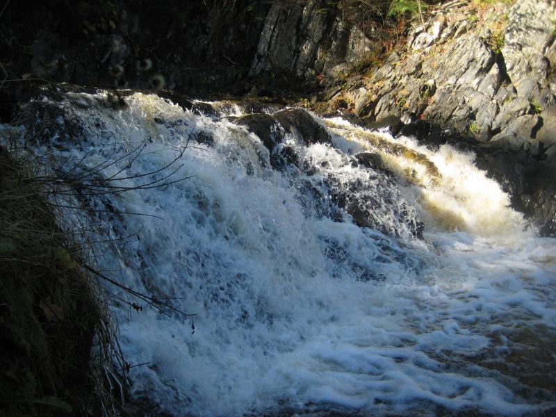
The hike along the edge of the gorge was incredible with no leaves blocking the view. The sense of scale was humbling, especially knowing how Stugeon River, the tiny trickle I had been to so early today, had grown to carve this massive valley. The trail was easy and empty this late in the season allowing us to make quick time down to the falls, admiring the swollen river and rising mist.
Logan cautiously checking the gushing chute
While we were coming back from the falls we bumped into an older couple. They were fans of the North Country Trail and had just hiked from O Kun de Kun Falls to the west. We shared some bits of knowledge back and forth before each continuing on our path. This was not the first time general hiking had snuck into my waterfall adventures.
Even though I had tried to maintain focus on waterfalls this year I had peeked on at other things, checking out Point Abbaye or climbing Little Mountain, researching the Huron Mountains or taking the longer route back from a hike to see a remote lake. There was just so much more to the Upper Peninsula. Maybe this winter, when the rivers were frozen and locked in snow, I would start venturing to other things besides a waterfall.
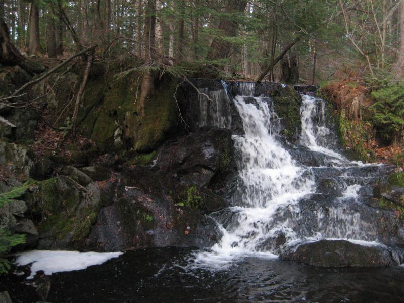
Logan and I were beyond tired after climbing back out of the gorge and to the car. The sun was low, hanging near the horizon and refusing to set, and I couldn't head home just yet. I drove eastwards on winding roads to another frequented waterfall. Parking near the side of the road by the old Baraga Prison Camp we headed over to Ogemaw Falls, a tiny drop that was wonderfully exposed thanks to the dying undergrowth.
Blocky rock wall
Finally the sun decided to drop and let us go home. Today's plan had changed multiple times, creating a wild weave across Houghton and Baraga County with no clear direction. At least Logan and I had fun. Sure, we had both taken a swim or two in icy waters and had to keep each other awake on the drive home with some loud sing-a-longs. But we had visited a lot of different places and finally found Upper Sturgeon Falls, even if they were a disappointment. We slept hard and well into the next day, exhausted from our full day.


-
Jacob P Emerick
Sep 21, '16
Hi Nancy! I think I know what you're talking about w/ 'Abutement Falls' - is that the one with the old bridge/trestle near the top? If so I didn't make it out there on this trip, it's a few miles south of this section of Silver River. But I was totally out there a few weeks earlier, in the middle of a huge thunderstorm, huddled next to the concrete with a nervous dog in my arms.
Add to this discussion